No items found.
Skip to main content
November 2026

MFB: Expanded DOD Obstacle Filtering

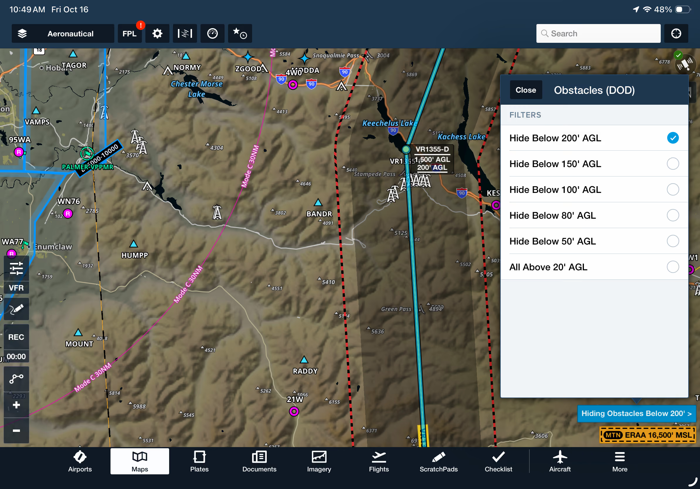
Filter DOD obstacles by altitude within Low Level Corridors to focus on relevant hazards.

No images available to display.
back
next

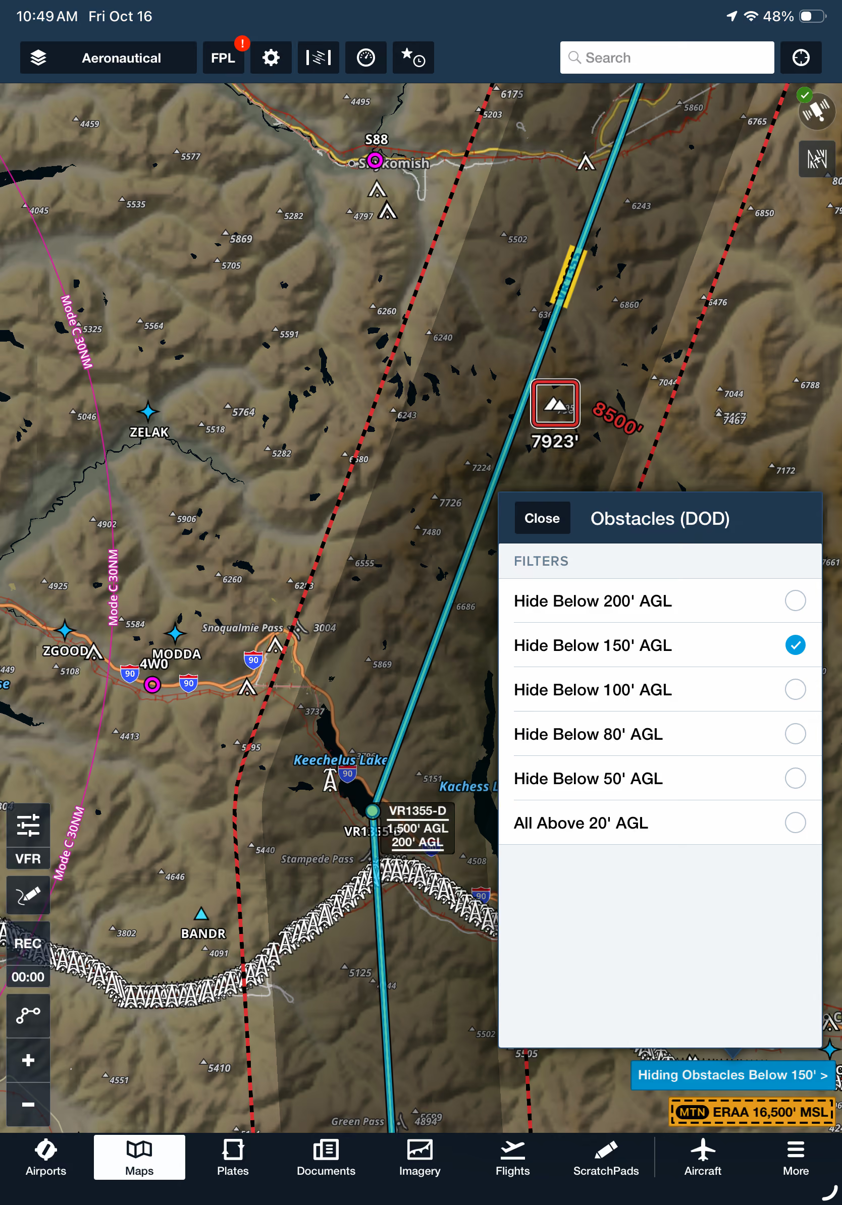
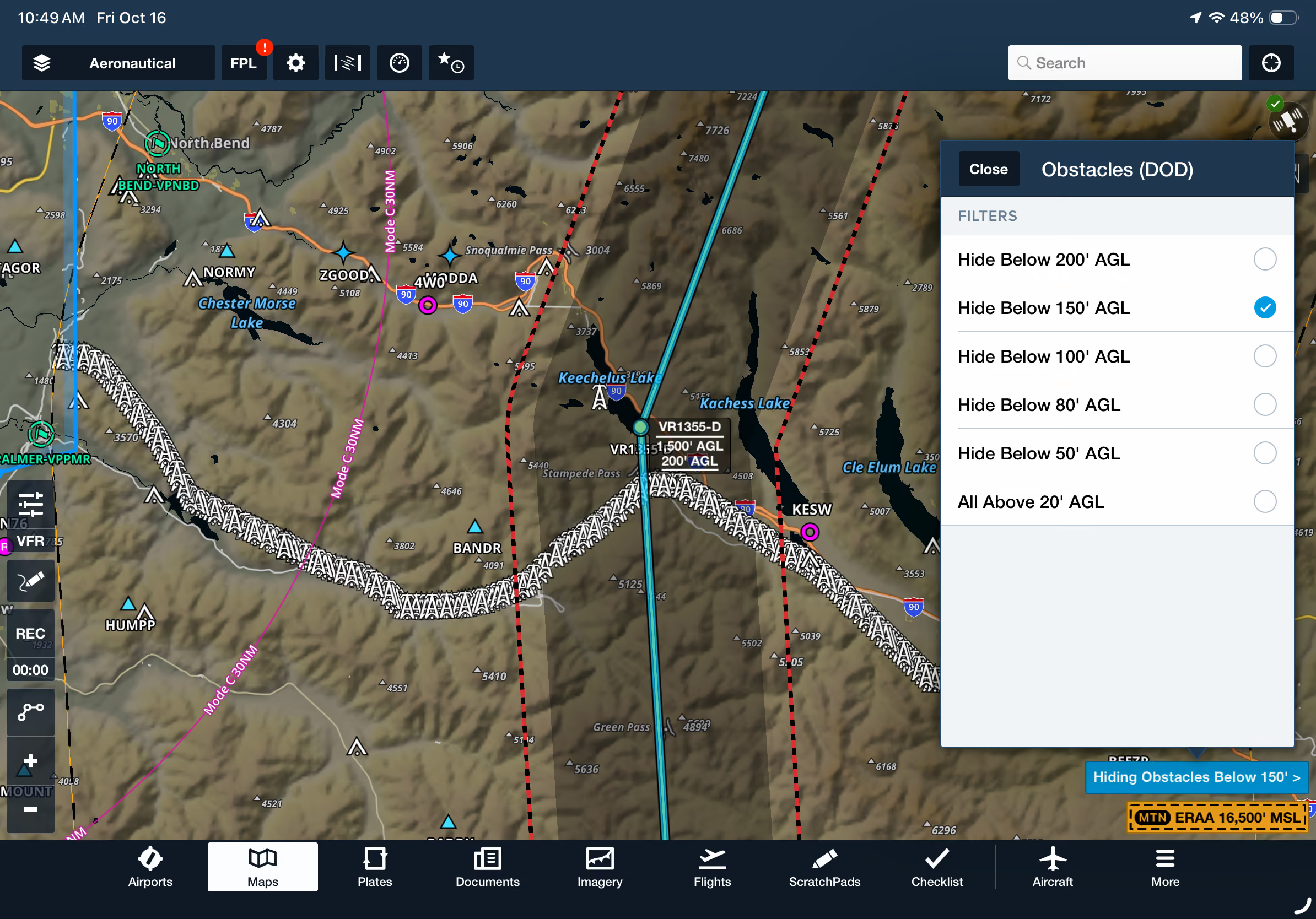
Simplify low-level mission planning with DOD obstacle altitude filtering now integrated into the Low Level Corridor tool. Navigate to Map Settings > DOD Obstacles and configure your desired AGL altitude threshold. Only obstacles above the selected altitude will appear on the map and within your Low Level Corridor, reducing visual clutter and making it easier to identify relevant obstacles along your route.

DOD obstacle filtering in Low Level Corridors is available with ForeFlight MFB One subscription plans.
Release notes

Release notes

  • The DOD Obstacles filter available in the Map Settings menu now applies to obstacles automatically shown while a Low Level Corridor is active, hiding any obstacles lower than the filter’s selected altitude to reduce map clutter.  
  • DOD Obstacles and Low Level Corridors are available with MFB One subscription plans.

Support

Support

FAQs
Find answers to your questions
Pilot's Guide
The complete ForeFlight handbook
Video Library
ForeFlight videos all in one place
Buying Guide
Choose the right iPad and plan