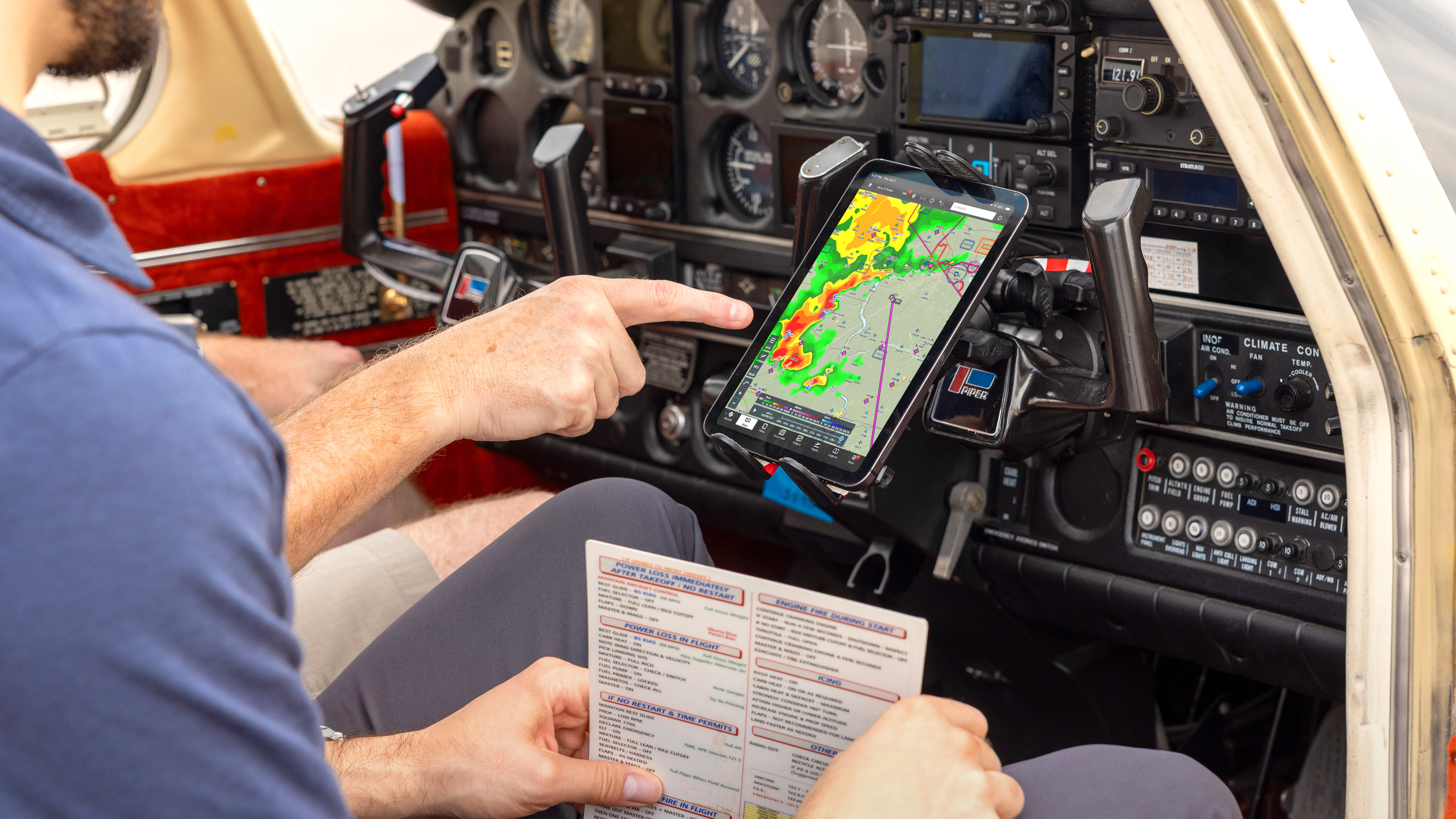
Flying safely isn't a single decision, it's a hundred small ones. Take a closer look at the tools ForeFlight gives you to make those decisions with better information, from weather and hazard awareness to emergency preparedness and staying current.
You won't need all of them on every flight. But knowing they're available, and knowing how to use them, will help you handle whatever circumstances thrown at you.
Weather
Make confident go/no-go decisions
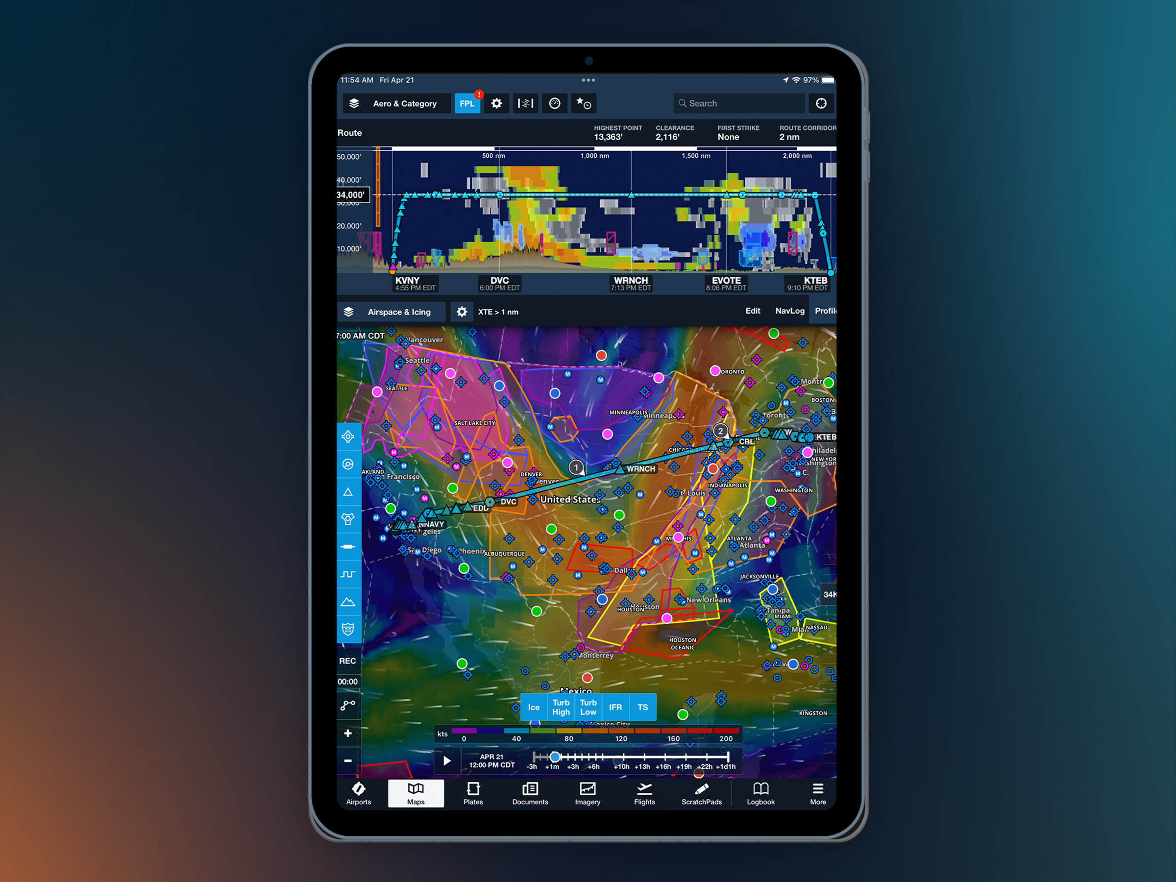
Weather is the biggest variable in any flight. The difference between a routine trip and a diversion often comes down to the comprehensiveness of your weather picture. ForeFlight offers layered, interactive weather data that goes well beyond a standard weather briefing.
Feature highlights
- Map weather layers: Color-coded flight categories, visibility values, cloud ceilings, and dewpoint spread are plotted directly on your map based on current station reports. Easily see if conditions are VFR, Marginal VFR, IFR, or Low IFR across your route with no decoding needed. Learn more >
- In-flight weather via ADS-B & Sirius XM: Connect a Sentry device or another compatible receiver to receive live, in-flight NEXRAD, METARs, TAFs, PIREPs, and TFRs through the FAA’s ADS-B network or Sirius XM satellite weather. Learn more >
- Preflight briefing: Receive a comprehensive look at current conditions, forecasts, NOTAMs, and advanced weather graphics in one briefing. Every briefing syncs across all your devices. Learn more >
- Global icing, turbulence & surface analysis layers (Essential and Premium plans): Five dynamic map layers graphically display global icing, turbulence, and surface analysis forecasts. These layers are powered by NOAA’s high-resolution forecast system for U.S. coverage. Learn more >
- Forecast windspeed & temperature layers (Premium plan): Animated wind layers display global forecasted wind speed, direction, and temperatures. Easily skim ahead in time with the time slider for 24+ hours of forecasts, and the built-in altitude slider to see forecasts from the surface up to 63,000 ft. Learn more >
Resources
Emergencies
Be ready when the unexpected happens
Nobody takes off expecting an emergency, but a good pilot always thinks through what they would do if one were to happen. ForeFlight offers a suite of emergency tools that are readily available on your iphone or iPad, so the next step is already on your screen if you need it. Take a few minutes to explore each of these features so you’re prepared if you need them.
Feature highlights
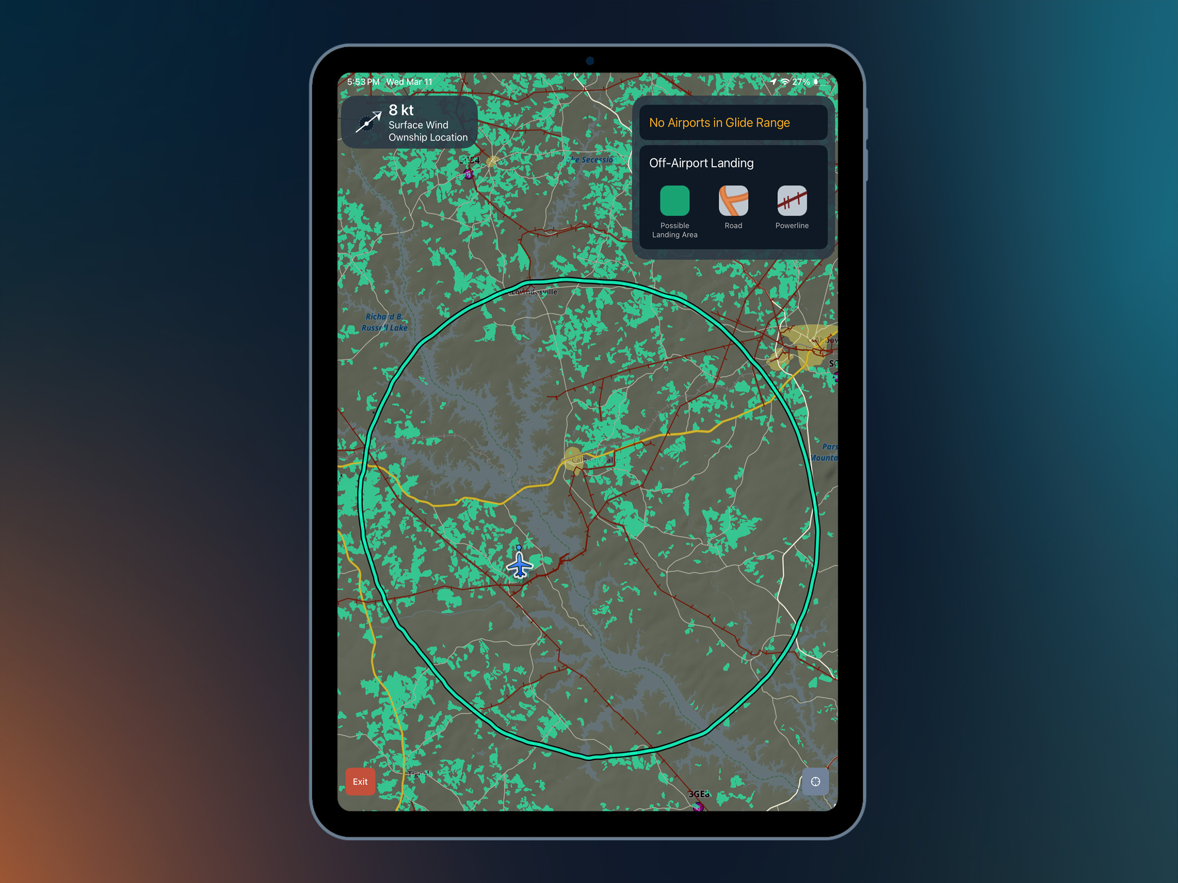
- Emergency Glide Mode: When an engine quits, two questions matter immediately: how far can I glide, and where can I land? Emergency Glide Mode calculates your aircraft's glide range based on current altitude, position, and winds, then highlights possible landing areas within that ring. Learn more >
- Sentry CO monitoring: Pair a Sentry device with a carbon monoxide monitor to ForeFlight and receive in-app alerts if CO levels exceed 200 PPM. Learn more >
- Unusual attitude and sink rate alerts: ForeFlight provides prominent aural and visual alerts when your aircraft enters an unusual attitude or exceeds safe descent rates while connected to a certified attitude source. Alerts adjust based on altitude and descent rate to help you recognize developing situations sooner. Connect your iPad to a certified and installed AHRS source to activate these features. Learn more >
Resources
Hazard Awareness
See it coming and stay clear
Awareness in the cockpit means always scanning for traffic, terrain, or anything that could pose a hazard to the flight. ForeFlight builds on that awareness with real-time data layered directly onto your map so nothing catches you off guard.
Feature highlights
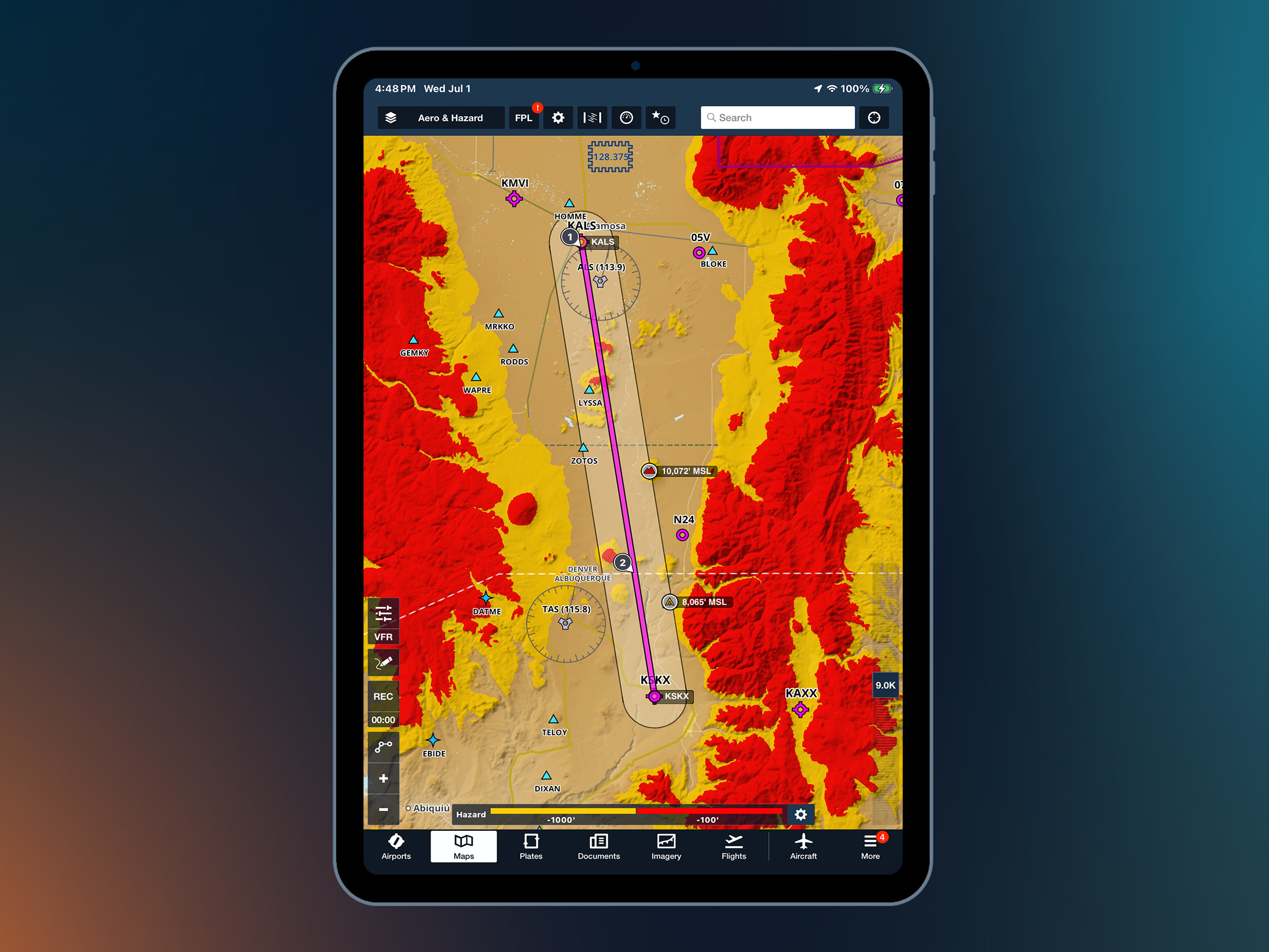
- Hazard Advisor (Essential and Premium plans): Color-coded terrain and obstacle overlays help you quickly identify potential hazards for your selected altitude before and during flight. In flight, Hazard Advisor automatically updates using your GPS altitude, while the Profile Corridor highlights terrain and obstacles along your route. Learn more >
- Synthetic vision (Essential and Premium plans): Pair your device with an AHRS-compatible receiver like Sentry to a 3D view of the terrain, obstacles, runways, and flight path indicators ahead of your aircraft, even in hard IMC or on a pitch-black night. Learn more >
- Reported turbulence (Essential and Premium plans): View measured turbulence reports from Sentry-equipped aircraft to identify smoother altitudes along your route. Filter reports by altitude and compare ride quality in Profile View before or during flight. Learn more >
- ADS-B traffic alerts & traffic breadcrumbs: With a compatible ADS-B receiver, ForeFlight displays nearby traffic on your map and alerts you to potential conflicts. Traffic Breadcrumbs, available on Essential and Premium plans, leave a track behind each target so you can see their direction and trend at a glance. Learn more >
- Obstacle layer: Toggle on the Obstacle Layer to see towers, antennas, and other vertical hazards plotted on your map during low-altitude operations, VFR flight in unfamiliar areas, or when planning routes near congested obstacle environments. Learn more >
- Wake turbulence alerts (Essential and Premium plans): ForeFlight uses ADS-B traffic data to alert you when your flight path may intersect the wake of a heavier aircraft, so you can plan your spacing and timing accordingly. Learn more >
- Automated terrain and obstacle hazard alerts (Essential and Premium plans): Receive visual and audio alerts when terrain or obstacles become a threat along your route. Smart airport awareness reduces unnecessary alerts during departures and arrivals. Learn more >
- Obstacles in 3D View (Premium plan): Visualize terrain and obstacles along your route in 3D. Highlight nearby obstacles and build a clearer mental picture of your arrival and approach. Learn more >
Resources
Preflight planning
Plan a safer flight before you leave the ground
The best risk mitigation happens on the ground. Pulling all your data from separate sources takes time and leaves room for mistakes. ForeFlight puts your entire preflight workflow in one place so nothing gets missed.
Feature highlights
- Performance Profiles & fuel planning (Premium plan): Build your performance profile once and ForeFlight shows enroute fuel burn, time en route, and climb/descent performance for every leg. Easily see if your flight satisfies VFR or IFR fuel minimums. Learn more >
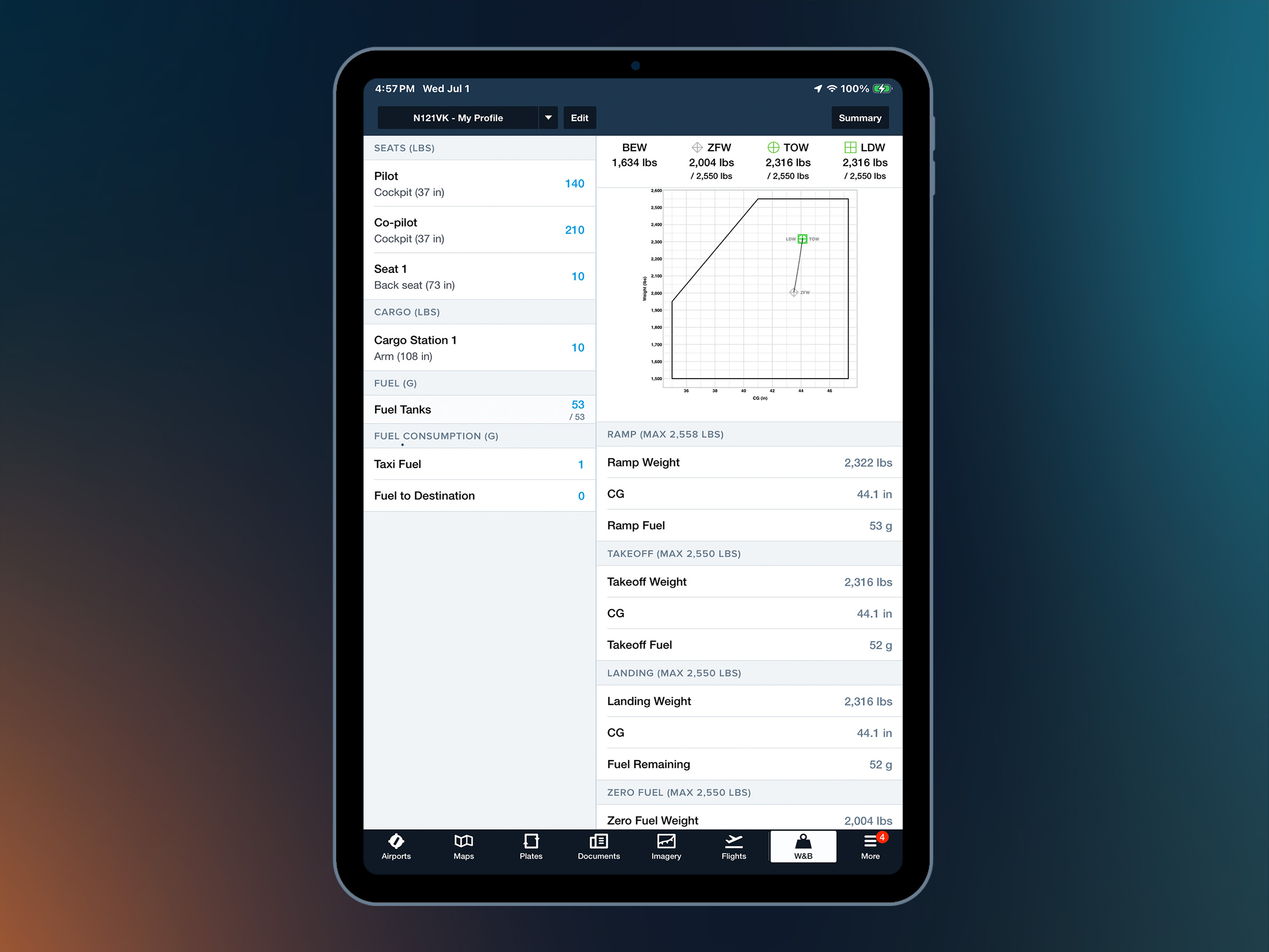
- Weight & Balance: The W&B tool lets you easily build loading scenarios and verify CG limits before your flight. No hand calculations required. Learn more >
- Runway Details: Verify that runway distances at your destination are suitable for your aircraft. ForeFlight displays declared distances (TORA/TODA/ASDA/LDA) with a toggle in runway details. Learn more >
- Takeoff and Landing Distances for Pistons (Premium plan): Get fast, safety-enhancing runway performance calculations for supported piston aircraft. ForeFlight calculates results like total takeoff distance and climb rate by combining weather conditions with manufacturer-published performance data, and takeoff/landing weight values and manufacturer performance data. Learn more >
- NOTAMs: See current and future graphical NOTAMs along your route and at your departure, destination, and alternate airports. ForeFlight's ClearNOTAMs feature helps you review NOTAMs faster with plain-English translations alongside the original text. Learn more >
- Flight Simulator Support: Stay proficient between flights by connecting ForeFlight to your home flight simulator. Practice with the same charts, planning tools, and workflows you'll use in the air, test new features, and fly your planned route before you ever leave the ground. Learn more >