
Release Spotlight
Release Spotlight

17.11
CFI Referral Program
Active CFIs can earn discounts on their subscription by introducing students to ForeFlight.
2026
18.5
June 2026
June 2026
Essential & Above
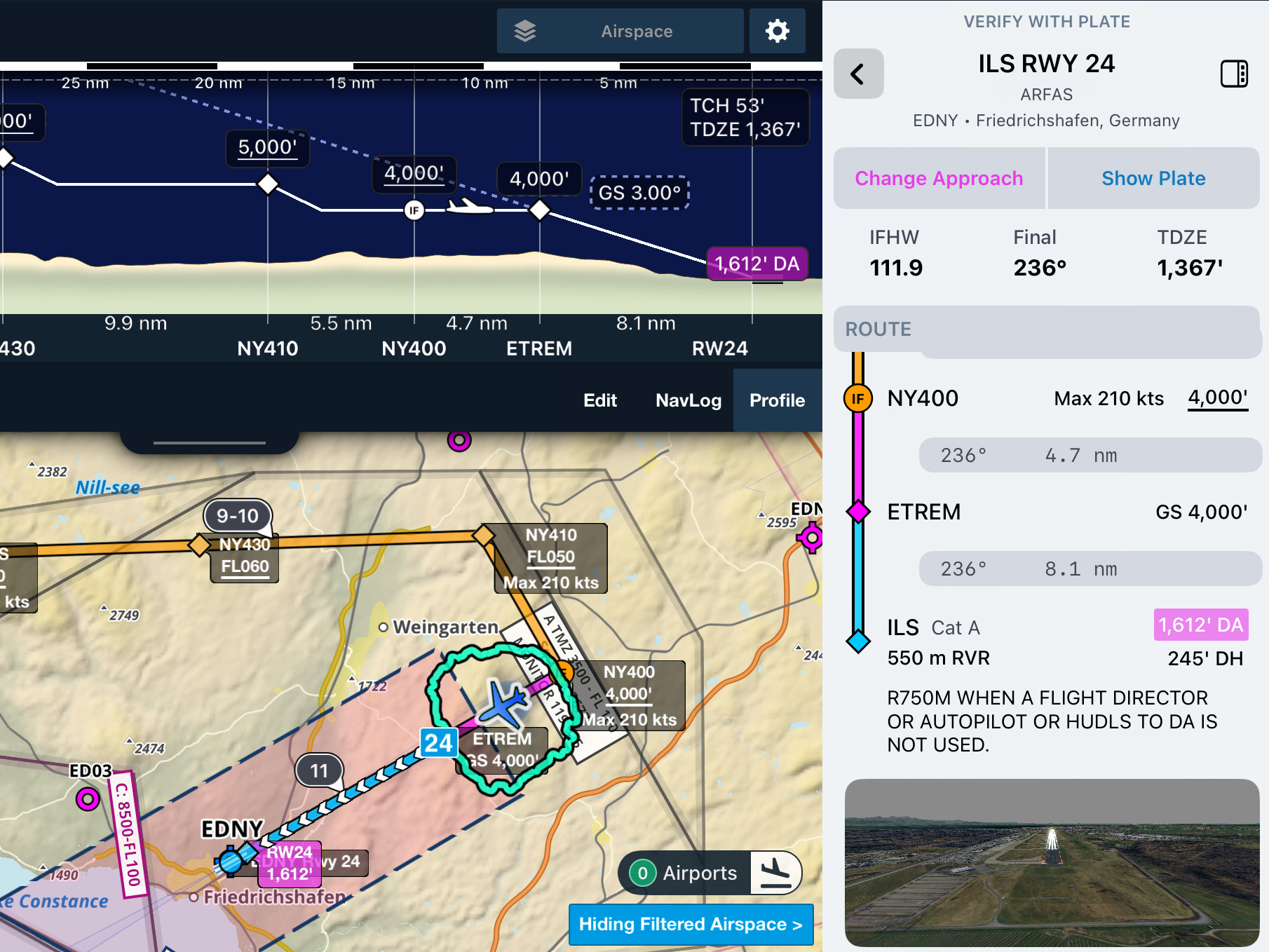
Dynamic Procedures in Europe
Brief and fly chart-free approaches, SIDs, and STARs in Europe with ForeFlight’s Dynamic Procedures sidebar.
Business Plans
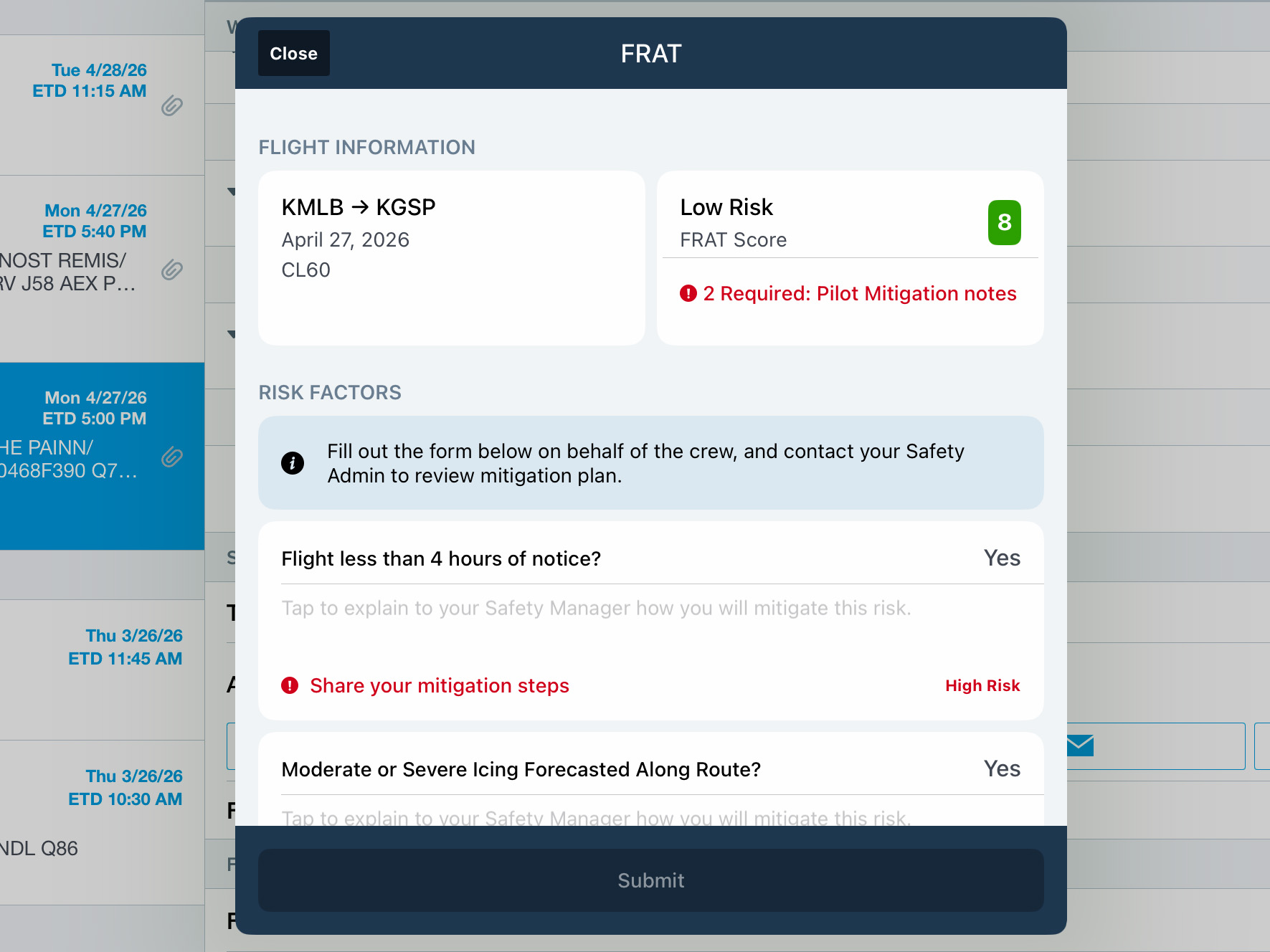
ForeFlight FRAT
2026
18.4
May 2026
May 2026
All Plans
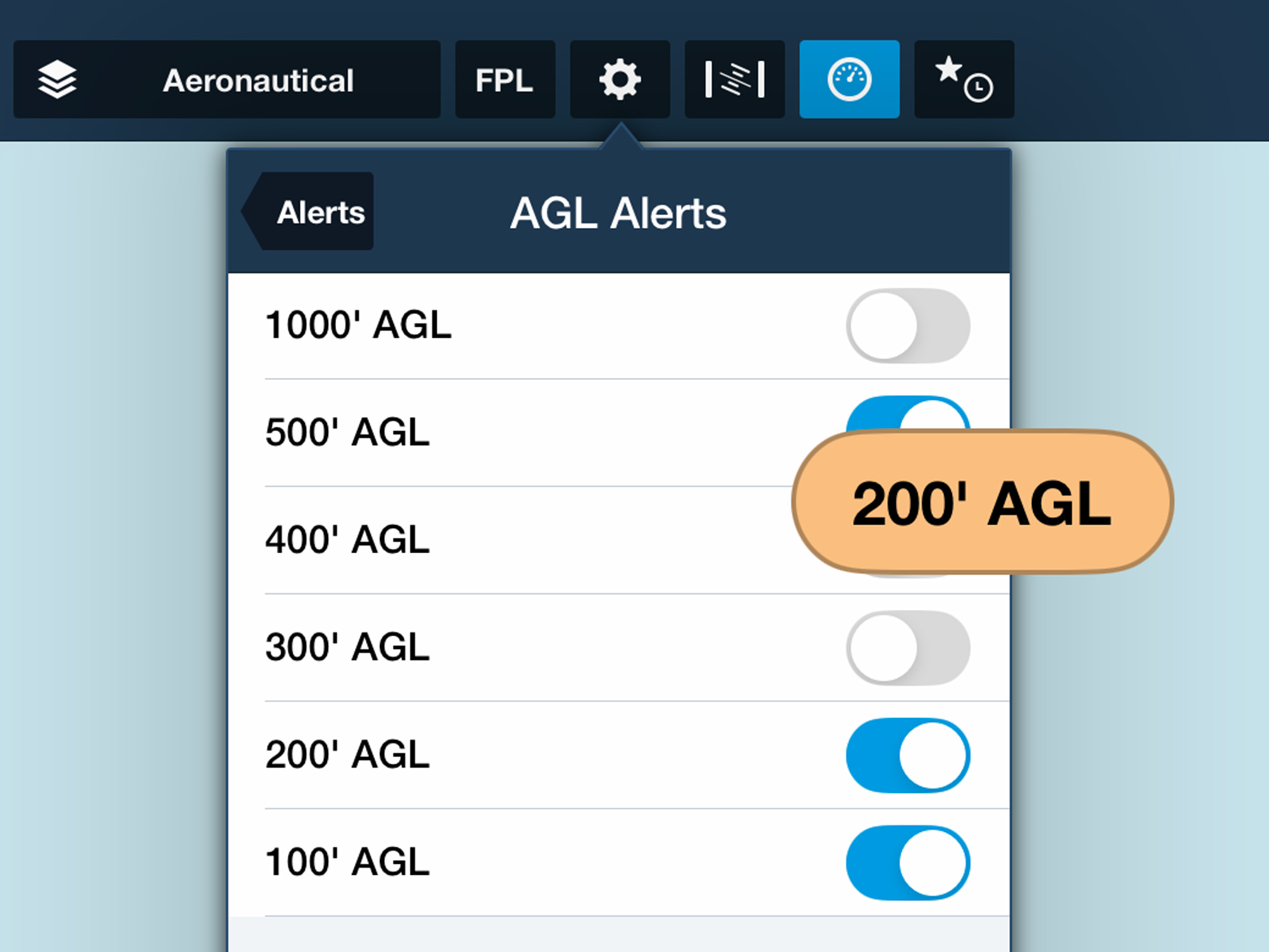
AGL Alert Altitudes
Receive prominent altitude callouts as you descend to land with new configurable options.
2026
18.3
April 2026
April 2026
Essential & Above
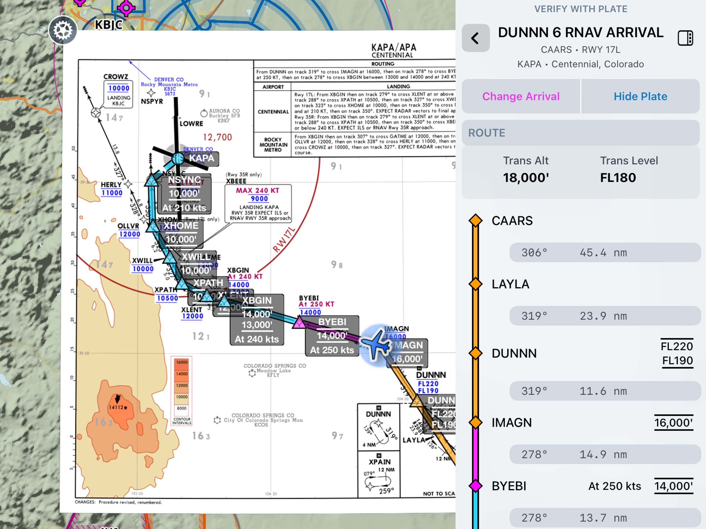
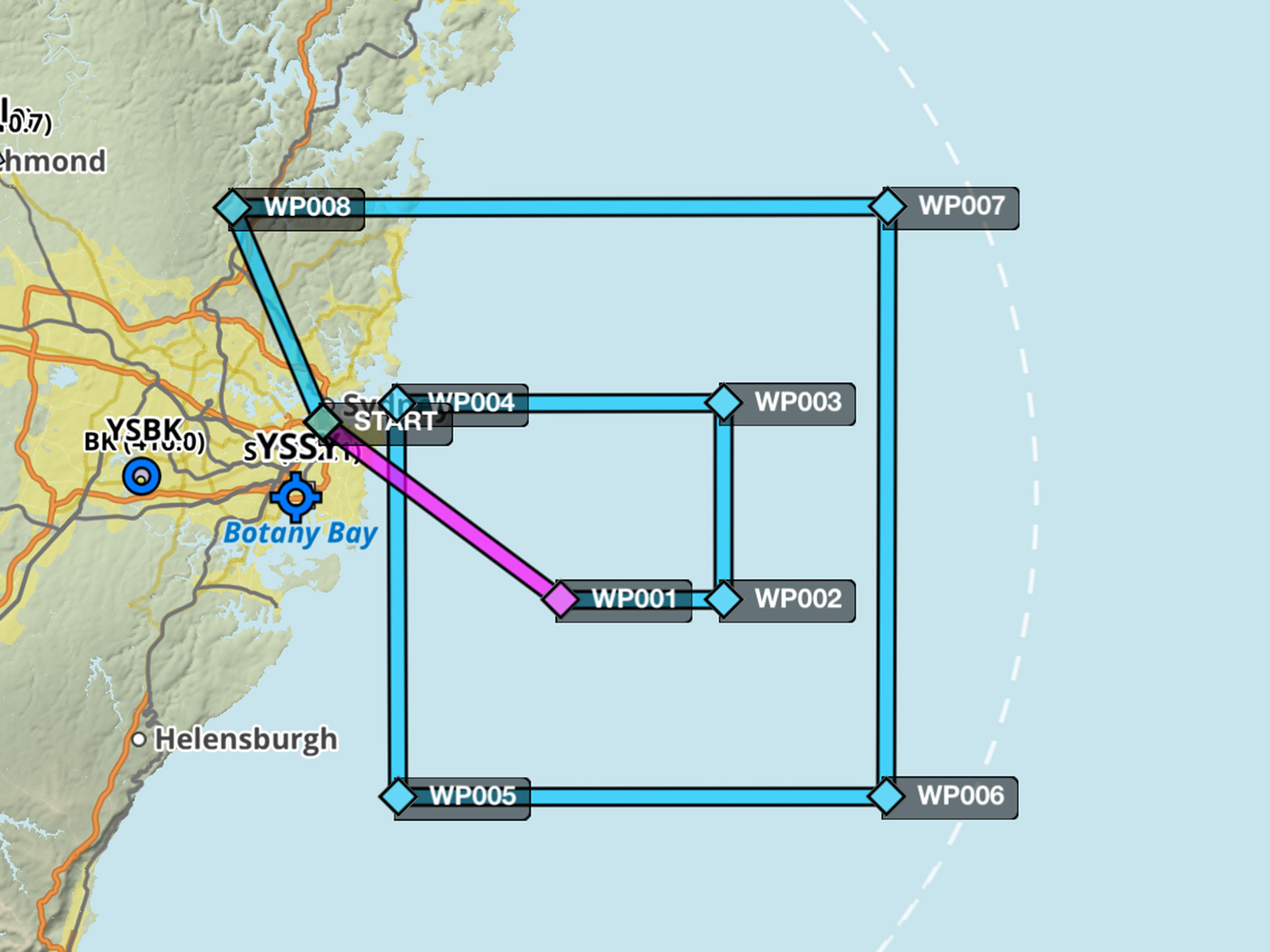
Dynamic Procedures: SID/STAR Support
Access SIDs and STARs in the Dynamic Procedures sidebar.
Essential & Above
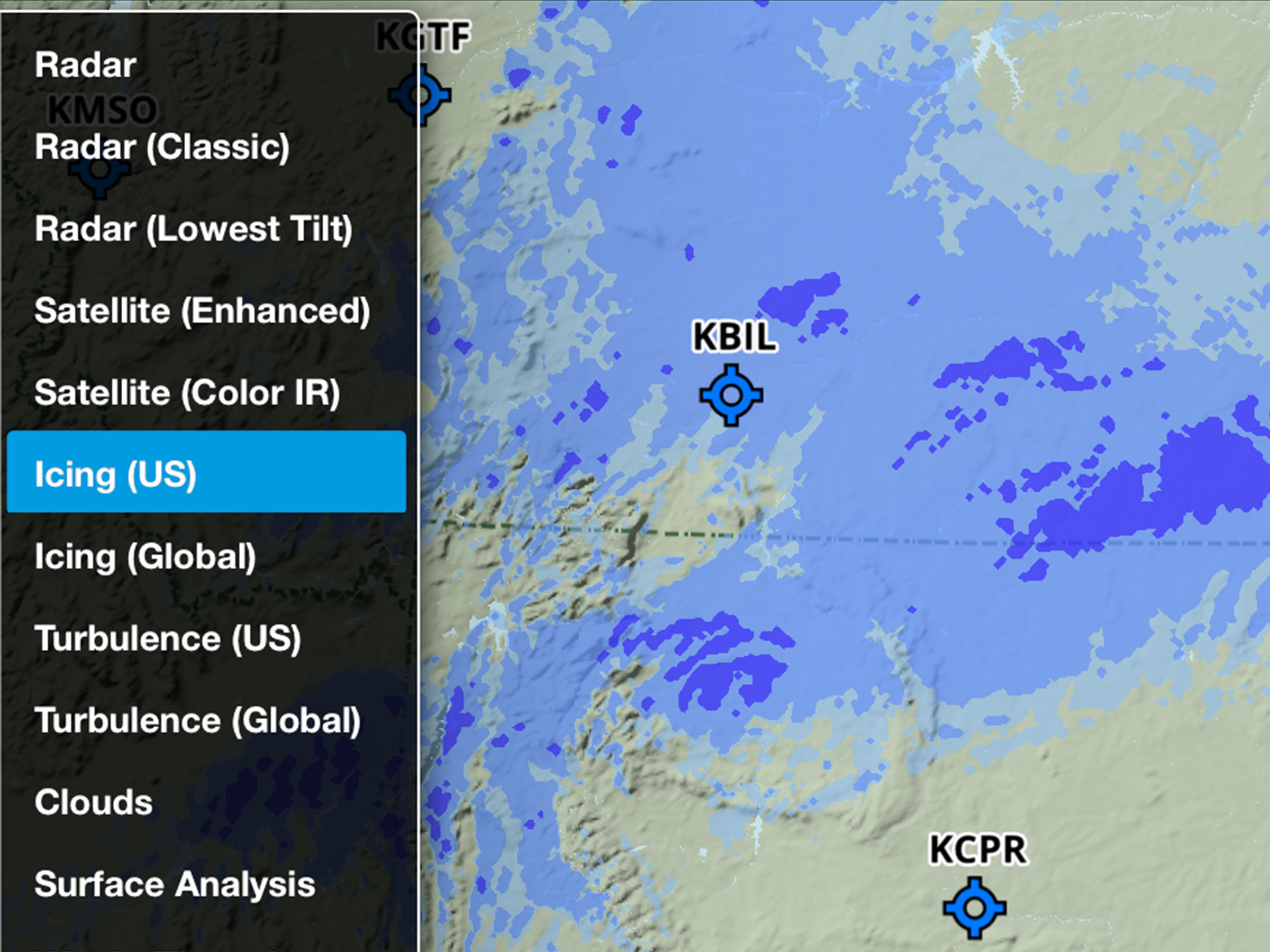
Enhanced US Icing & Turbulence Map Layers
Plan more accurately with improved US Icing and Turbulence layers.
All Plans
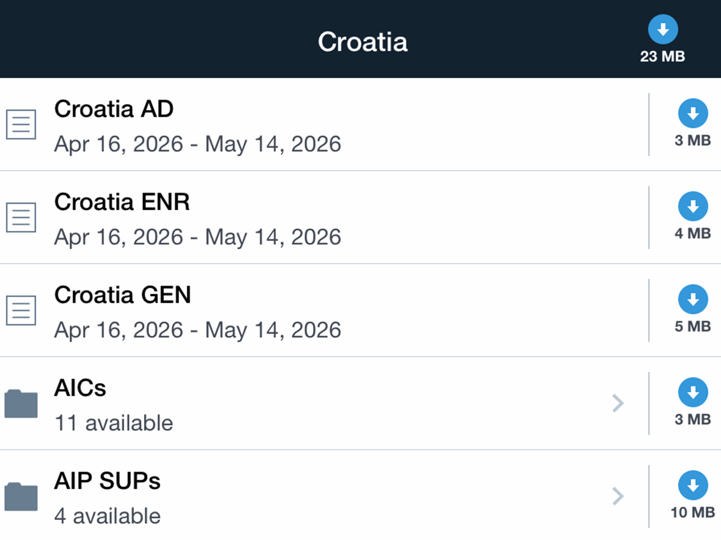
Documents: European Supplements & AICs
Stay up to date with European AICs and AIP supplements.
2026
18.2
March 2026
March 2026
Business Plans
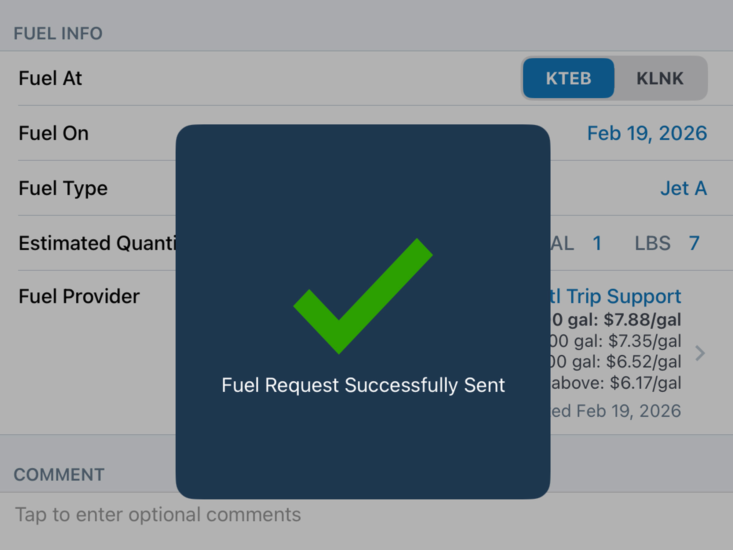
Mobile Fuel Releases
Compare JetFuelX contract prices and request fuel releases directly in the Flights view.
.jpg)
Active Navlog
E-Sign Weight & Balance
Sign and lock a Weight & Balance load summary with a secure PIN code.
2026
18.1
February 2026
February 2026
All Plans
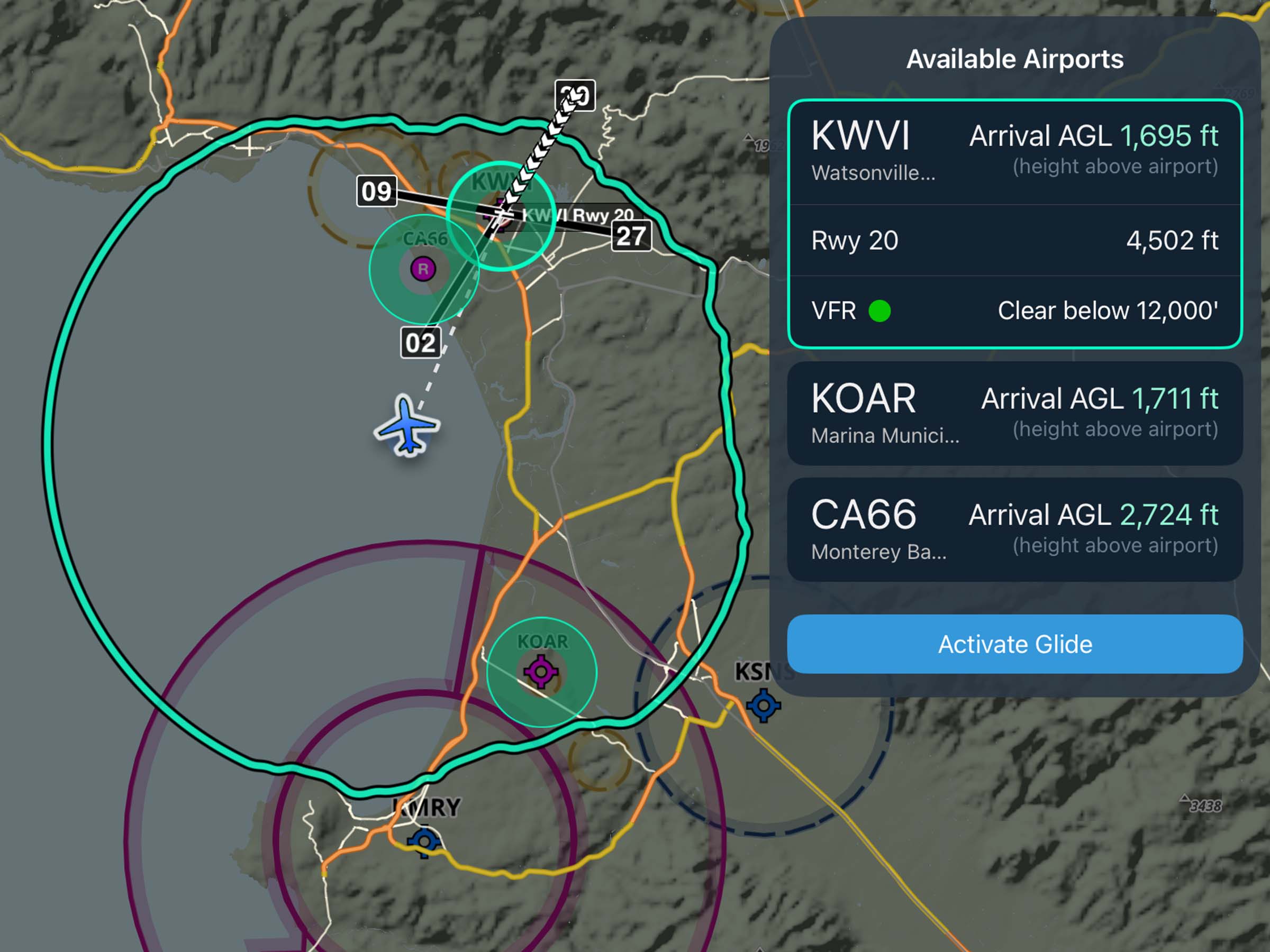
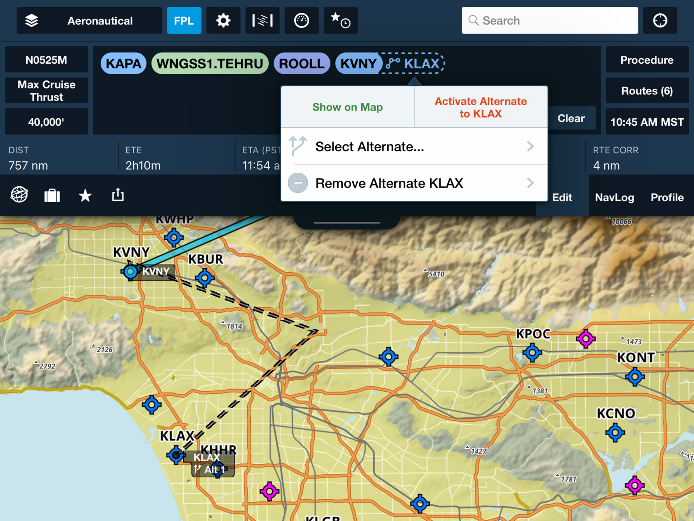
Alternate Airports on Maps
Select and route to alternate airports in-flight from the Maps view.
.avif)