.avif)
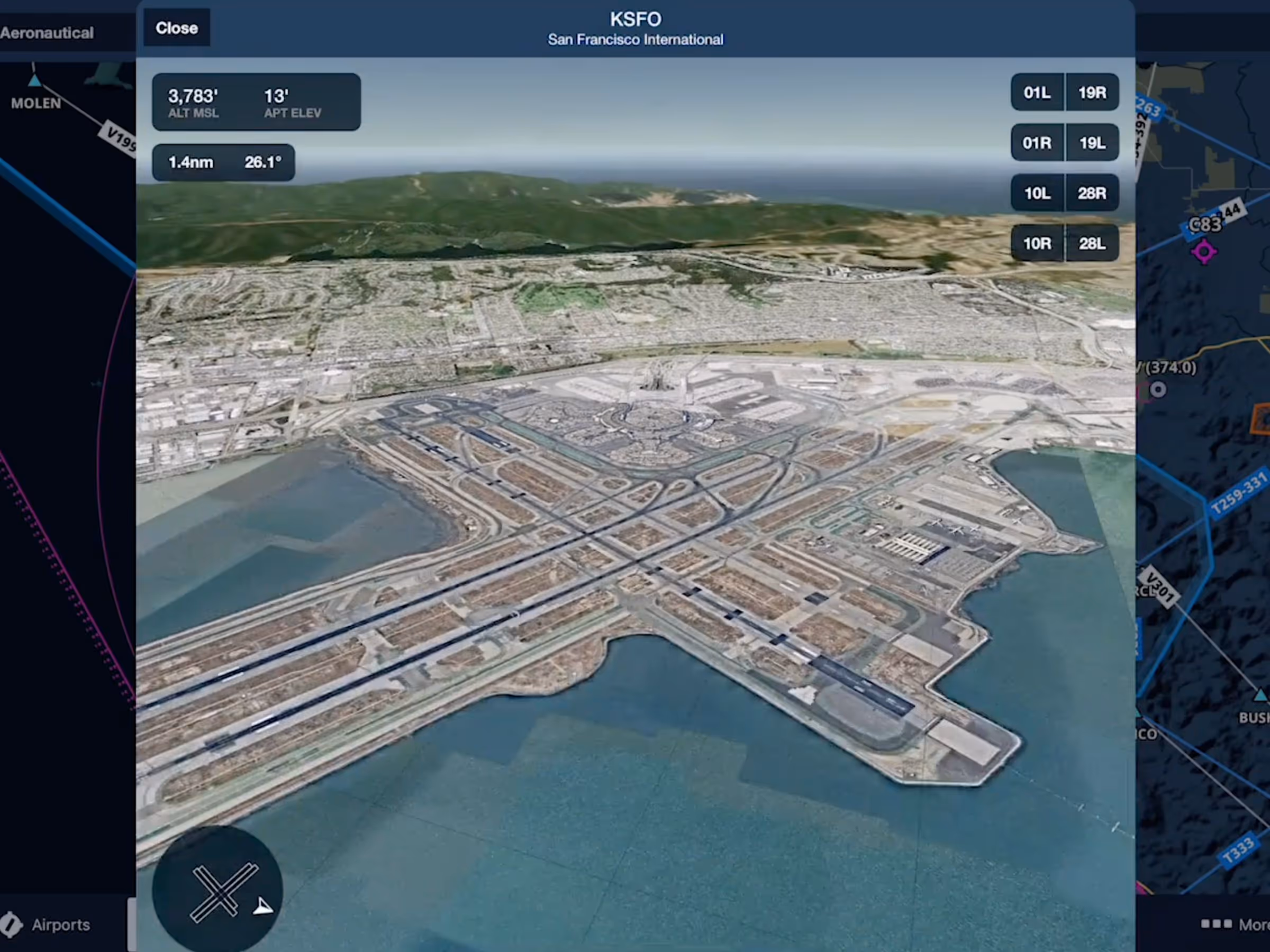
This 3-dimensional preview of the airport environment combines terrain data and aerial imagery to help you get familiar with new airports, whether you’re preparing for your next flight or exploring new places to fly. This feature is available with Premium and Business Performance subscription plans.
You can access any airport’s 3D View by tapping the “3D View” button on Airports or in the airport popup on Maps. ForeFlight combines high-resolution terrain and streamed aerial imagery to create a realistic representation of the airport environment. Rotate and zoom the camera in or out to access every perspective, and watch the metrics in the top-left of the view update as you move the camera. Tap the runway button in the top-right to position the camera along the published glideslope for that runway, or at an angle of 6° if the runway doesn’t have any published approaches. Check the compass and airport diagram in the bottom-left of the view to see the wind direction relative to the selected runway.