
Skip to main content
- Products
- solutions
- resources
- company
12.5
June 2020
This release includes hotspots on airport diagrams, a Multimode Timer in the More menu, Offline Address Searching in the U.S., and more.

Premium
Offline Address Database & Search
Search for and route to street addresses in the U.S. without an internet connection during a flight.

PDF Form Support in Documents
The Documents and Files in Flights views now provide better support for PDF files with editable form fields.
Release Notes
Release Notes
Hotspots on Airport Diagrams
- ForeFlight’s embedded airport diagrams now display published hotspots for improved situational awareness on the ground.
- The embedded airport diagrams are part of ForeFlight’s Aeronautical Map layer, and appear as you zoom into most U.S. airports and many other airports around the world.
- Hotspots on airport diagrams appear as orange highlighting on top of runways, taxiways, and aprons.
- ForeFlight’s PDF airport diagrams also display hotspots in the same manner.
Multimode Timer in More
- Keep track of time in a variety of ways using the new Multimode Timer located at the bottom of ForeFlight’s slide-out More menu.
- Tap the up/down arrow to the right of the timer to switch between Count Up and Count Down modes.
- In Count Up mode, tap the timer to begin counting up from zero, tap it again to stop the count, and tap it once more to reset the count to zero.
- In Count Down mode, tap the timer to set a length in hours, minutes, and seconds, select whether the timer will repeat, and set the number of repetitions after the initial countdown. Tap the timer to start the countdown, and tap it again to stop and clear the count.
- ForeFlight displays an in-app audio and visual alert whenever the timer reaches zero in Count Down mode, and states whether or not the timer will repeat. If ForeFlight is in the background or closed when the timer expires your device will display an iOS notification with the same information if you’ve allowed ForeFlight to display notifications.
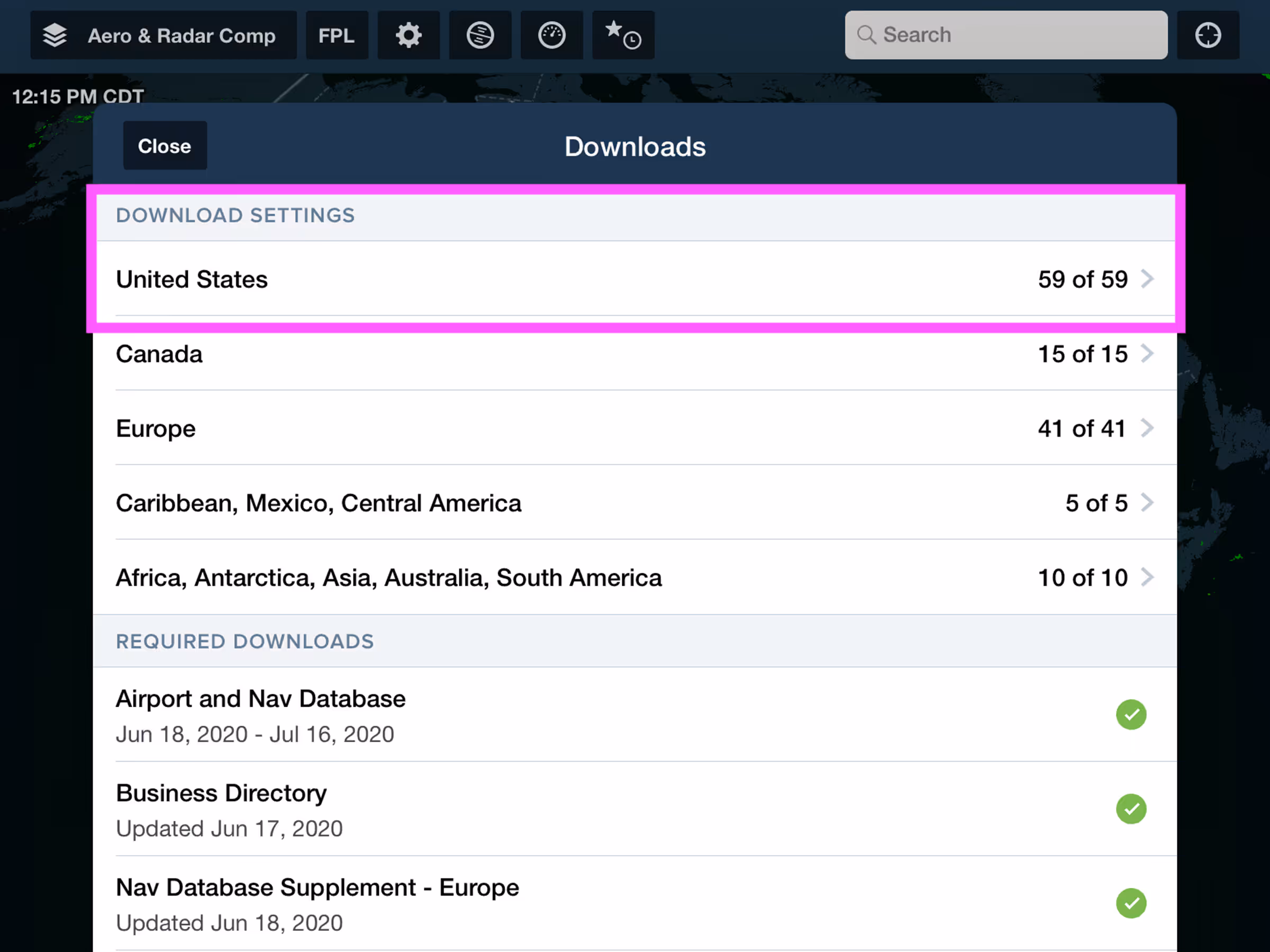
Offline Address Database & Search
- Download address databases for U.S. states so you can search for and route to street addresses without an internet connection during a flight.
- Enable the new Street Addresses download setting in More > Downloads > United States to download address databases for all selected U.S. states and territories.
- The Pack feature will also download address databases for any states in your route that you haven’t already downloaded.
- Offline Search supports the standard format for street addresses, specifically the address number, street name, street suffix (including contractions), town/city name, two-letter state identifier, and zip code.
- ForeFlight only requires the first two terms to begin searching and returning matches, and prioritizes matches that are closer to your position. Finding addresses that are far away, especially those in other states, requires additional terms like the state and zip code.
- Tap on a search result to locate it on the map and add it to your route, or save it as a user waypoint.
- Offline Address Search is available with ForeFlight Premium subscription plans and currently supported for U.S. states and territories only.
PDF Form Support in Documents
- The Documents and Files in Flights views now provide better support for PDF files that contain editable form fields.
- Tap on any form field to enter text using the keyboard.
- Closing and reopening an edited document will retain all previous edits, while also still allowing you to access the edited fields to make additional changes.
Other Improvements
- On iPads and large iPhones, swiping in from the left side of the screen on the Airports view will open the Favorites/Recents/Browse sidebar.
- Weather stations now support the same style of popup window the Maps view as airports, with tabs for basic information and different kinds of available weather information. You can access weather station information from the Search bar or by tapping one on the map with a suitable weather layer enabled.