Per-Leg Altitude in Profile
- Plan enroute altitude changes around terrain, weather, or airspace and visualize them in Profile View
- To insert an altitude change in Profile View, tap any waypoint’s label along the bottom of the view. You can also access the same menu by tapping a waypoint in the Route Editor and tapping Set Altitude/Speed/Time, or by tapping a waypoint on the map, followed by More > in the top-right.
- Enter the new altitude in the Altitude field, and use the Start At/Cross At selector to determine where the altitude change is conducted in relation to the waypoint: Start At will initiate the altitude change at the waypoint, while Cross At will complete the altitude change at the waypoint.
- ForeFlight uses your aircraft’s selected climb and descent profiles to calculate the altitude change’s duration and impact on time and fuel calculations, so you may see different results if your actual enroute climb or descent differs from the selected profile.
- Once you input a new altitude, Profile View automatically updates and displays the change to your route and performance calculations.
- Profile View is included in Essential subscription plans and above.
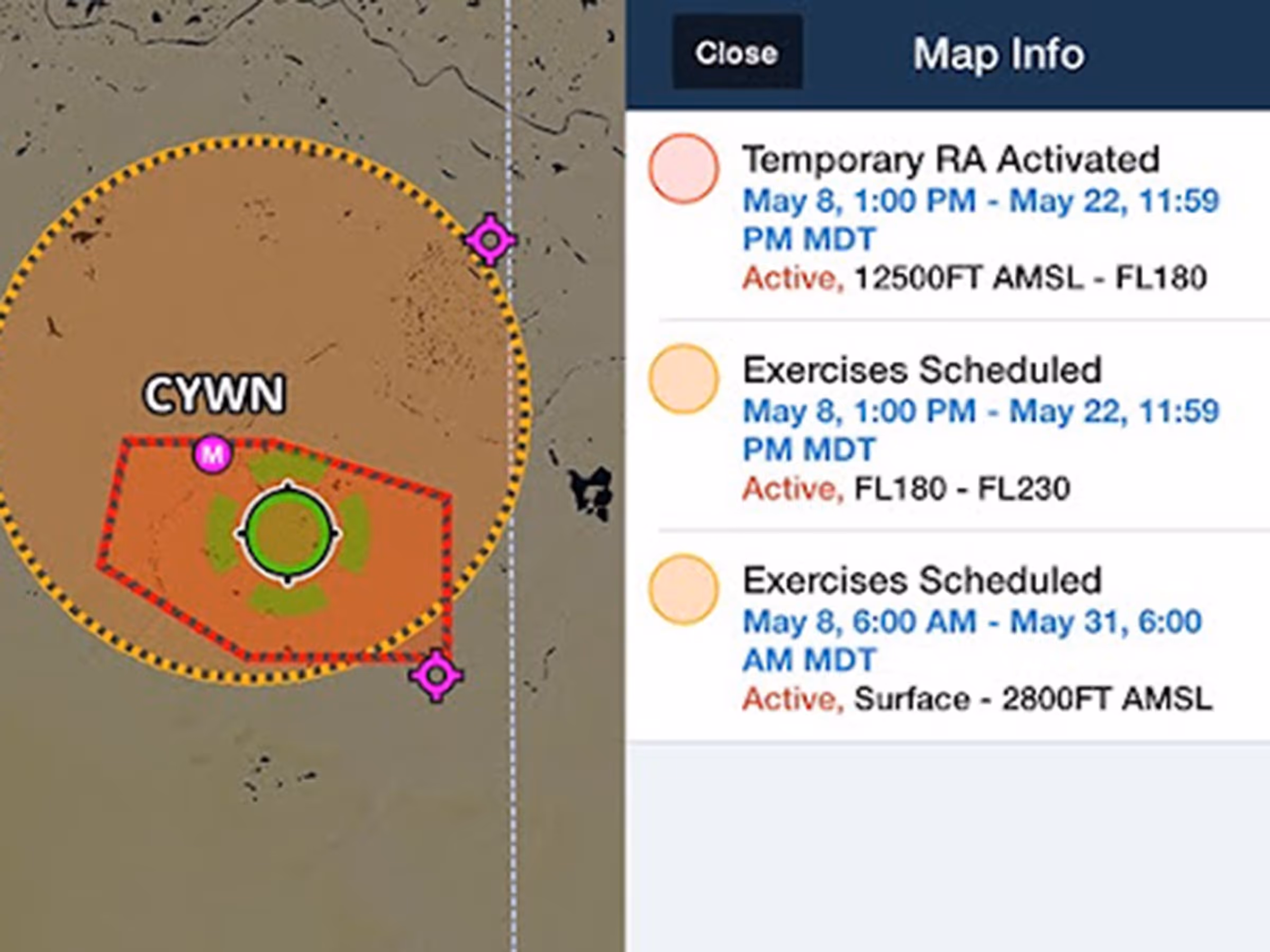
Global Graphical NOTAMs
- Previously limited to Europe, Graphical enroute NOTAMs are now supported around the world with the new NOTAMs map layer.
- To enable Graphical NOTAMs, tap the Layer Selector and then tap NOTAMs on the right.
- Tap a NOTAM on the map to view its details or tap on multiple overlapping NOTAMs to select one from a summary list.
- NOTAMs are color-coded red, yellow, or gray based on type, severity, and active times. Airspace restriction NOTAMs first appear in yellow 120 minutes prior to activating and turning red.
- With the NOTAMs layer enabled, selectively filter which types are shown using the new menu in Map Settings > NOTAMs settings, with toggles for Exercises, Controlled Airspaces, Obstacles, and Other.
- The Graphical NOTAMs layer does not display 5G or GPS NOTAMs in the US, and does not currently support any NOTAMS in Australia.
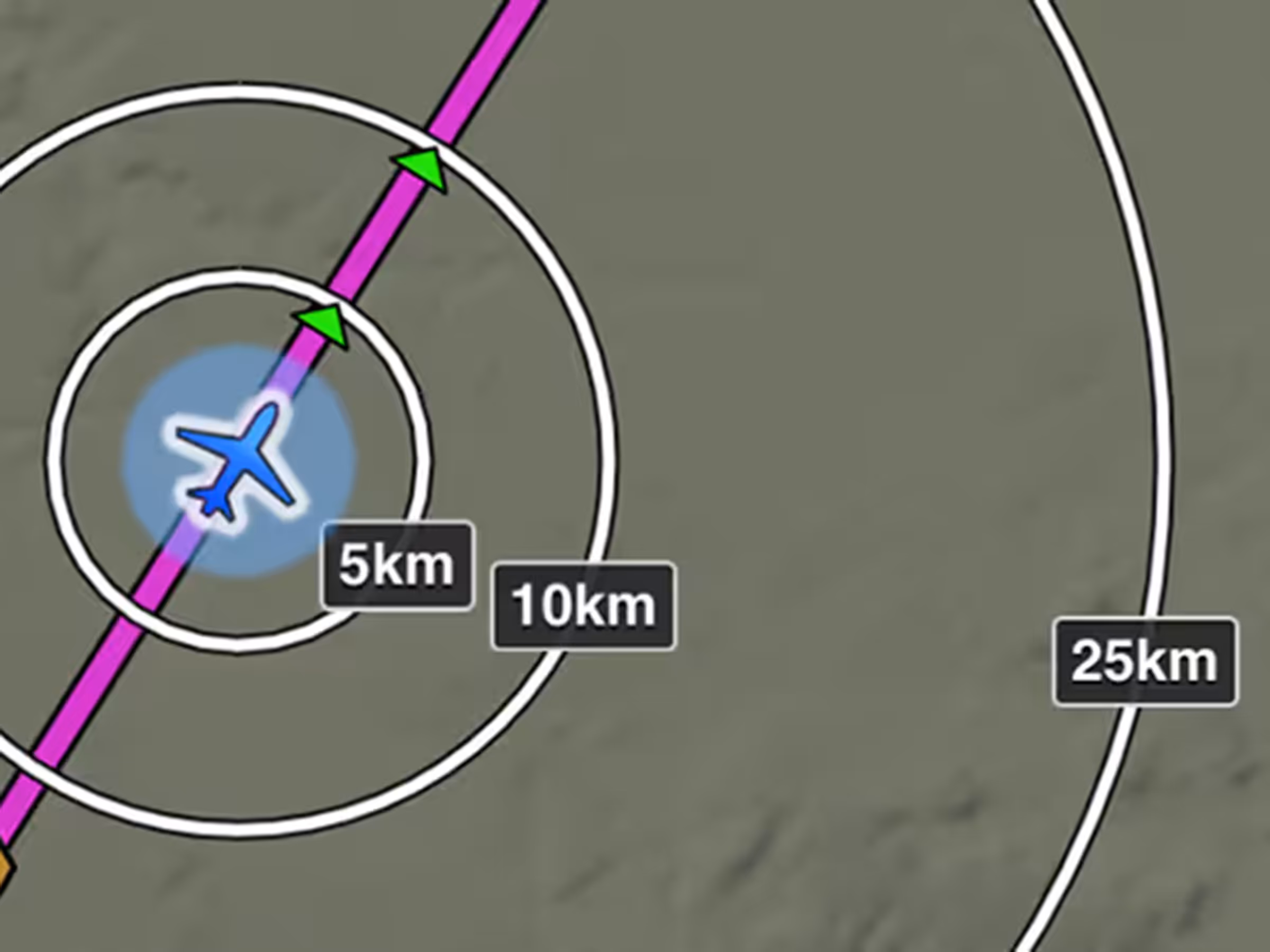
Distance Rings in Kilometers
- Gauge the distance to your surroundings in kilometers with a new Distance Rings setting.
- Enable Distance Rings in Map Settings > Distance Rings, and tap any of the three labels attached to Distance Rings to change the unit of measurement.
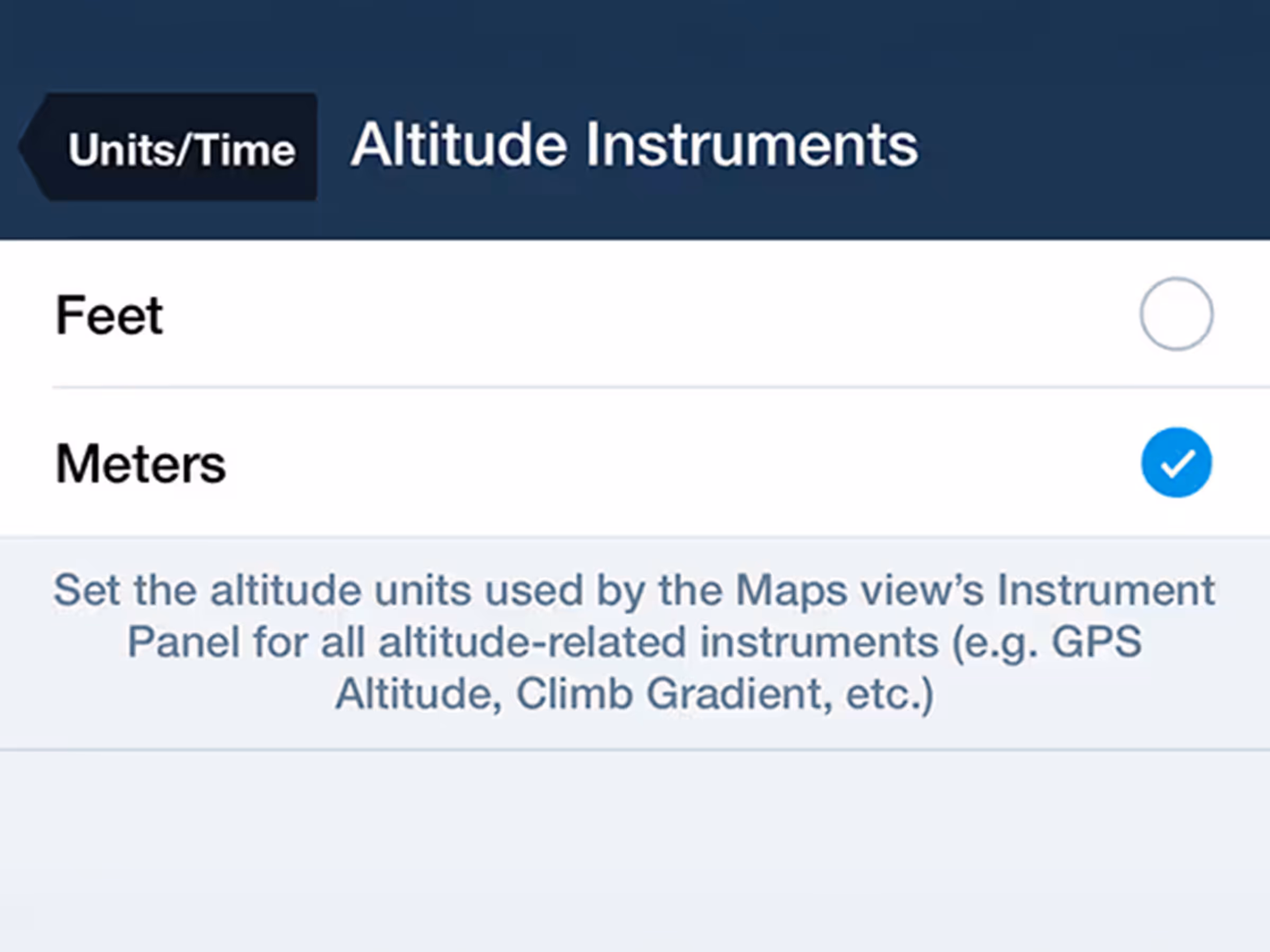
Altitude Instruments in Meters
- Customize the units of altitude displayed by the Map’s Instrument Panel for inflight reference with the new Altitude Instruments menu, accessible in More > Settings > Units/Time > Altitude Instruments.
- Altitude Instruments affected by this setting are GPS Altitude, Height AGL, Height MEF, Pressure Altitude, Cabin Pressure, Vertical speed (meters per minute), Climb gradient (meters per distance unit), and Descent to Destination (meters per minute).
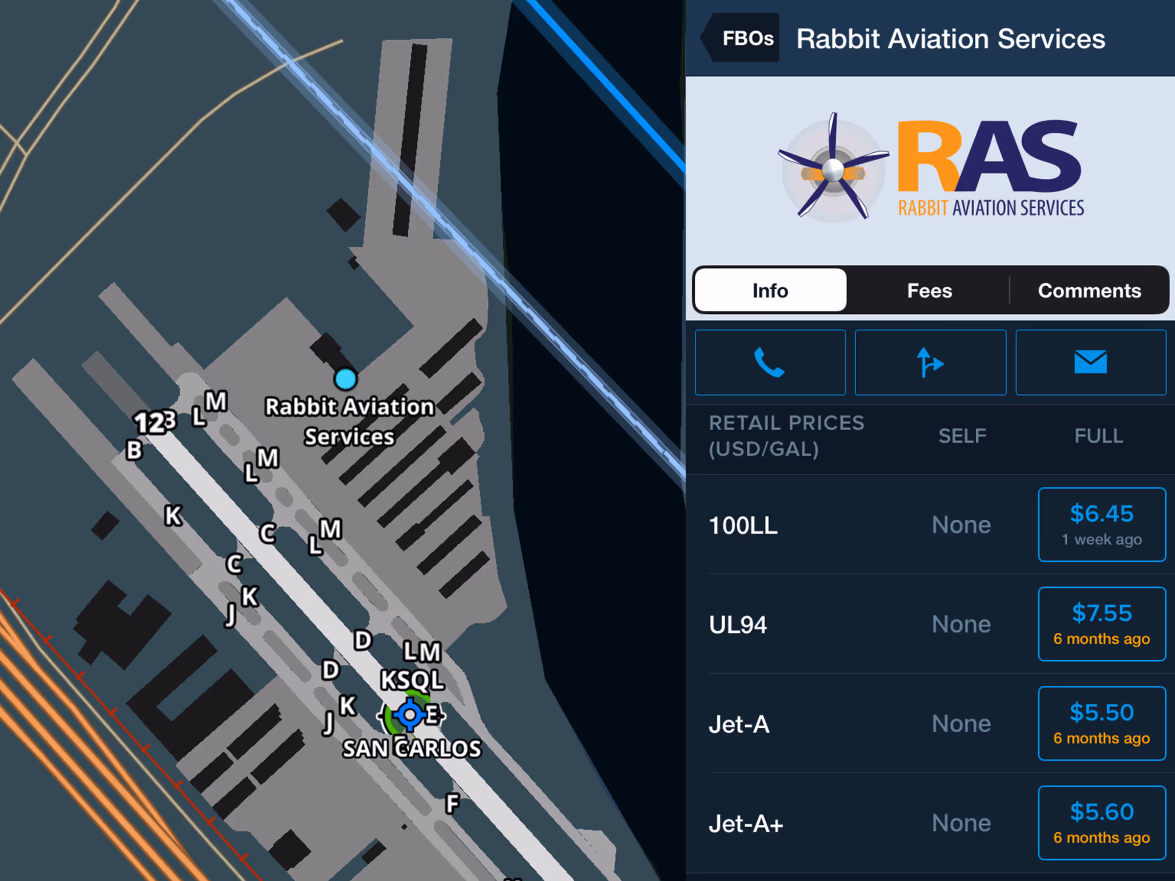
UL94 Fuel Prices
- Find pricing and availability of UL94 fuel at FBOs in Airports > FBOs or by tapping an FBO icon on a plate or the map.
- Each FBO displays self service and full service pricing as applicable.
- Like with other fuel types, you can update outdated or missing UL94 prices by tapping Update Fuel Prices in the bottom-right of the FBO detail view.