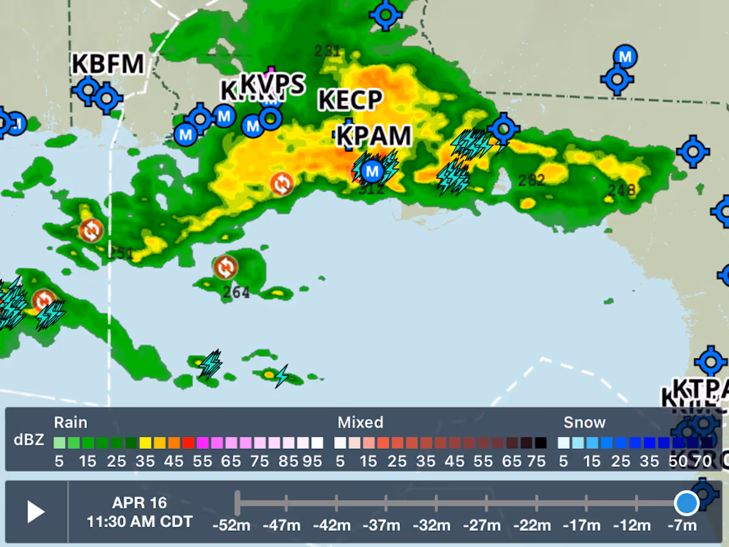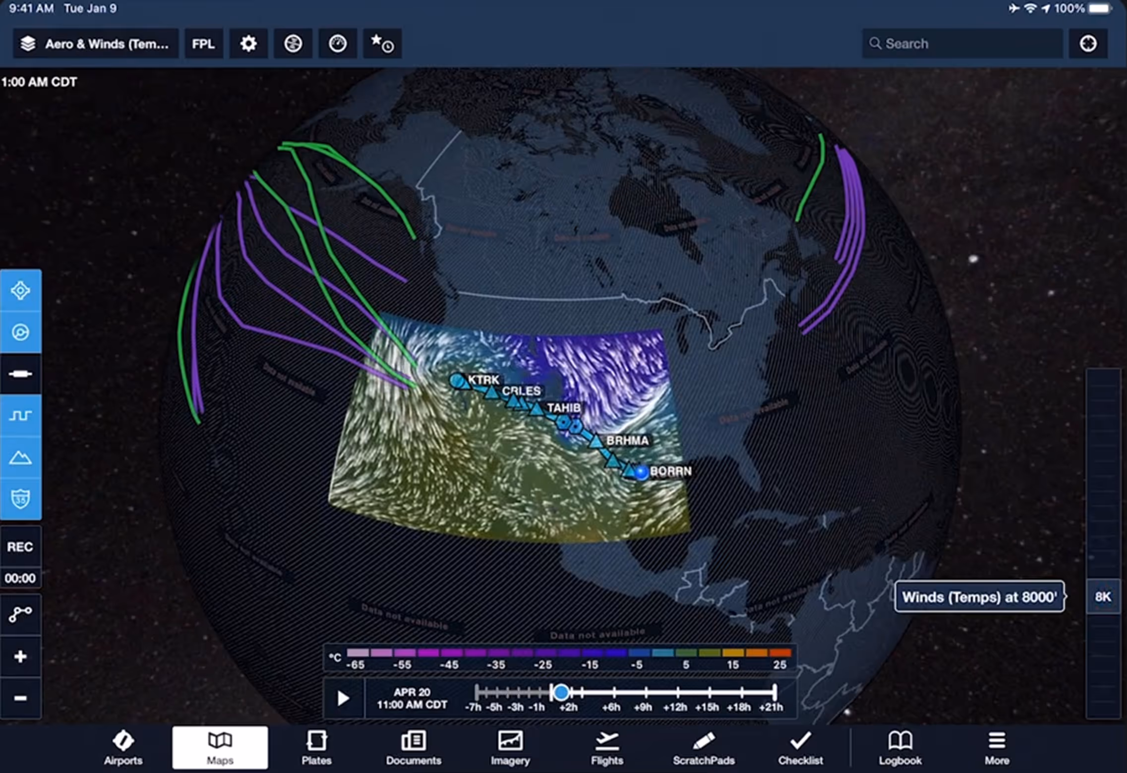
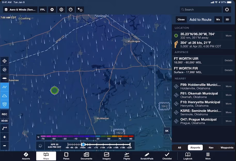
View global forecast wind speed, direction, and temperatures at multiple altitudes and times using these stunning animated weather layers. Both the “Winds (Temps)” and “Winds (Speeds)” layers use colorful heat maps covering the globe to represent their primary forecast values at the selected altitude and time. Overlaid on each layer’s heat map are smoothly-flowing particle animations representing wind direction and speed, providing an intuitive view of large-scale weather patterns in relation to the layer’s primary forecast value (wind speed or temperature). Use the Time Slider to view wind forecasts in a 24+ hour period, and move the Altitude Slider to view winds from the surface up to 63,000 ft.
Both layers are included with ForeFlight Premium subscription plans.