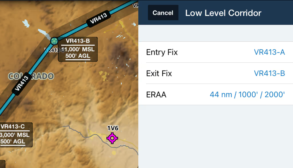


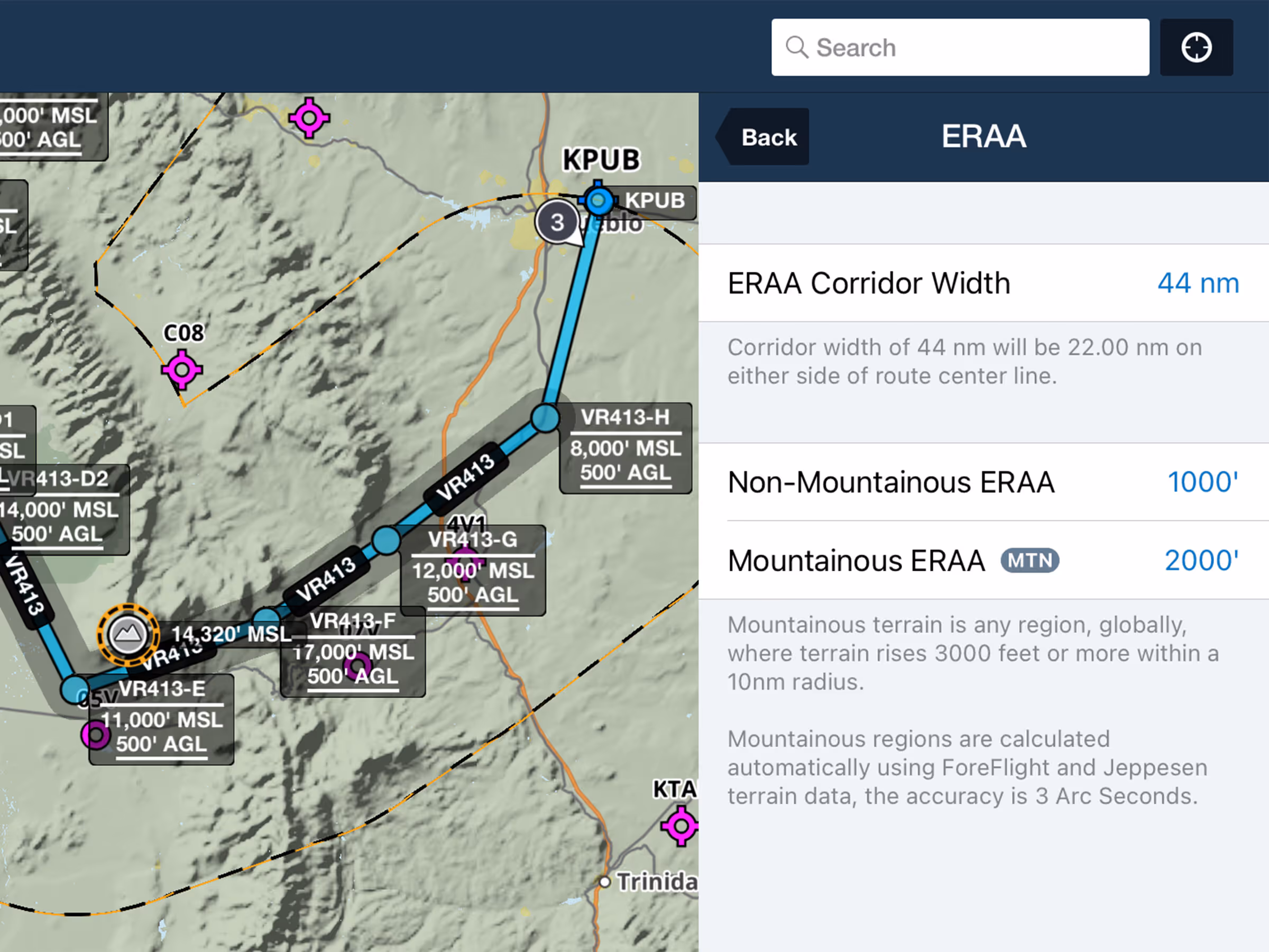
Easily customize, calculate, and display the Emergency Route Abort Altitude and control point for a Low Level Corridor. Tap any route bubble in the FPL Editor and tap Low Level Corridor to enter the Low Level Corridor set up menu where you can set entry and exit fixes and customize the ERAA. In addition to setting the ERAA corridor width (44nm by default), you can also set both a mountainous and non-mountainous ERAA (1,000 feet and 2,000 feet respectively by default). Tap Apply to Route to add the Low Level Corridor to your route and display the ERAA corridor outline and ERAA control point directly on the map. ForeFlight also adds a badge in the bottom-right corner of the screen displaying the ERAA for quick reference, which you can tap to show or hide the ERAA corridor outline. Available with ForeFlight’s Military Flight Bag One subscription plan.
.avif)