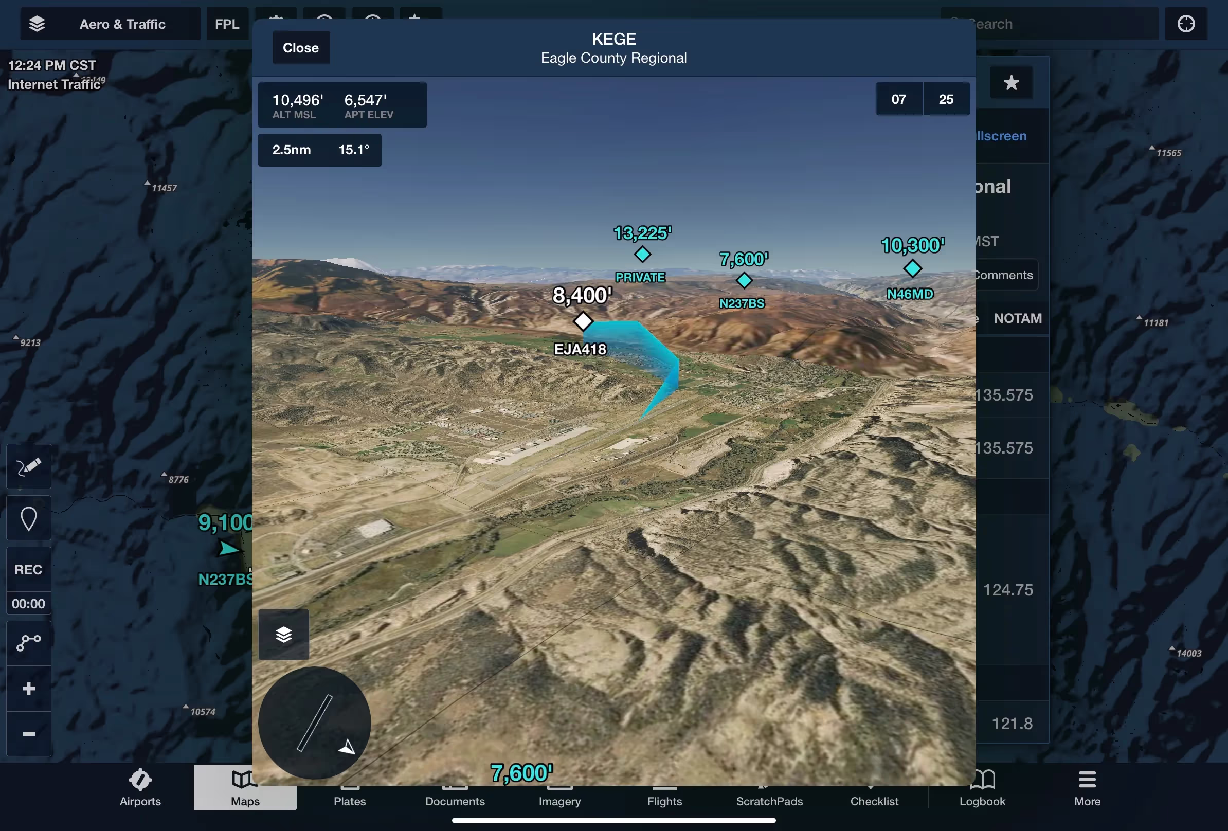
Follow live approaches, landings, and takeoffs in 3D with FlightAware-sourced Internet Traffic in 3D Airports, available with Premium and Business Performance subscription plans.
To display 3D Traffic, open any airport in 3D and tap the Layer Selector button in the bottom-left and tap Traffic. This layer uses the same FlightAware-sourced data as the overhead map’s Traffic layer.
Traffic targets appear as blue diamonds and display their altitude and tail number if nearby, becoming progressively smaller the further away they are. Tap on any traffic target to reveal its flight path from the time you opened 3D View or enabled the Traffic layer.
Since ForeFlight interpolates aircraft movement based on discontinuous position reports, an aircraft’s immediate flight path may appear to shift in response to new position data. 3D View will only show Internet Traffic, not ADS-B Traffic, so an internet connection is required to use it. Unlike the overhead map layer, 3D View does not depict ground traffic, although aircraft on the ground may still appear depending on their speed and other factors.