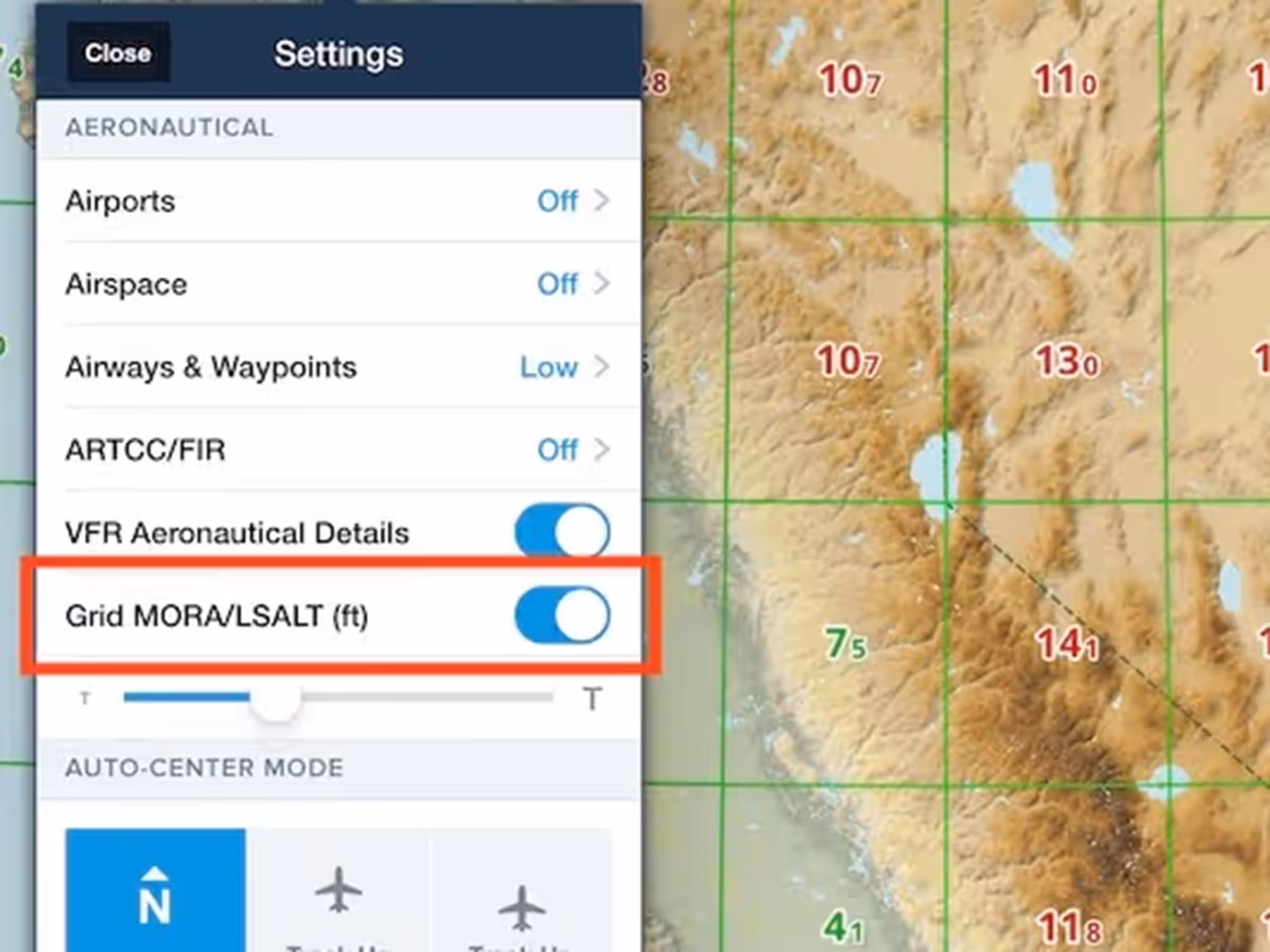
Identify the altitudes to avoid along your flight route by referencing the Minimum Off-Route Altitude (MORA), or Lowest Safe Altitude (LSALT) in Australia, directly on the Aeronautical Map.
Altitudes, in feet, are represented as the first number indicating thousands and the second, smaller number indicating hundreds within the grid.
The grid initially is presented as a 5ºx5º grid, which dynamically condenses to 1ºx1º as you zoom in on the map. Altitudes under10,000 feet are depicted in green, suggesting lower terrain/obstacle heights, while altitudes exceeding 10,000 feet are highlighted in red, indicating significantly higher terrain/obstacles.
The Grid MORA overlay in ForeFlight provides pilots with a visual representation of these altitudes, aiding in flight planning, terrain avoidance and safer navigation. Grid MORA incorporates altitude buffers of 1,000 feet for 6,000 feet or less and a 2,000 feet buffer for 7,000 feet and above for obstacle clearance globally.
This differs from OROCA, which is U.S. only, and maintains a standard 1,000-foot buffer unless in designated mountainous terrain when it uses 2,000 feet.
This new setting is disabled by default but can be enabled in the Aeronautical Map Drawer > Aeronautical Settings > scroll to the bottom > GridMORA/LSALT (ft) while the Aeronautical Map is active.