October 2018

SiriusXM Surface Visibility

No items found.
back
next
This is some text inside of a div block.

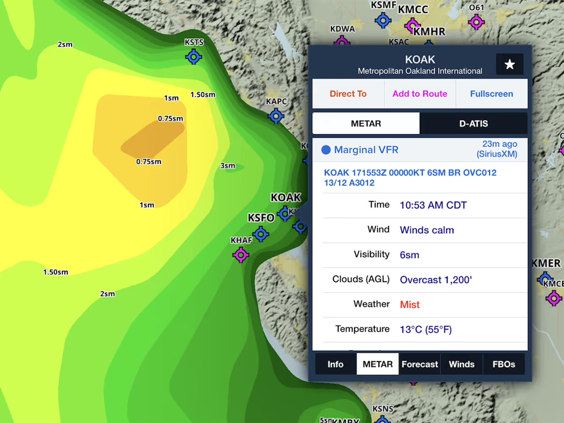
If you fly with a SiriusXM-enabled device, such as the SXAR1 and Garmin’s GDL 51 and 52, you can now access the new SiriusXM Surface Visibility layer from the layer selector. This displays near-term forecasts of surface visibility using colors to indicate distances ranging from 10 to 0 statute miles. The layer covers all of CONUS, southern Canada, and northern Mexico.

Release notes

Release notes

  • Customers who fly with a SiriusXM-supported device, including the SXAR1 and Garmin’s GDL 51 and 52, can now access the Surface Visibility layer from the layer selector.
  • See near-term forecasts of surface visibility that use colors to indicate distances ranging from 10 to 0 statute miles.

Support

Support

Month 2025

FAQs

FAQs

Find answers to your questions

Month 2025

Pilot's Guide

Pilot's Guide

The complete ForeFlight handbook

Month 2025

Video Library

Video Library

ForeFlight videos all in one place

Month 2025

Buying Guide

Buying Guide

Choose the right iPad and plan