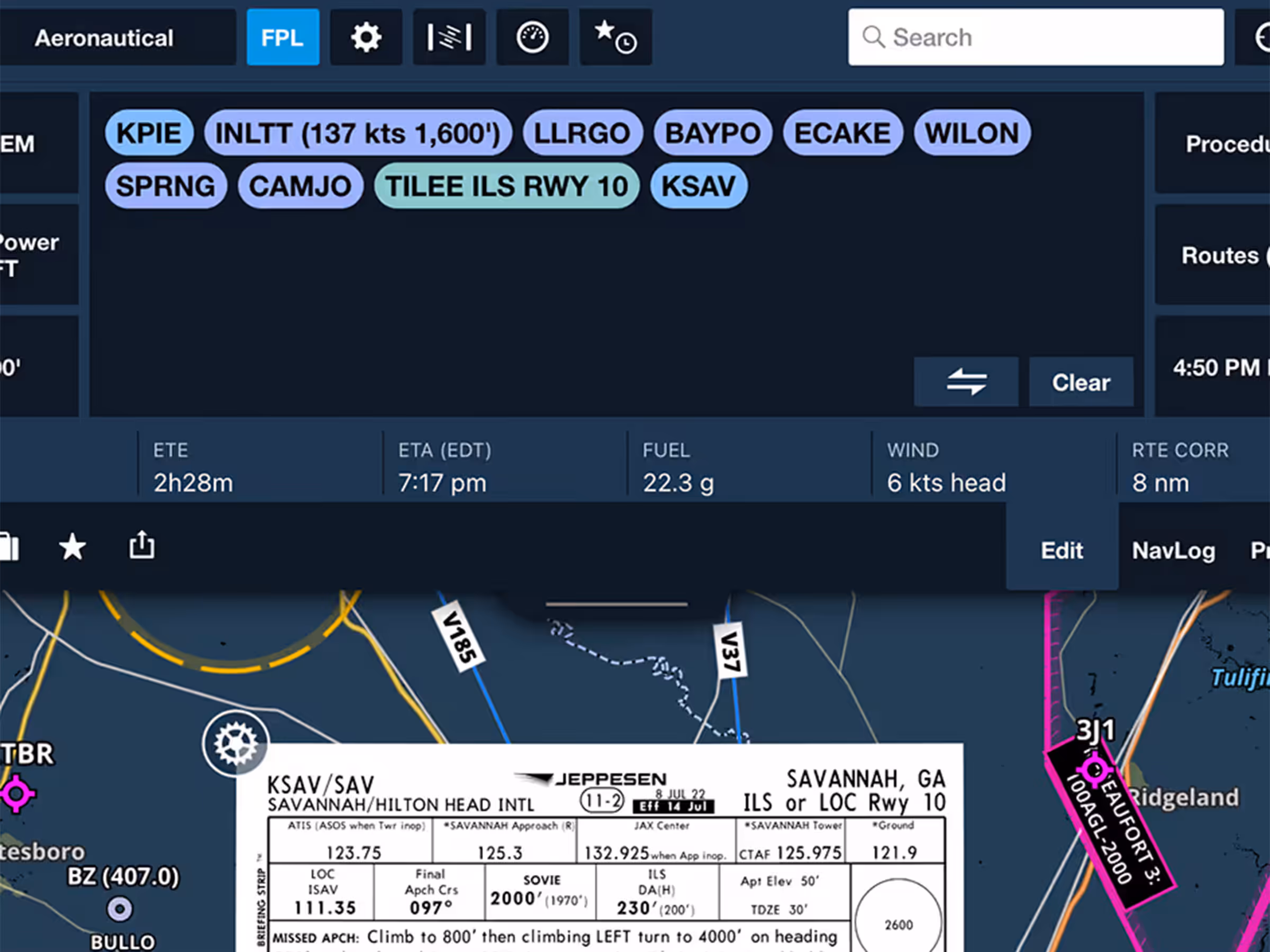
FPL Drawer Enhancements
- A new strip across the bottom of the FPL drawer provides an enhanced view of key flight information, with a touch control that allows you to resize the FPL view vertically.
- The flight information strip is also visible at the bottom of the Navlog Profile View, just as it is in the Edit tab.
- In the Profile View, the Layer Selector and Settings have been relocated to the top-right corner for easier access.
- The Profile View ruler has also been improved for ease of use.
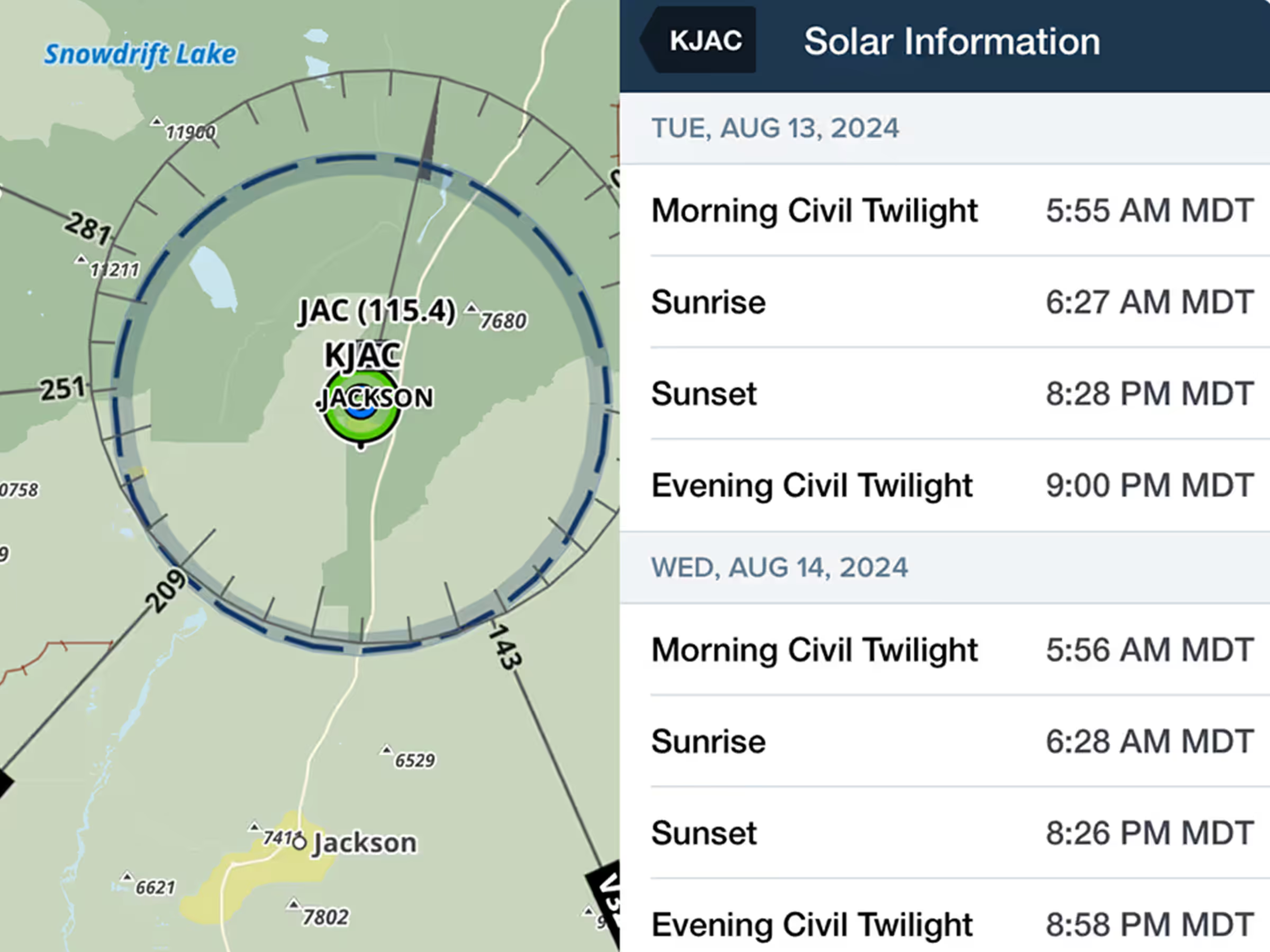
Support for Civil Twilight
- Accurately log day and night hours with new solar data, including morning civil twilight, sunrise, sunset, and evening civil twilight for any airport worldwide, ensuring compliance with flight regulations.
- View solar data for the current day and the next three days.
- Access solar data for four days total: the current day plus the next three days.
- To access this information, tap the chevron next to the sunrise/sunset times in Airport Details or navigate to Info > Details > Solar Information.
- Solar information uses latitude and longitude to accurately calculate when the sun is 6° below the horizon, providing a more precise measurement for FAA night flight requirements.
- Solar Information is available wherever airport details are provided within ForeFlight.
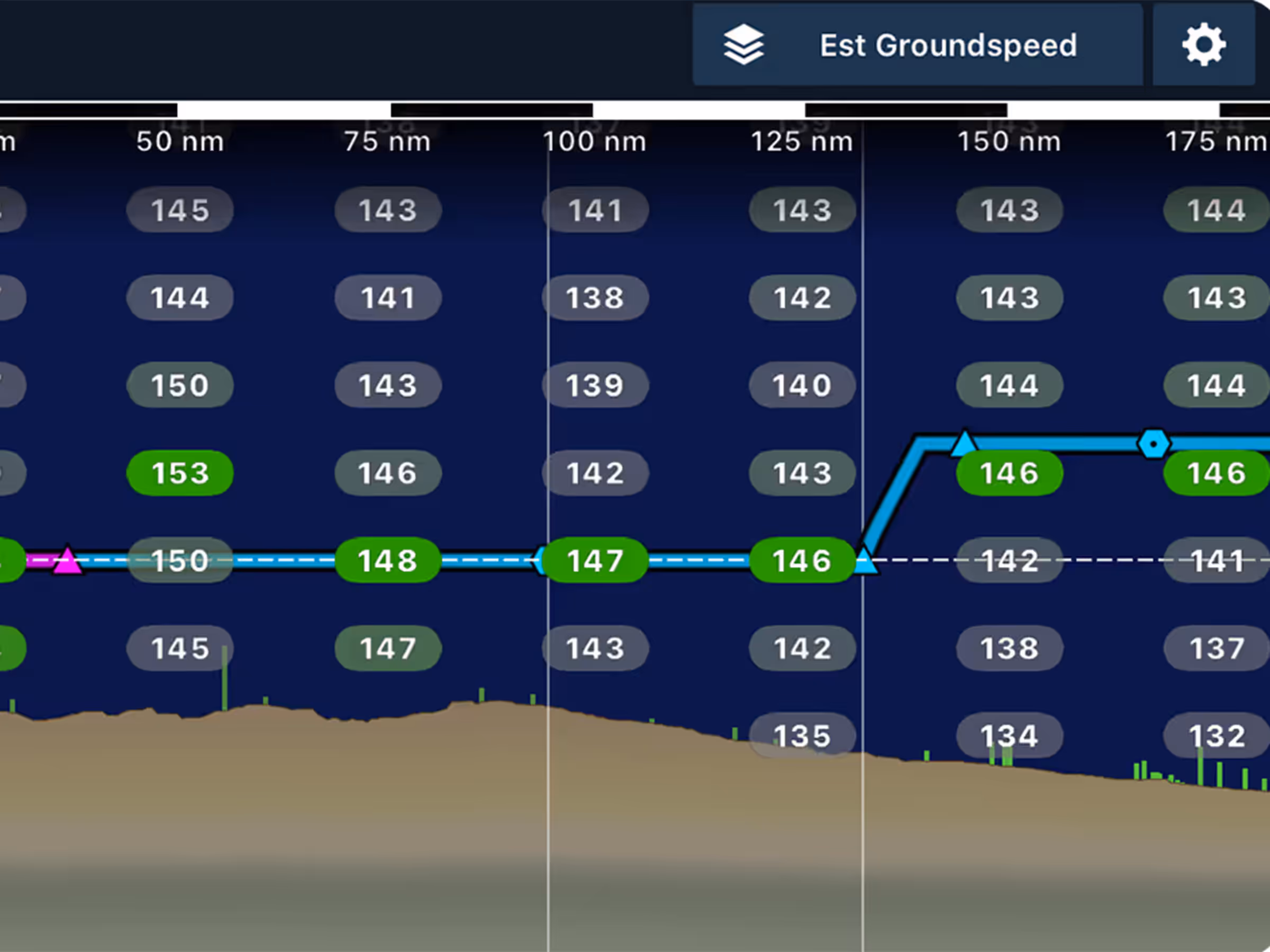
New Layers in Profile View
- Enhance flight planning with new headwind/tailwind and estimated ground speed layers in Profile View, offering precise altitude insights and timely route analysis.
- Use aircraft performance data combined with headwind/tailwind data at different altitudes to identify the most efficient flight levels, with visual cues—green for favorable conditions and gray for less favorable—making it easy to assess your options at a glance.
- The wind speed and estimated ground speed layers use the same packed winds aloft data as the Dynamic Winds and Temperatures layers, offering time-differentiated forecasts along your route.
- Tap and hold in the Profile View to see additional details as you scrub left or right along the route.
- Available for Premium customers.
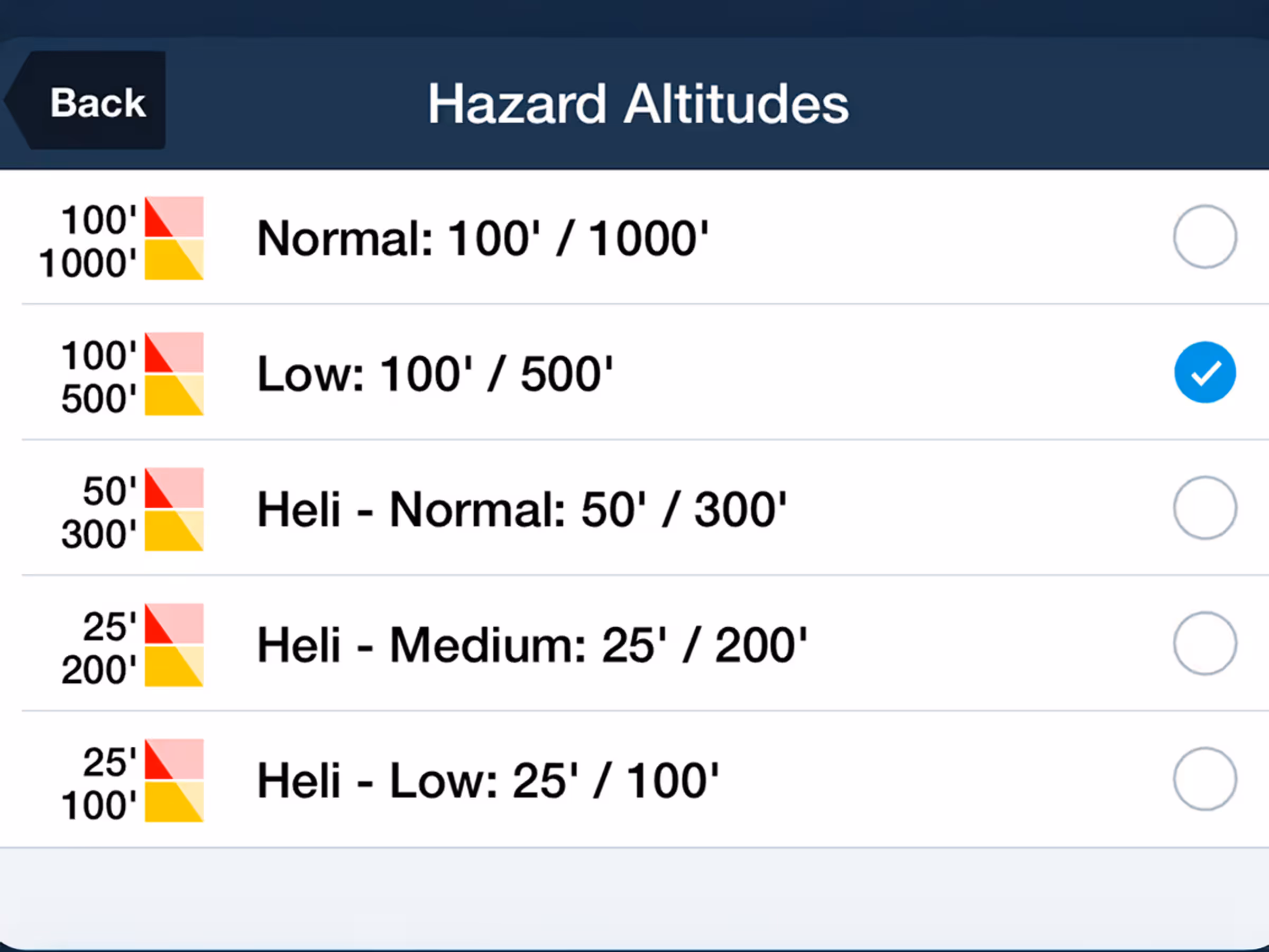
Additional Hazard Altitude Options
- New 100’ and 500’ Hazard Altitude options are now available for lower altitude flying.
- Access these options by navigating to Map Settings > Hazards > Hazard Altitudes > Low: 100’ / 500’.
New VFR Add-On Charts
- Customers in North Africa and Japan can now add VFR charts from Rogers Data and AIS to any subscription that includes the corresponding ForeFlight regions.
- New Rogers Data VFR charts for North Africa East and North Africa West are available for customers with the Africa region as part of their ForeFlight subscription. Coverage includes the northern Middle East up to Syria.
- New AIS Japan VFR charts, provided by Airman’s Information Service Ltd., are available for customers with the Asia/Pacific region as part of their ForeFlight subscription. These charts offer detailed coverage in three scales: 1:500k for full country coverage, 1:250k for specific parts of the country, and 1:100k for the Tokyo area. The appropriate scale will automatically display based on your zoom level, or you can manually switch between them using the Map Touch Action feature.
New Runway Analysis Aircraft Support
- ForeFlight’s advanced Runway Analysis product for turbine aircraft now supports the Piper M700, Cessna Citation 550B Bravo, and Cessna Citation 560 V.