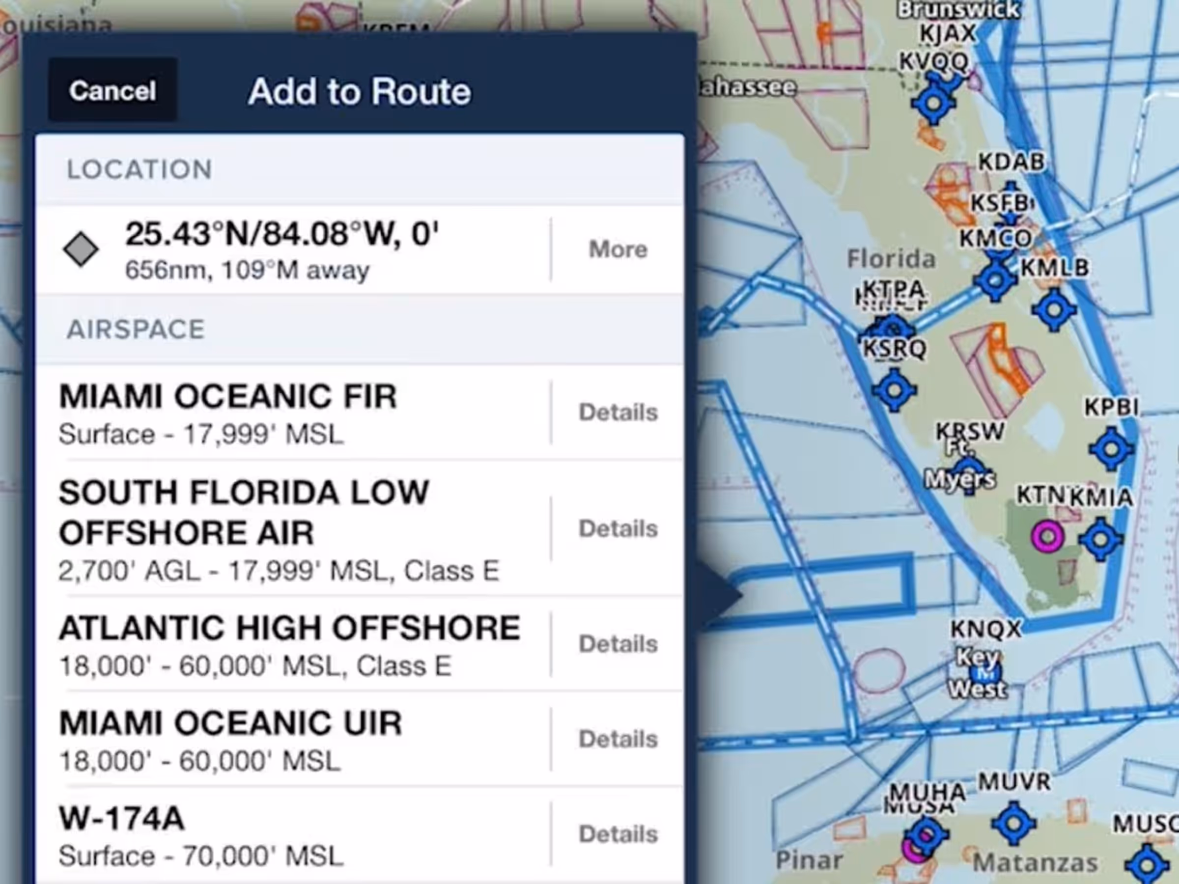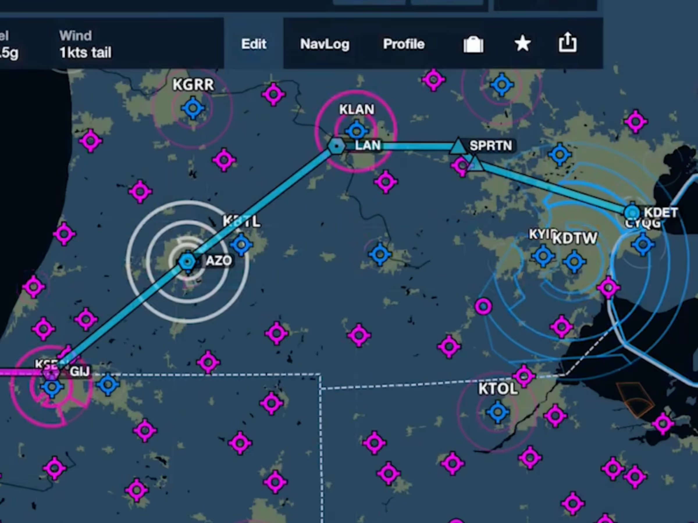
ForeFlight’s data-driven Aeronautical Maps now highlight airspace along your route while dimming other airspace, making it easy to focus on the airspaces that matter for your flight. ForeFlight automatically highlights any airspace within +/- 1,000 feet of your altitude and within 1-nautical mile on either side of your route. Adjust your route or altitude, and ForeFlight smoothly updates the on-screen depiction.
ForeFlight considers the flight’s climb, cruise, and descent trajectory to highlight nearby airspace. Once in flight, ForeFlight uses your current altitude to determine which airspaces to highlight, and looks ahead to highlight airspace along your current heading, even if not directly on your route.