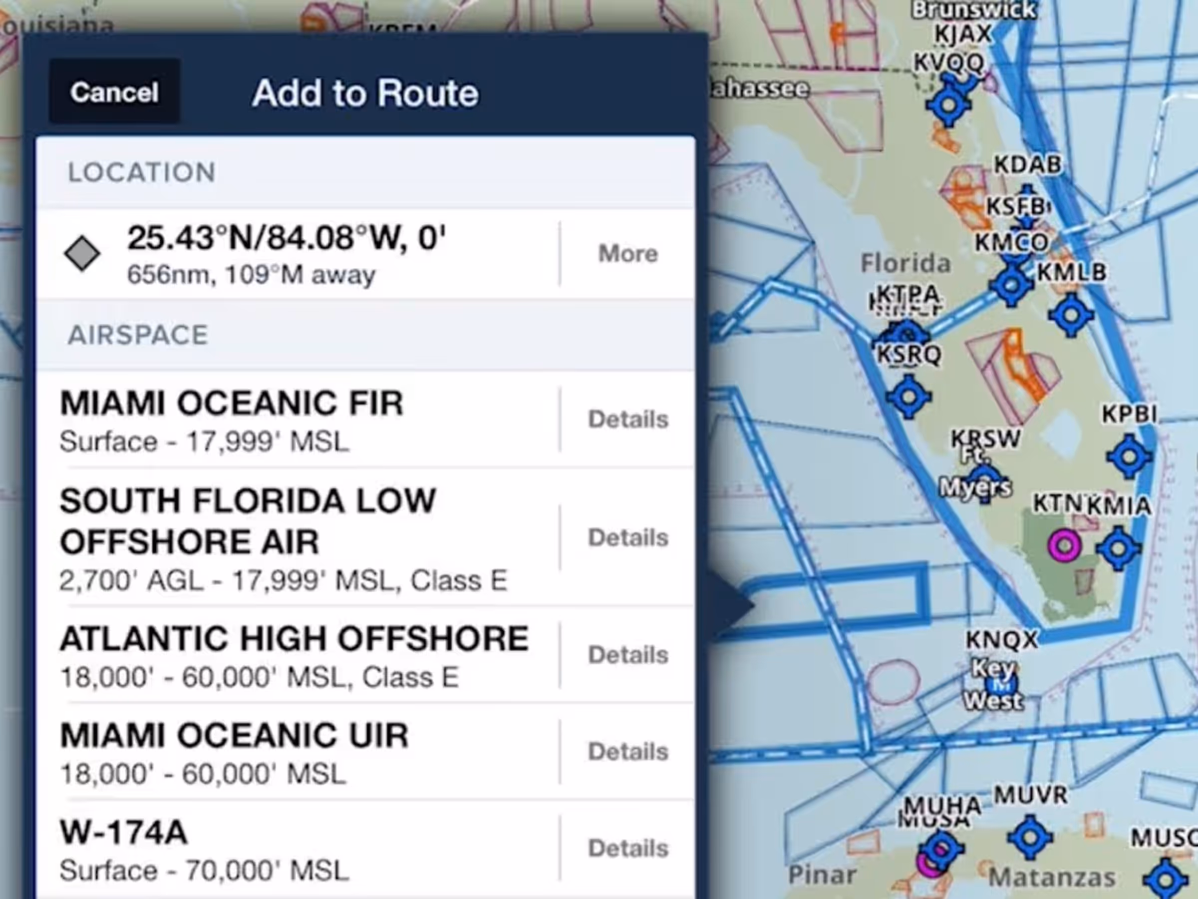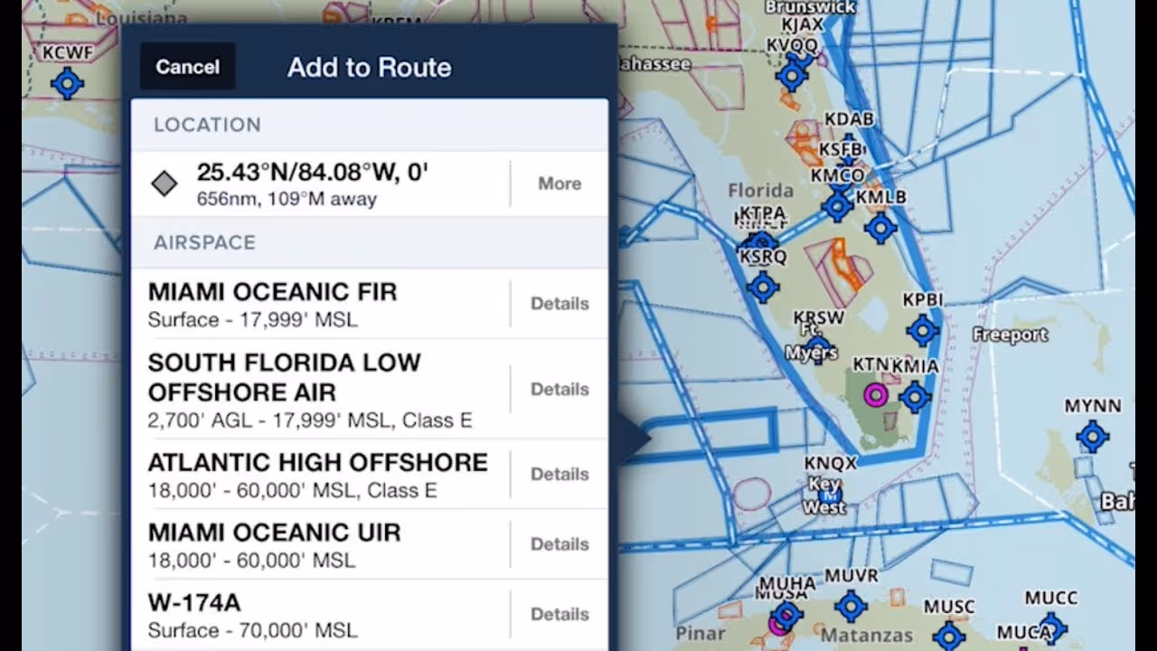
ForeFlight’s Maps view now features Jeppesen-sourced global airspace information for FIRs, UIRs, controlled airspace, and special use airspace. Tap-hold anywhere on the map to see a list of airspaces at that location, then tap “Details” to find more information.
Different types of airspace provide different amounts of information: controlled airspace shows basic information about the class of airspace and altitude limits. Special use airspace and MOAs add to this with information about communication frequencies, activation hours, and the controlling agency. Flight information regions (FIRs) and upper information regions (UIRs) have even more detailed information, listing center, control, and radio frequencies; RVSM cruise tables; and operational notes required for transnational and oceanic flights.