Specify elevations for your User Waypoints and custom waypoints imported via Content Packs to plan routes to and from them like you would airports, with accurate climb/descent calculations and depictions in Profile View.
You can add an elevation to a User Waypoint in More > Custom Content > User Waypoints. Tap the waypoint you would like to edit, tap the Elevation field to input the number, and then tap Save. Another way to edit a waypoint’s elevation is by directly tapping it on the Maps view, then tapping Edit. Specify the elevation and tap Save as before. Lastly, you can specify elevations in KML or CSV waypoint lists you import as part of the “navdata” sub-folder in a Content Pack. While standalone CSV files also support elevations, standalone KML files do not, so they must be imported as part of a Content Pack. For a .csv file, simply add a column for elevation and express each value in meters (ForeFlight will automatically convert them to feet upon import). While the column names in a .csv file don’t matter, their order does. Column A is the waypoint ID or name, column B is the description, column C is latitude, column D is longitude, and column E is for elevation.
NOTE: To import a CSV file as user waypoints, it must be named user_waypoints.csv.
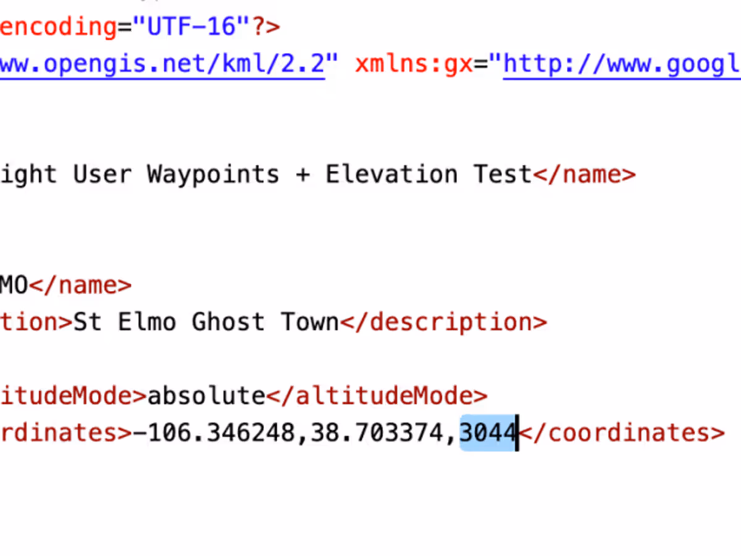
For .kml files, include your waypoint elevation (in meters) in the optional altitude component of the coordinates tuple. This value often defaults to 0, so ForeFlight will only recognize non-zero values (positive or negative) as elevations.