
Release Spotlight
Release Spotlight

17.11
CFI Referral Program
Active CFIs can earn discounts on their subscription by introducing students to ForeFlight.
2024
16.7
July 2024
July 2024
MFB One
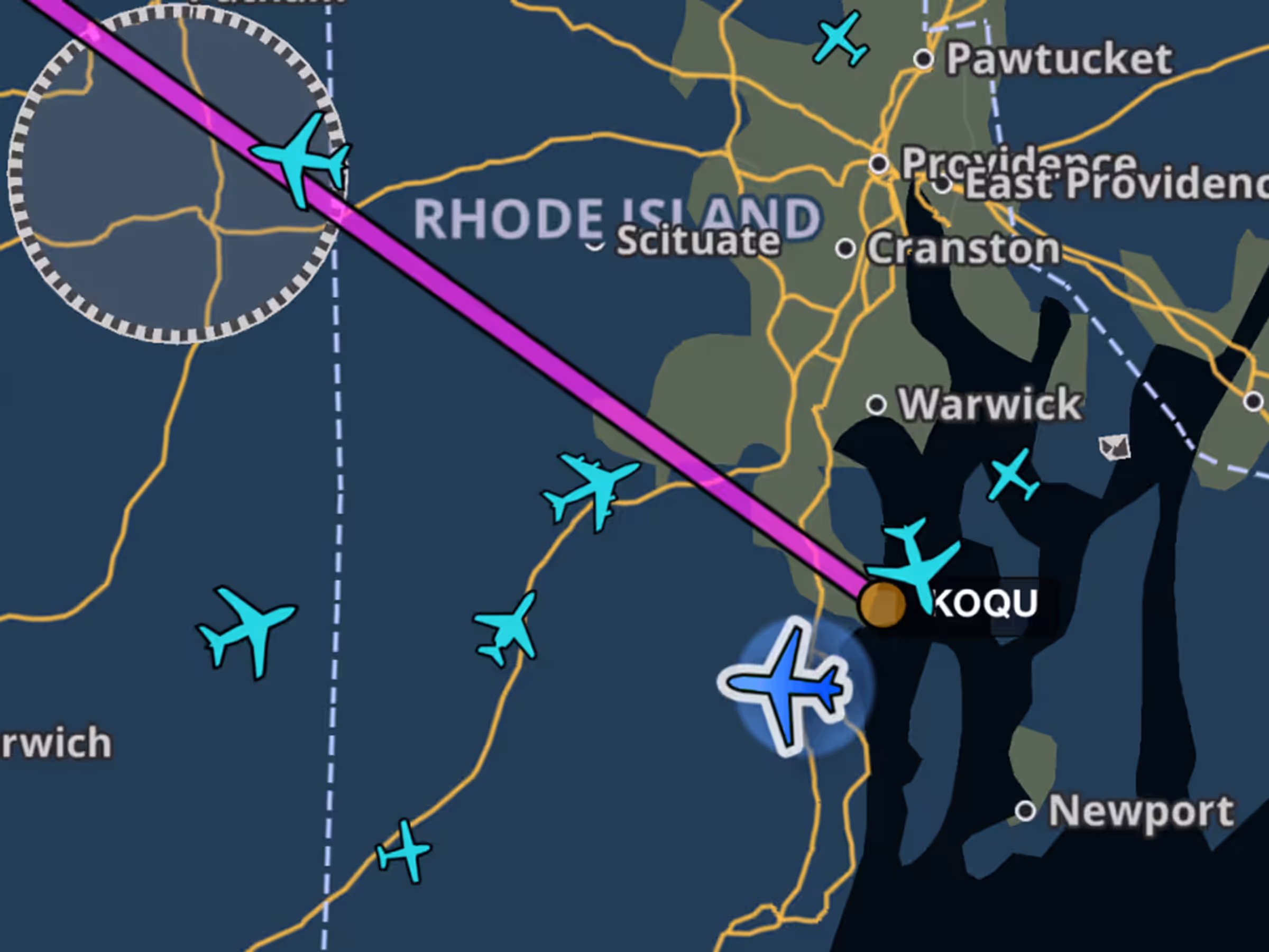
Military Flight Bag: Enhanced Traffic Icons
New Map Settings toggle shows aircraft types on the map using ADS-B traffic.

Essential & Above
New Categories for Reported Turbulence
Added intermediate turbulence categories showing periods of lower severity with moments of higher intensity.
2024
16.6
June 2024
June 2024

All Plans
Aeronautical Map - Waypoint Settings
Customize VFR, IFR, or both waypoint types on the Aeronautical Map in VFR Mode.
All Plans
Discover - Events & Education
Find fly-ins and aviation events with the new Discover tab featuring AOPA and EAA events.
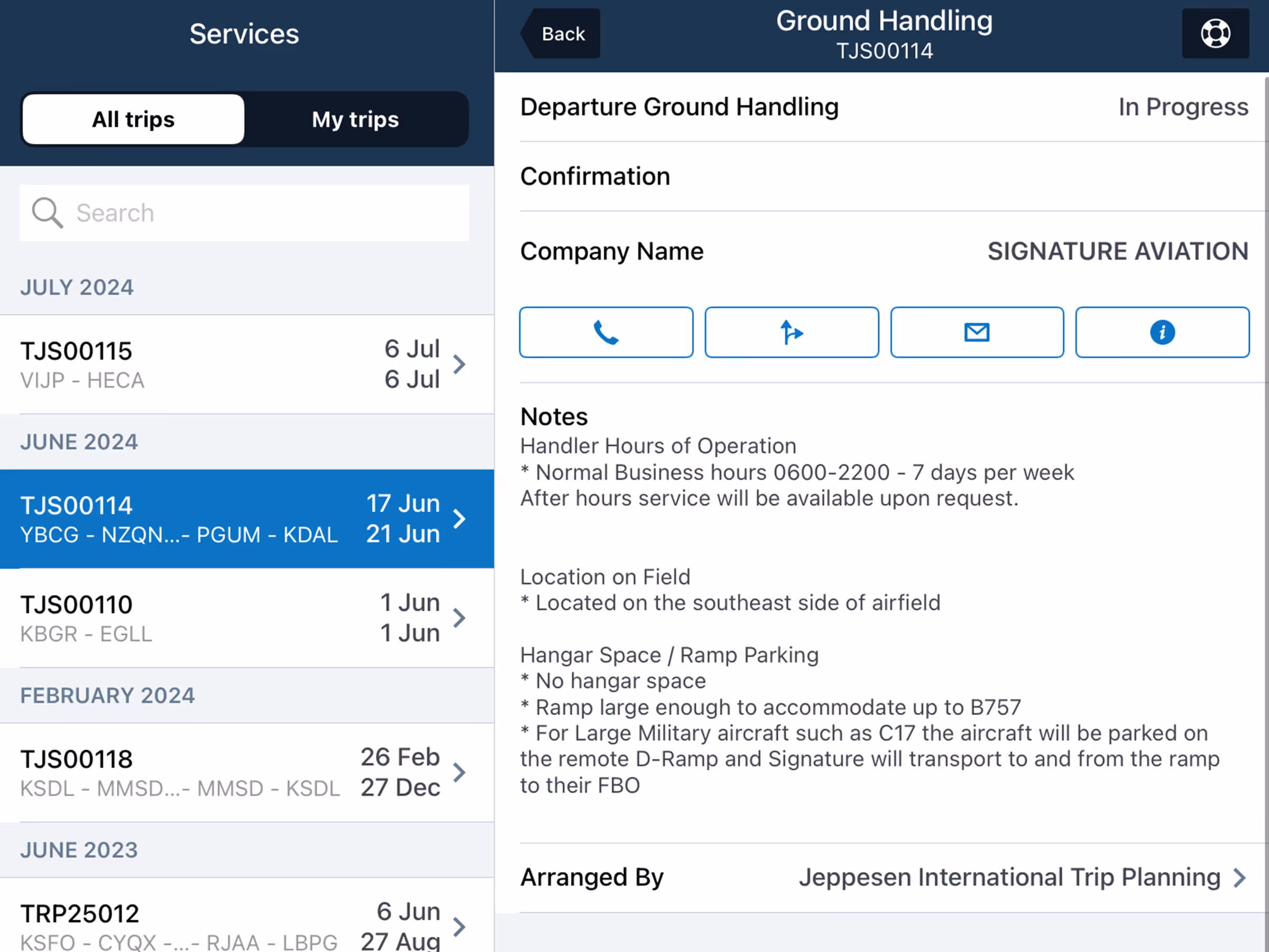
Trip Support
ForeFlight Trip Support - Services Tab
Track Trip Support services in-app with details on trip legs, crews, passengers, and service status.
2024
16.5
May 2024
May 2024
All Plans
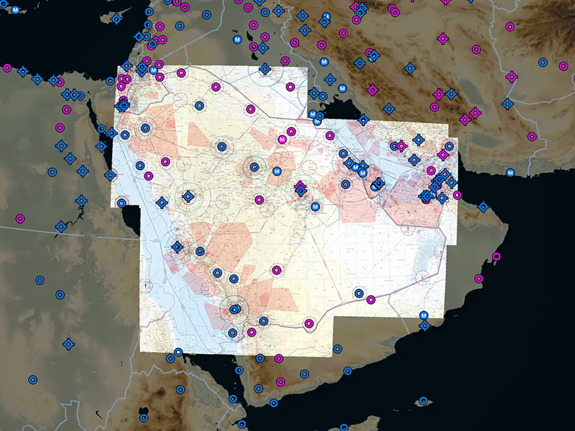
New Middle East VFR Add-On Charts
New Middle East VFR charts cover Saudi Arabia, UAE, Bahrain, and Qatar.

All Plans
New South Africa VFR Add-On Charts
New South Africa VFR charts cover Johannesburg and Cape Town Special Rules Areas.
Essential & Above
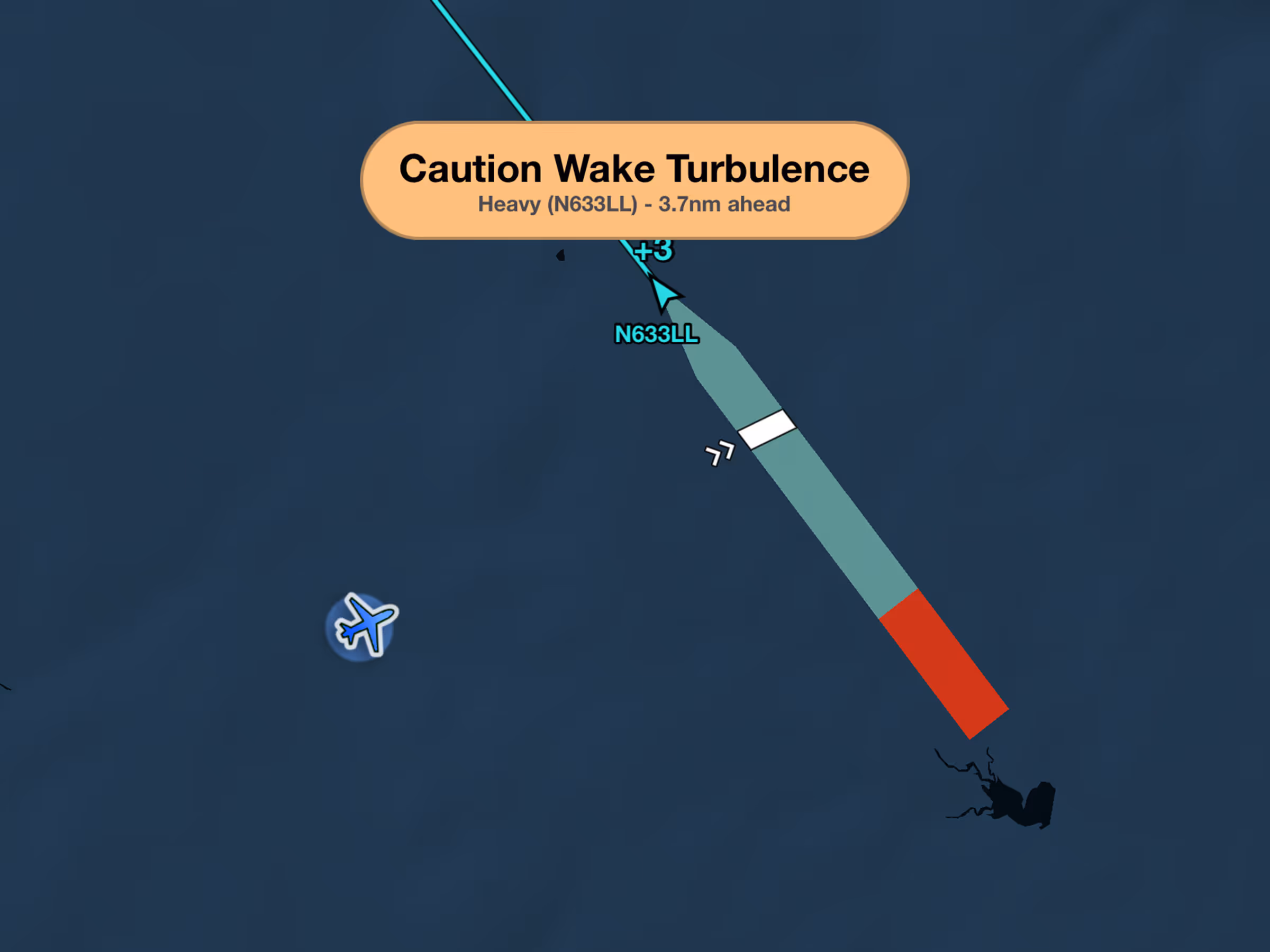
Wake Turbulence Alerts
Get wake turbulence alerts with ADS-B/FLARM showing wake position and relative altitude.
2024
16.4
April 2024
April 2024
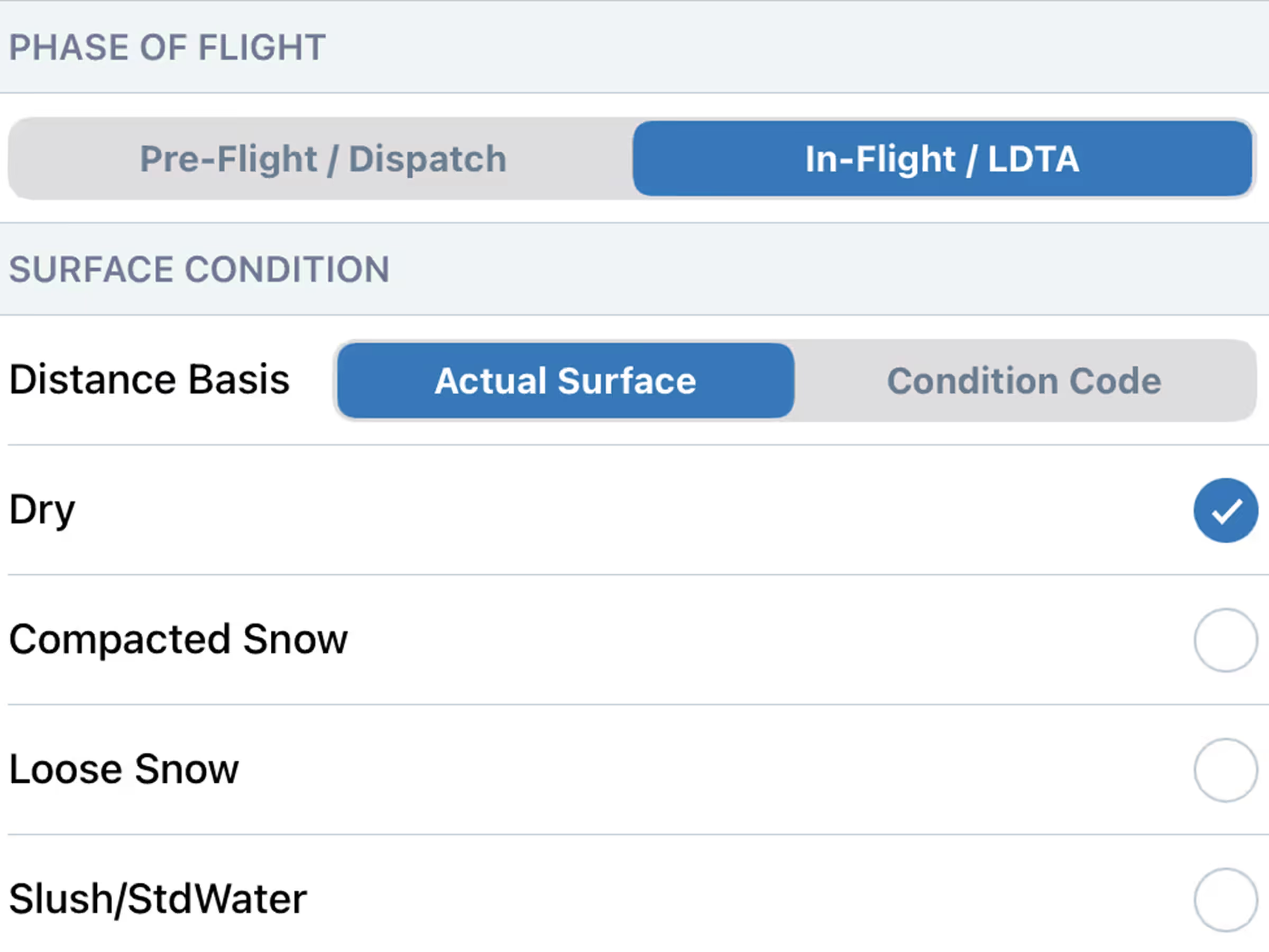
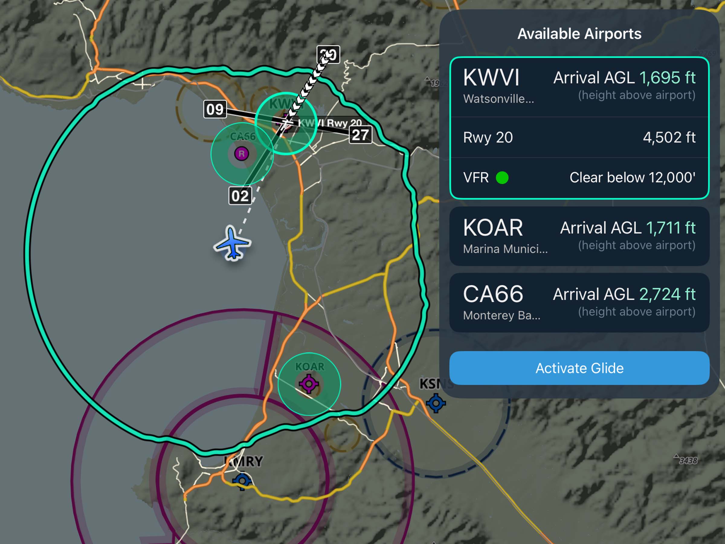
Runway Analysis
Landing Factor Selector
Calculate landing distance during pre-flight and before arrival for better SOP compliance.
Essential & Above
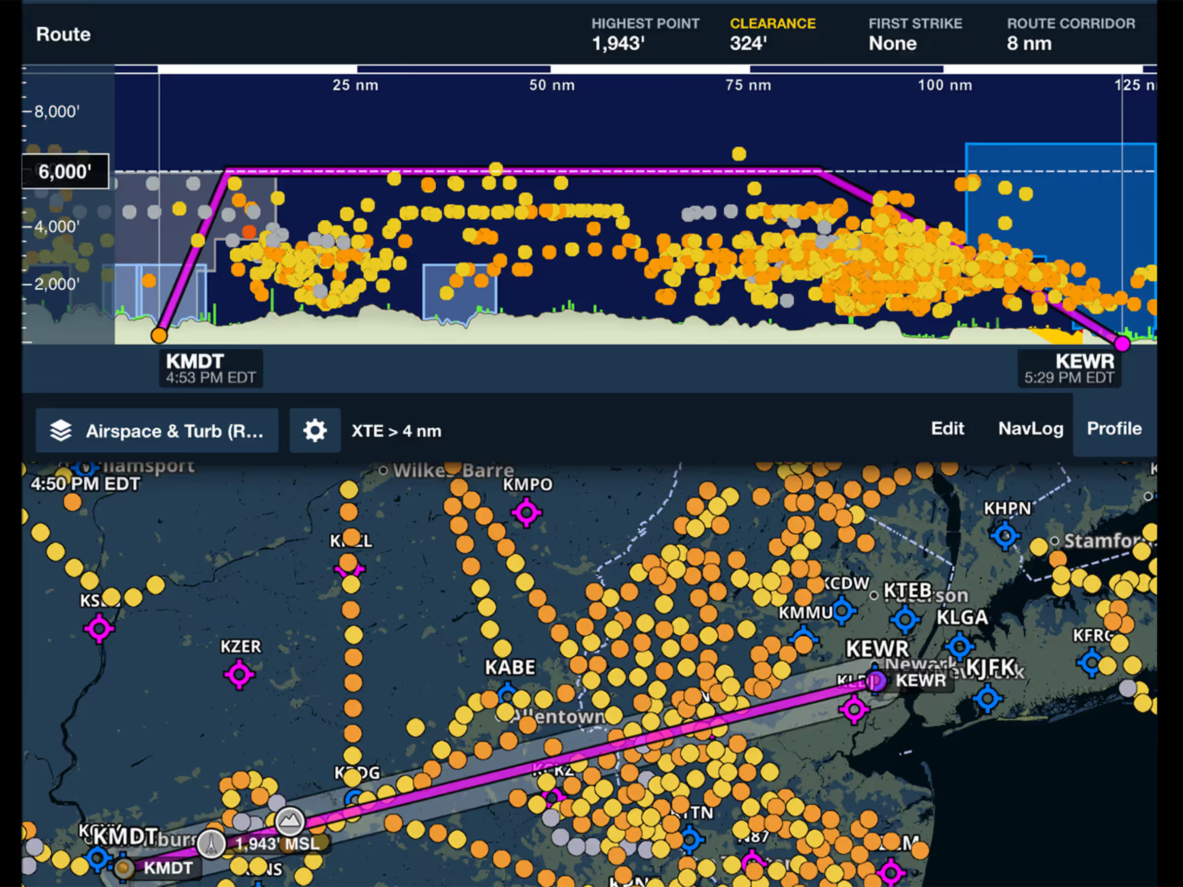
Reported Turbulence
View real pilot reports of smooth air or turbulence with color-coded intensity indicators.

Runway Analysis
TOLD Card
Get printer-friendly takeoff and landing briefings with critical Runway Analysis information.
All Plans
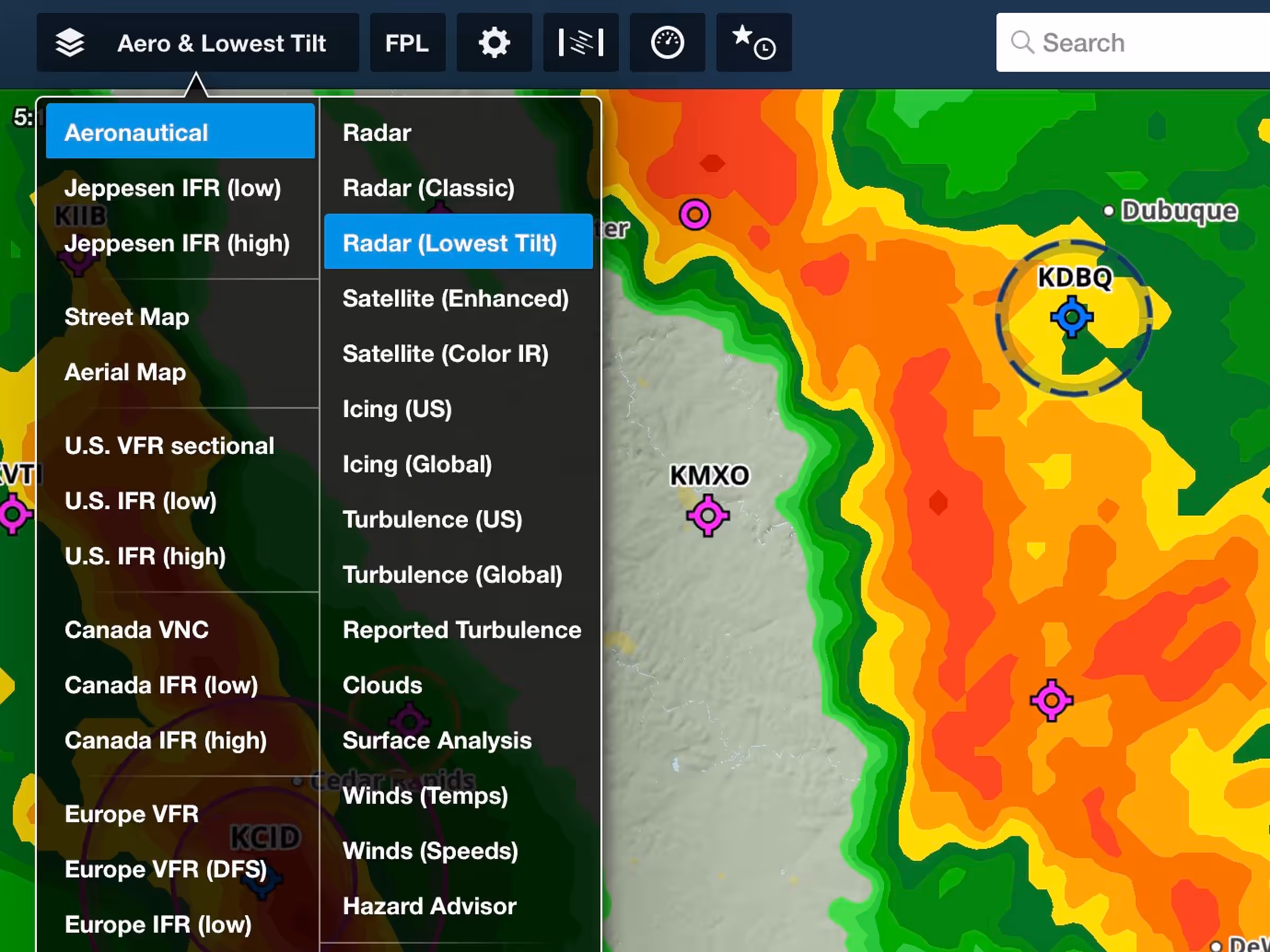
US Lowest-Tilt Radar
See ground precipitation with improved map layer featuring lower latency and better resolution.
2024
16.3
March 2024
March 2024

All Plans
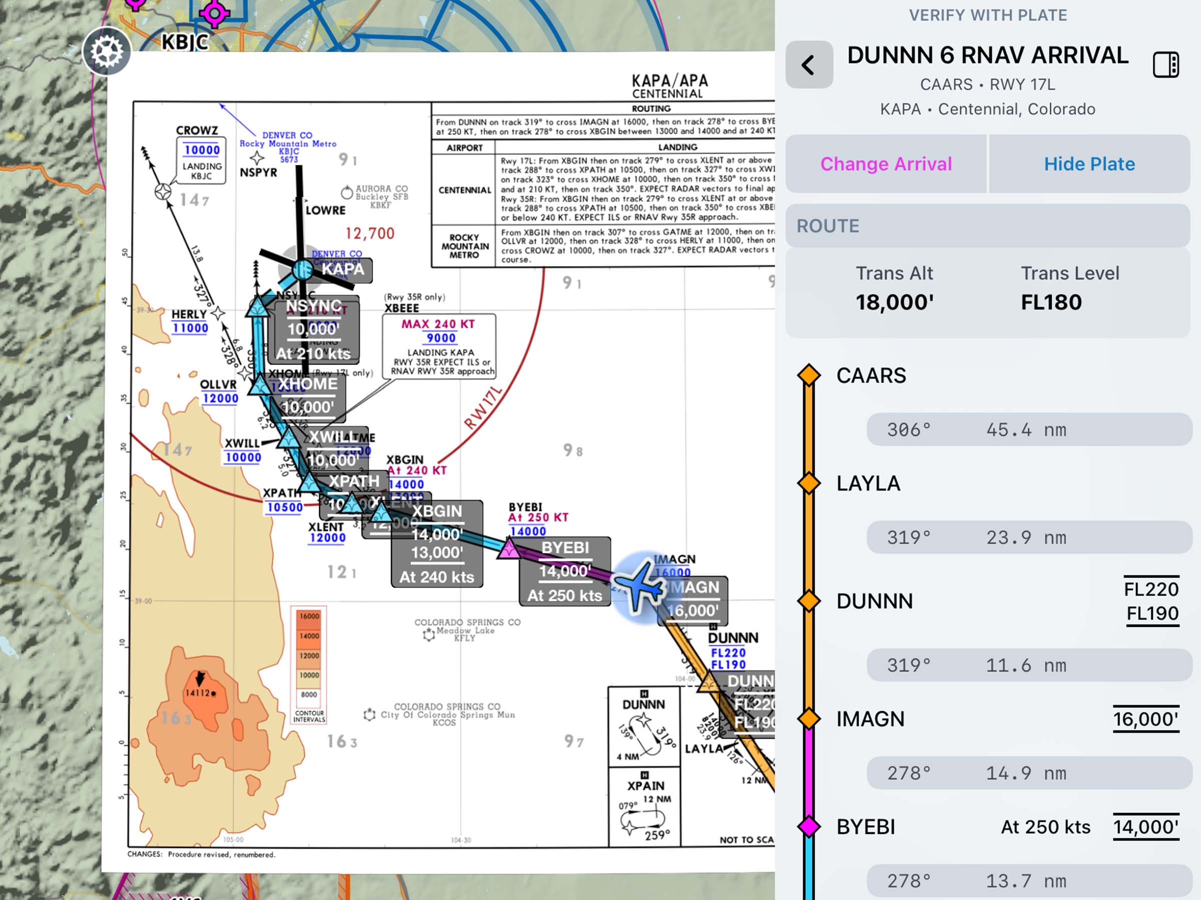
Aeronautical Map Drawer
A consolidated settings container for aeronautical map toggles and settings, optimizing space.
All Plans
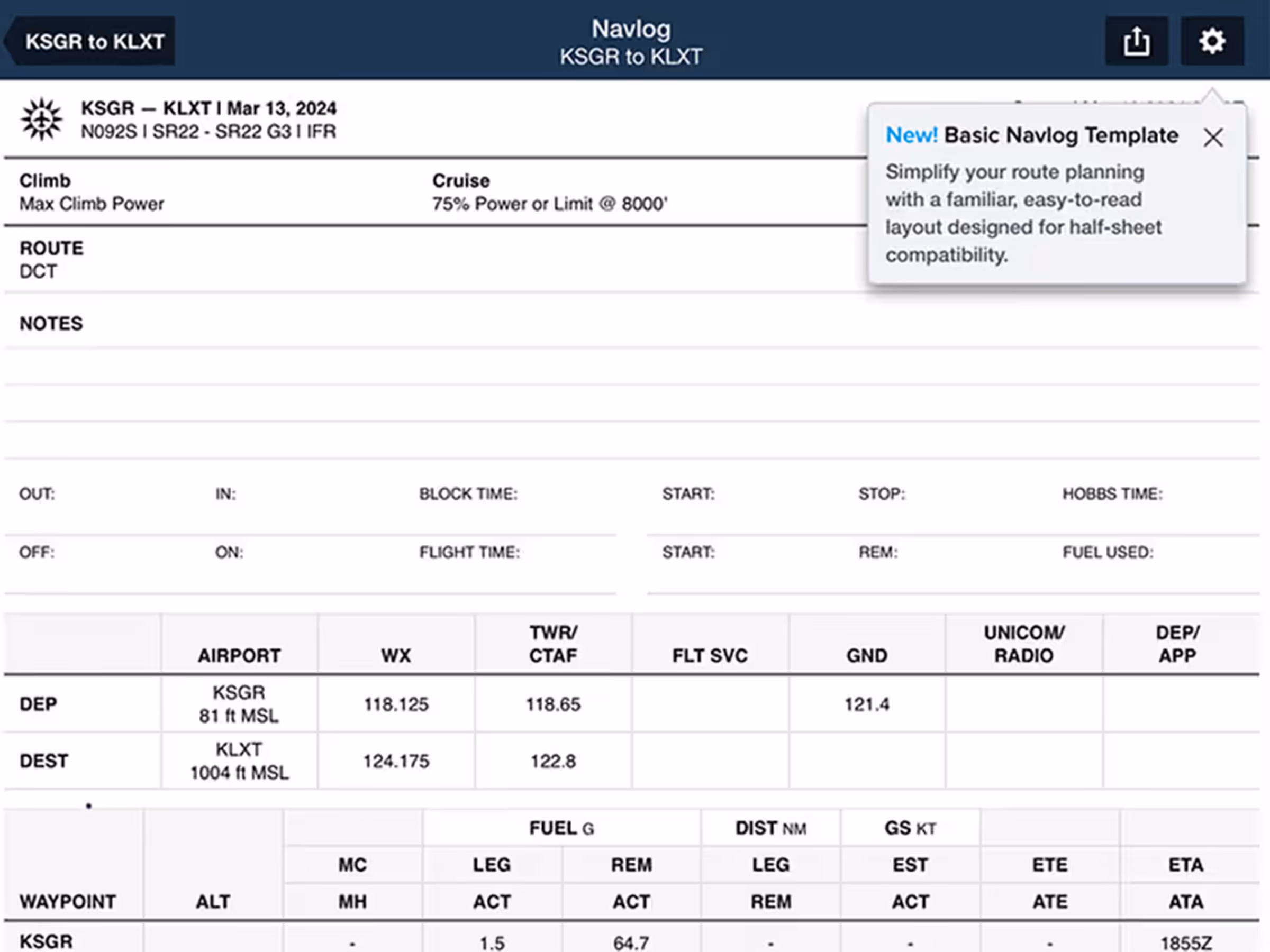
Basic Navlog Template
New Basic Navlog template gives VFR pilots a cleaner, traditional format.
All Plans
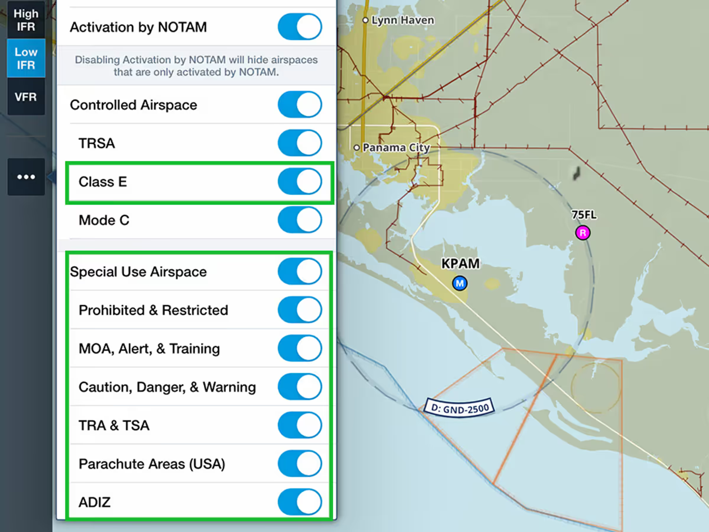
New Airspace Settings
Control airspace display with global Class E filtering and detailed Special Use Airspace options.
All Plans
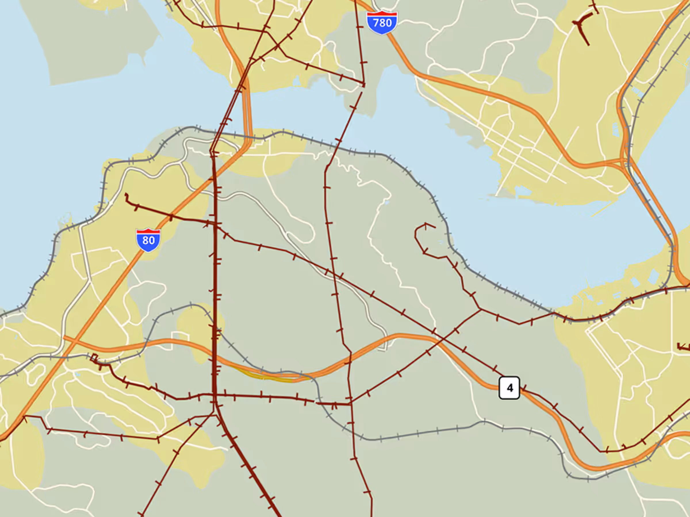
Powerlines on Basemap
View global power lines on the Basemap shown as maroon lines with hash marks.