
Release Spotlight
Release Spotlight

17.11
CFI Referral Program
Active CFIs can earn discounts on their subscription by introducing students to ForeFlight.
2024
16.1
January 2024
January 2024

Premium
Copy & Convert Coordinates
Copy waypoint coordinates in multiple formats including standard degrees and MGRS.
MFB One
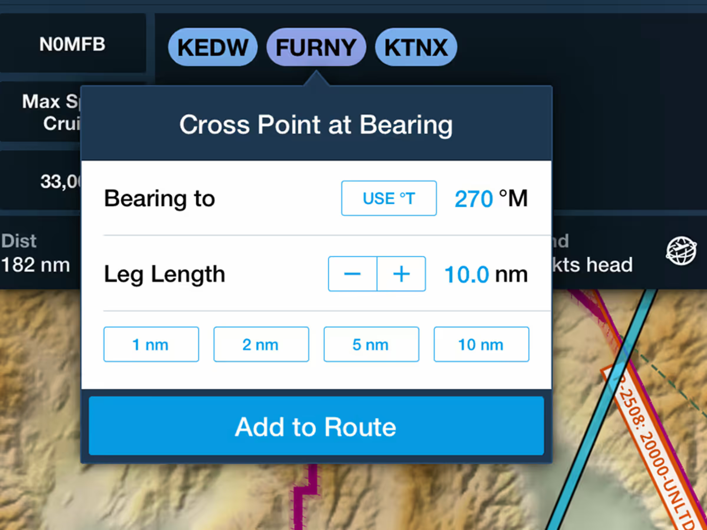
Cross Point at Bearing
Cross points at specific bearings like a virtual OBS by setting bearing and leg length.
All Plans
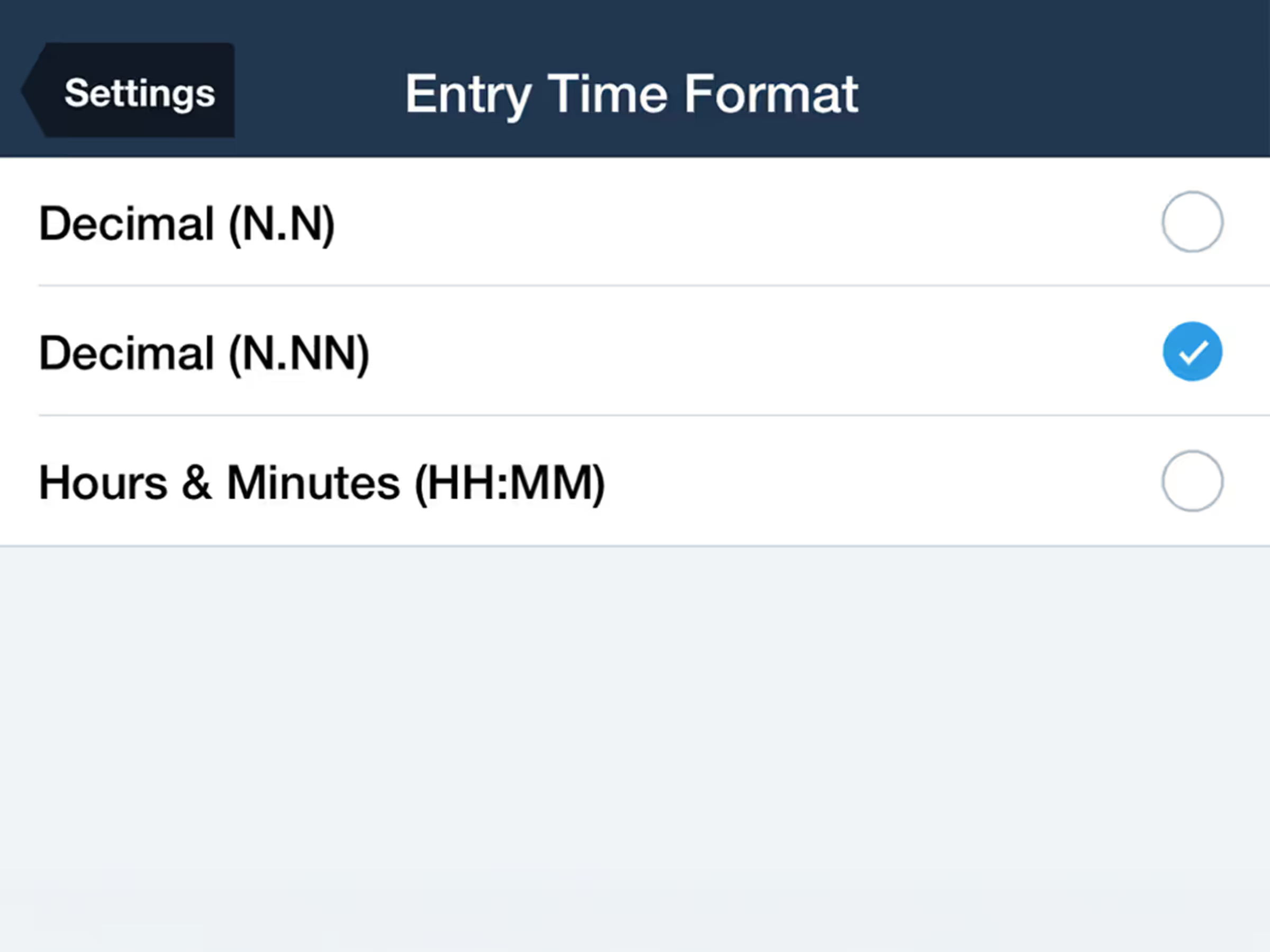
Logbook Time Setting: Decimal (N.NN)
Track flight time with new decimal format option (N.NN) for more precise logging.
2023
15.11
November 2023
November 2023
All Plans
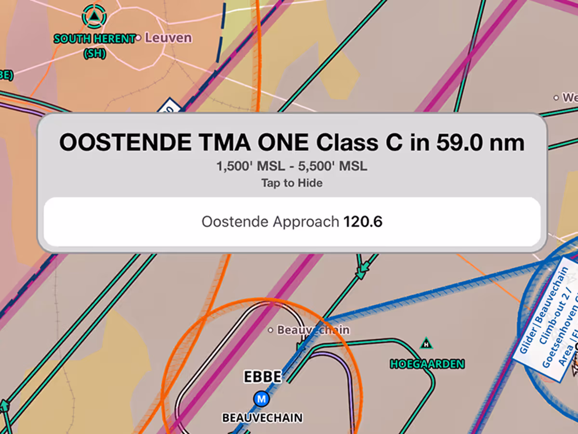
Frequencies in Airspace Alerts
See relevant frequencies in airspace alerts as you approach controlled airspace.
All Plans
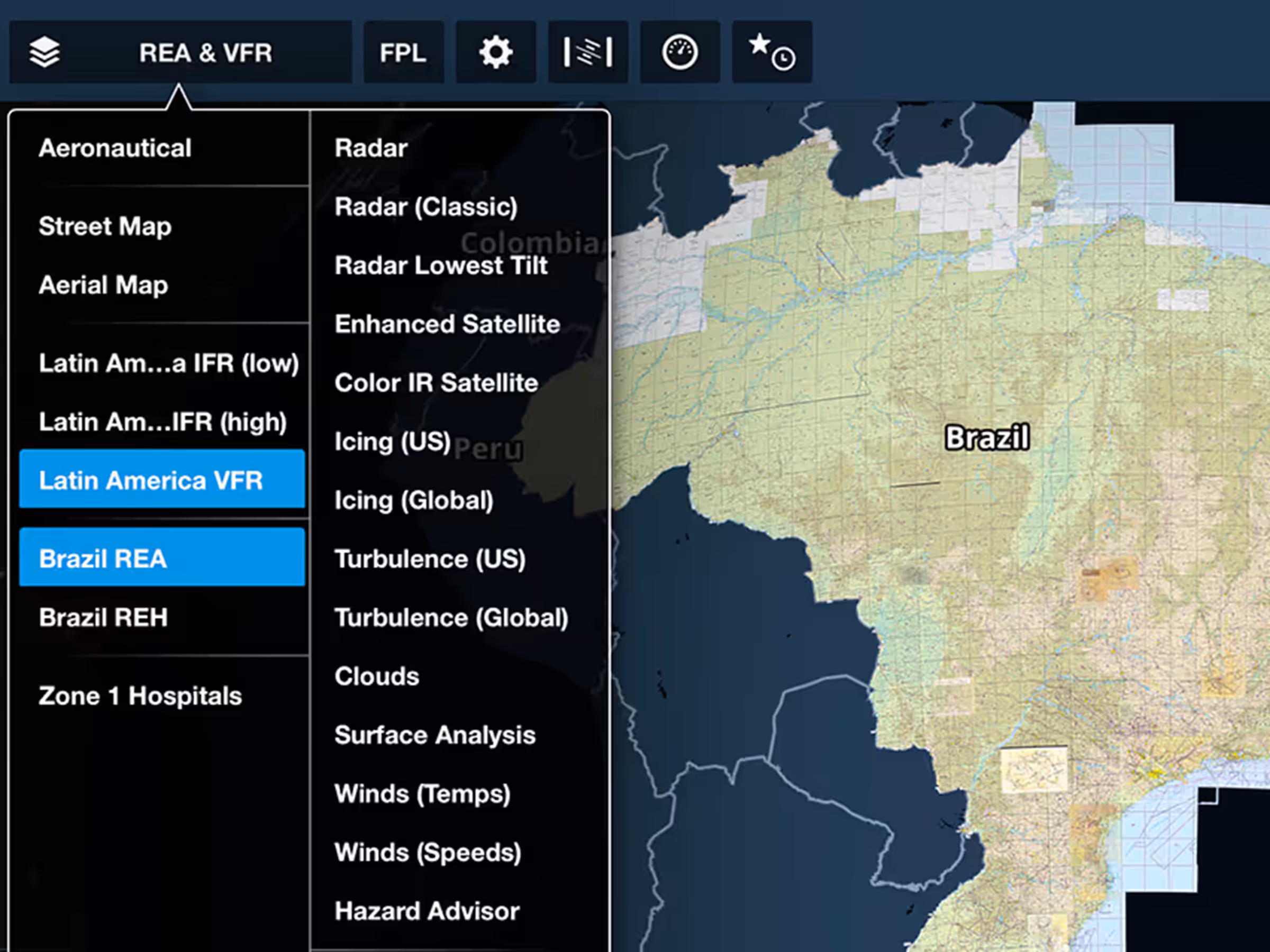
New Country Support: Brazil
Access Brazilian government charts, data, and documents in the Latin America region.
All Plans
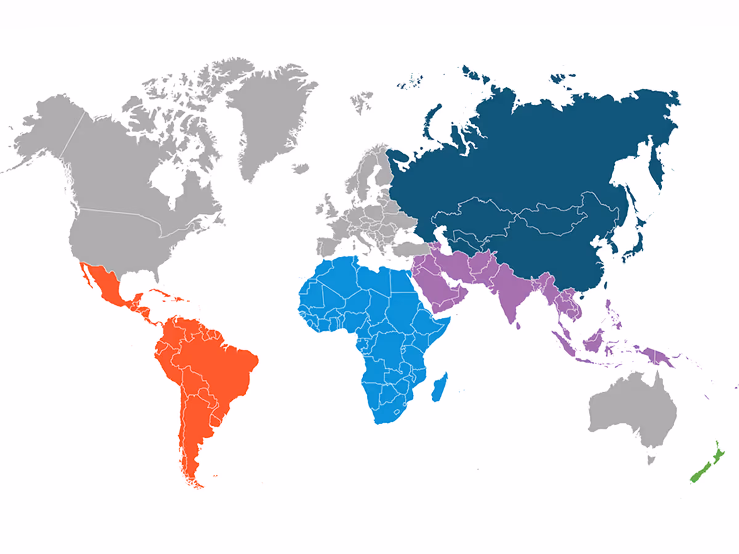
New ForeFlight Regions
Access new global regions including Latin America, Africa, Middle East, Asia Pacific, and New Zealand.
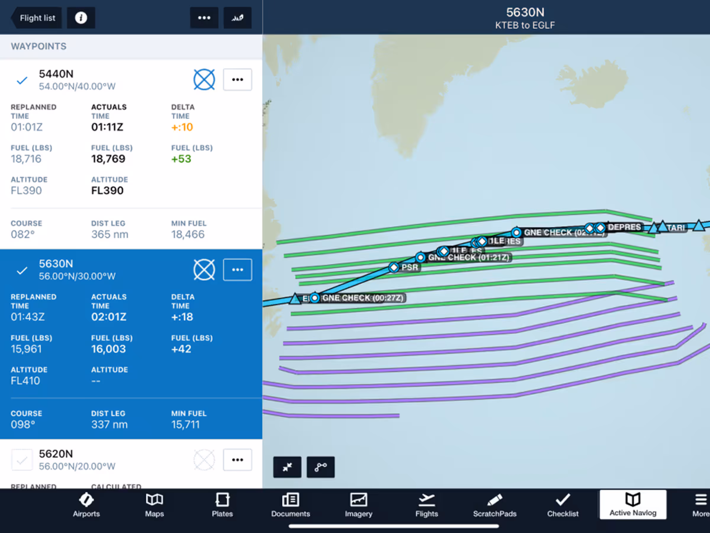
Active Navlog
Oceanic Plotting
Record position reports and GNE checks with streamlined oceanic plotting in Active Navlog.
2023
15.10
October 2023
October 2023
Premium
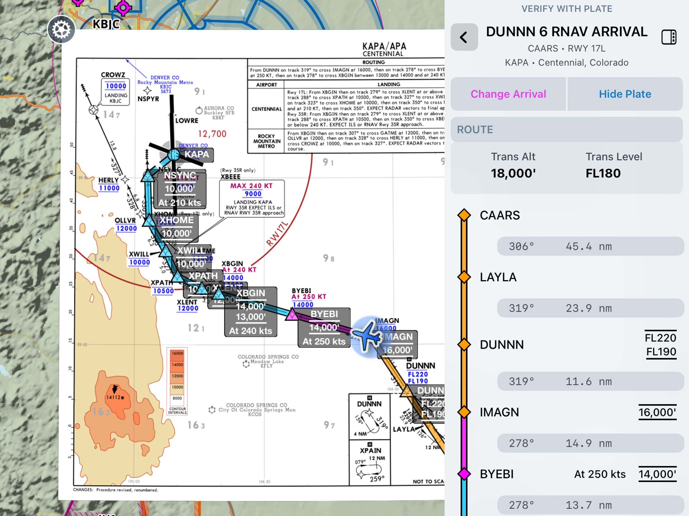
Augmented SID/STAR Fix Labels
Check speed and altitude limits for every fix in SIDs, STARs, and approaches with Augmented Procedures.
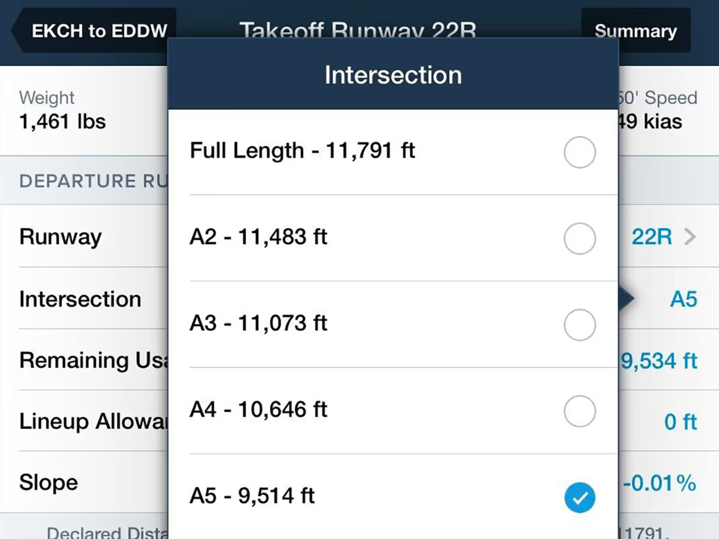
Runway Analysis
Intersection For Takeoff
Specify runway intersections for takeoff with automatic reduced runway length calculations.
All Plans
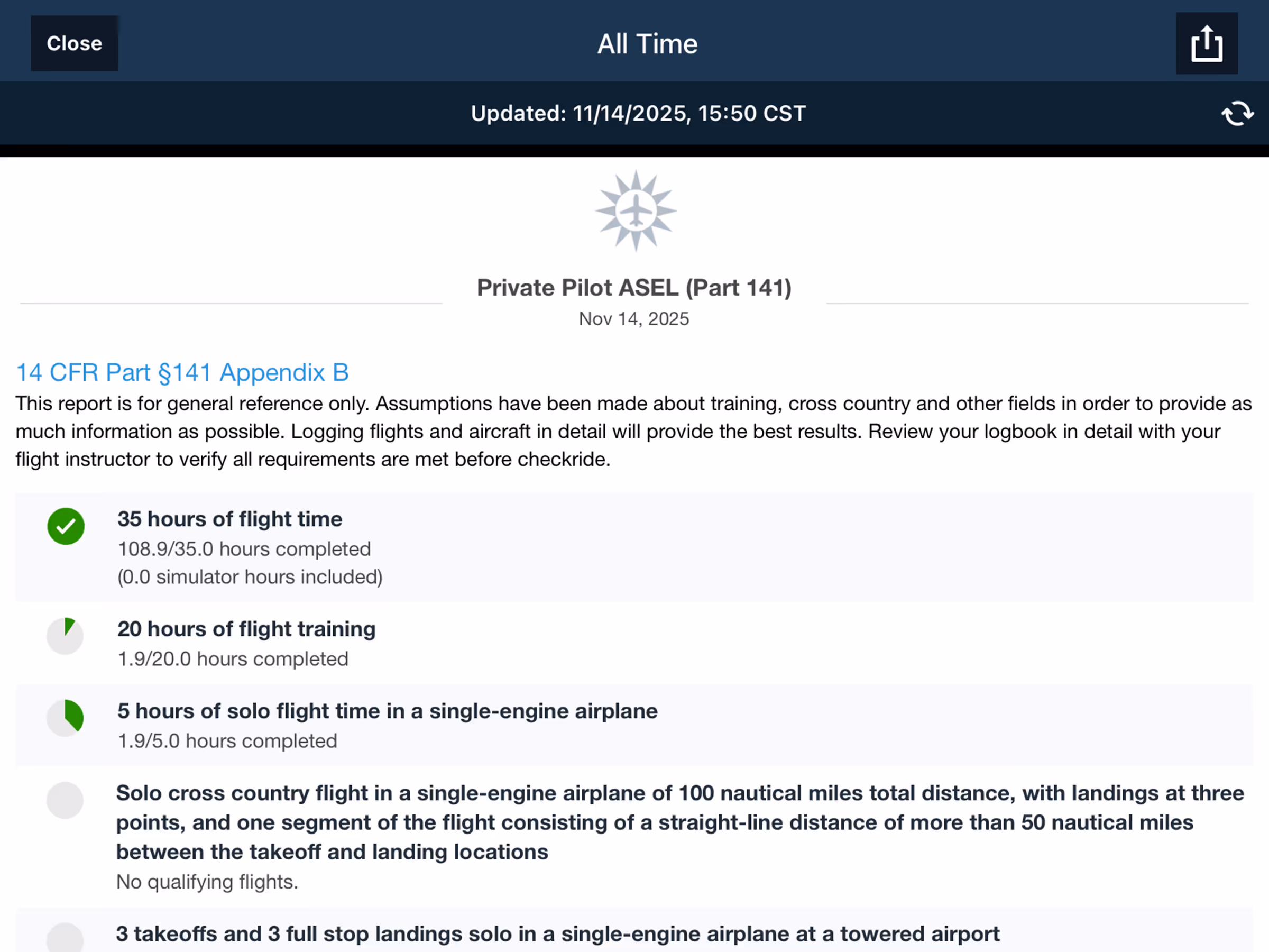
Logbook Report Enhancements
Enhanced logbook reporting features including report timestamps and better FAA Part 141 progress tracking,
2023
15.9
September 2023
September 2023

All Plans
Hide Airspace Activated By NOTAM
Hide airspace activated by NOTAM to declutter the Aeronautical Map.
All Plans
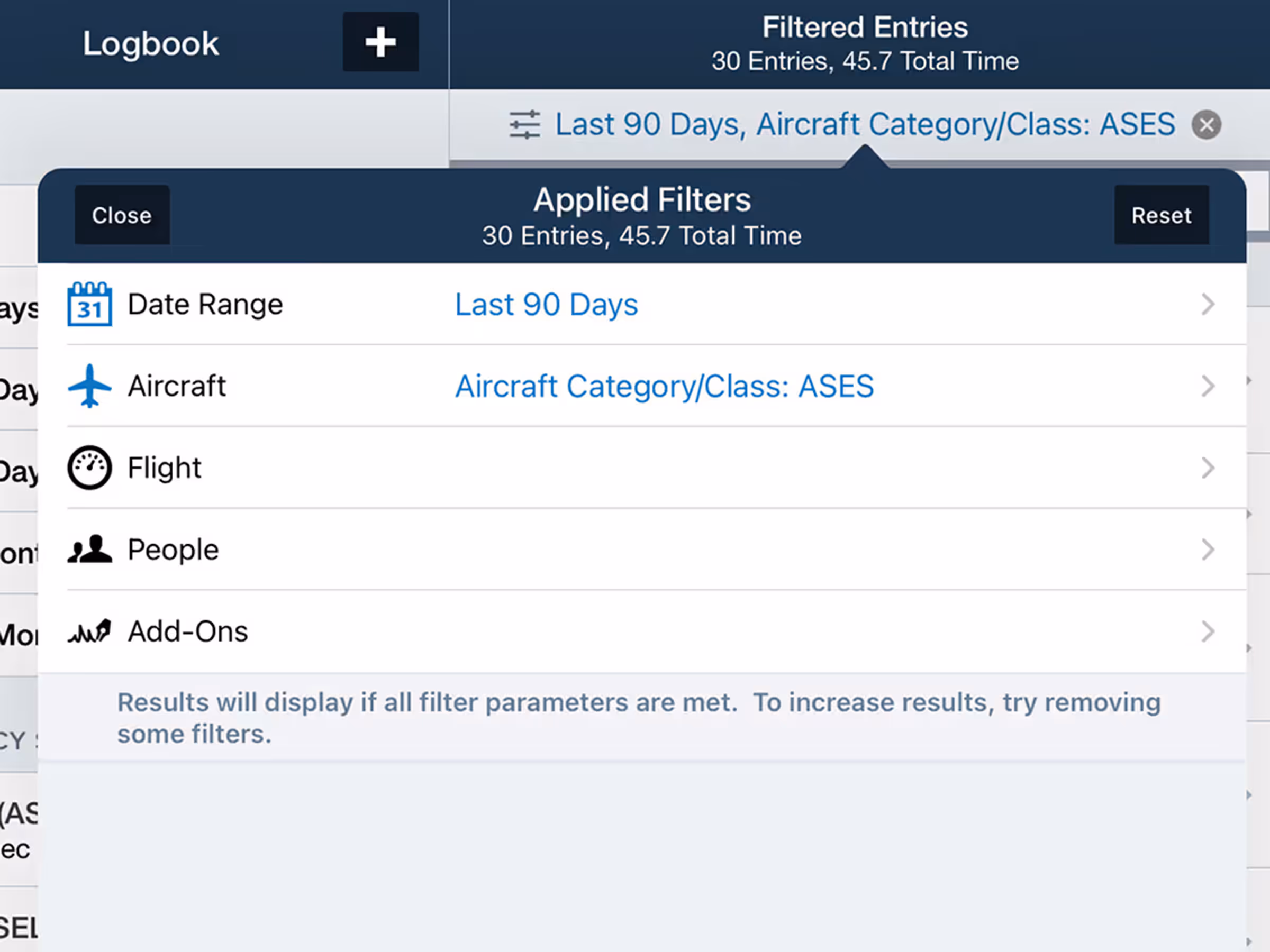
Logbook Filtering
Search Logbook entries by date, aircraft, airports, and more with new filters.

All Plans
Map Annotations Eraser
Erase map annotations by dragging your finger across them using the new Eraser tool.
Runway Analysis
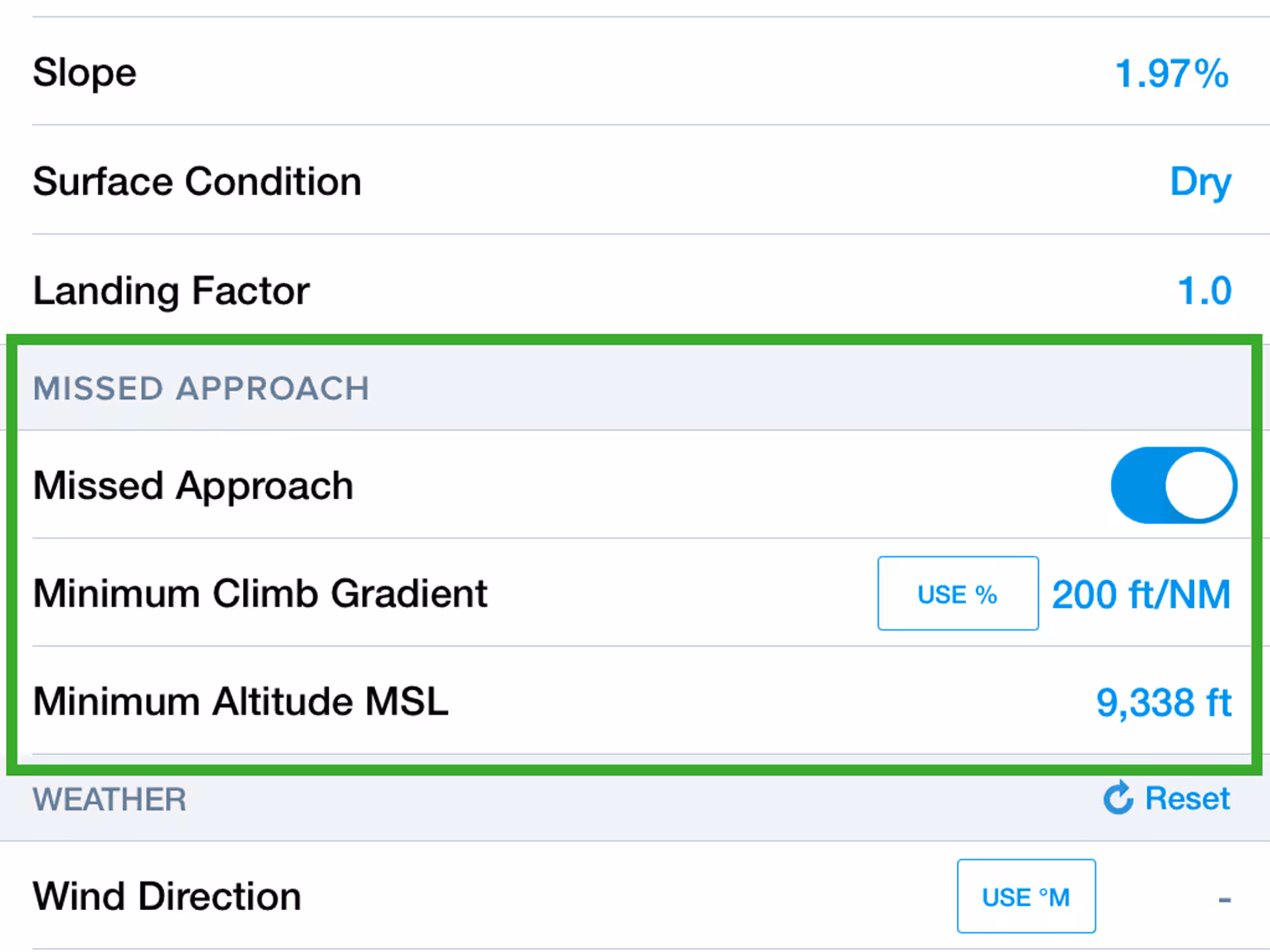
Missed Approach Climb Requirements
Include missed approach climb requirements in Landing Analysis calculations.
2023
15.8
August 2023
August 2023

All Plans
New Zealand VFR Waypoints
Pilots in New Zealand can now view, plan, and file with VFR Waypoints on the Aeronautical Map layer.
All Plans
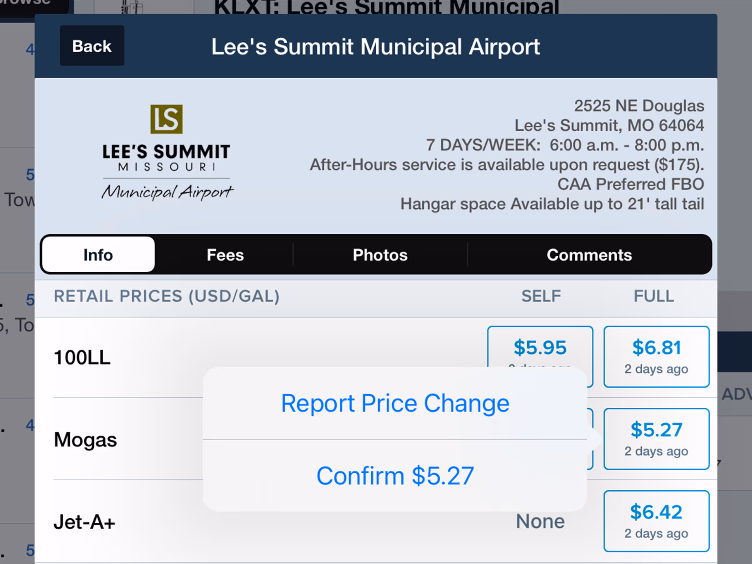
Streamlined Fuel Price Submissions
Report or confirm fuel prices with streamlined interface at airports and on fuel map layers.