
Release Spotlight
Release Spotlight

17.11
CFI Referral Program
Active CFIs can earn discounts on their subscription by introducing students to ForeFlight.
2023
15.7
July 2023
July 2023

All Plans
ForeFlight on Apple Watch
Access ForeFlight on Apple Watch for weather and airport information.
Essential & Above
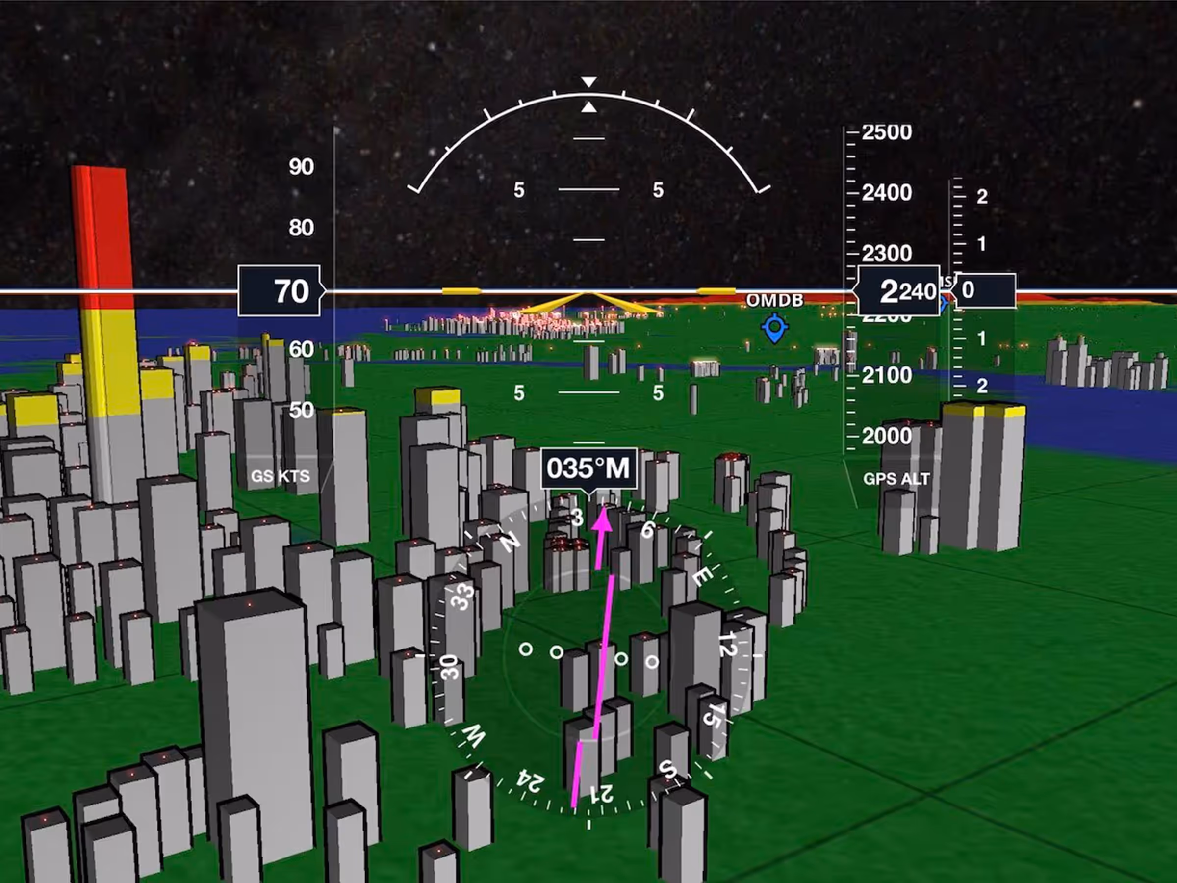
Synthetic Vision Enhancements
View enhanced 3D obstacles with nighttime lighting in different shapes for buildings, towers, and windmills.
Essential & Above
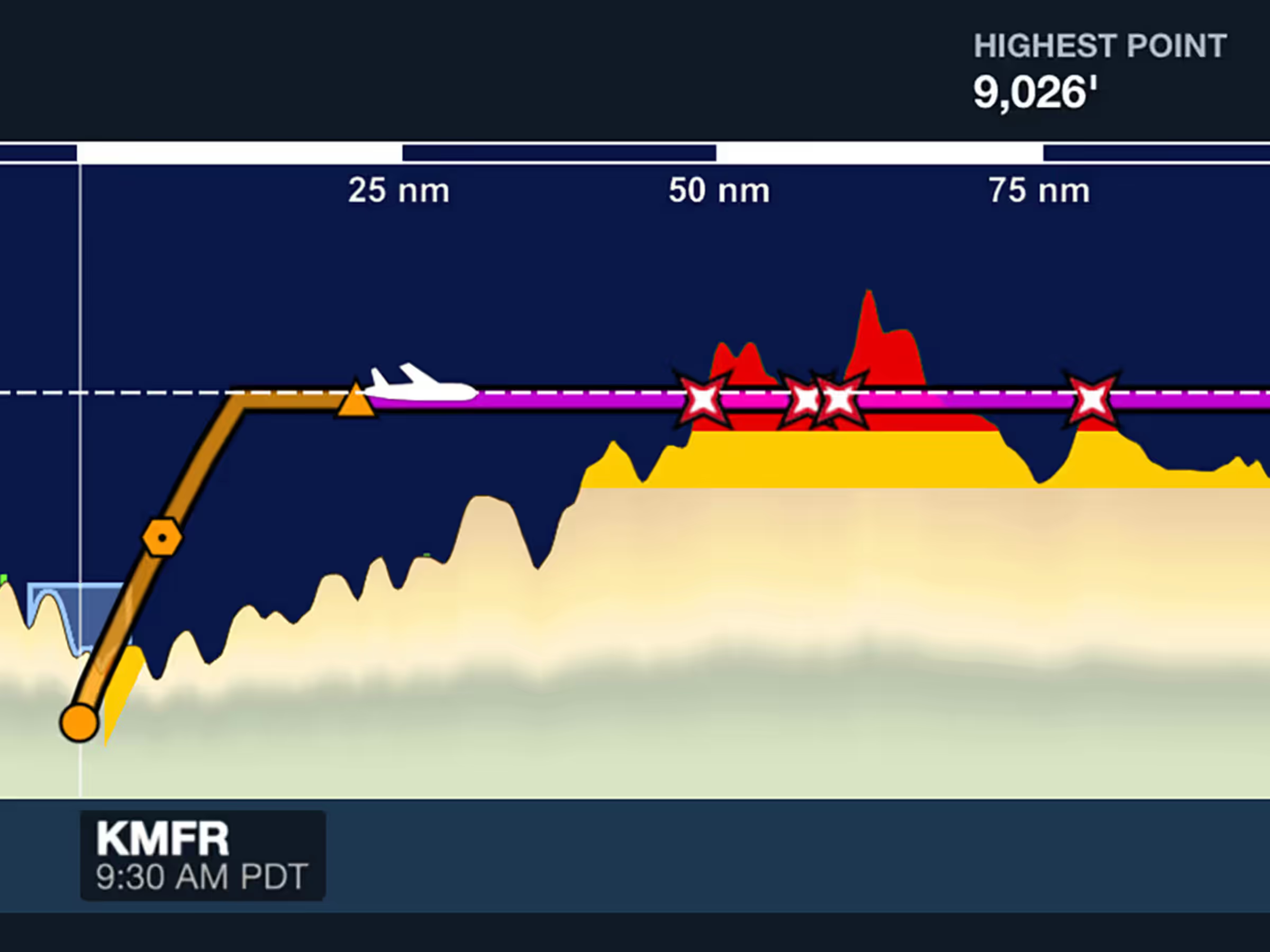
Terrain/Obstacle Strikes in Profile View
See terrain and obstacle strikes clearly marked with red X markers in Profile View.
2023
15.6
June 2023
June 2023
Essential & Above
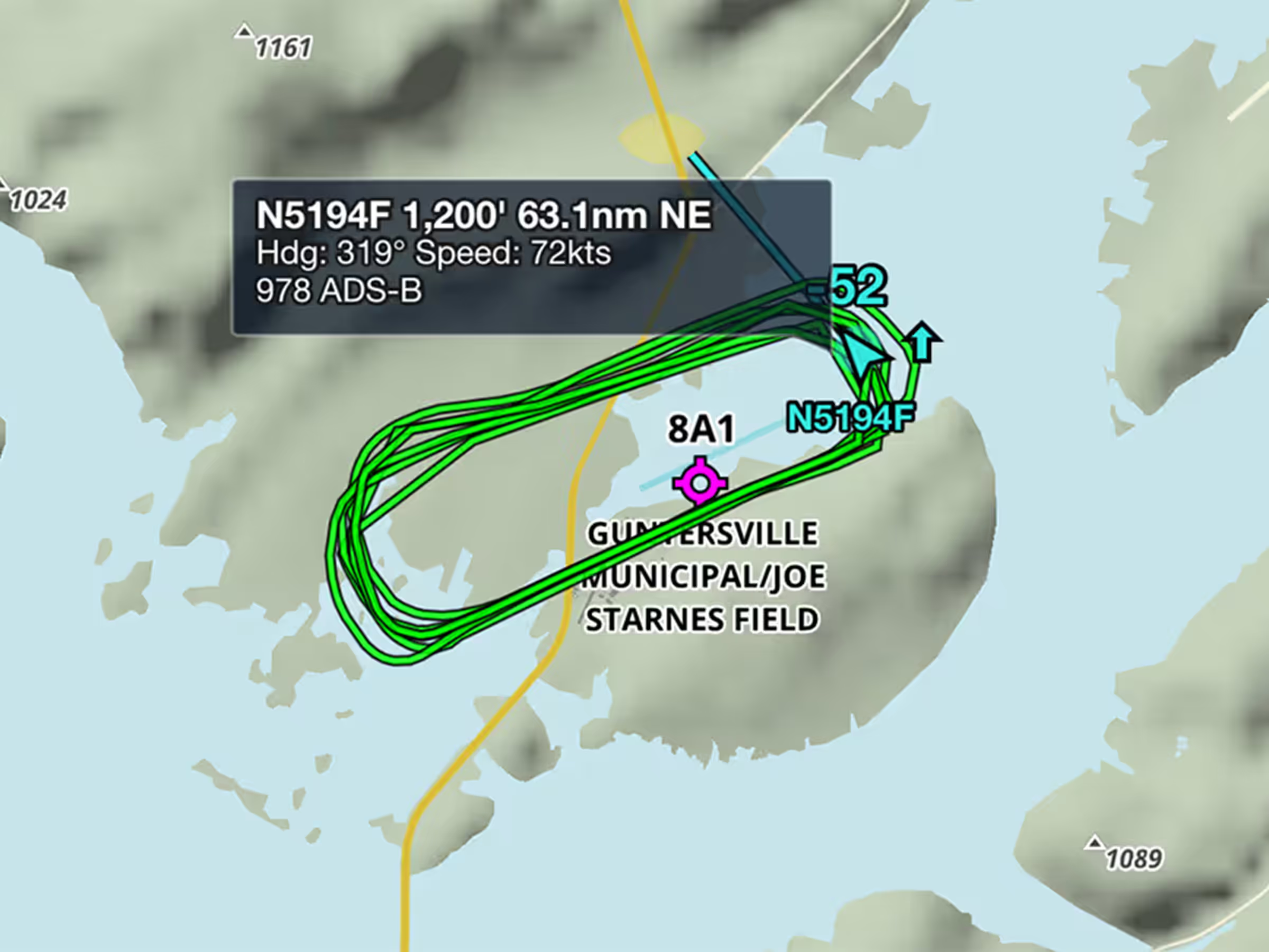
ADS-B Traffic Breadcrumbs
View recent flight paths of nearby aircraft to see which runways and procedures are in use.
All Plans
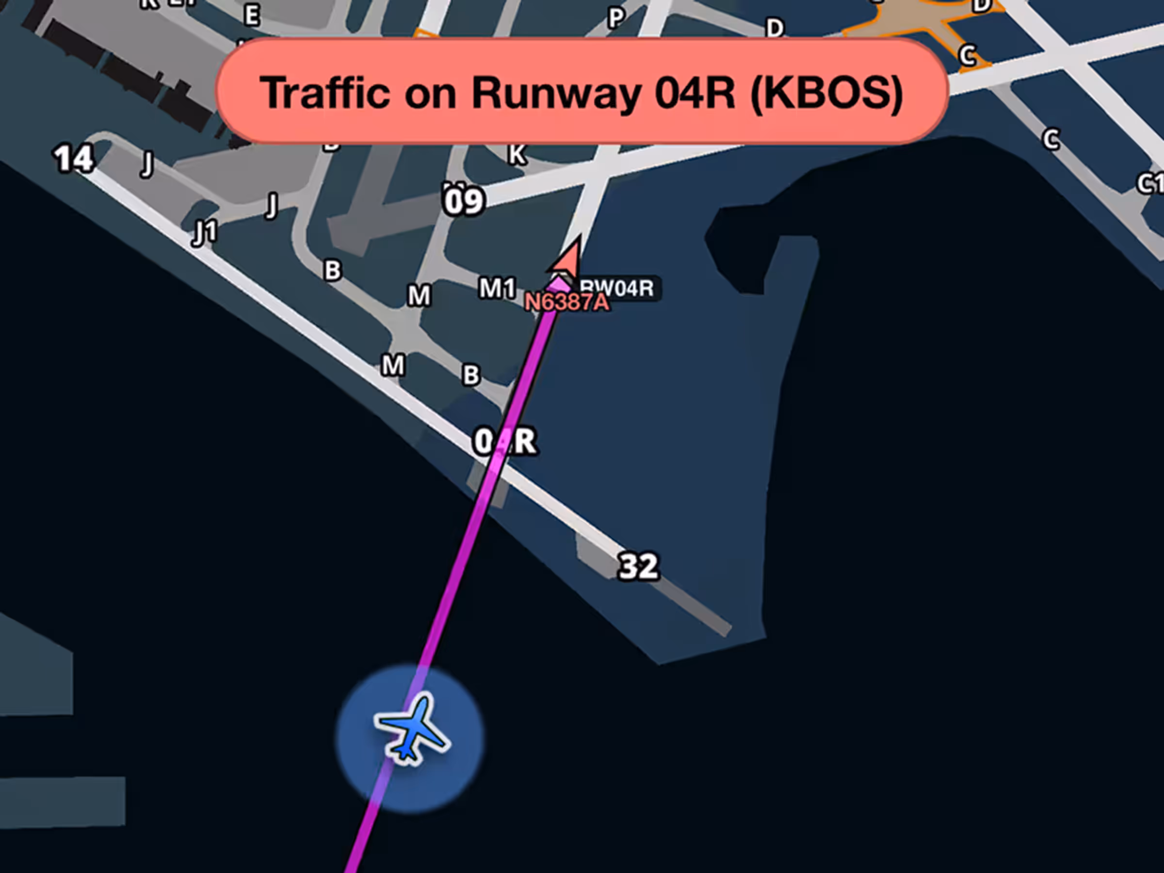
Aircraft on Runway Alerts
Get runway safety alerts during approach when aircraft are on or approaching your runway.
All Plans
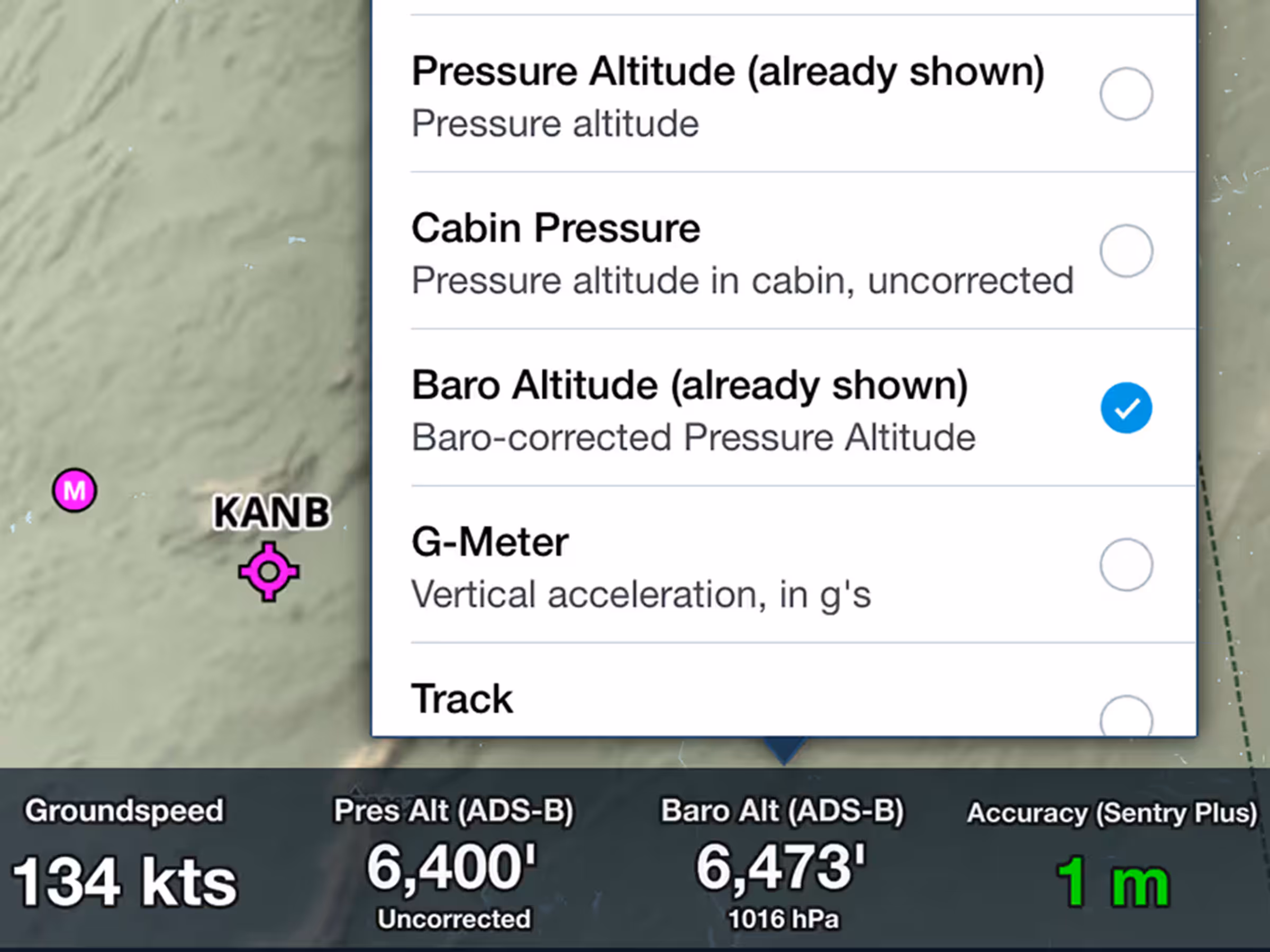
Baro-Corrected Pressure Altitude
View corrected barometric altitude based on pressure readings and nearby METAR data.

Essential & Above
Cloud Documents: OneDrive Support
Upload documents wirelessly from Microsoft OneDrive to all your devices.
2023
15.5
May 2023
May 2023
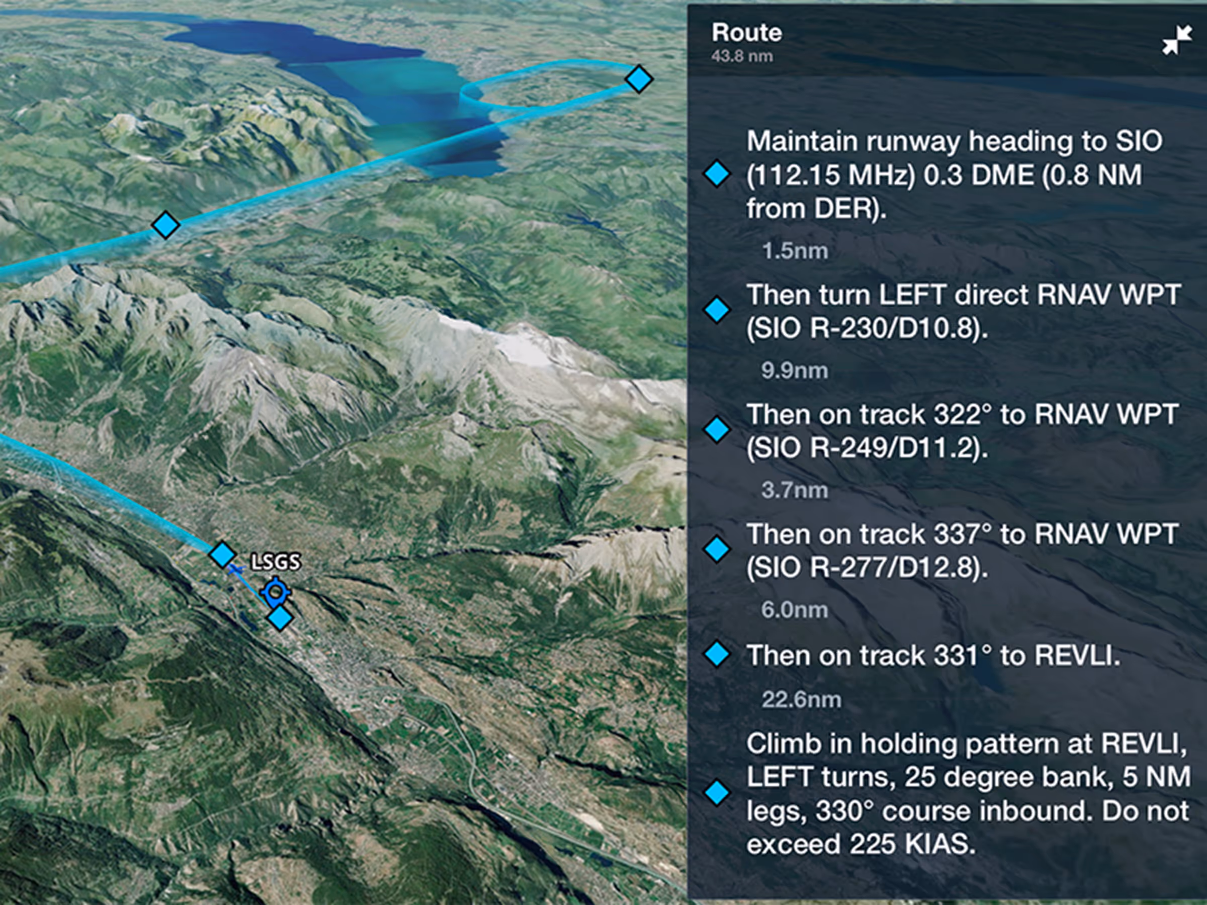
Runway Analysis
3D Engine Out Procedures
Preview Engine Out Procedures in 3D with terrain and aerial imagery before takeoff.
All Plans
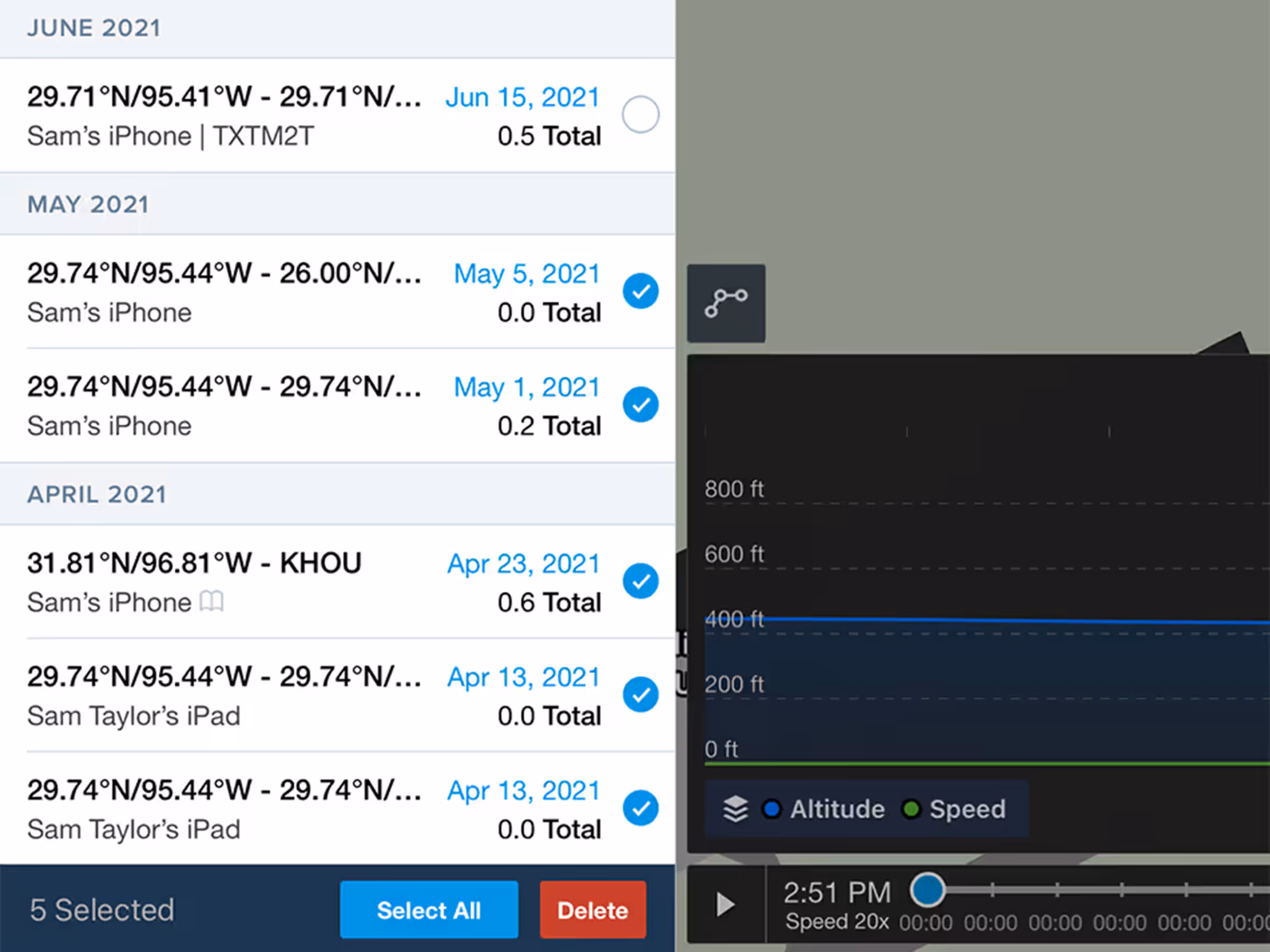
Bulk-Delete Track Logs
Select and delete multiple track logs at once with warnings for those linked to Logbook entries.
All Plans
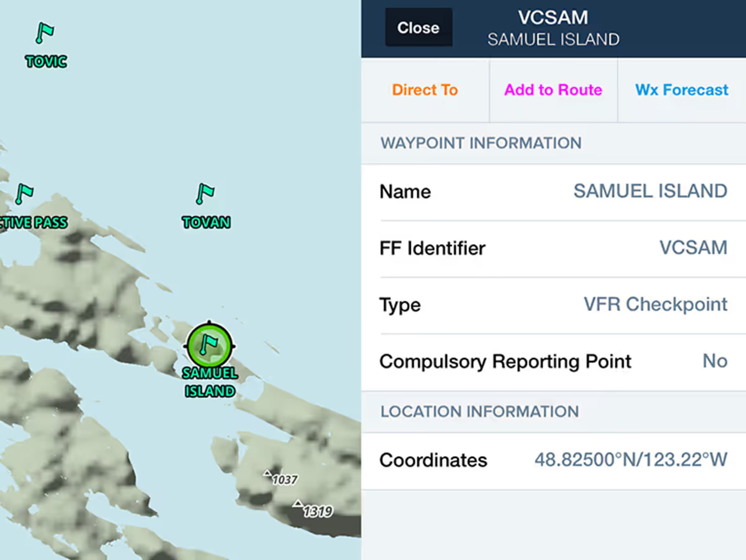
Canadian & South African VFR Points
Use VFR checkpoints and call-up points on Canadian and South African Aeronautical Maps.
All Plans
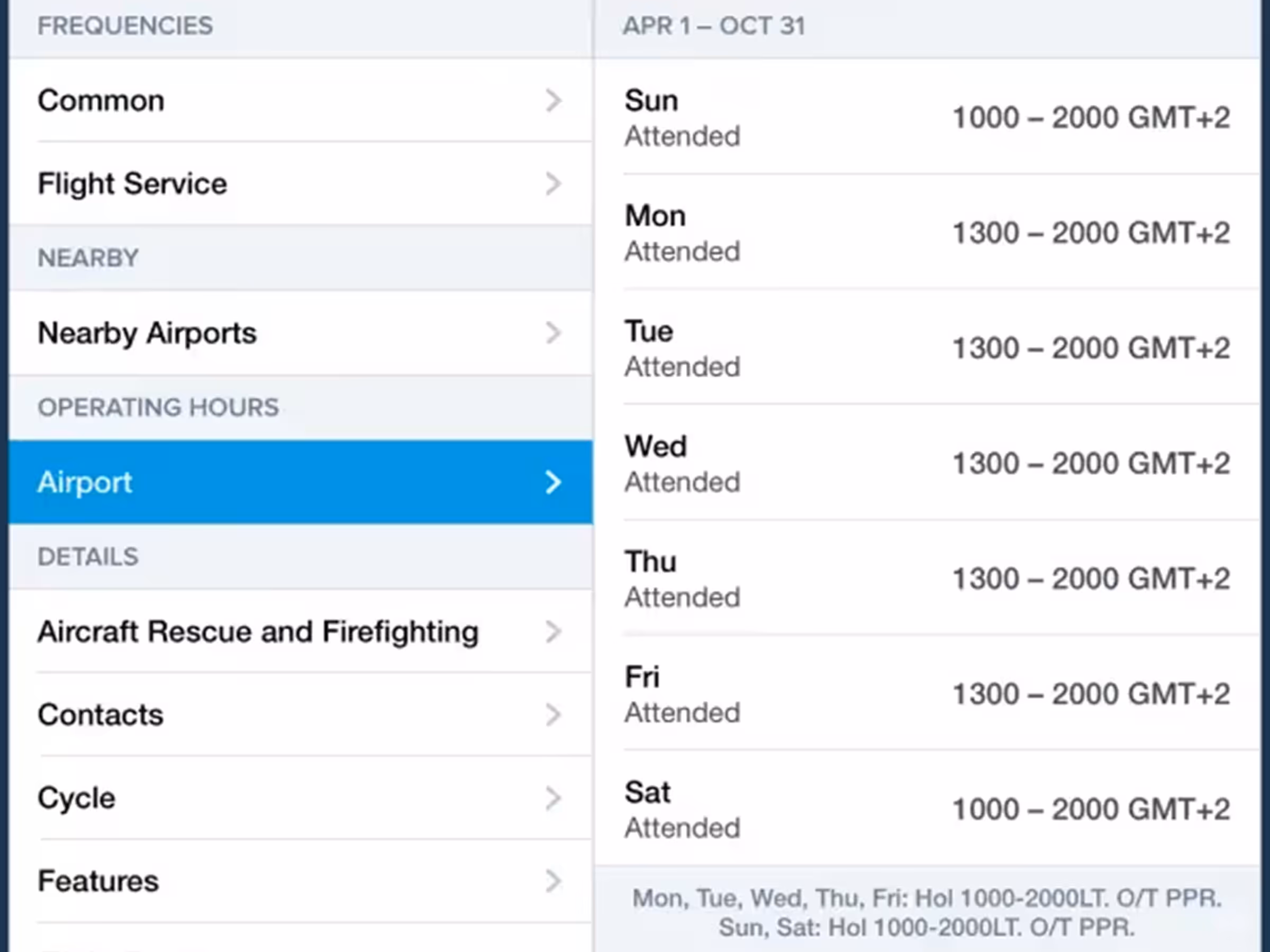
Expanded Airport Operating Hours
Access more detailed airport operating hours globally with time zones and custom remarks.
2023
15.4
April 2023
April 2023
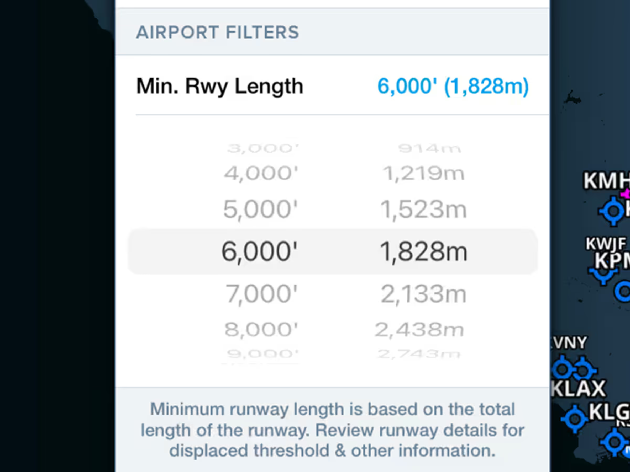
All Plans
Airport Runway Length Filter
Hide airports with shorter runways by setting minimum runway length filters.
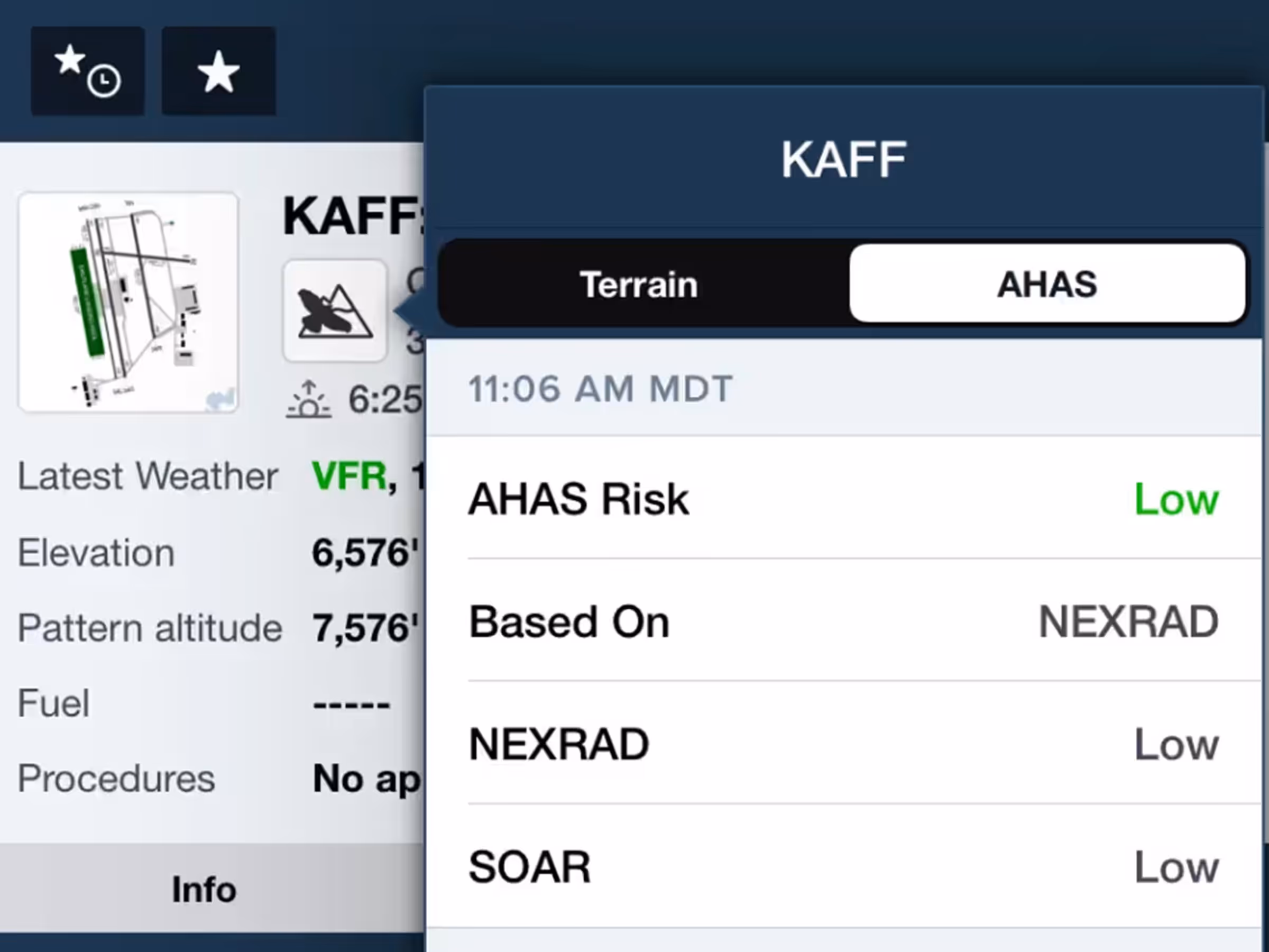
MFB One
Avian Hazards Forecast
View consolidated military bird forecasts (NEXRAD, BAM, SOAR) for supported airports.
All Plans
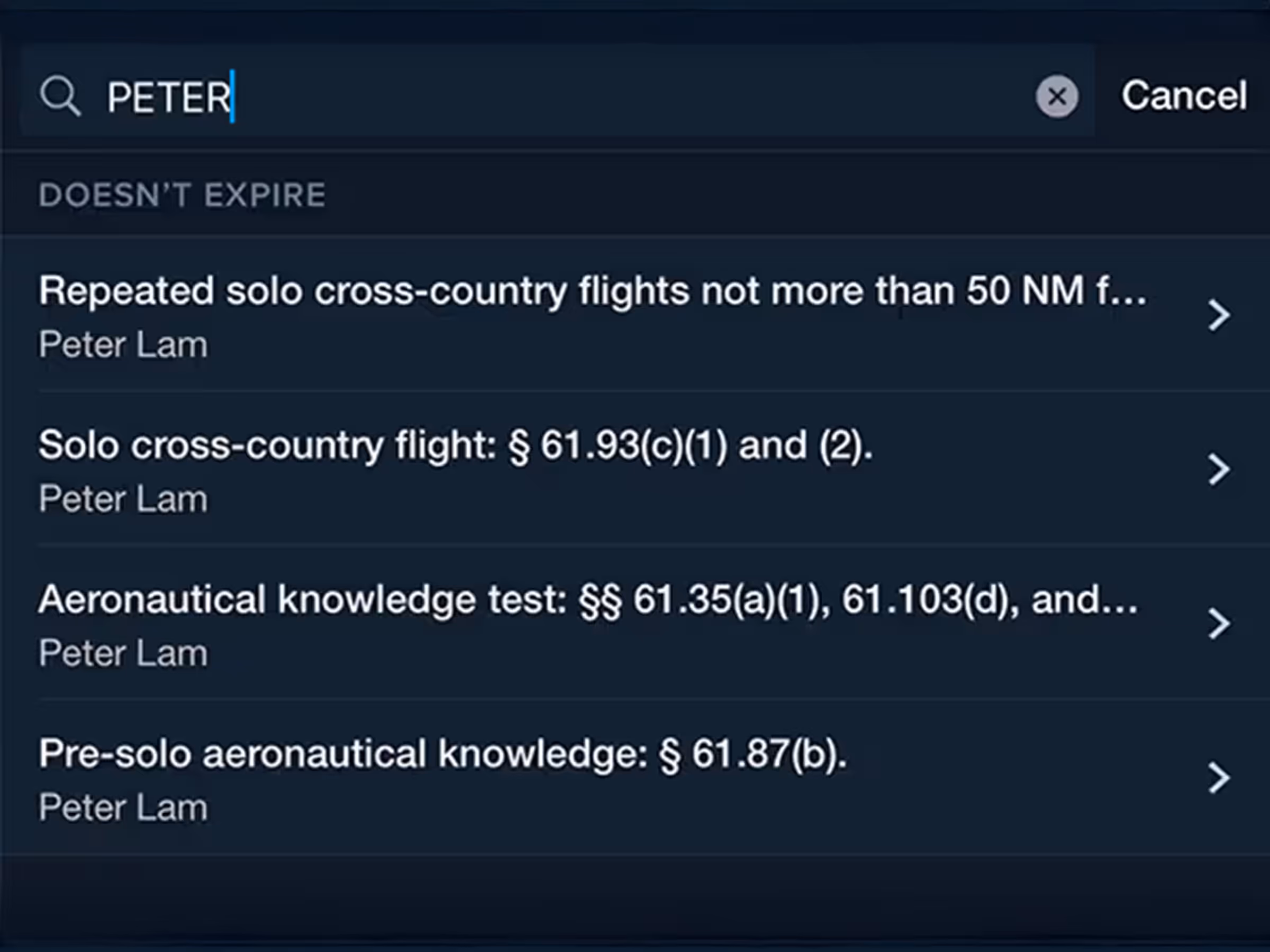
Logbook Instructor Tools Enhancements
Improved endorsement filters, searches in addition to regulatory references in endorsement titles.

Essential & Above
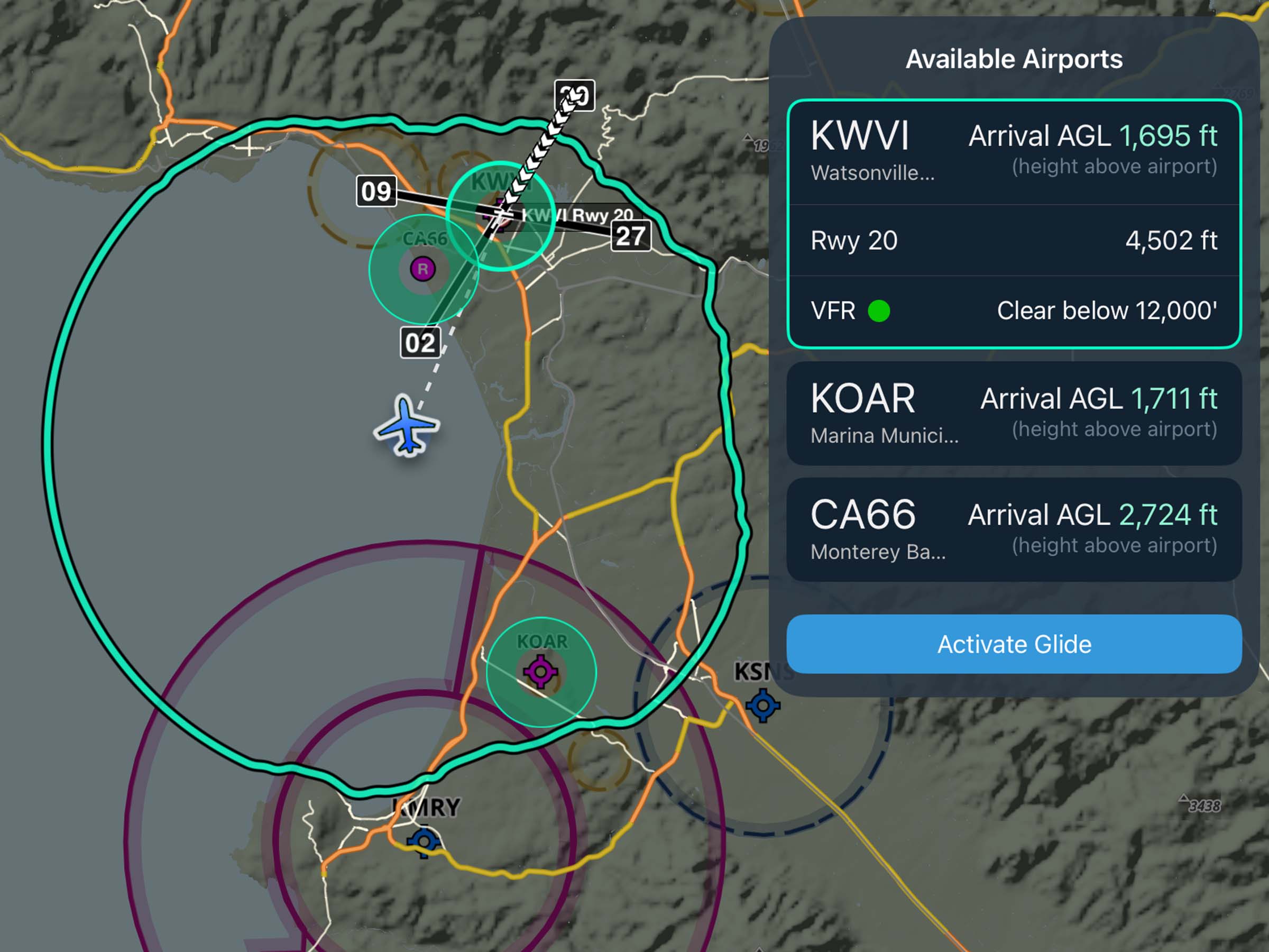
Profile Corridor
See your Profile View corridor on the map with highest hazards highlighted for each leg.
2023
15.3
March 2023
March 2023
All Plans
Ownship Colors
Change your ownship marker color and shape in settings for better visibility.
All Plans
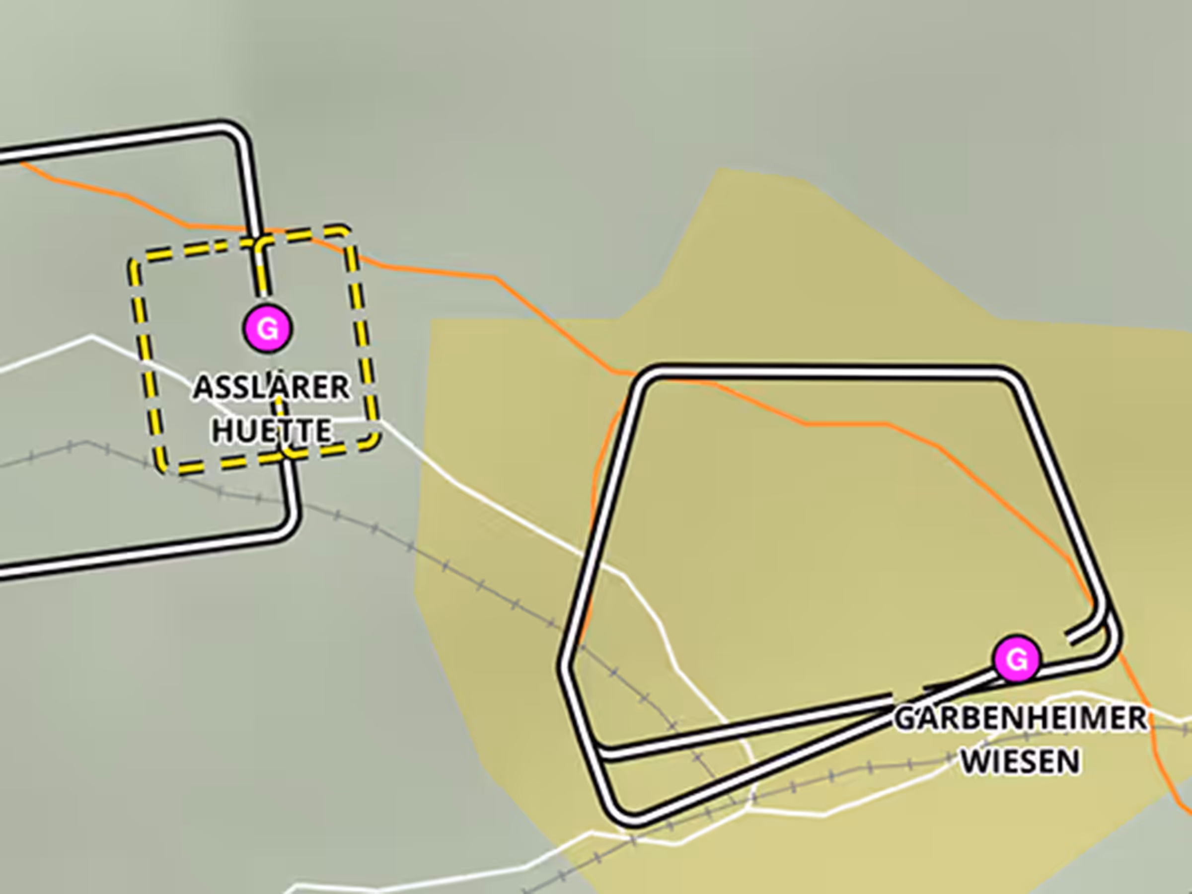
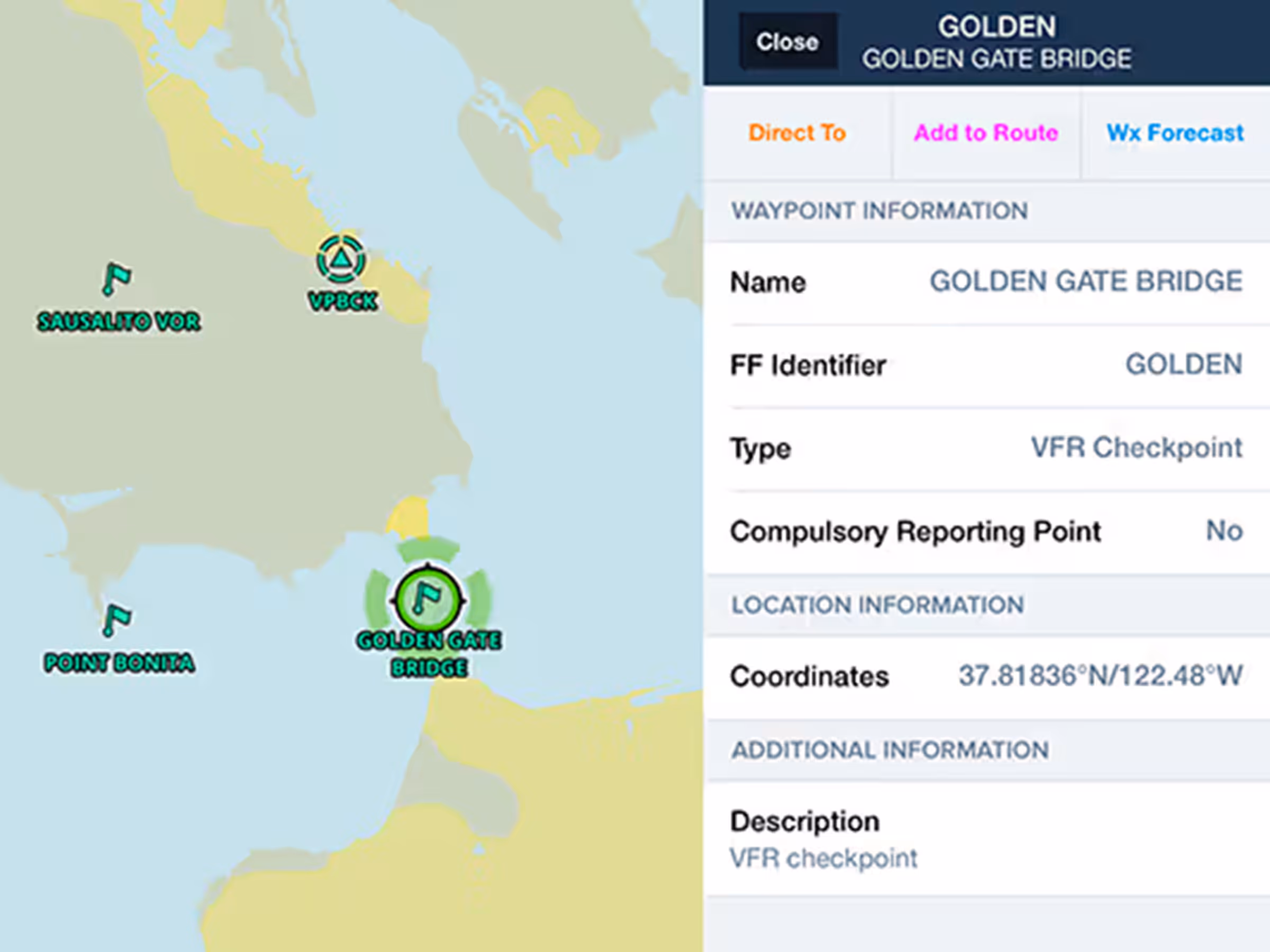
VFR Waypoints
Plan with VFR Checkpoints and Visual Reporting Points in Europe, US, Canada, Australia, and South Africa.