
Release Spotlight
Release Spotlight

17.11
CFI Referral Program
Active CFIs can earn discounts on their subscription by introducing students to ForeFlight.
2022
14.5
June 2022
June 2022

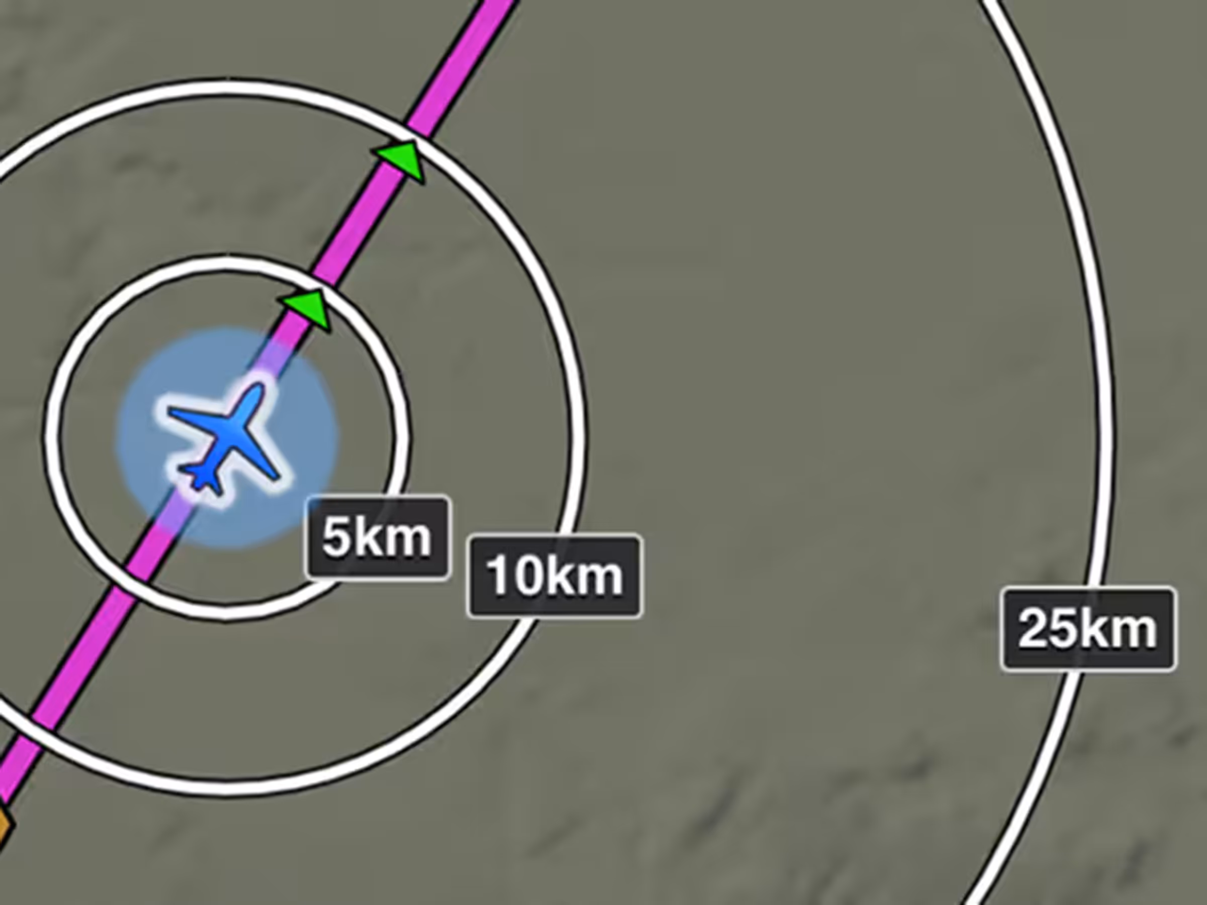
Bearing and Track Orientation Setting
Display bearing and track using Magnetic or True North for Ruler, Synthetic Vision, and Cockpit Instruments.
All Plans
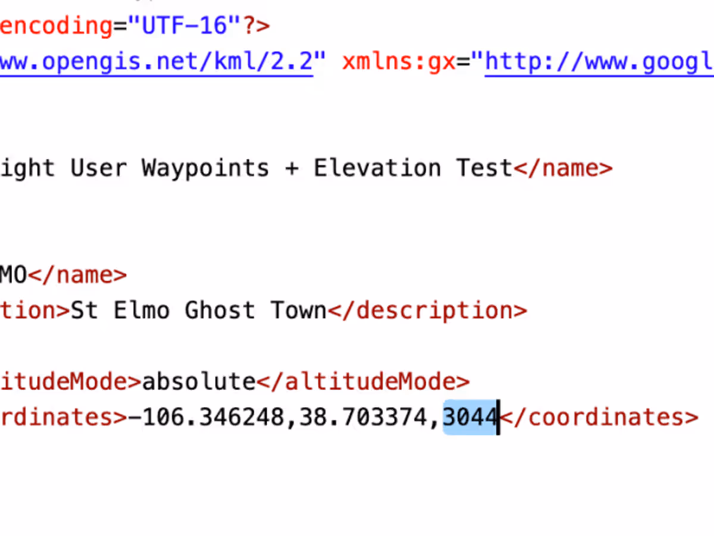
Custom Waypoint Elevation
Add elevations to User Waypoints for accurate climb/descent metrics and Profile View depictions like airports.
All Plans
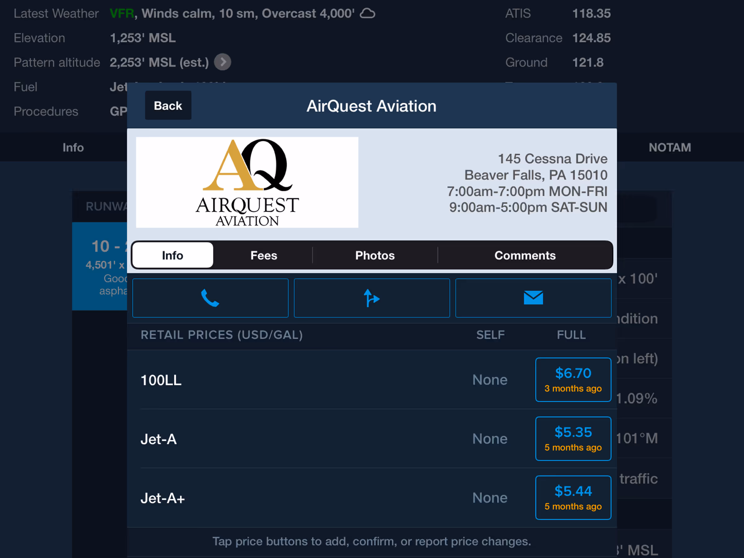
Fuel Price Table Updates for FBOs
The fuel price table in an FBO’s detail view now only displays fuel types that are actually offered.

All Plans
Simplified Download Settings
Configure downloads faster with separated Data/Chart and Region selection menus.
2022
14.4
May 2022
May 2022
All Plans
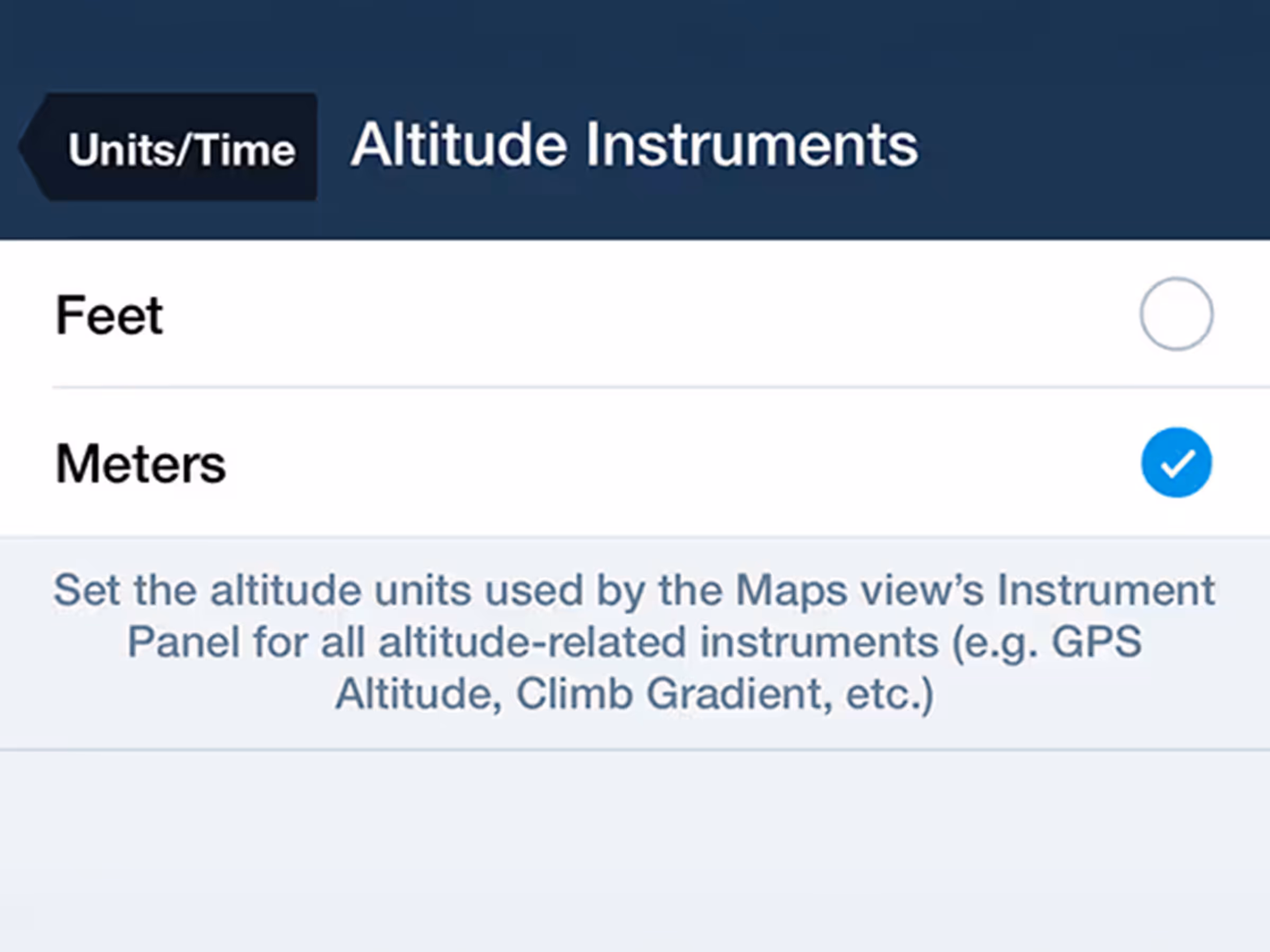
Altitude Instruments in Meters
Customize altitude display units in the Map's Instrument Panel.
All Plans
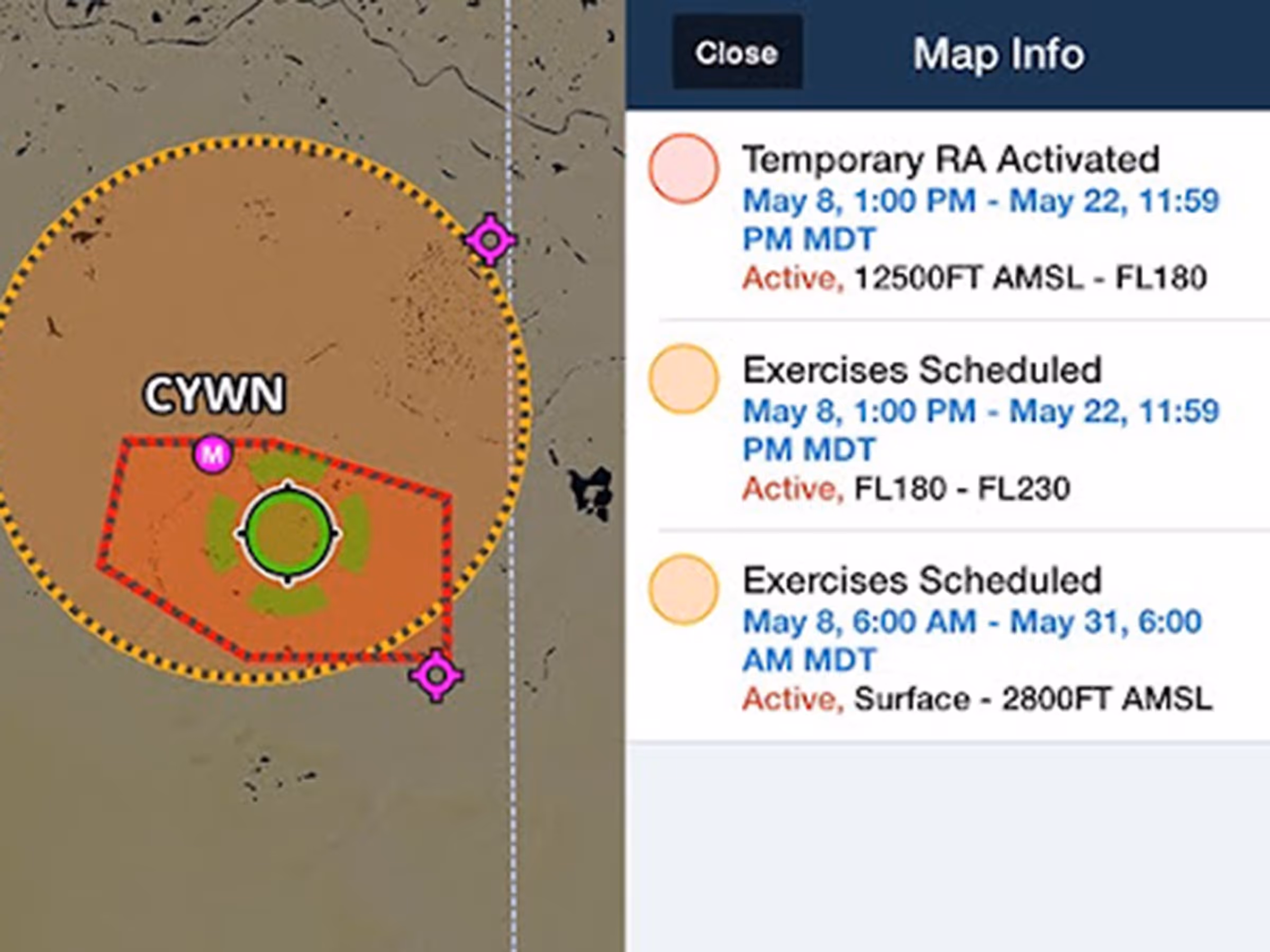
Global Graphical NOTAMs
View color-coded global Graphical NOTAMs with filters for Exercises, Controlled Airspaces, and Obstacles.

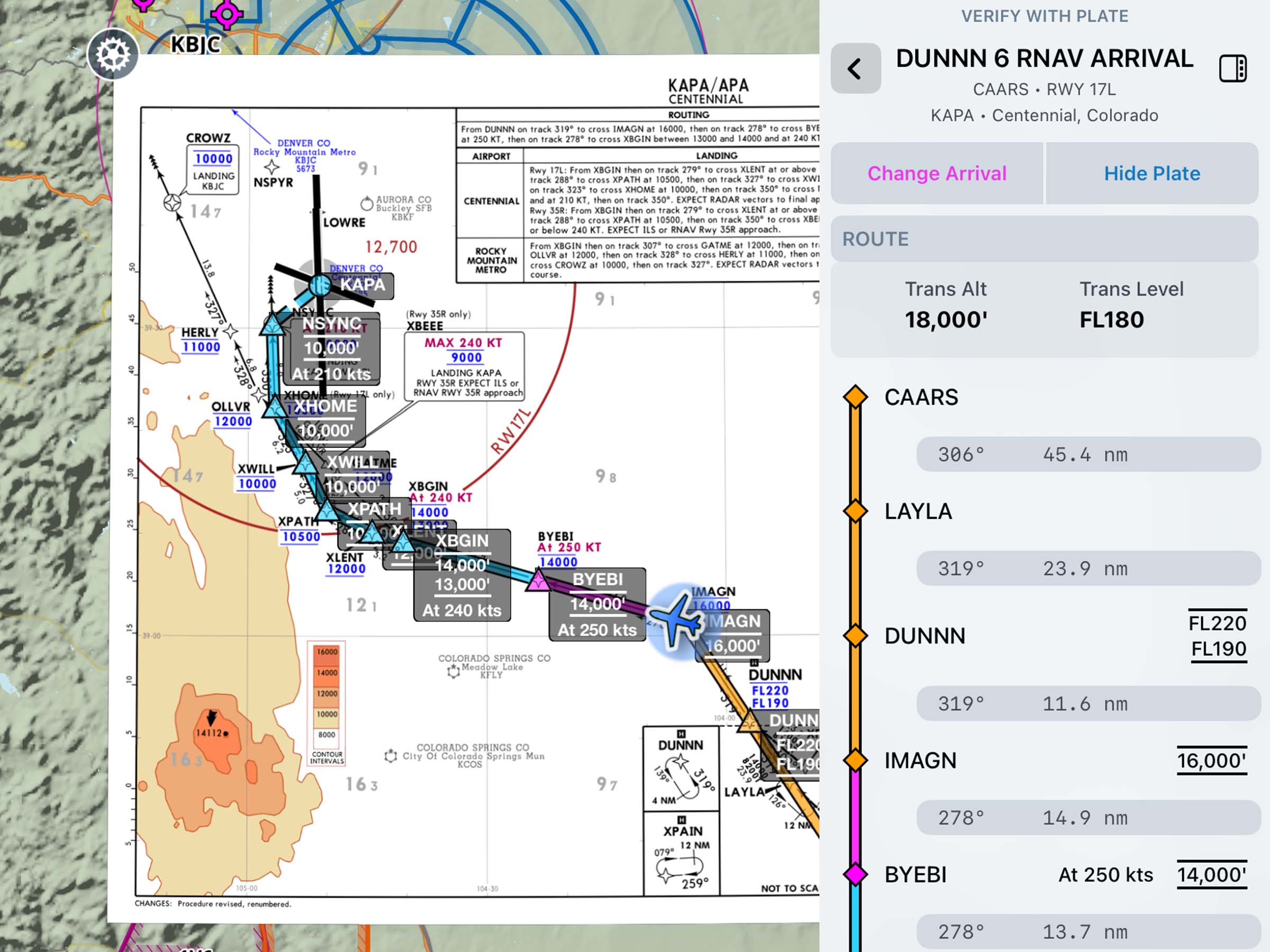
Per-Leg Altitude in Profile
Visualize and plan enroute altitude changes at key waypoints to avoid terrain, weather, and airspace.
2022
14.3
April 2022
April 2022
Premium
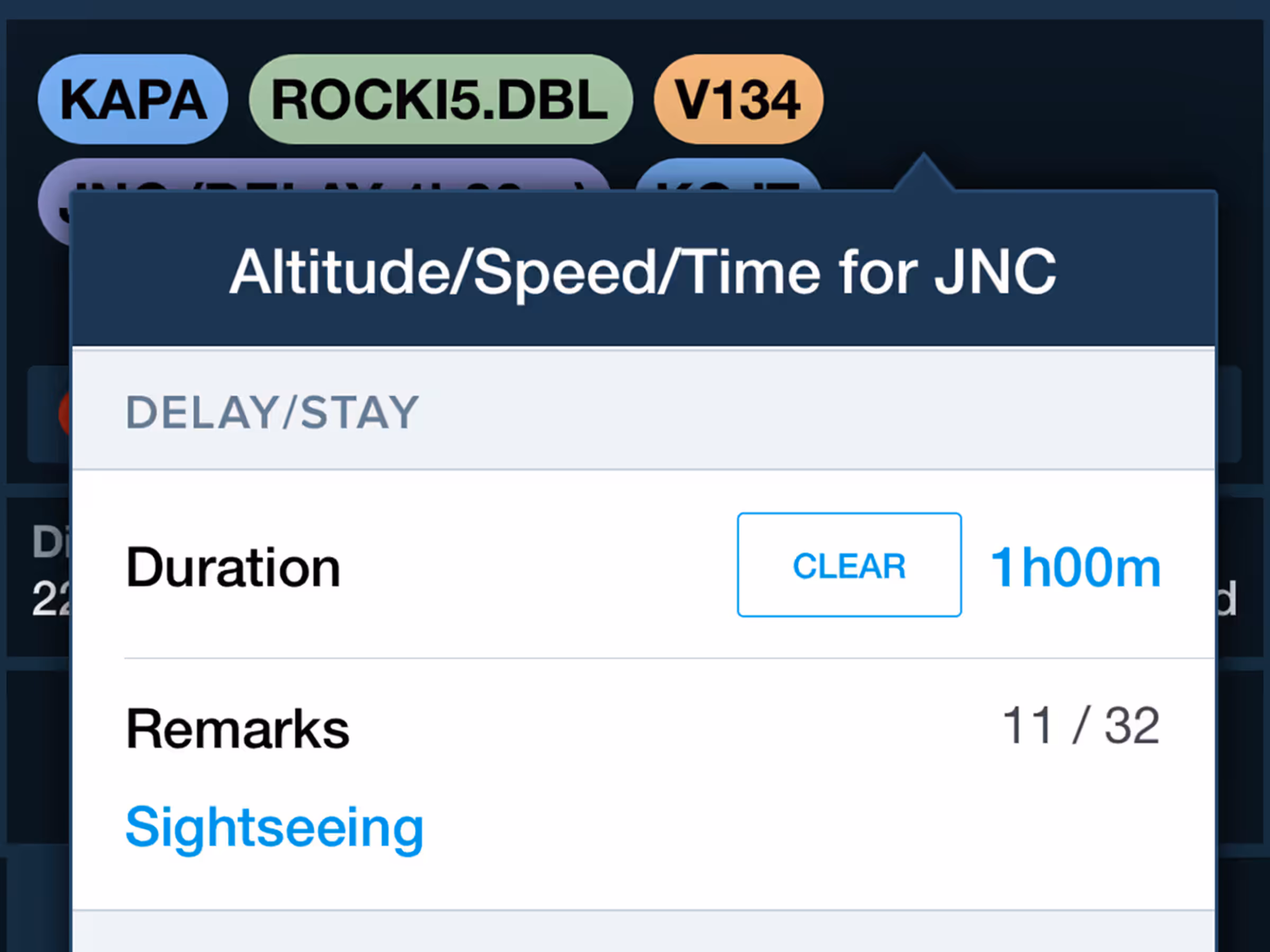
Delay/STAY Planning
Incorporate enroute delays into flight plans with automatic regional formatting at specific waypoints.
All Plans
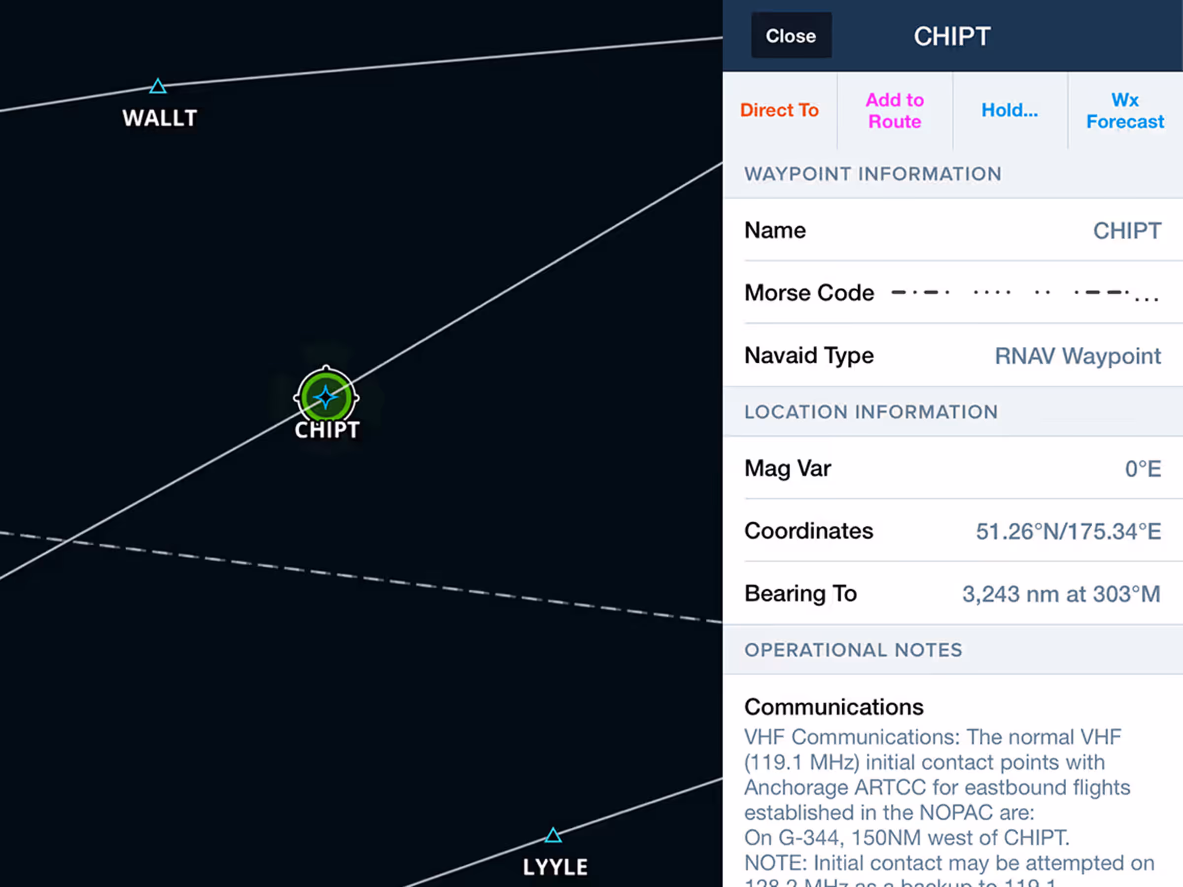
Expanded Operational Notes
Access Jeppesen-sourced Operational Notes for airways, waypoints, navaids, and airspace.
2022
14.2
March 2022
March 2022
All Plans
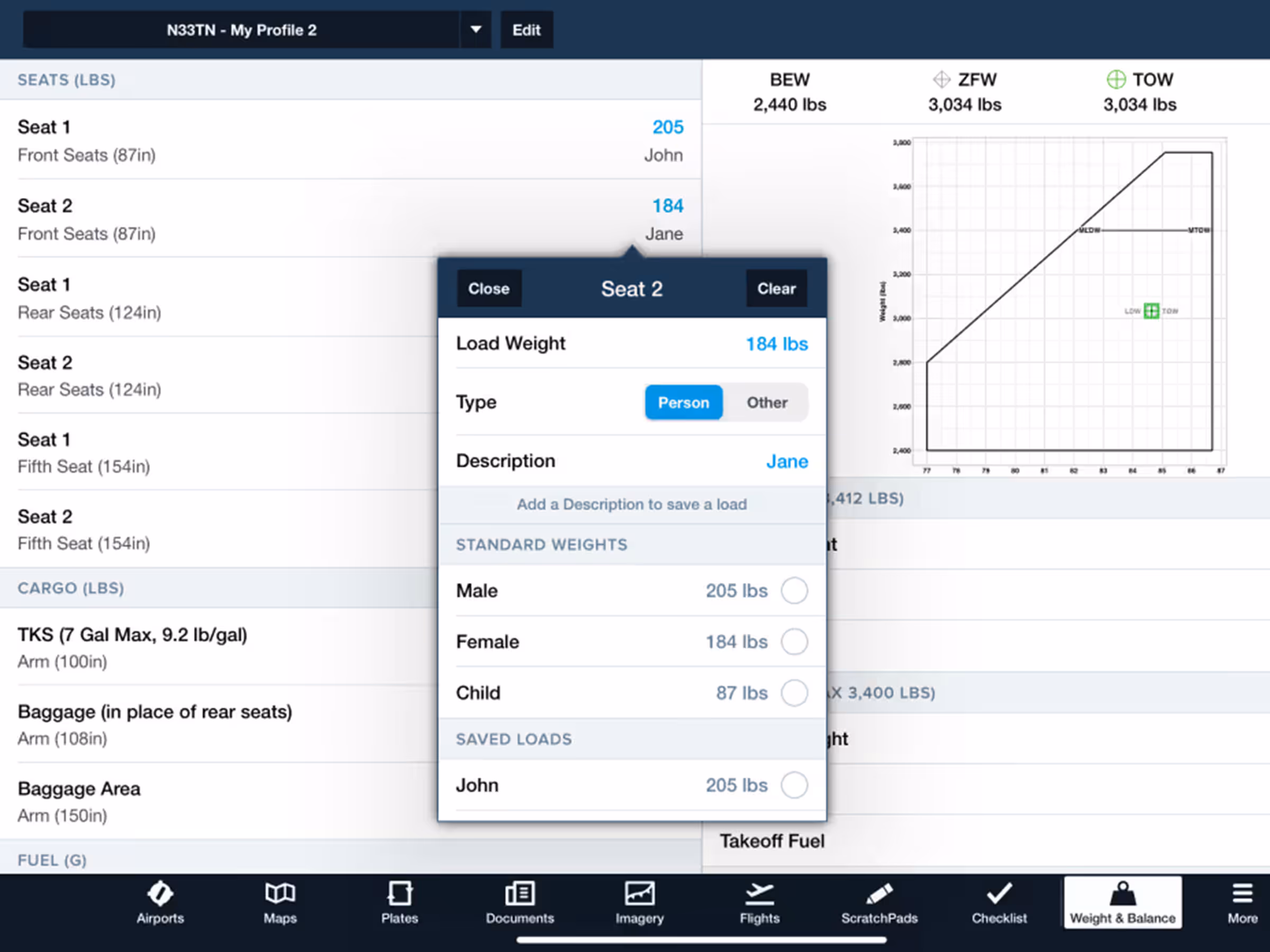
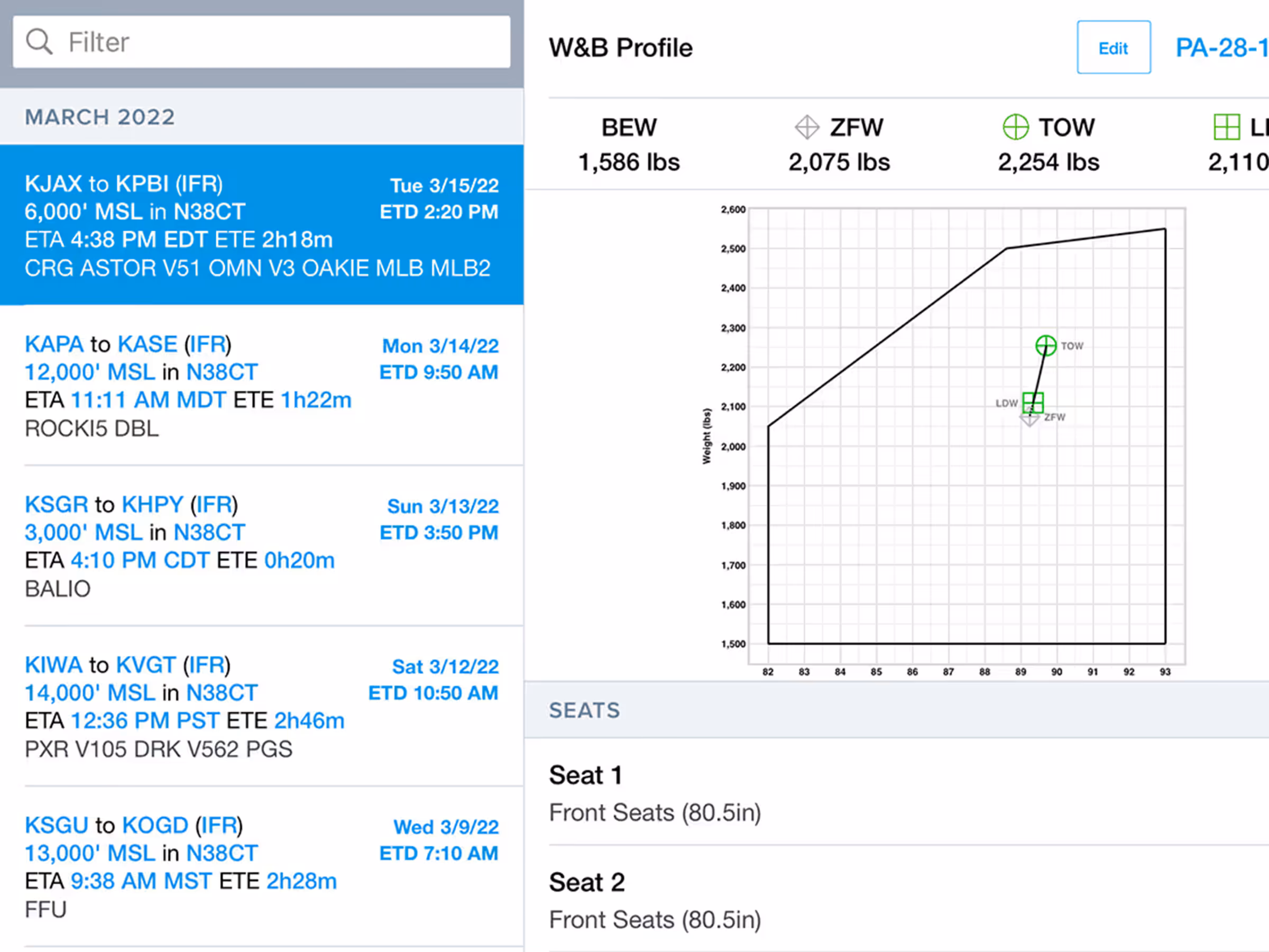
Enhanced Weight & Balance
Easily create and edit Weight & Balance profiles with enhanced interface, standard weights, and saved loads.
Essential & Above
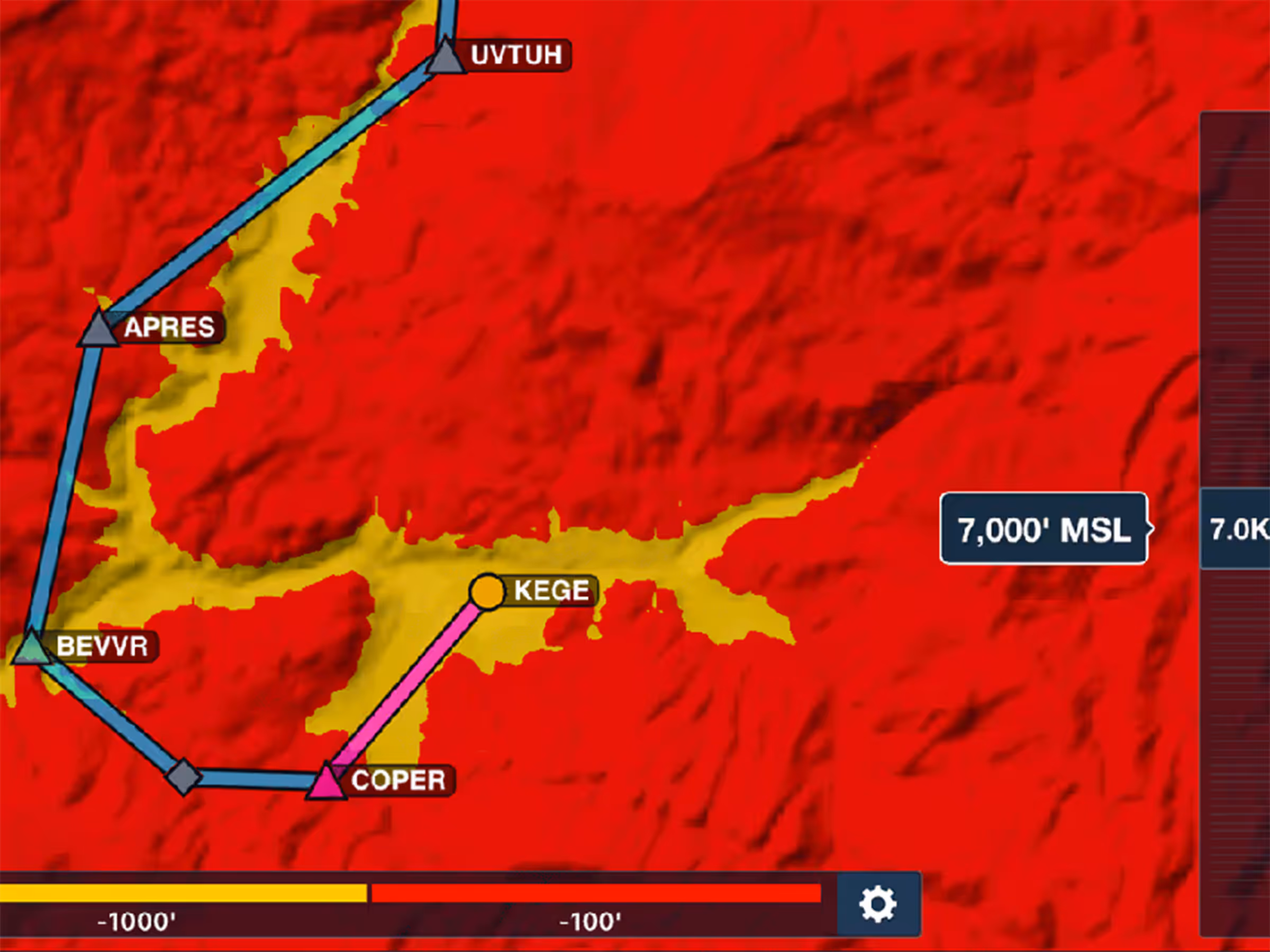
Hazard Advisor Altitude Preview
Control Hazard Advisor's altitude to evaluate routes through terrain and visualize different height options.
Premium
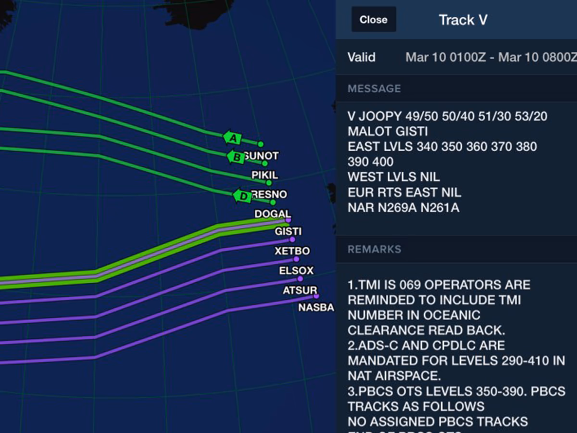
Organized Track Systems on Jeppesen Enroute Charts
View and plan with North Atlantic, Pacific, and Australian organized tracks on Jeppesen IFR charts.
Premium
Weight & Balance Integrated with Flights
Integrate Weight & Balance with flight planning for accurate calculations and access to the load manifest PDF.