
Release Spotlight
Release Spotlight

17.11
CFI Referral Program
Active CFIs can earn discounts on their subscription by introducing students to ForeFlight.
2022
14.1
February 2022
February 2022
All Plans
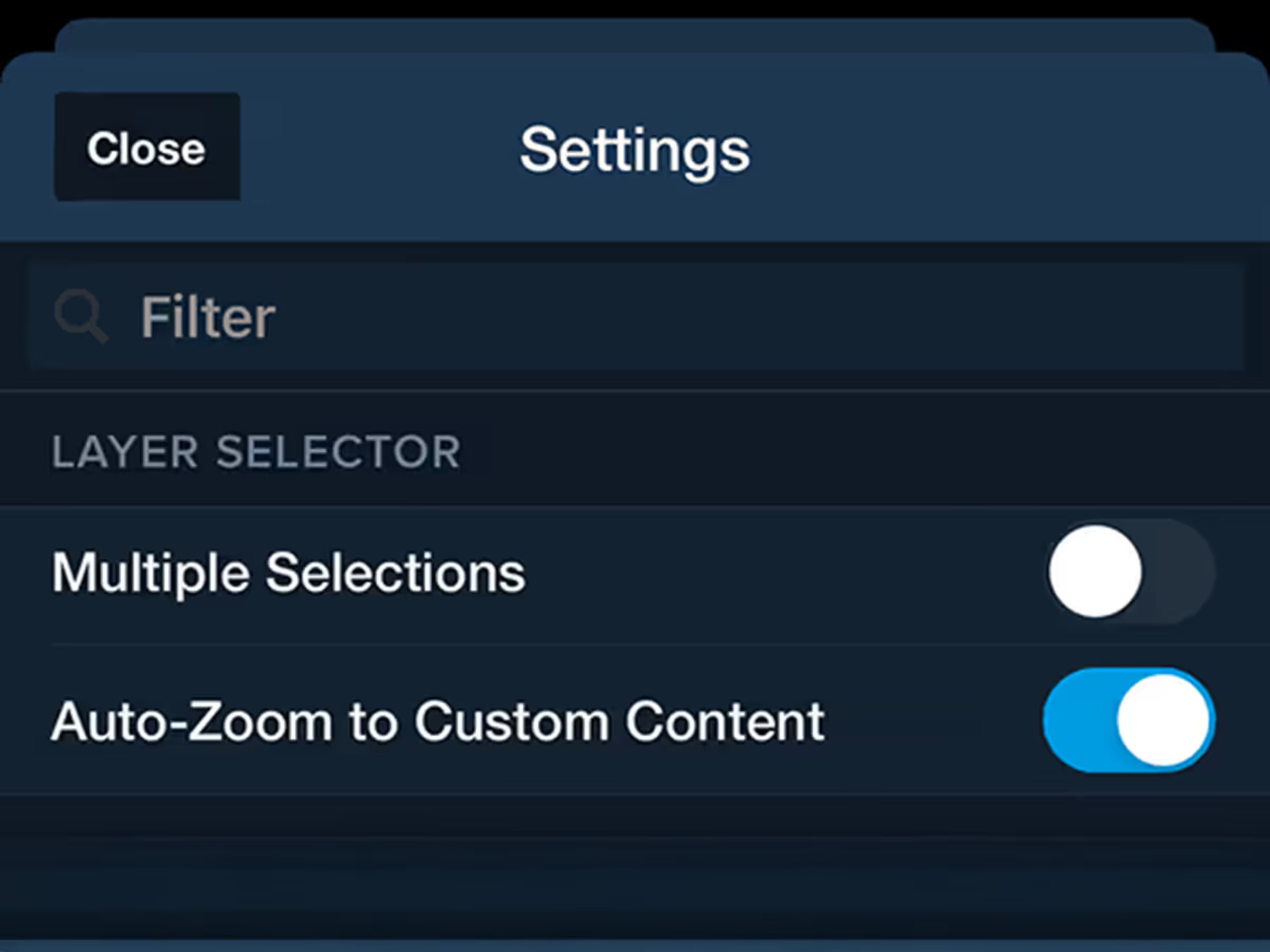
Auto-Zoom to Custom Content
Control whether ForeFlight auto-zooms into custom charts and map layers when you enable them.
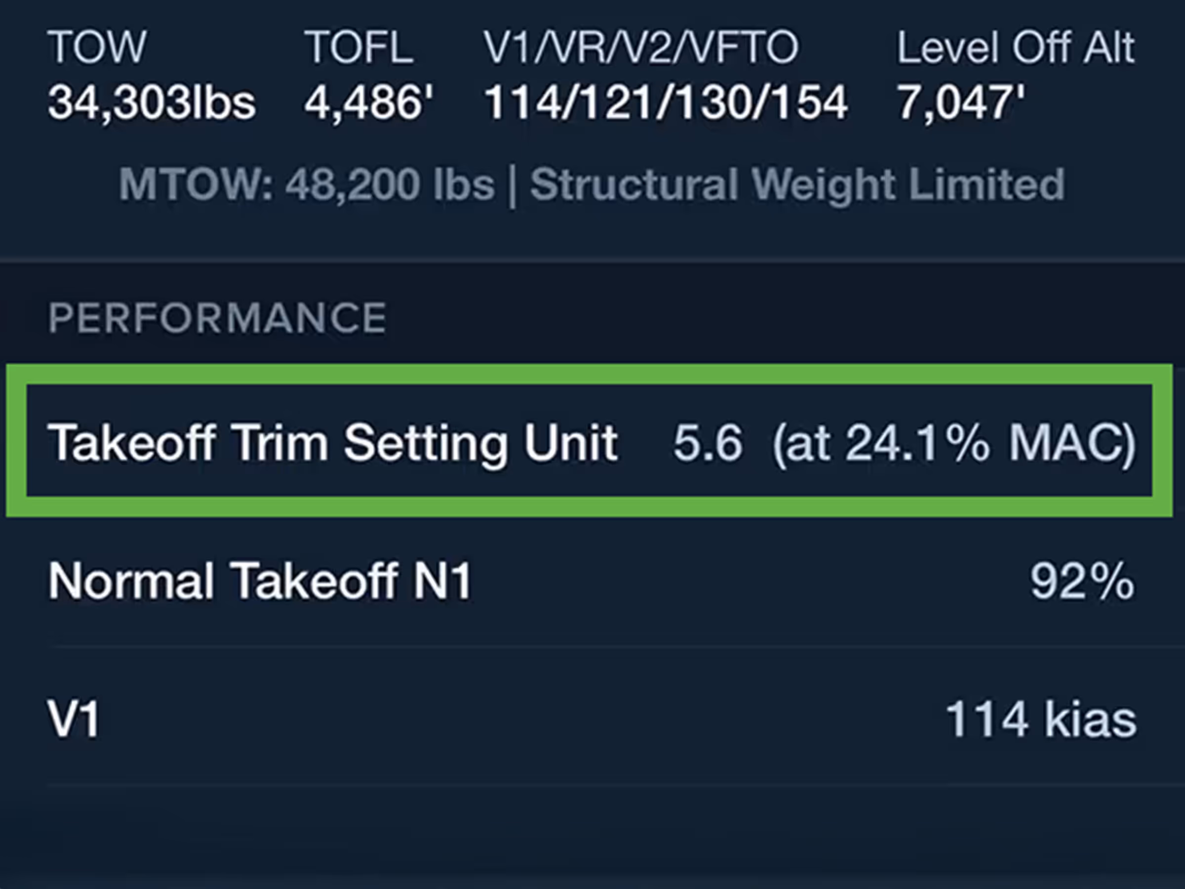
Runway Analysis
Takeoff Trim Support in Runway Analysis
Calculate Takeoff Trim settings for Pilatus PC-24, Bombardier, Citation, and more.
2022
14.0
January 2022
January 2022
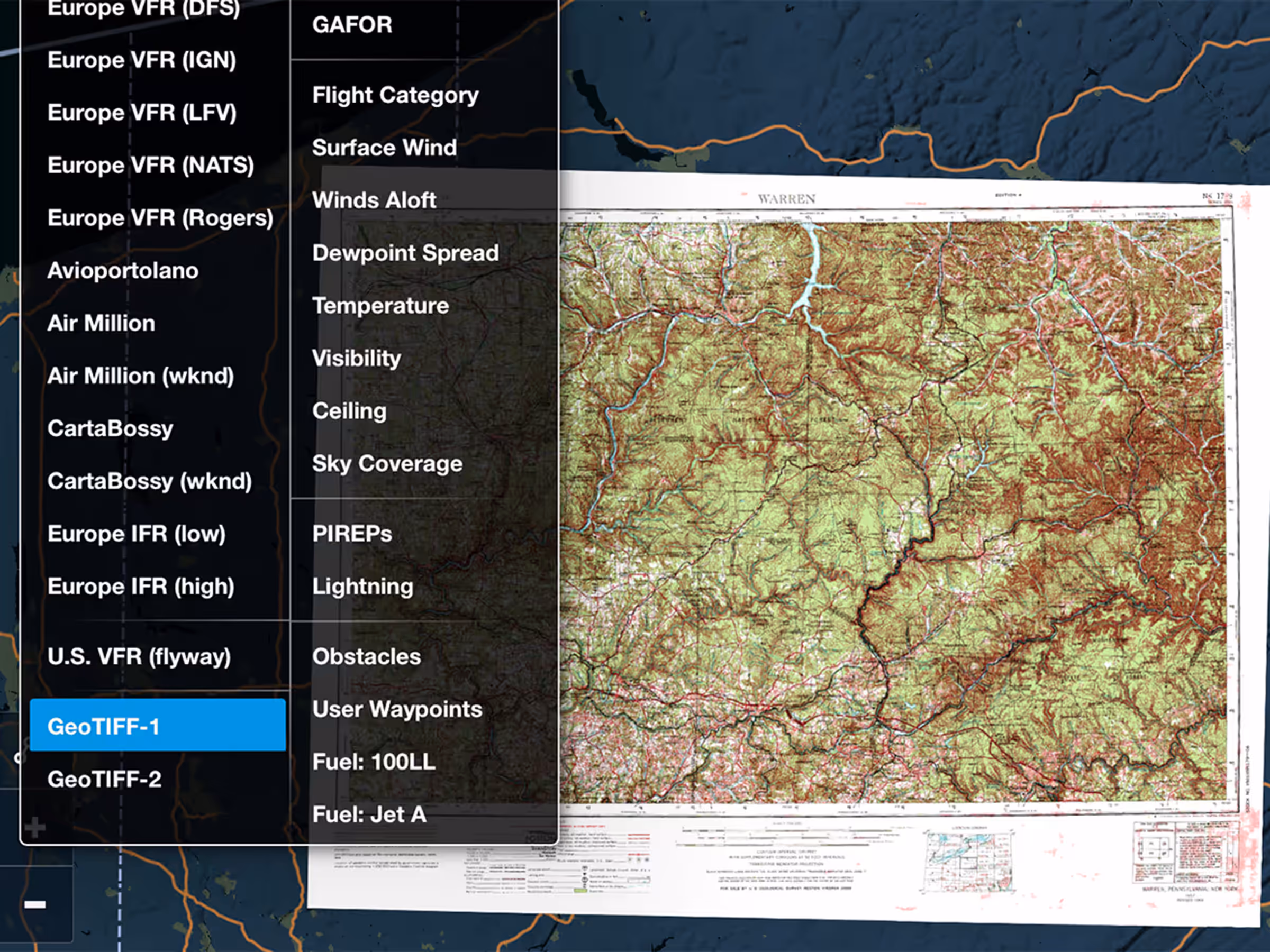
MFB Plans
Military Flight Bag: GeoTIFF Support
Import GeoTIFF charts and maps from military mapping software like FalconView.
All Plans
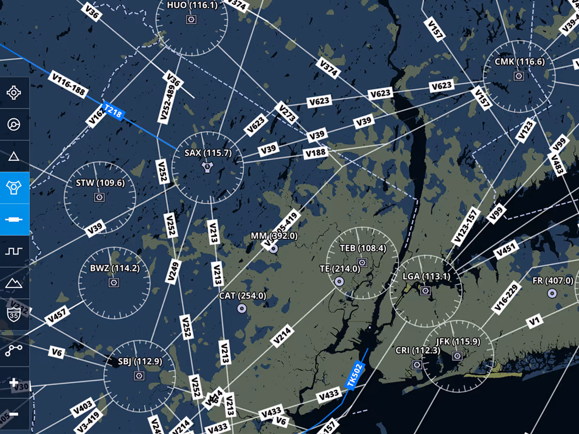
New Aero Map Filters
Customize Aeronautical Map with separate toggles for Airways, Navaids, and Waypoints.
All Plans
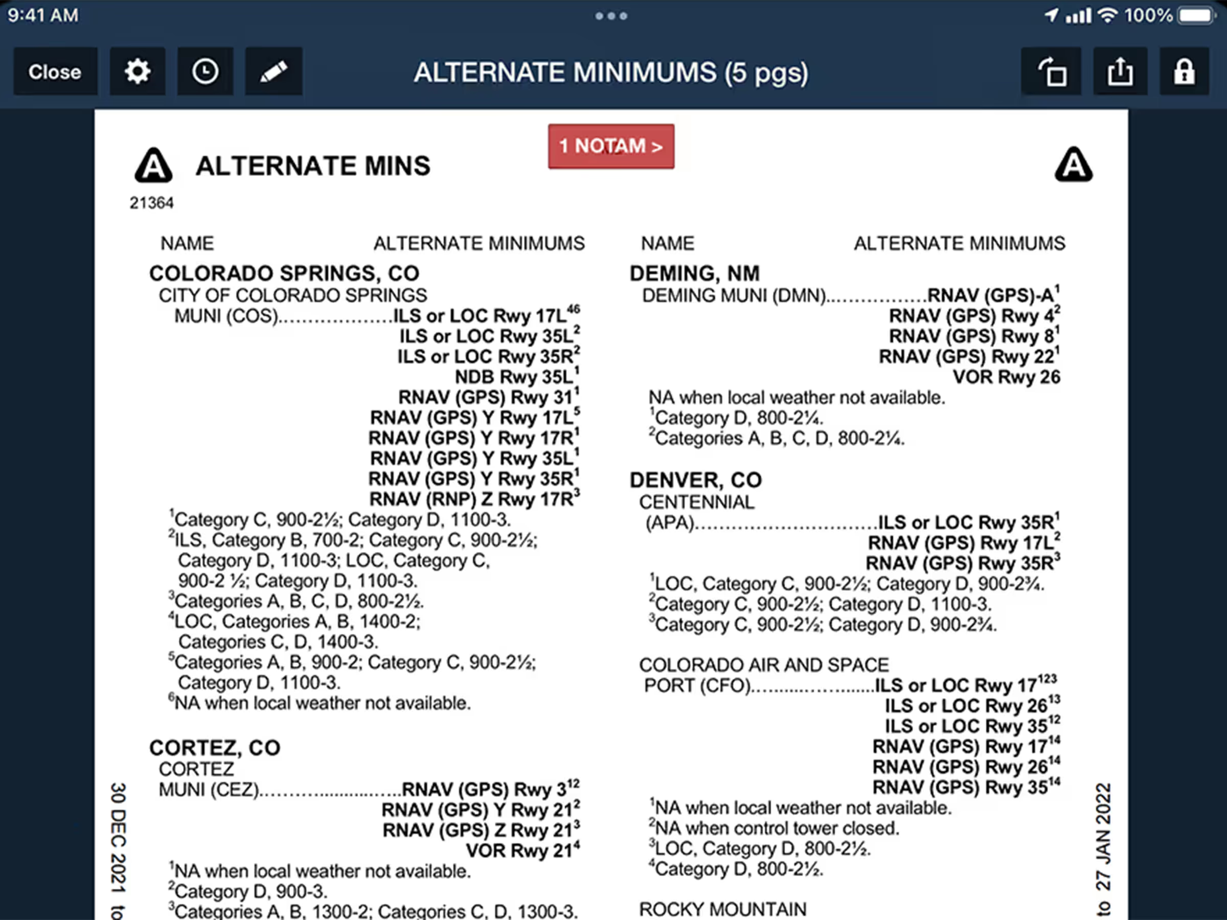
Quickly Find Takeoff & Alternate Minimums
Auto-open Takeoff and Alternate Minimums documents to the correct page for US airports from Procedures list.
2021
13.10
November 2021
November 2021
Premium
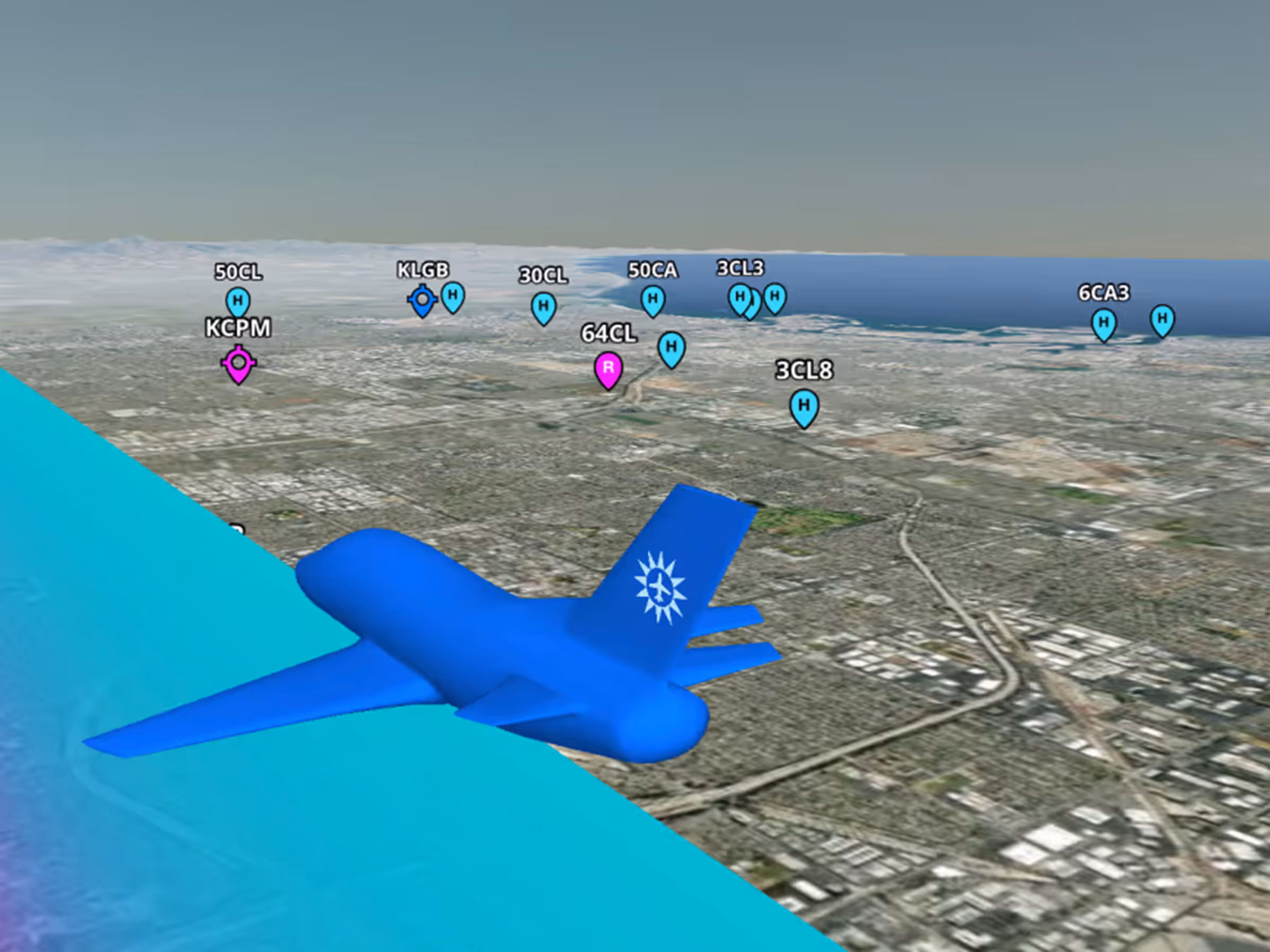
Airport Markers in 3D
Easily access airport information along your route with tappable airport markers in 3D Preview and Review.
2021
13.9
October 2021
October 2021
All Plans
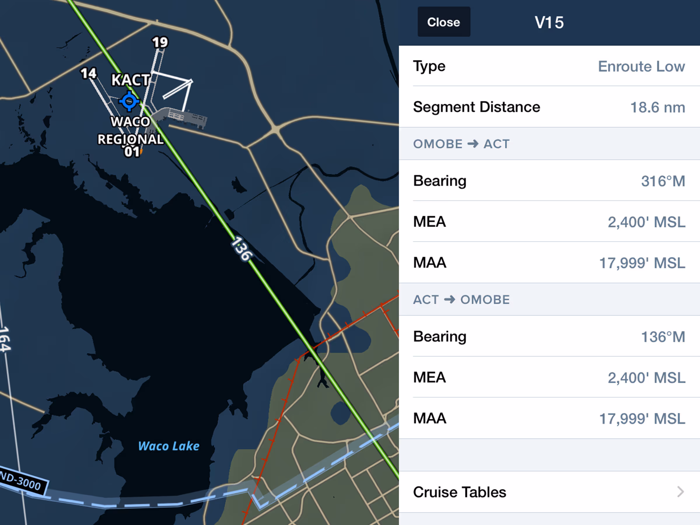
Enhanced Airway Details
View airway details including MEA, MOCA, MAA altitudes, and bearing.
2021
13.8
September 2021
September 2021

Premium
GPS Data with Honeywell Apex & Aspen Connected Gateway
Receive GPS position from Honeywell Apex FMS via Aspen Connected Gateway.
Essential & Above
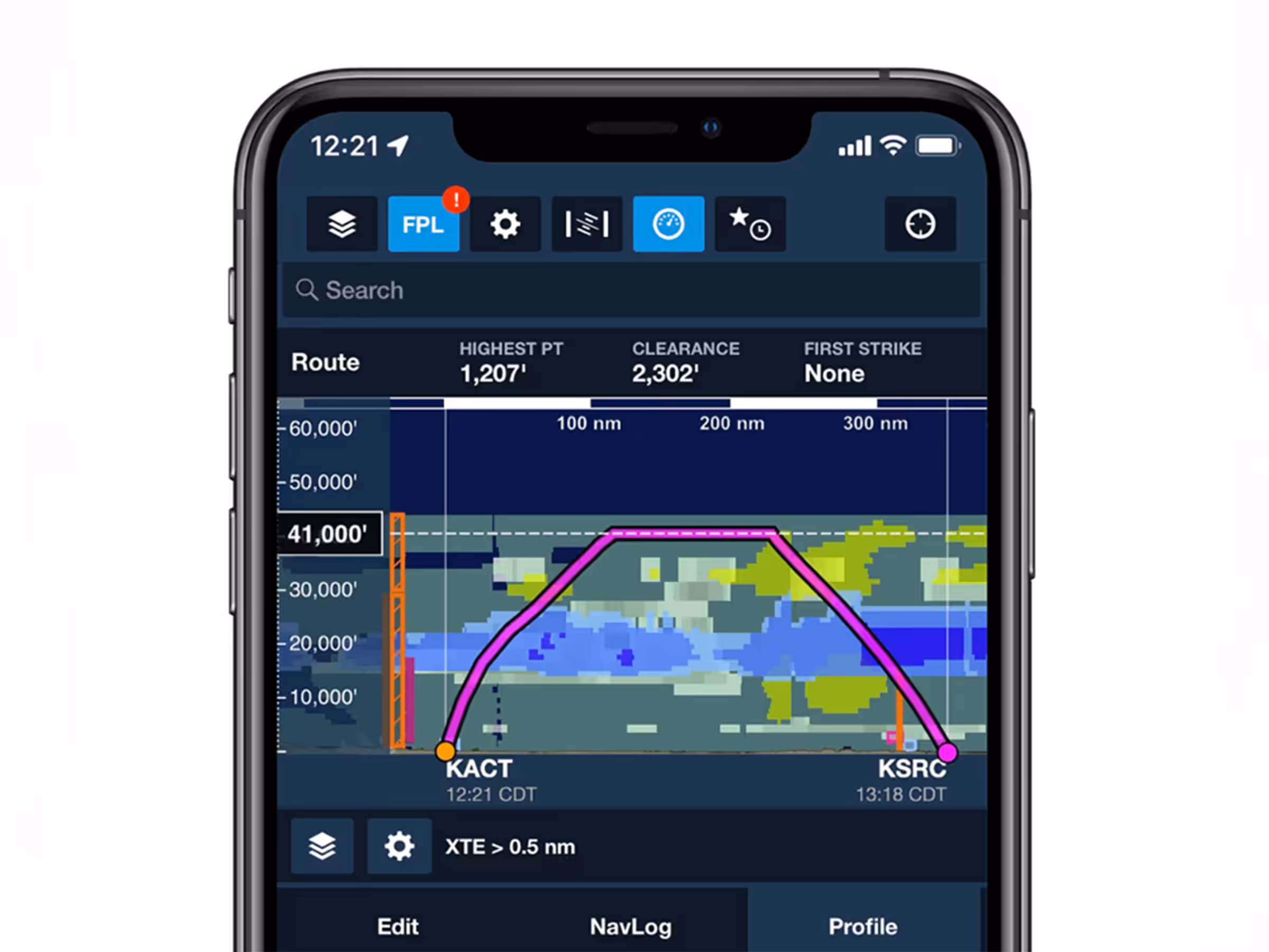
Profile View on iPhone
Use Profile View on iPhone to see terrain, obstacles, and weather forecasts along your route.

All Plans
Track Log Review Layer Selector
Access combined flight data buttons for Speed, Altitude, Pitch, and Bank in the Track Log Graph.