
Release Spotlight
Release Spotlight

17.11
CFI Referral Program
Active CFIs can earn discounts on their subscription by introducing students to ForeFlight.
2021
13.7
August 2021
August 2021

Premium
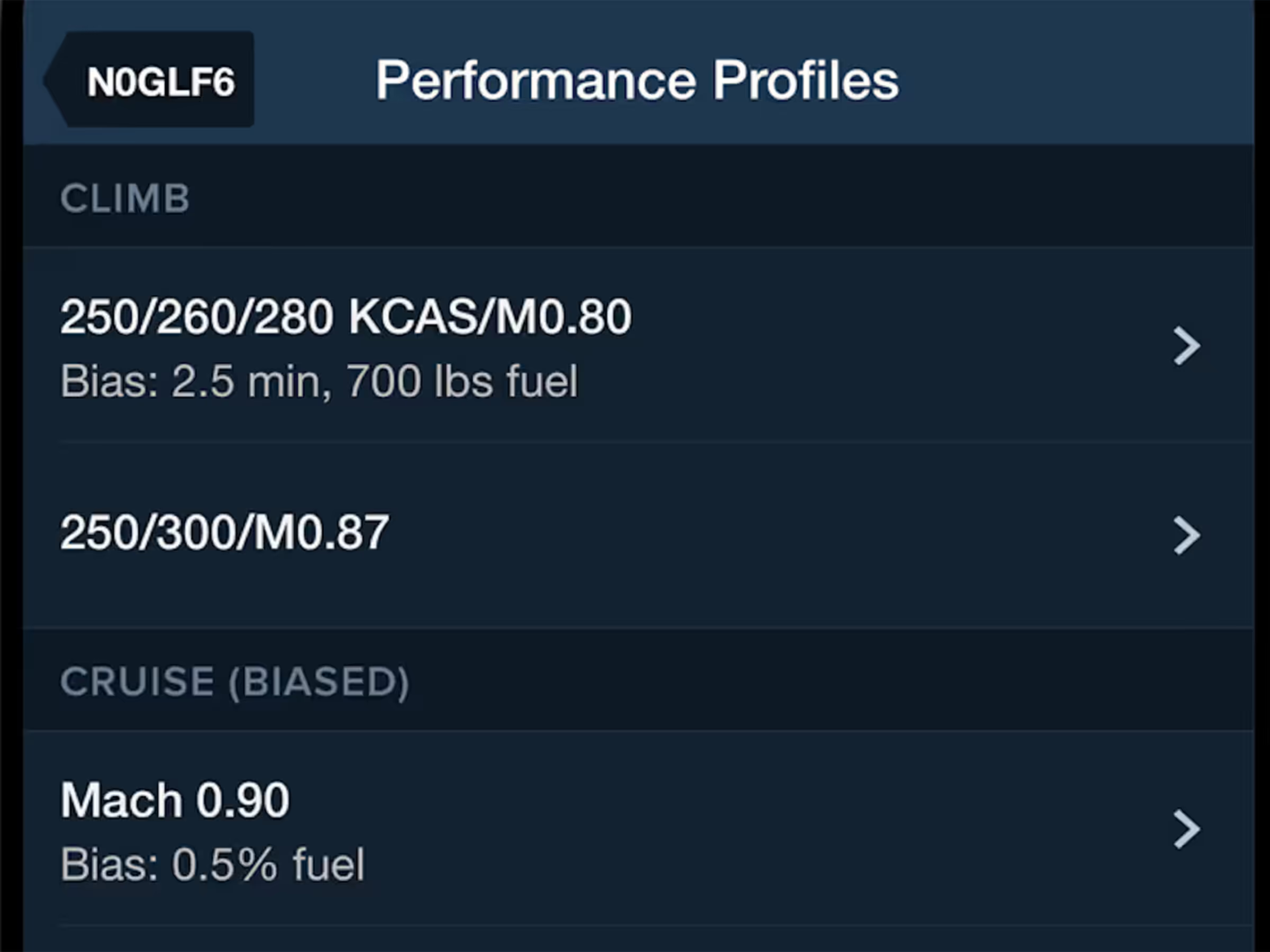
Bias Climb & Descent Performance Profiles
Adjust aircraft climb and descent profiles with bias settings to match real-world performance.
Premium
Multiple Climb/Descent Profiles
Access multiple climb and descent profiles for select Bombardier, Dassault, Embraer, and Gulfstream aircraft.
2021
13.6
July 2021
July 2021
All Plans
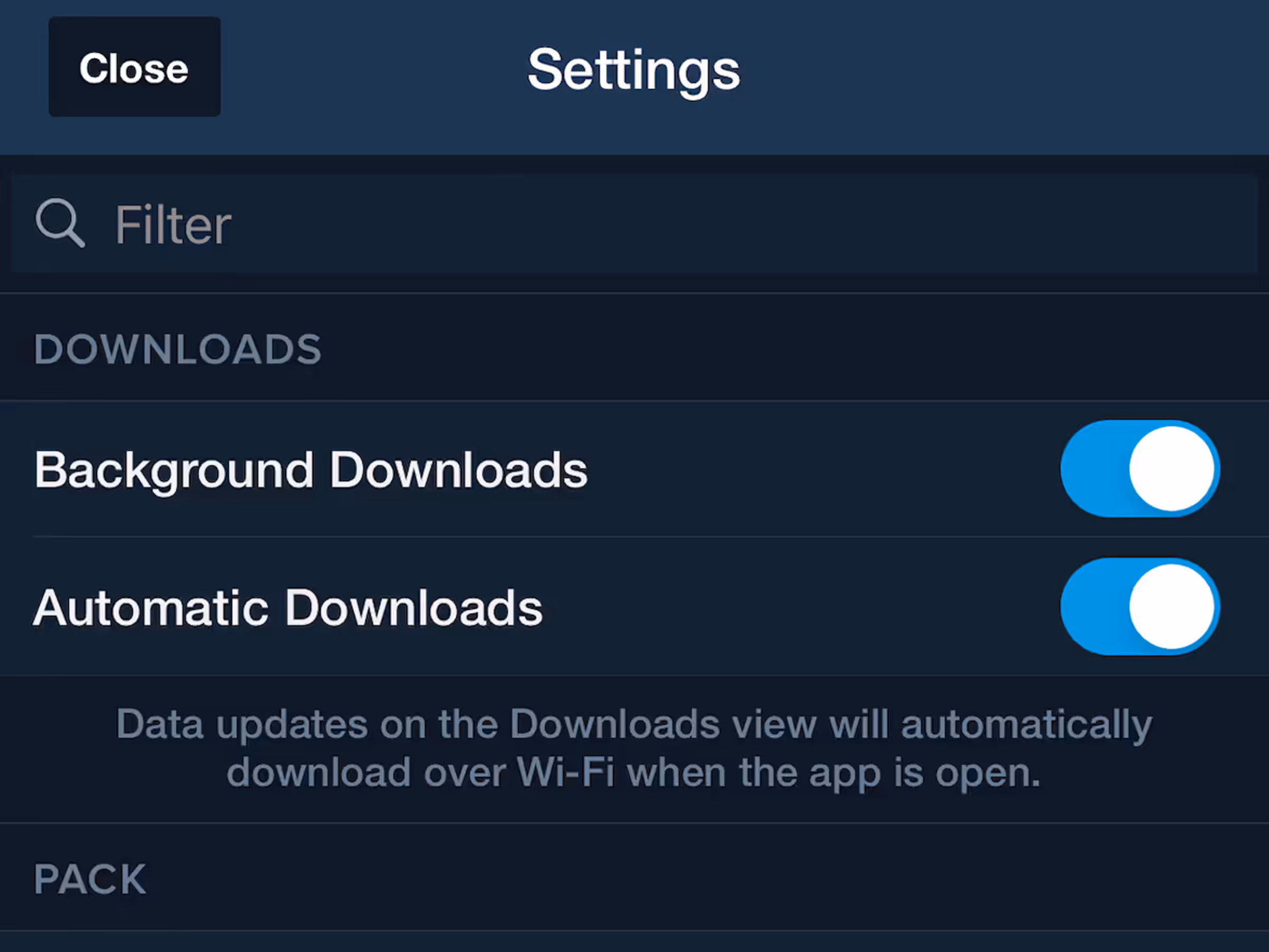
Background Downloads Setting
Disable background downloads to prevent interruptions from slow internet connections.
All Plans
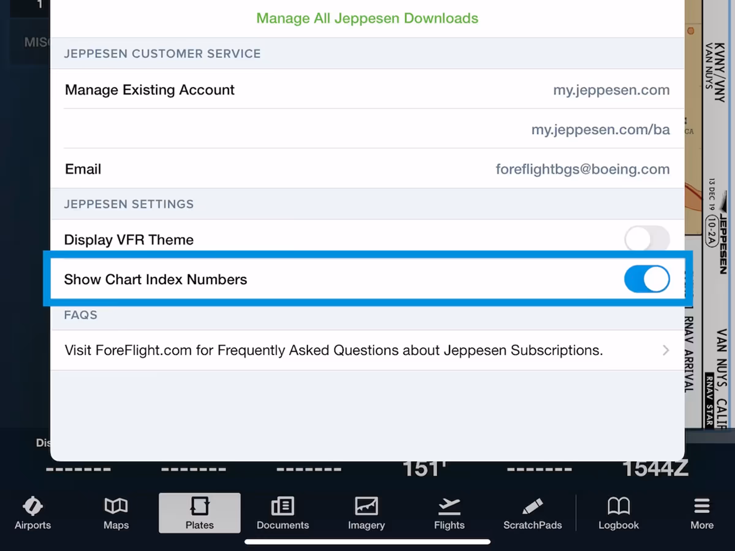
Jeppesen Chart Index Numbers
View chart index numbers alongside names for faster identification of Jeppesen procedures.
All Plans
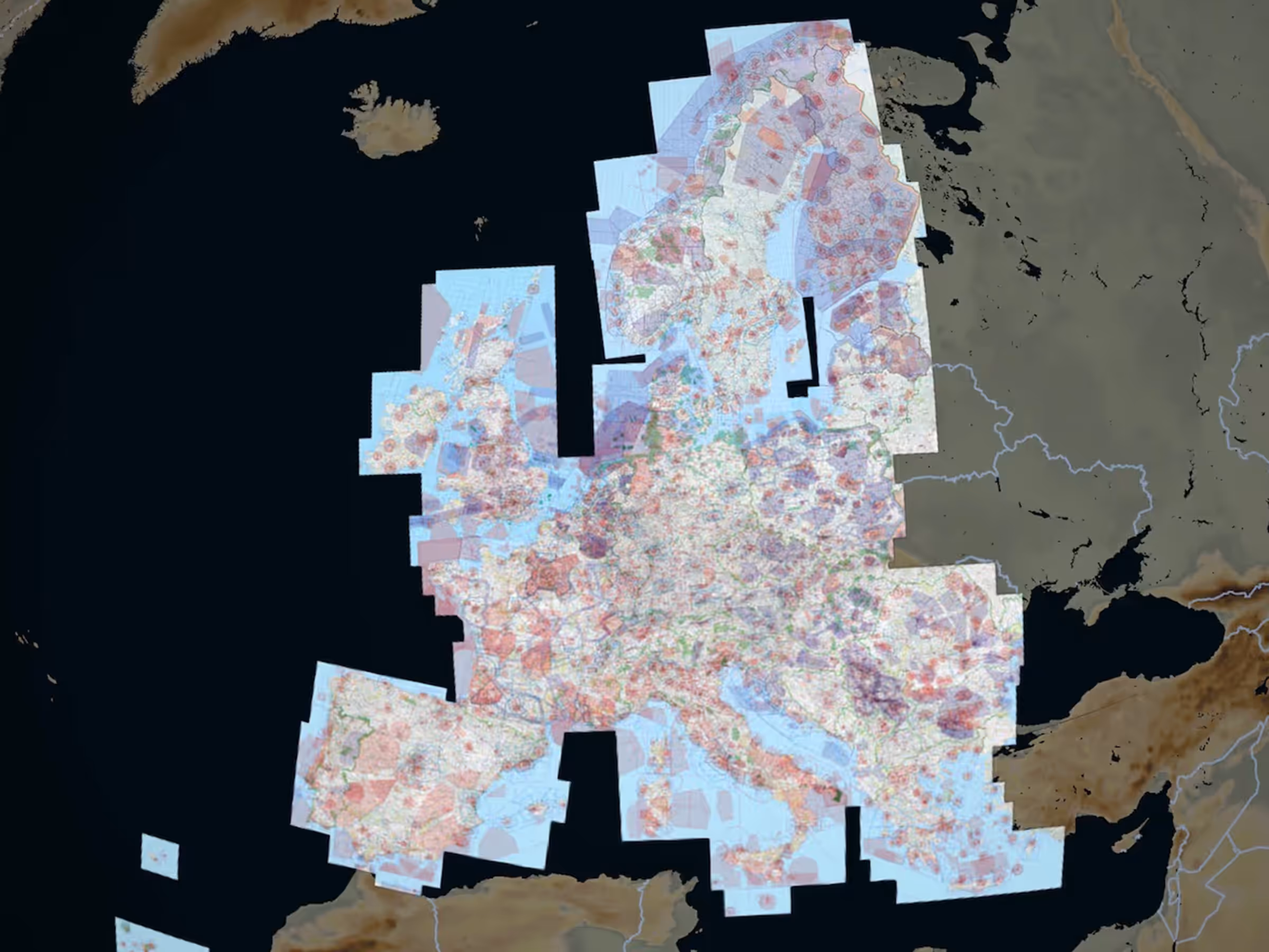
New Rogers VFR Chart Coverages
Access new Rogers Data VFR 500k charts for Serbia and the Baltics as European subscription add-ons.
All Plans
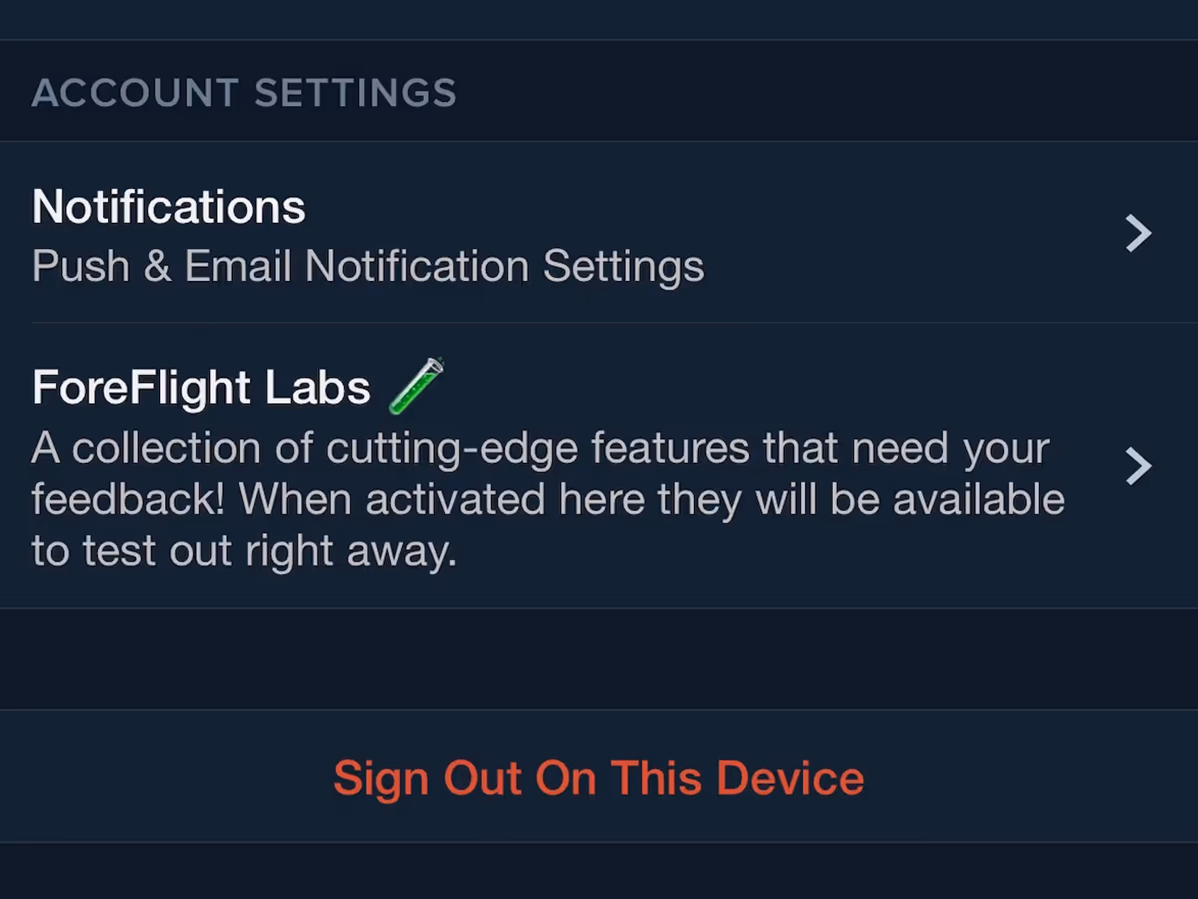
Notification Preferences
Opt-in to marketing notifications about feature releases, subscription offers, events, and training.
2021
13.5
June 2021
June 2021
Premium
Augmented Procedures™
Find and display approach minimums on your route to reduce risk with Augmented Procedures.

MFB Plans
ForeFlight MFB: Select Multiple MTR Types
Military Flight Bag formats U.S. aerial refueling tracks more neatly and simplifies ATC filing.
Essential & Above
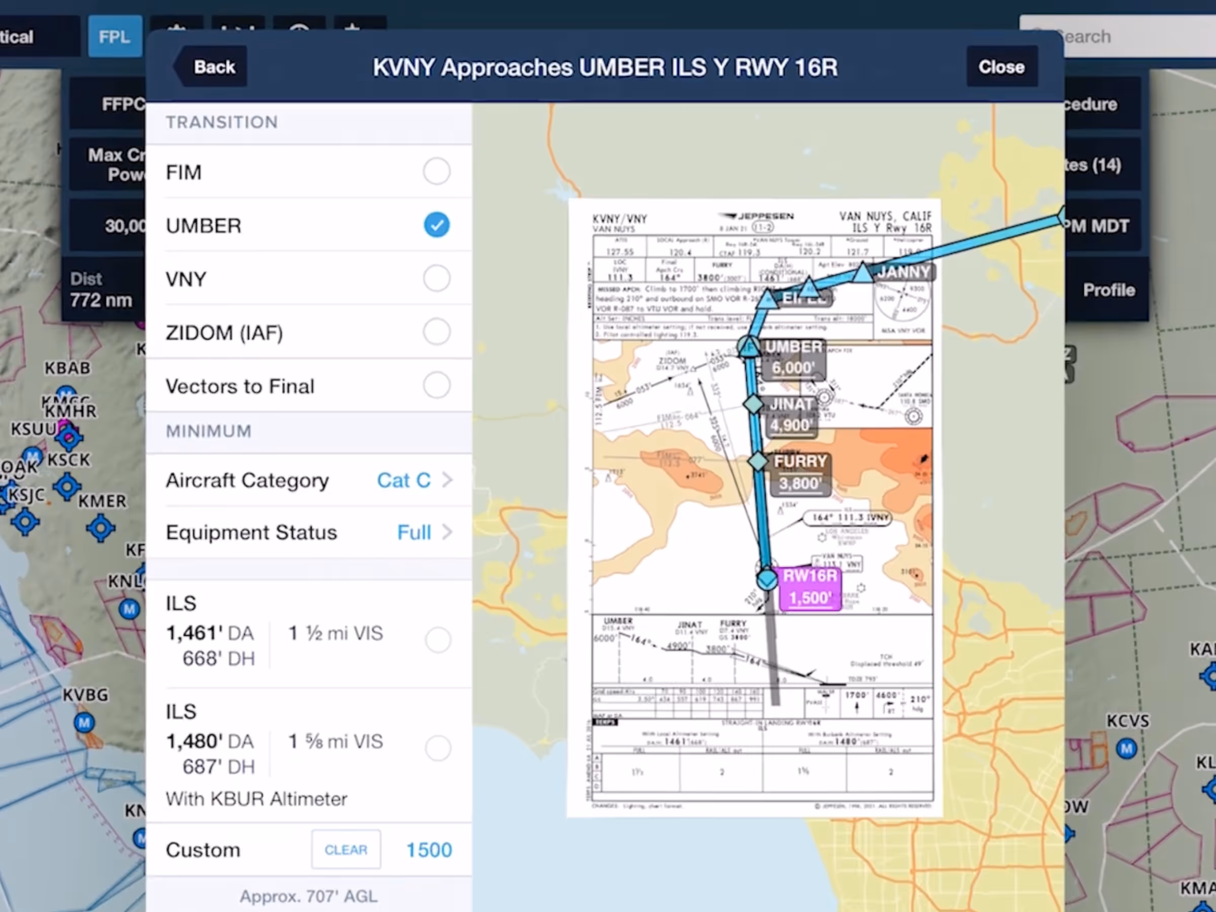
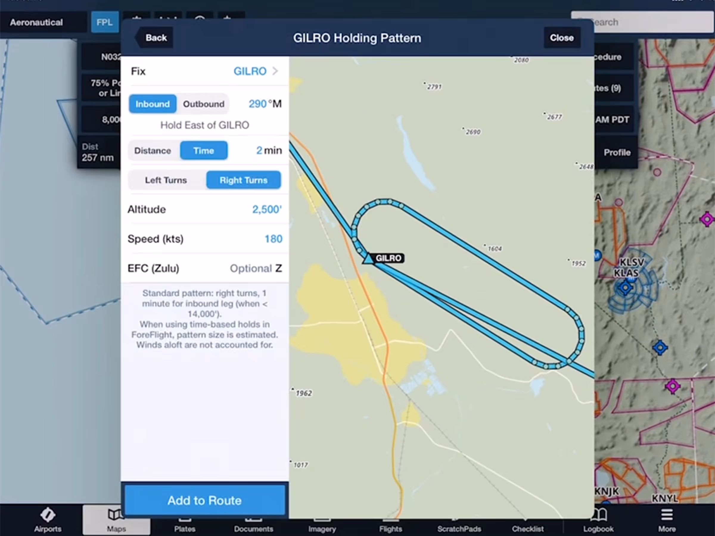
Hold Advisor
Quickly add a holding pattern anywhere in your route with flexible parameters and automatic entry selection.

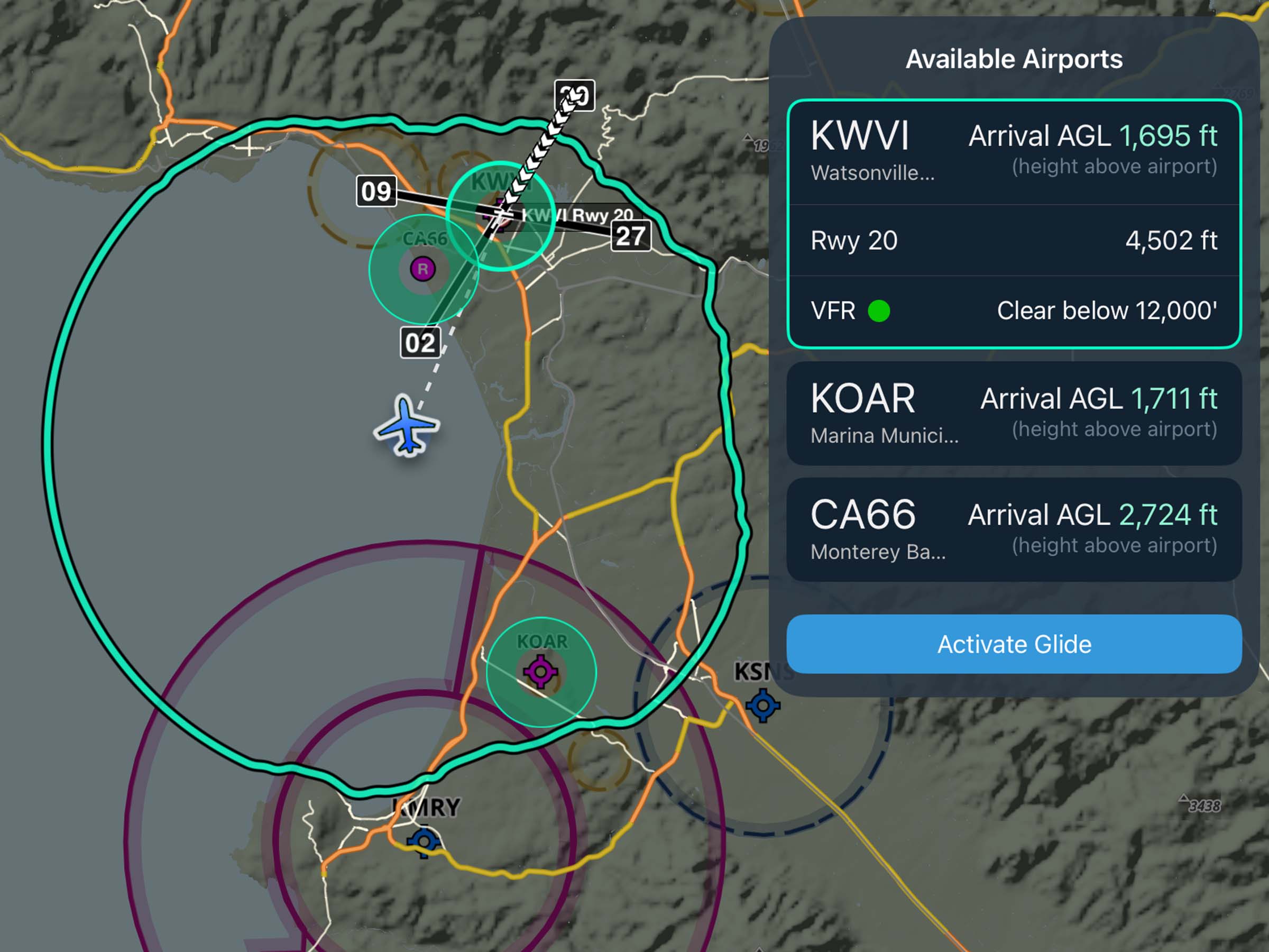
Runway Analysis
Runway Analysis: EOP Visualization
View EOP ground tracks and instructions in Runway Analysis for better flight planning visualization.
2021
13.4
May 2021
May 2021
Premium
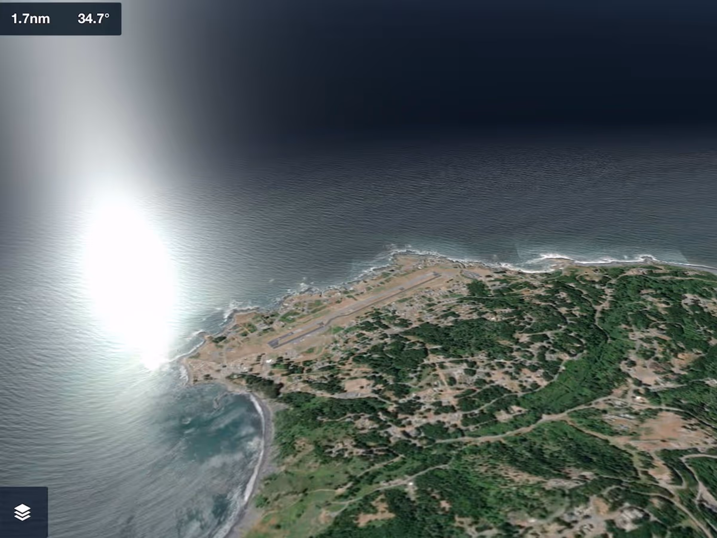
3D View Visual Upgrades
3D View adds sunlight reflections on ocean water, improved sky coloring, and more across all 3D View modes.
Essential & Above
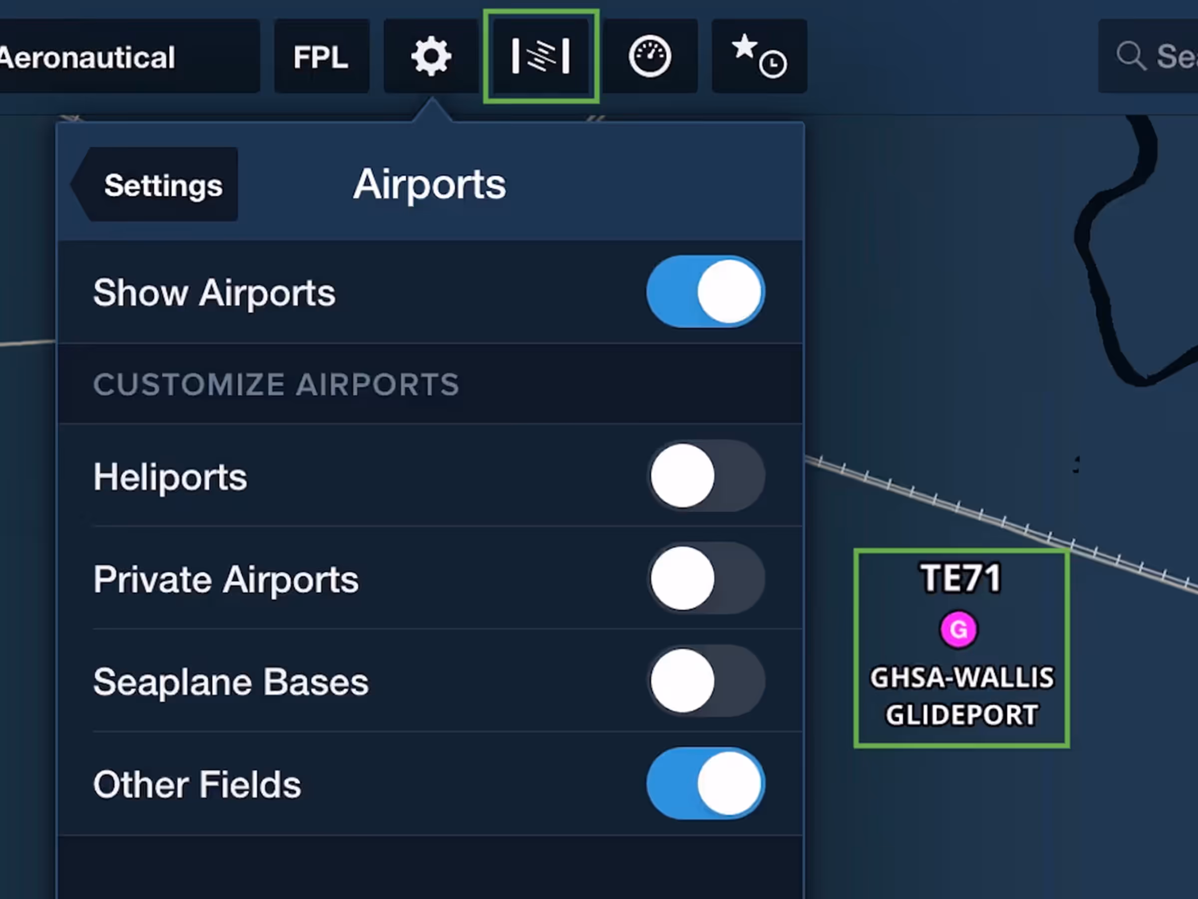
Aeronautical Map Enhancements & New Synthetic Vision Button
Aeronautical Map layer adds glider and balloon fields, TACAN navaids, plus a new Synthetic Vision button.
All Plans
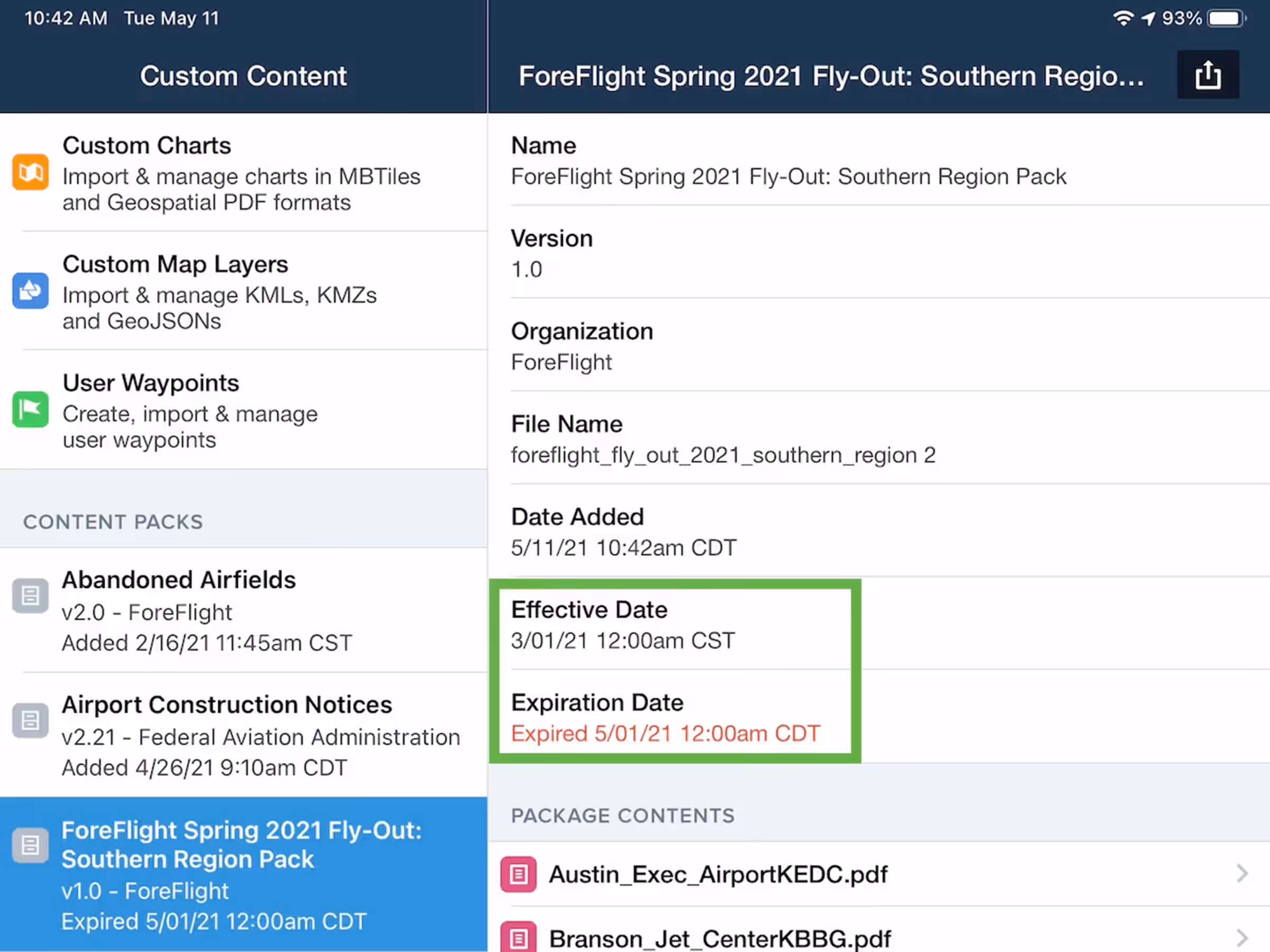
Content Pack Effective Dates
Add effective and expiration dates to Content Packs to display warnings for expired content.
All Plans
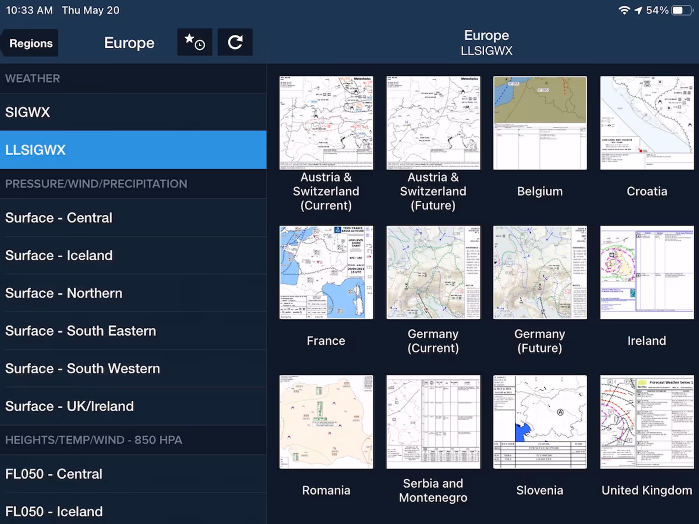
European SIGWX Forecast Graphics
Access extended European coverage with standard and low-level SIGWX charts in Imagery view.
2021
13.3
April 2021
April 2021
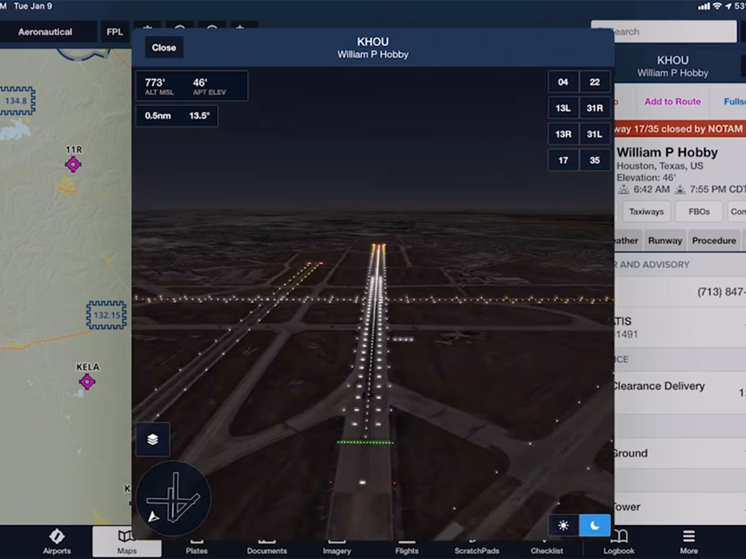
Premium
Airport 3D Runway Lighting
Use Day/Night modes and realistic Runway Lights in Airport 3D to prep for night approaches.
All Plans
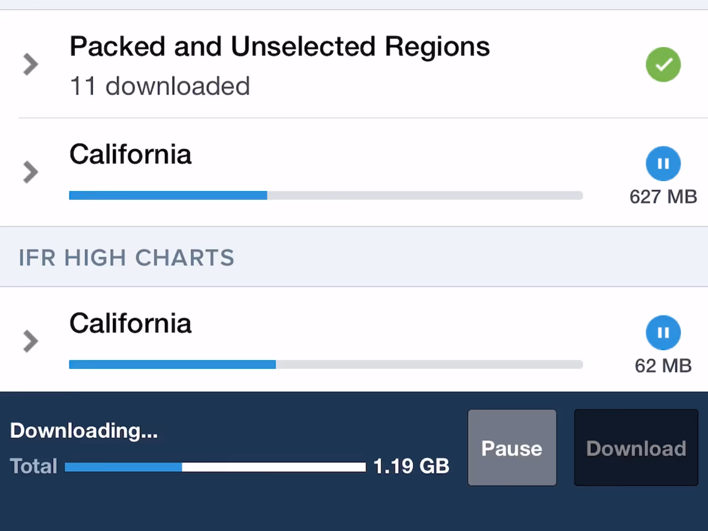
Download in Background
Download charts and data without needing to keep the ForeFlight app open.
Premium
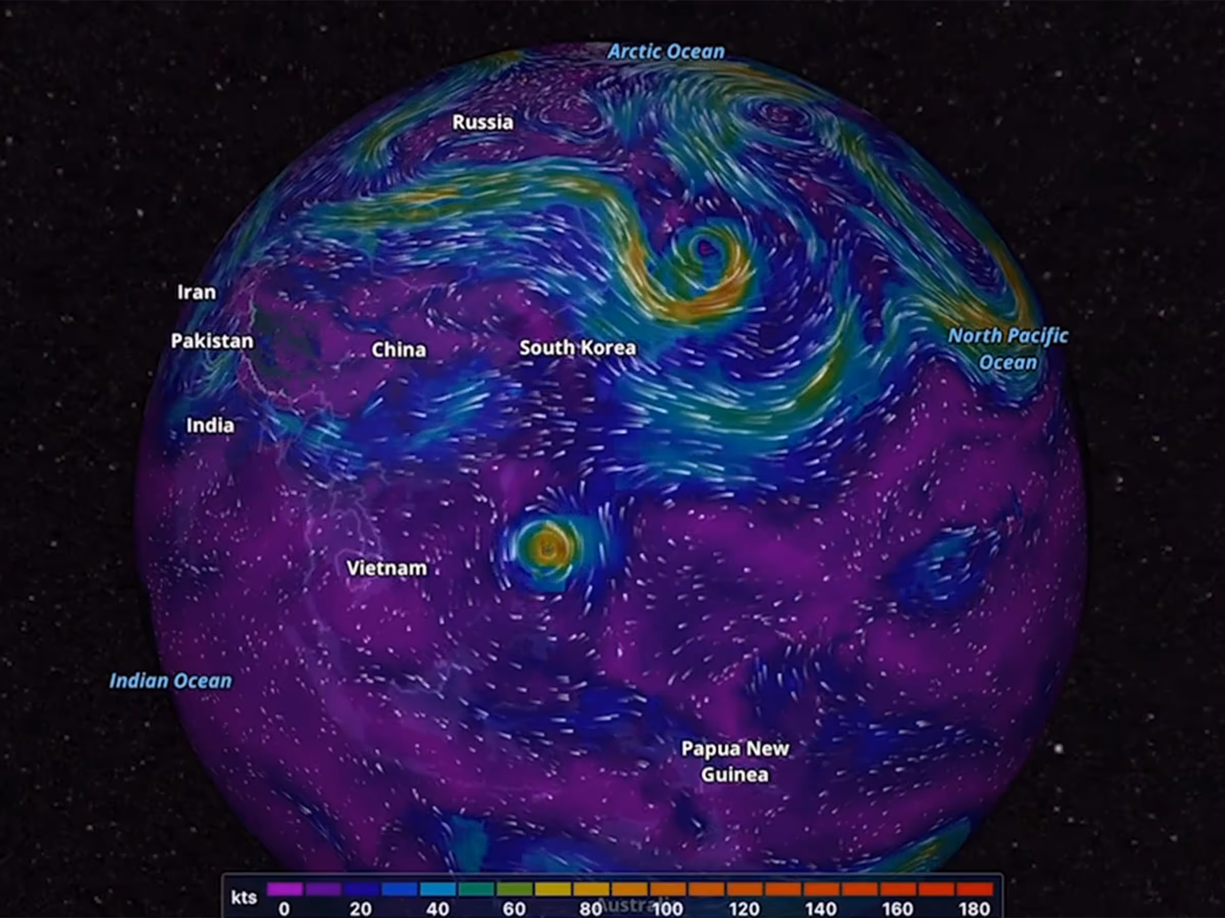
Dynamic Winds and Temperatures
View forecast wind speed, direction, and temperature worldwide with animated layers at high altitudes.
