Quick Tips
Map Annotations
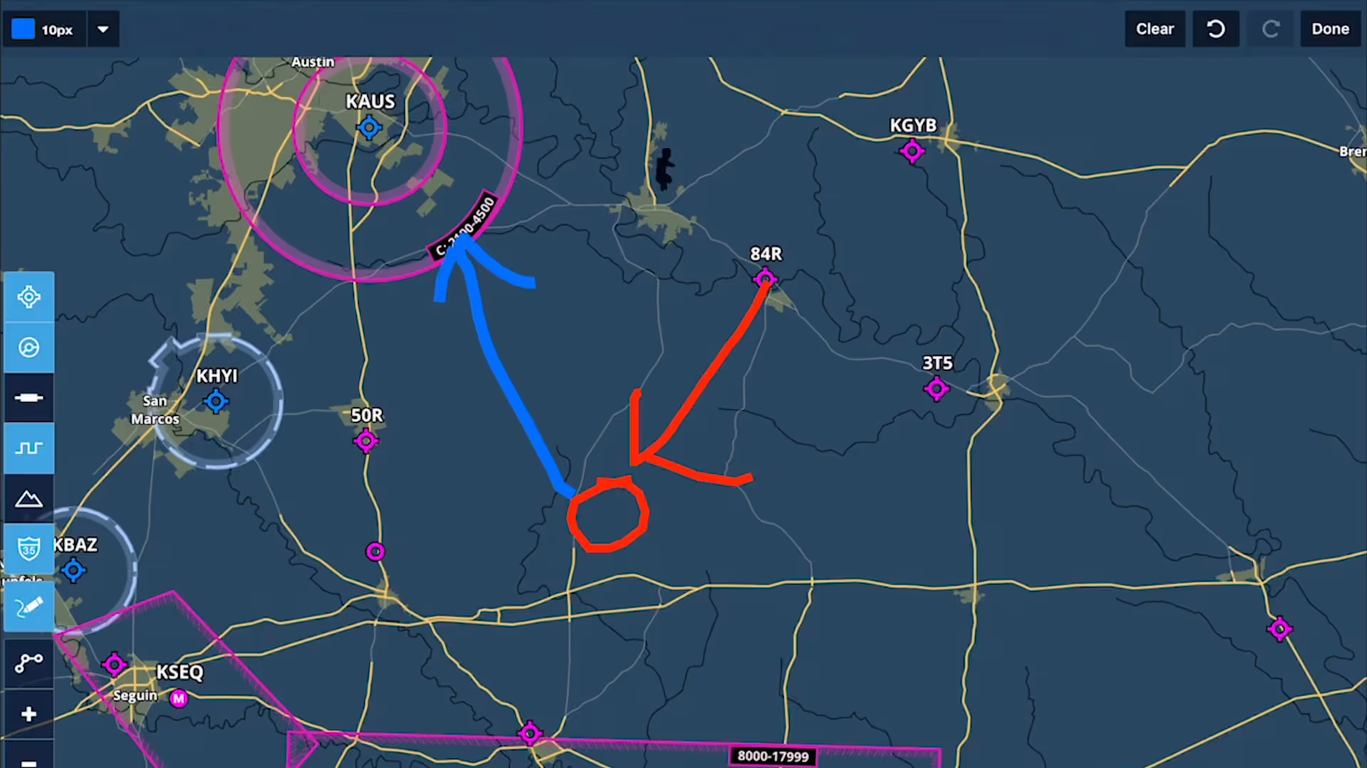
Take notes on the fly and mark up charts using ForeFlight's Map Annotations feature. Tap the Annotations buttons on the Maps view to enter Drawing Mode, and use a finger or stylus to draw on the map.
Dozens of detailed map layers and responsive overlays help you get the full picture on any flight.
Take notes on the fly and mark up charts using ForeFlight's Map Annotations feature. Tap the Annotations buttons on the Maps view to enter Drawing Mode, and use a finger or stylus to draw on the map.
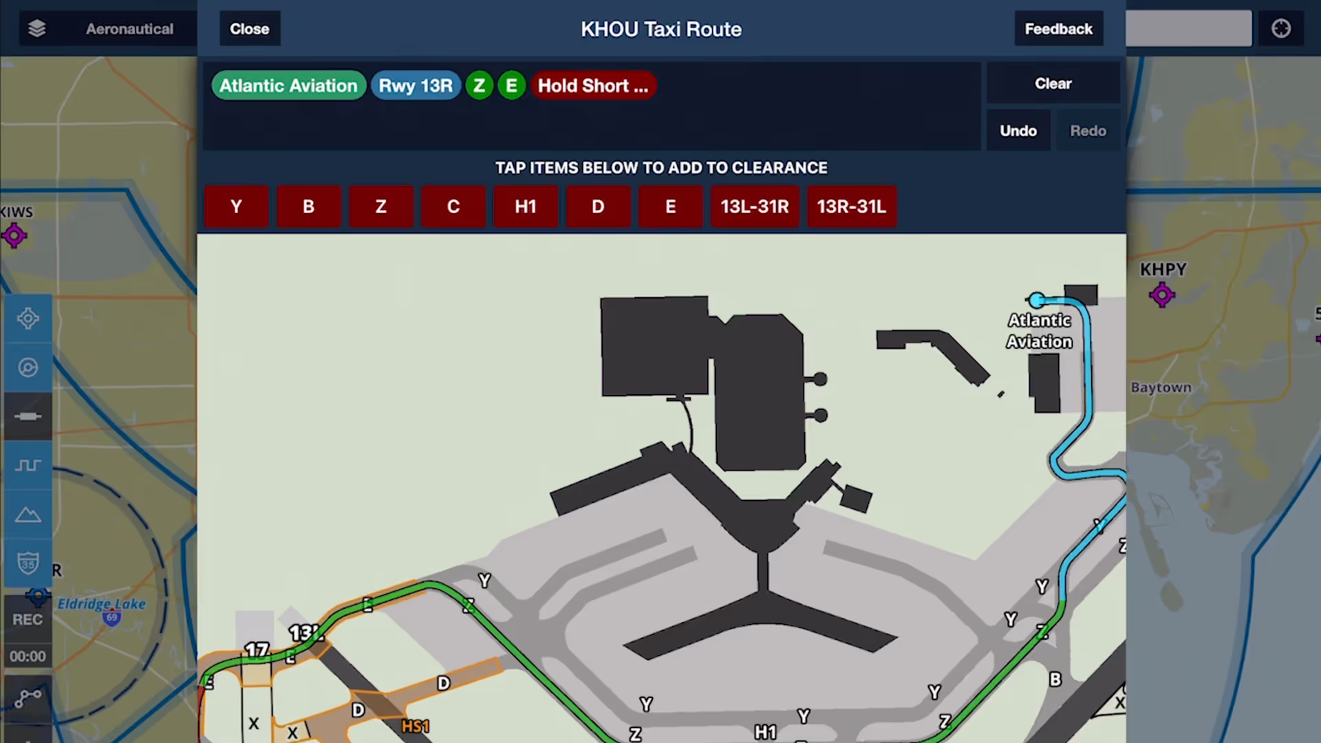
Chart a course to or from the runway with an interactive and contextually-aware Taxi Route editor, available with ForeFlight Performance subscription plans.
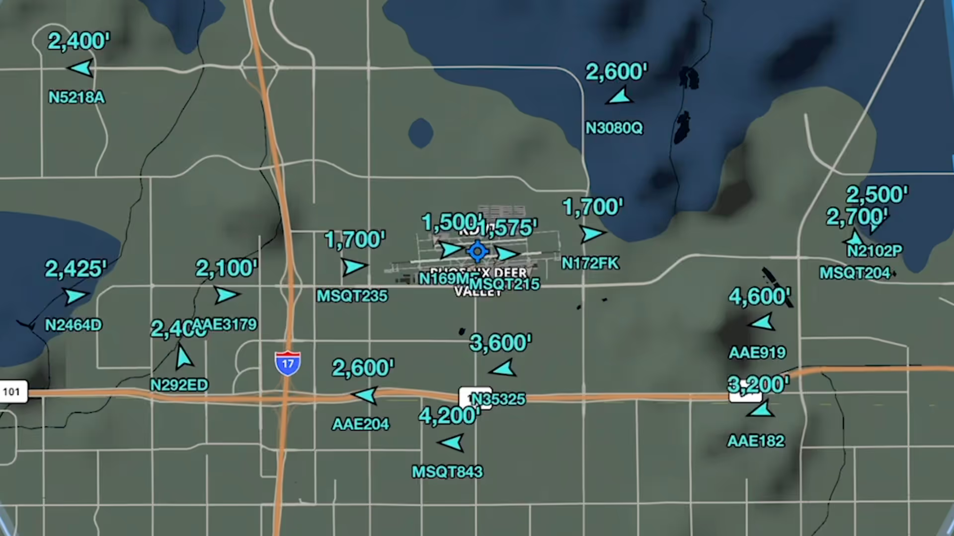
Stream live global aircraft traffic directly in ForeFlight with the Internet Traffic feature
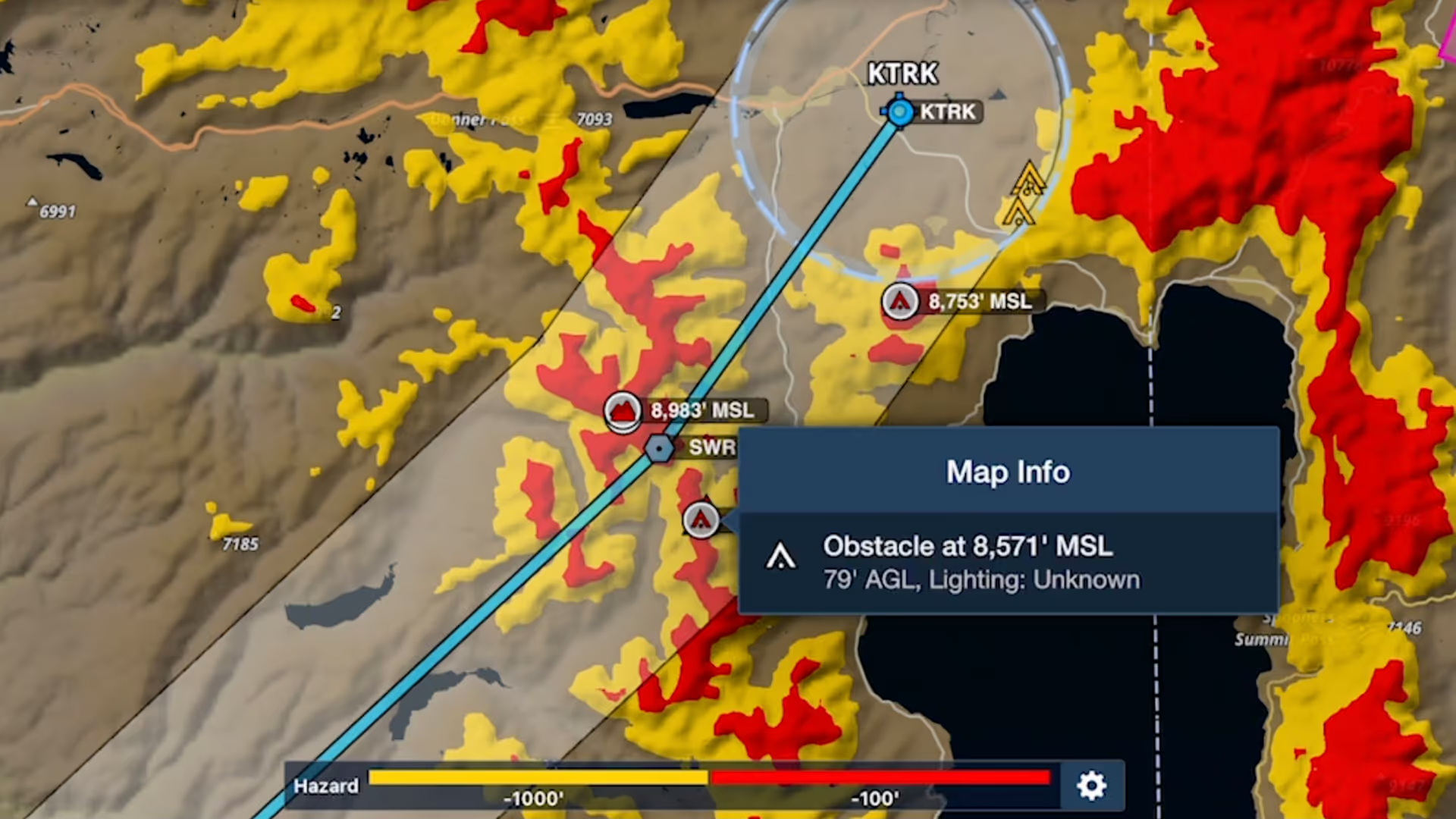
Bolster your preflight and inflight hazard awareness and get a fresh perspective on Profile View with Profile Corridor, available with ForeFlight’s Pro Plus subscription plan and above.

Tap to learn about airspace, map elements, and more using the Maps view’s information Sidebar, which lets you dig into details while still interacting with the map.

ForeFlight’s High Resolution Basemap includes Jeppesen-sourced terrain and cultural elements such as mountain passes, highway labels, and more for improved inflight reference.

Graphical enroute NOTAMs are now supported globally with the new NOTAMs map layer. NOTAMs are color-coded based on type, severity, and active times.

Breadcrumbs allow you to see a track log as it’s recorded, leaving a continuous line that you can reference for maneuvers, Search and Rescue and survey work, or just to see where you’ve been.