JEPPESEN CHARTS IN FOREFLIGHT
Built for how pilots think
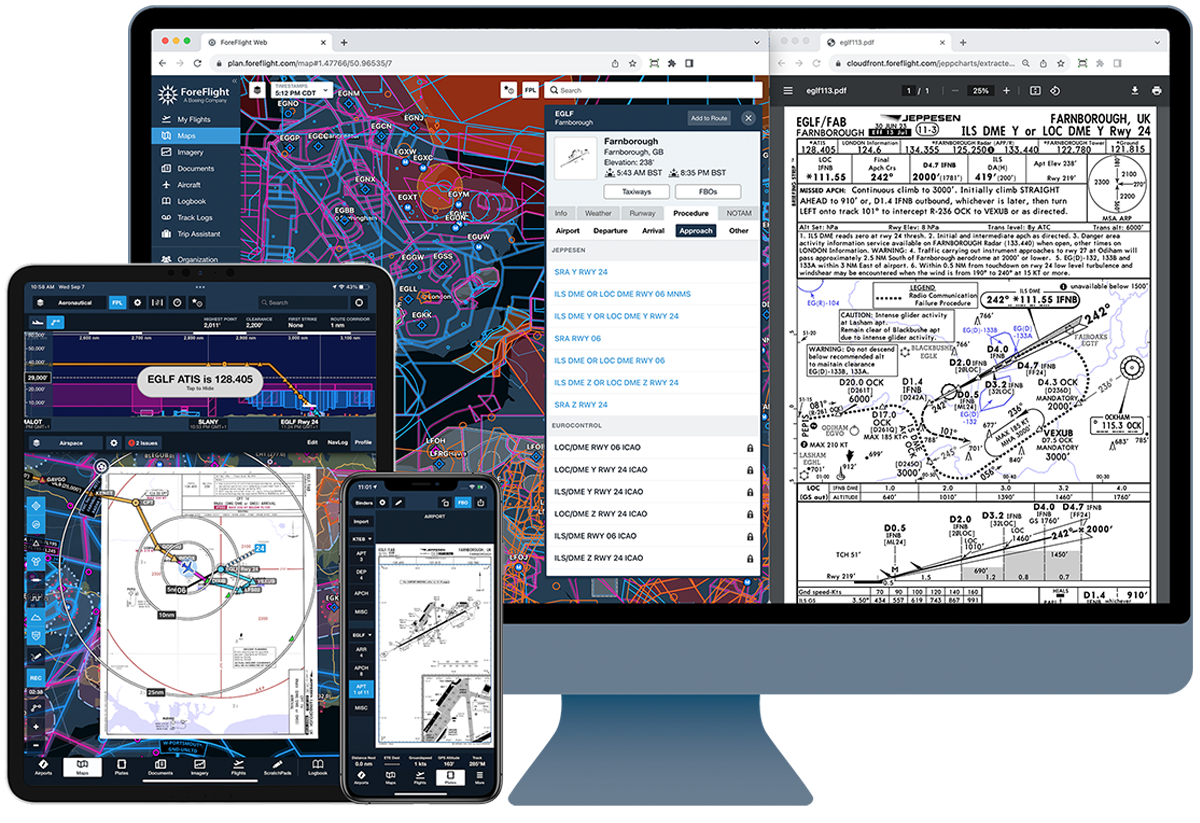
Spend less time searching and more time flying. A consistent chart layout based on human factors research keeps critical information where you expect it, so you can brief more efficiently and stay ahead of the airplane. All inside ForeFlight on mobile and web.
Already purchased Jeppesen charts? Link them here.
Why Pilots Choose Jeppesen
Jeppesen charts are designed to help you find what you need faster. The Briefing StripTM format is based on NASA research into how pilots mentally organize approach information. Every approach, airport diagram, and procedure follows the same familiar organization, so you know exactly where to look, every time you brief an approach.
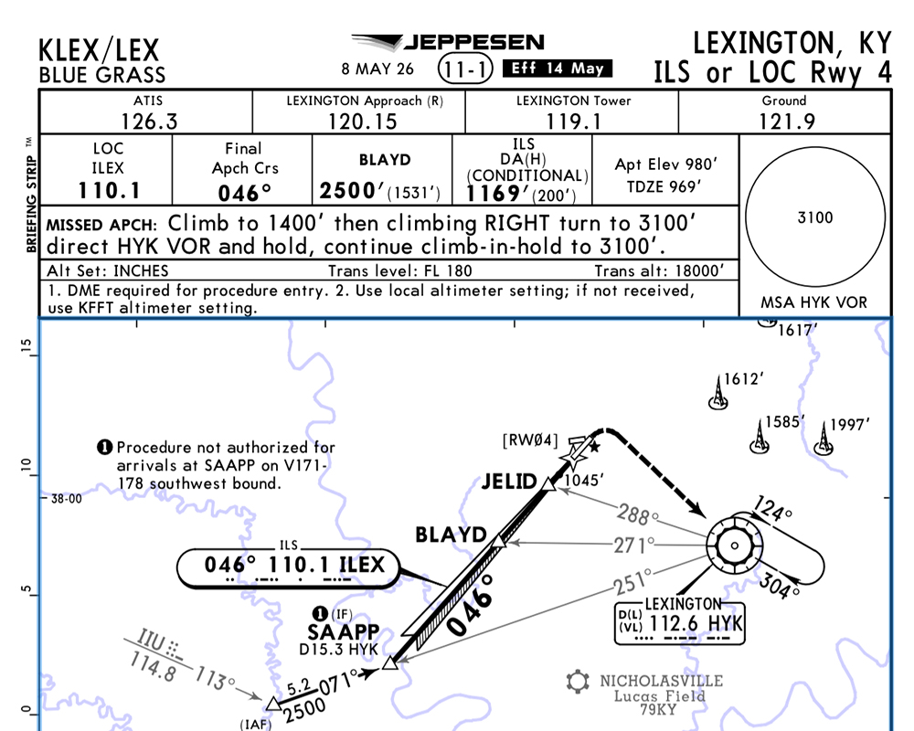
Critical information where you expect it
Every Jeppesen approach chart follows the same layout. Frequencies, minimums, courses, and missed approach instructions remain in familiar locations, so your briefing flows the same way every time.
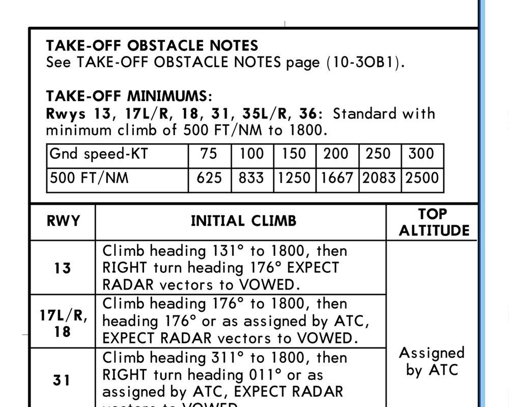
Skip the calculations in the cockpit
Jeppesen charts include feet-per-minute conversion tables for minimum departure climb gradients and standard glideslope descent rates. The numbers you need are already on the chart.
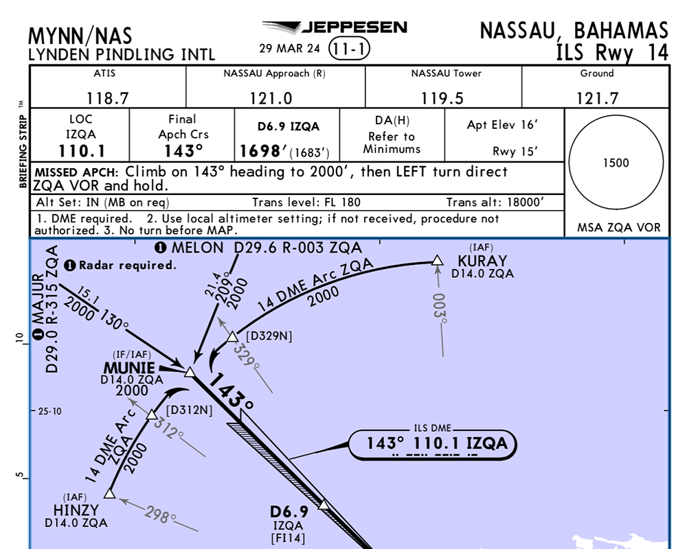
One chart format, wherever you travel
Cross a border, and government charts often switch to a different format. Jeppesen charts reduce your workload when flying to new destinations with the same familiar presentation around the world.
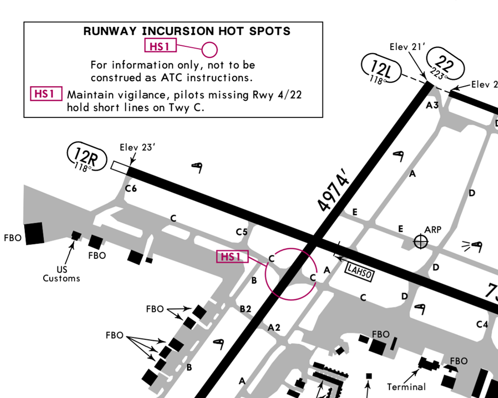
Brief your departure with one chart
Jeppesen airport diagrams include each airport's Obstacle Departure Procedure, hot spot notes, and takeoff and alternate minimums, bringing the information you need before departure into one view.
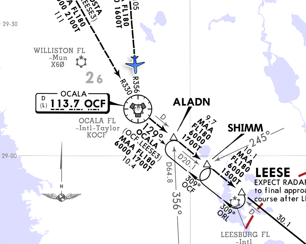
See your position on SIDs and STARs
When flying IFR into larger airports, georeferenced Jeppesen SID and STAR procedures display directly on the ForeFlight map, making it easy to confirm your position along the procedure.
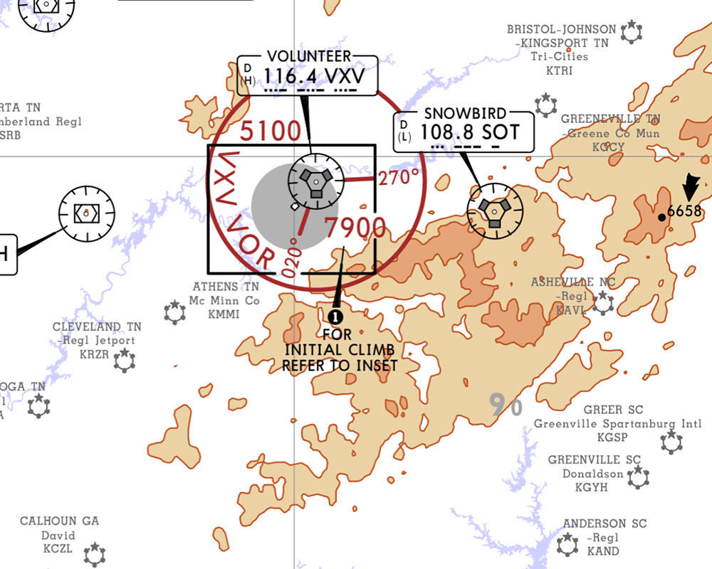
Terrain awareness at a glance
Understand the environment around you before the approach. Jeppesen SID and STAR charts include terrain depiction, water features, minimum sector altitudes, and grid MORA data.
Over 90 years of refinement
In 1930, Elrey Jeppesen started drawing his own charts because the government charts of the day weren't organized for the way pilots think and work under pressure. That pilot-first approach has shaped Jeppesen charts through more than 90 years of refinement, helping you find the information you need, right when you need it.
| Government Charts | Jeppesen Charts | |
|---|---|---|
| Brief an unfamiliar approach | Hunt across the plate for frequency, minimums, missed approach, and notes | Work top to bottom through the Briefing Strip, in the same location every time |
| Fly internationally | Different chart format in each country's airspace | Same format worldwide, with no relearning and no confusion across borders |
| Pre-taxi at an unfamiliar airport | Find the ODP in a separate publication; scroll through pages | ODP included directly on the Jeppesen airport diagram |
| Read altitude constraints on complex procedures | Standard black text, easy to miss a restriction | Altitude in blue, speed in magenta, with high contrast that's harder to miss |
| See terrain on SIDs and STARs | No terrain info on SID/STAR charts, so you flip to approach to check | Terrain, MSA, and MORA shown directly on SID and STAR charts |
| Fly a STAR in ForeFlight | Cross-reference a non-scaled diagram that can't overlay on the map | Your position overlays on the georeferenced STAR chart, so you see where you are |
Getting started
New to Jeppesen charts? Pilot and CFI Dan George from FlightInsight hosts this four-part video series that walks through exactly what makes Jeppesen charts different, side by side, plate by plate. It's the best place to start before linking your account or adding chart coverage in ForeFlight.
APPROACH PLATES
A side-by-side look at Jeppesen and traditional approach plates, and a dive into the anatomy of a Jeppesen chart.
AIRPORT DIAGRAMS
A look at how Jeppesen airport diagrams bring taxi and departure information together in one place.
DEPARTURE, ARRIVAL & ENROUTE CHARTS
A look at how Jeppesen's SID, STAR, and enroute charts add georeferencing and terrain data that government charts lack.
ORGANIZING PLATES WITH FLIGHT BINDERS
A look at how Flight Binders organize Jeppesen charts for a flight, and navigating plates using the 3-finger swipe gesture.
Chart coverages for where you fly
Jeppesen chart coverages through ForeFlight include all civilian departure, arrival, and terminal procedures, airport charts, data-driven enroute charts, and Jeppesen Airway Manual supplements for your selected region. Choose the coverage for where you fly.
Visit foreflight.com/buy to view per-coverage prices.











Already have a Jeppesen account?
Link your existing Jeppesen subscription to view your charts in ForeFlight, or connect multiple Jeppesen accounts to combine coverage in one place.