
Flying & Navigation
Hazard Awareness
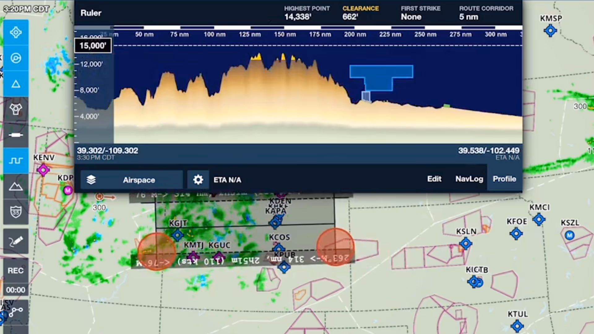
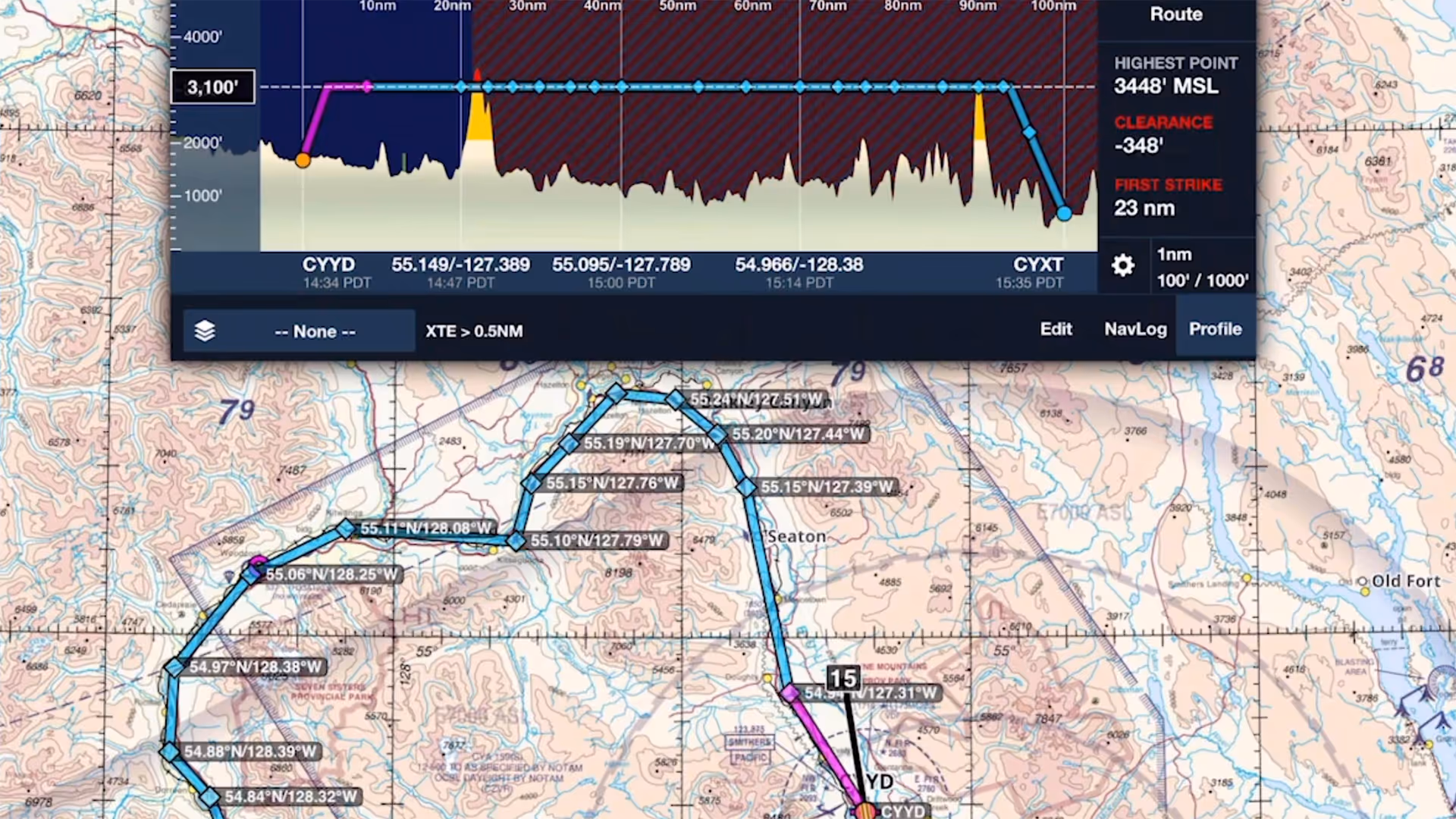
No sneak peaks with ForeFlight's powerful terrain and obstacle avoidance features.

Watch our latest videos and featured playlists to learn tips, tricks, and best practices for using ForeFlight like a pro.
No sneak peaks with ForeFlight's powerful terrain and obstacle avoidance features.

Plan and fly with industry-leading IFR charts, airport diagrams, and more in ForeFlight.

Get the full weather picture, from up-to-the-minute radar and satellite to global forecast layers.

Learn about powerful and underutilized features, whether you're brand new or a ForeFlight veteran.
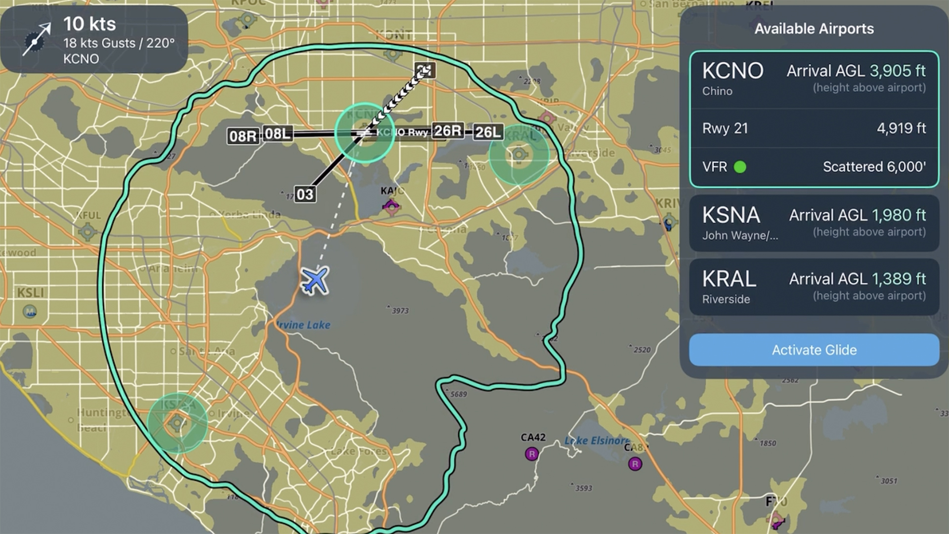
Learn how to set up and use Emergency Glide Mode to quickly identify landing options during an engine-out or inflight emergency.
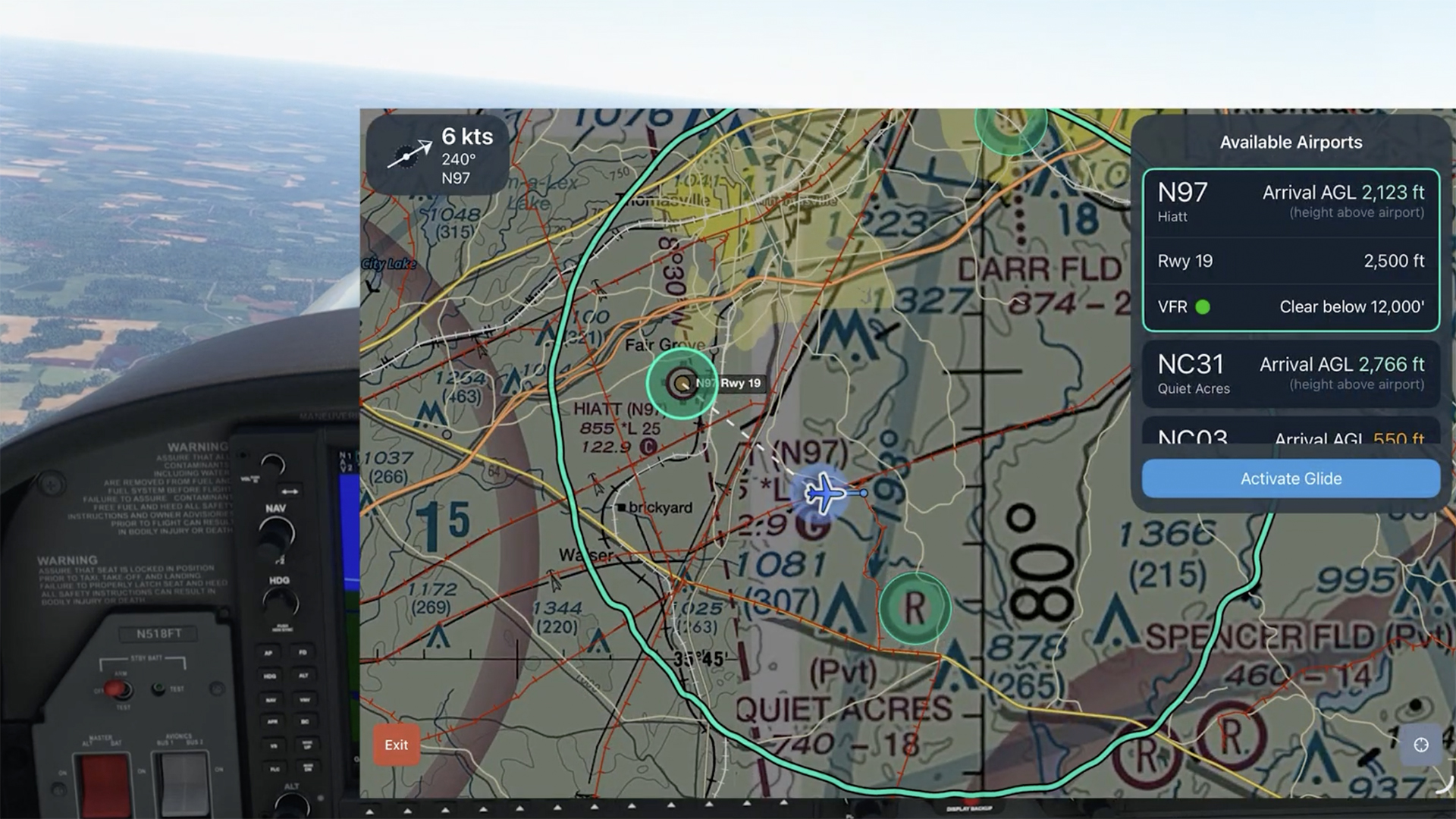
See how Emergency Glide Mode helps identify landing options within glide range during an engine-out scenario.
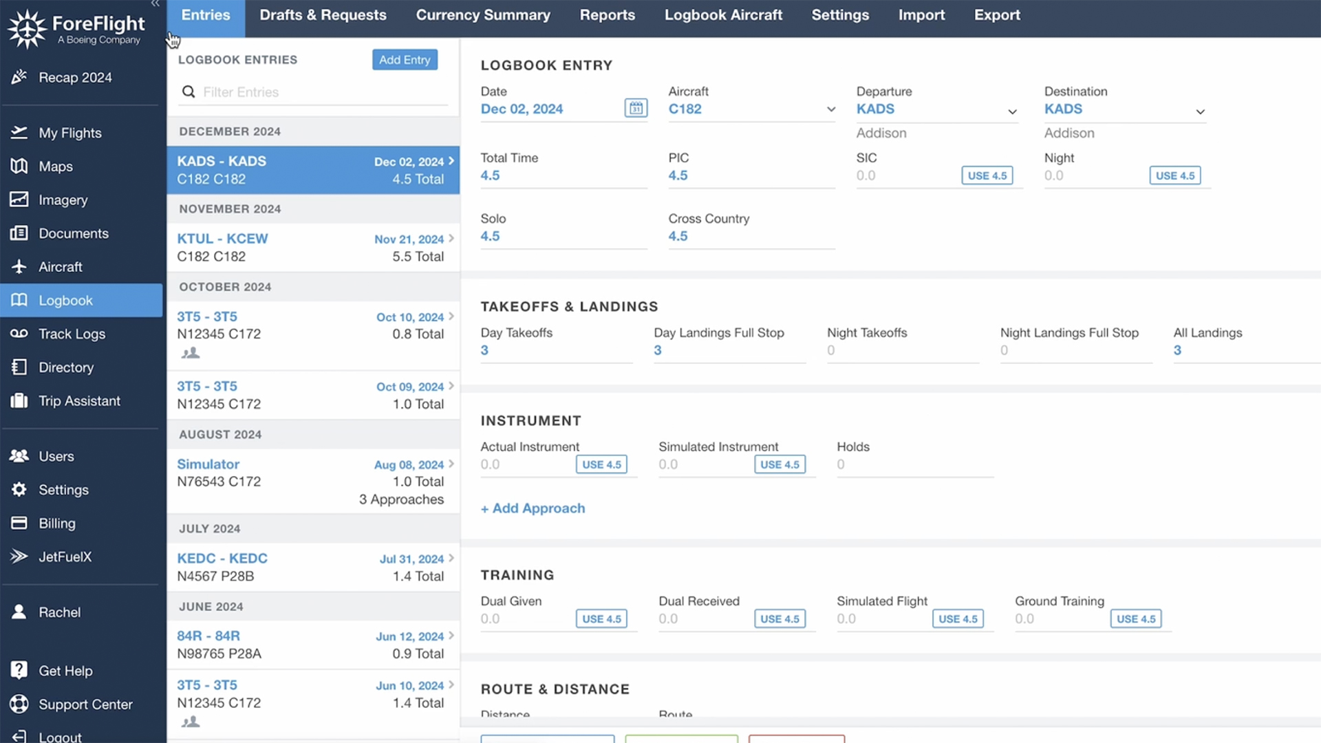
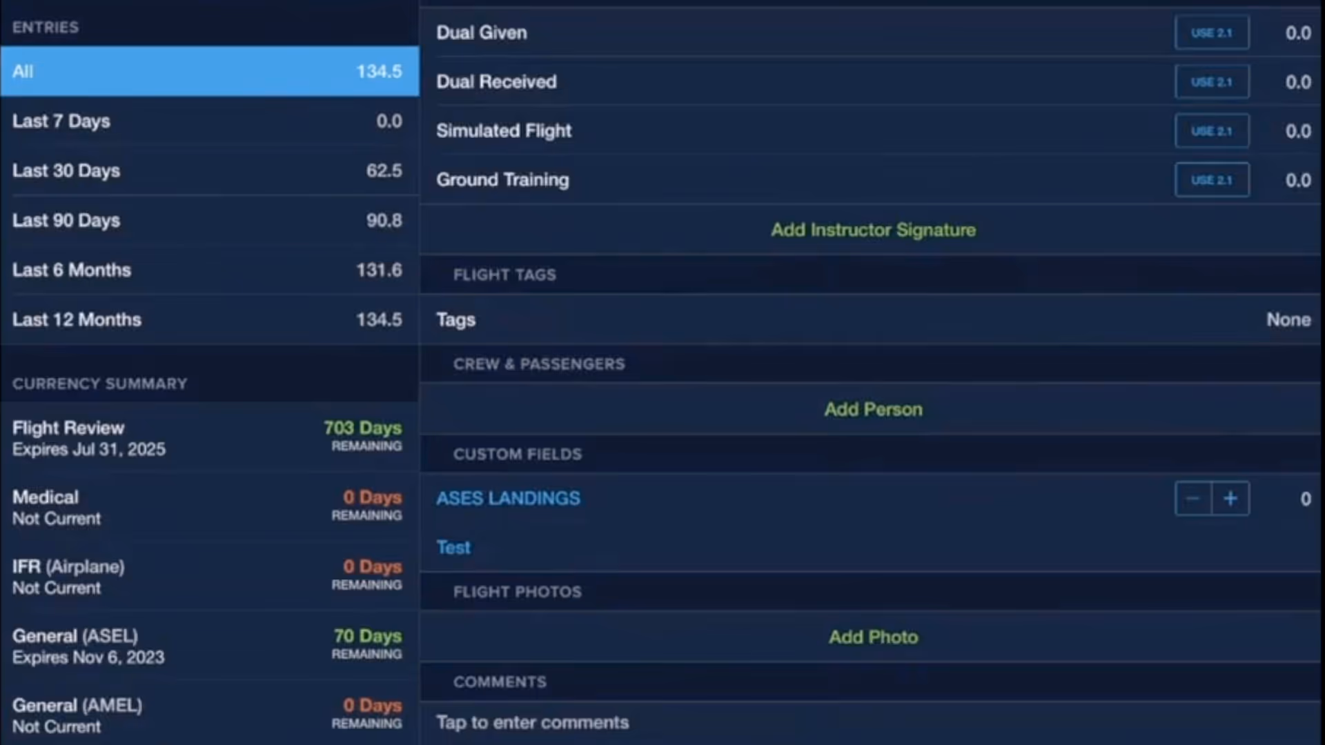
Learn how to use ForeFlight Logbook, import flight data, auto-record with track logs, edit flight details, and more in this quick walkthrough.
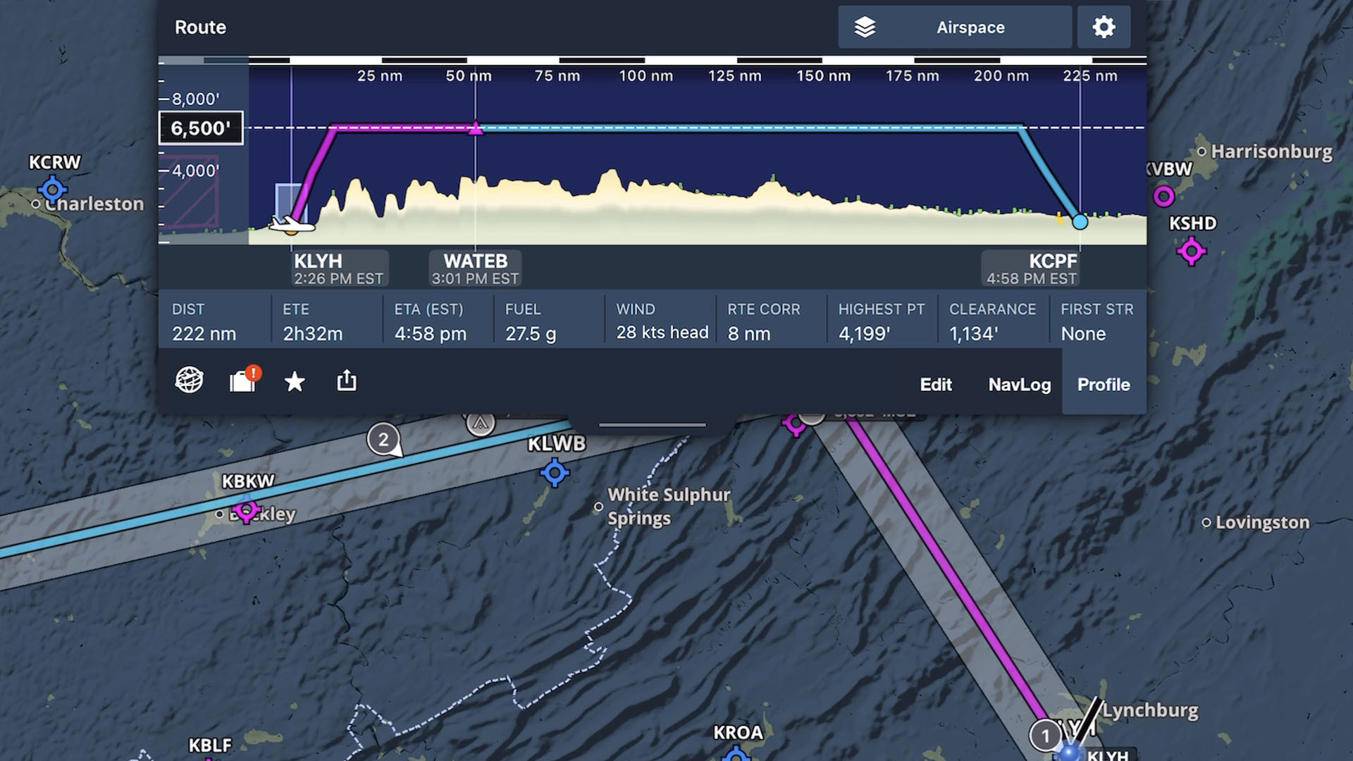
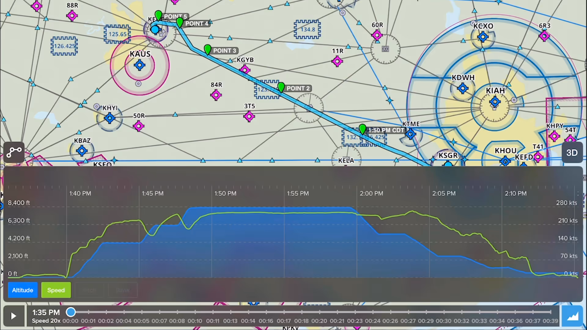
Learn how to create a flight plan in ForeFlight, from setting up your route to using performance tools, and more.
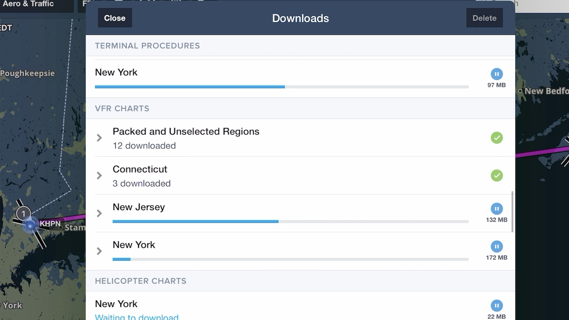
Learn how to download charts and data for offline use and set up your aircraft profile so your ForeFlight app is ready for any flight.
New to ForeFlight? This video walks you through initial setup, the main tabs in the app, and basic map gestures to get you started using the app.

There’s never been a better time to bring your old paper logbook into the 21st century!
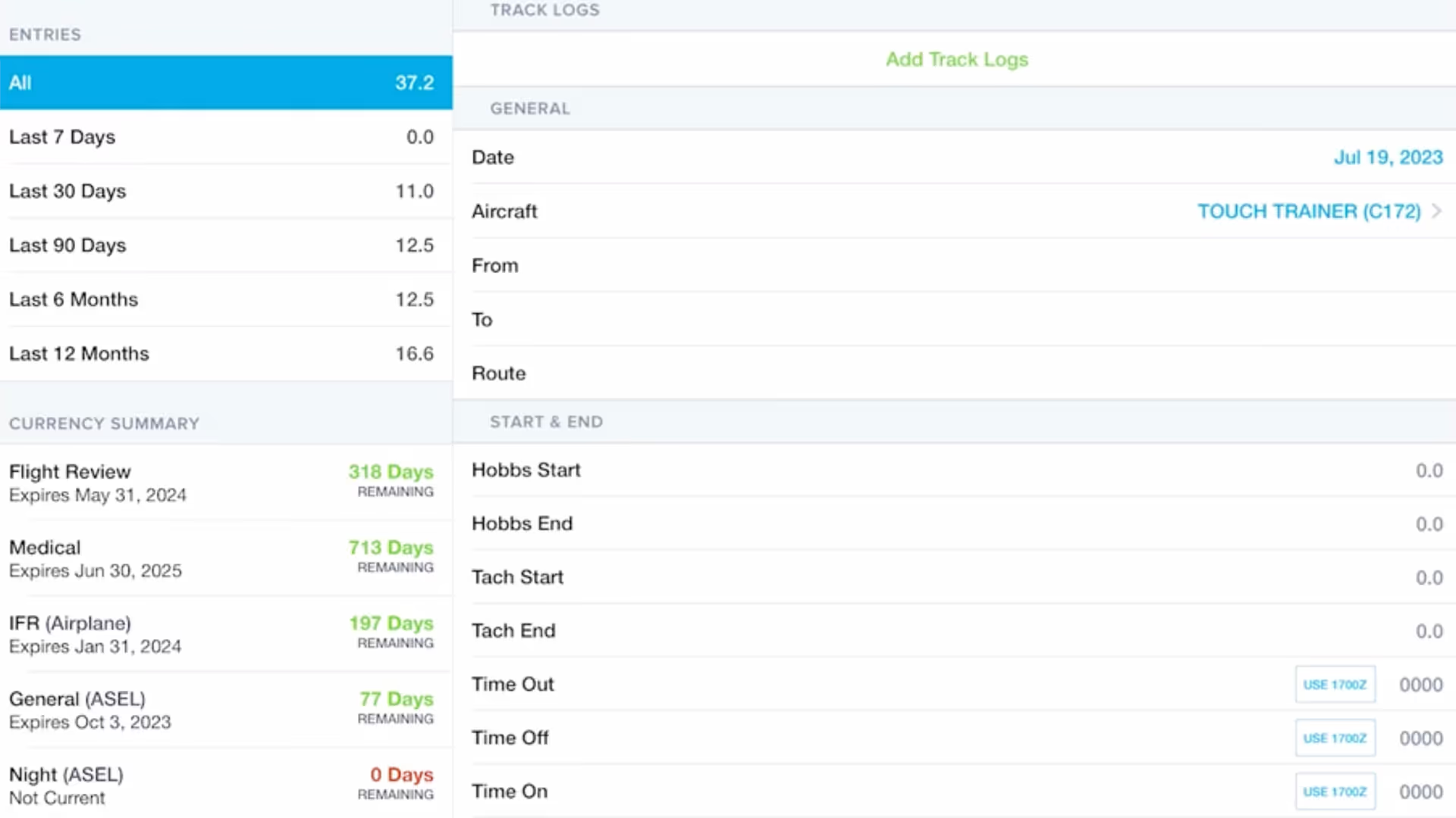
From paper to digital, see how ForeFlight Logbook helps record flights, import Track Logs, and manage reports and currencies.
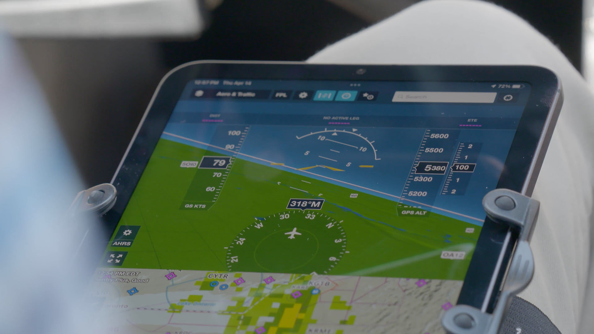
Learn how to use the Maps view in ForeFlight, including map layers, weather, traffic, and settings to customize your map.

Configuring your downloads in ForeFlight is the crucial first step when setting up the app to ensure the charts and data you need for a flight are readily available.
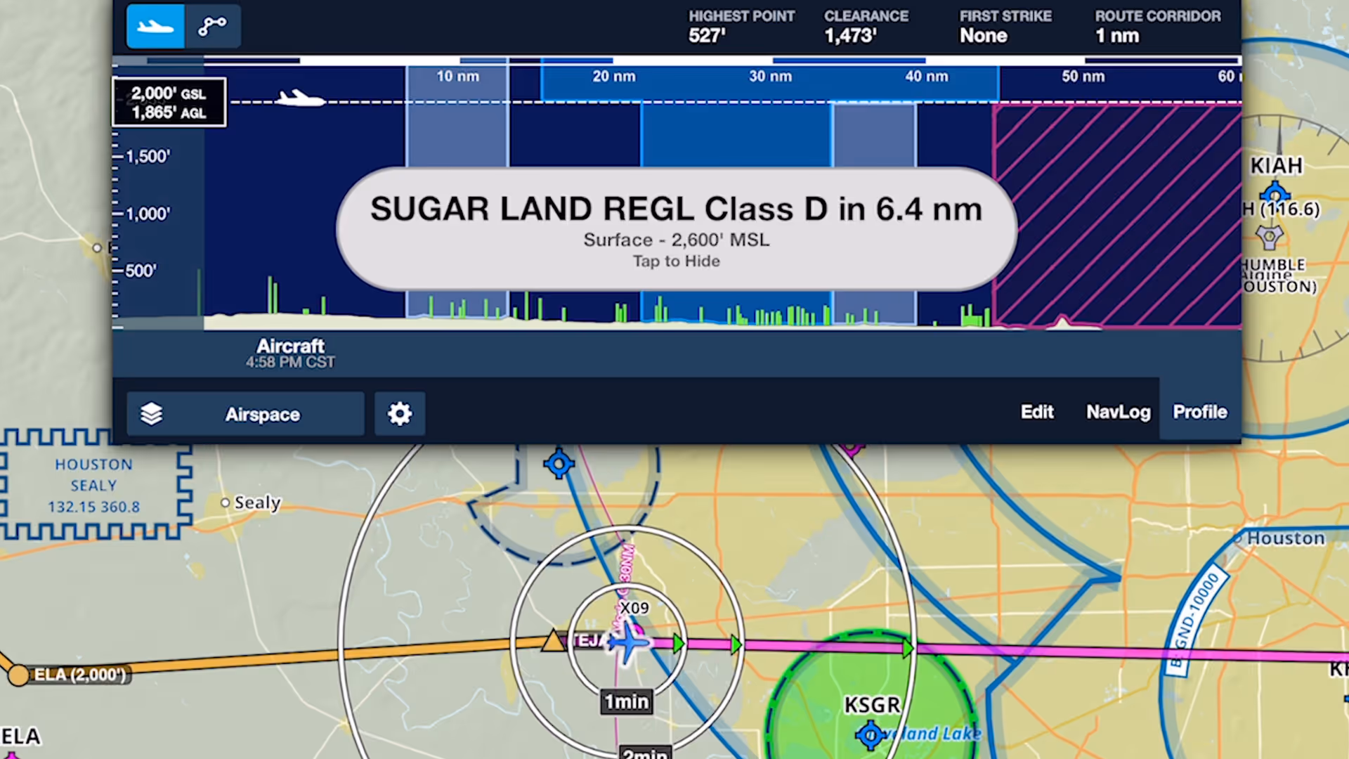
Fly more confidently around controlled airspace with multi-stage visual and audio alerts that proactively warn you of approaching airspace with Controlled Airspace Alerts.

This webinar guides new ForeFlight users through a realistic VFR flight, highlighting core features like charts, fuel planning, waypoints, diversions, and enroute tools.
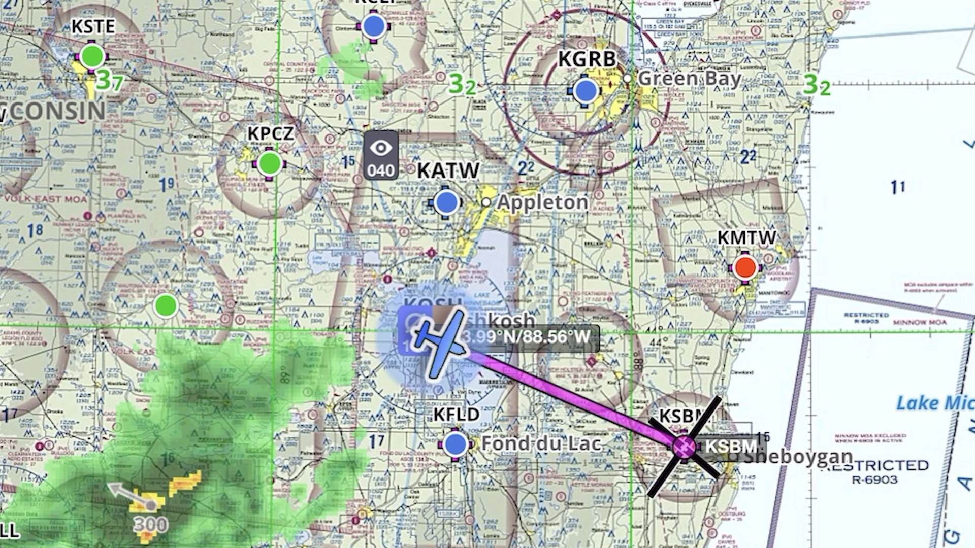
This presentation, given at EAA AirVenture in Oshkosh, Wisconsin, is an advanced, scenario-based course on flying with ForeFlight.

This course, given at EAA AirVenture in Oshkosh, Wisconsin, is designed to prepare you for your first flight in ForeFlight.
Join ForeFlight support staff to learn everything you need to get spun up and off the ground with ForeFlight. They will demonstrate the essentials of critical workflows like using the map, setting up
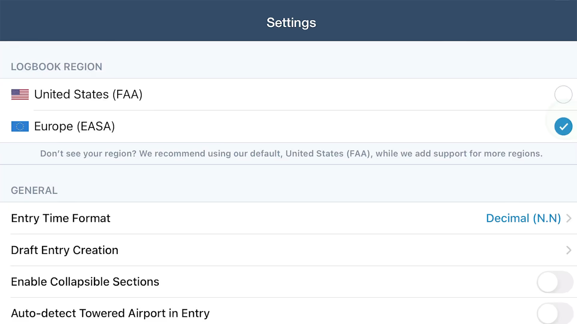
Set up ForeFlight Logbook for Europe to log flights, track currencies, and generate FCL.050 reports with this step-by-step guide.
Drop detailed markers along your route and view or share them after the flight using ForeFlight’s Marked Positions feature.
This course, given at EAA AirVenture in Oshkosh, Wisconsin, will discuss the tools available to you in ForeFlight Logbook.
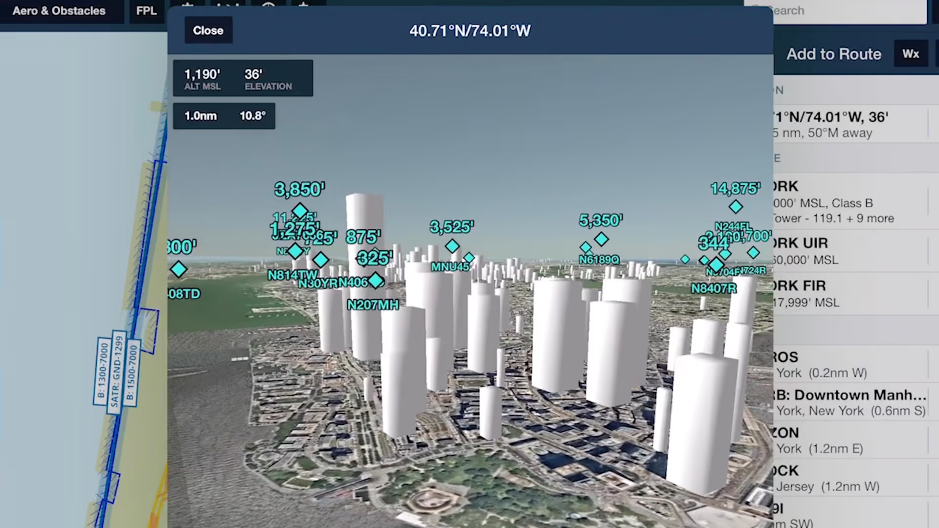
Spot potential hazards along your route and establish a mental picture of final approach with the help of Obstacles in ForeFlight's 3D View suite
Join ForeFlight Pilot Support Team member and active Canadian pilot Adrian Tegler to learn how ForeFlight's extensive collection of inflight hazard awareness features can improve your safety of flight
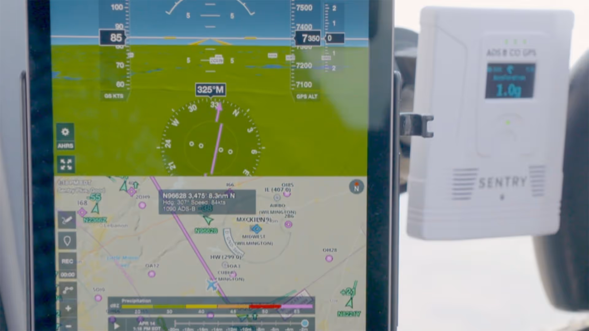
Join Cole Crawford of ForeFlight, John Zimmerman of Sporty’s, and Ryan Braun of uAvionix to learn about Sentry Plus, the latest in portable ADS-B receivers from ForeFlight.
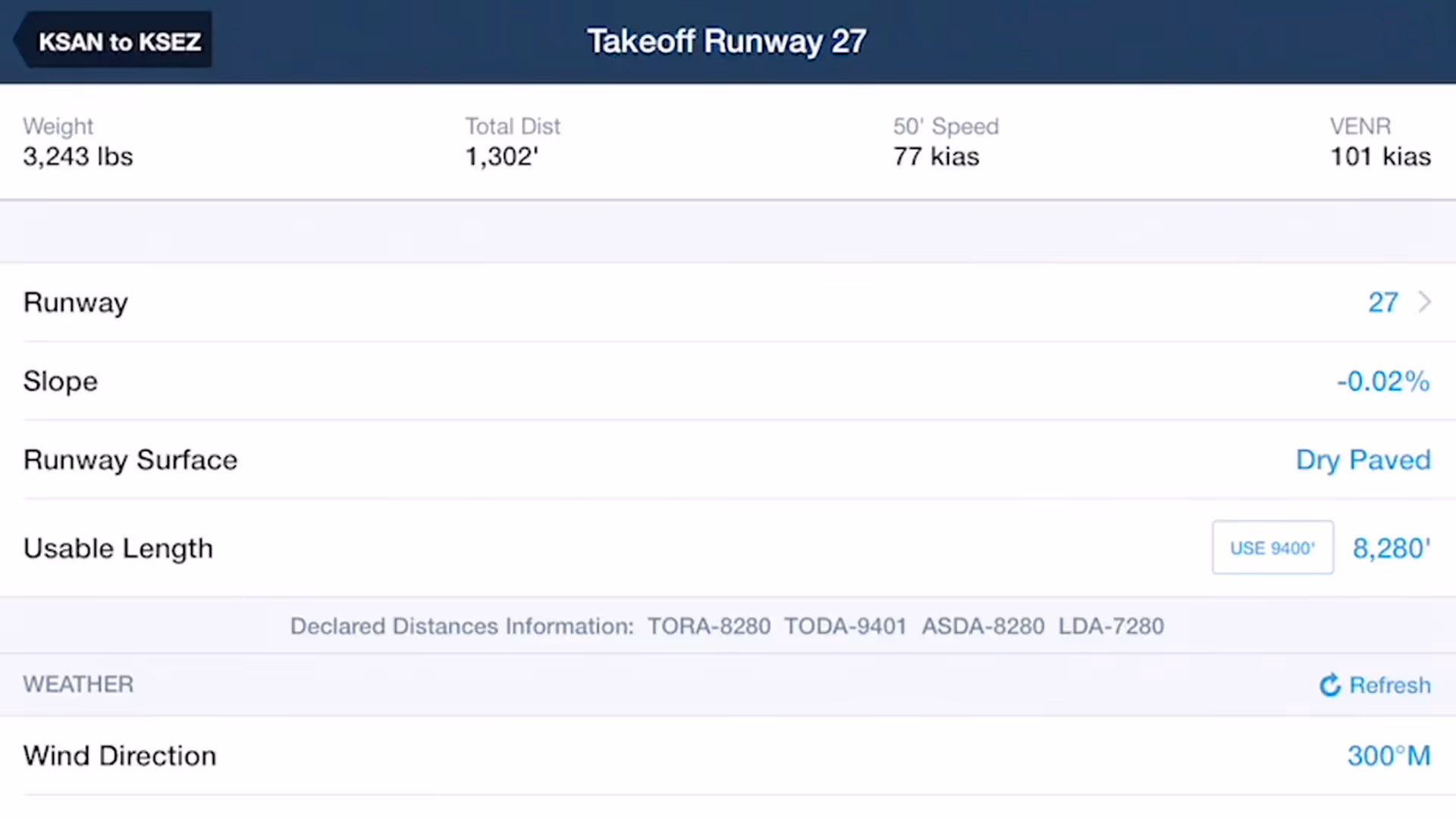
Takeoff and Landing Distances is a powerful flight planning capability that provides safety-enhancing runway performance calculations for supported piston aircraft in seconds.
ForeFlight product lead Thomas Daugherty leads you through getting current again and back in the air with the help of ForeFlight.

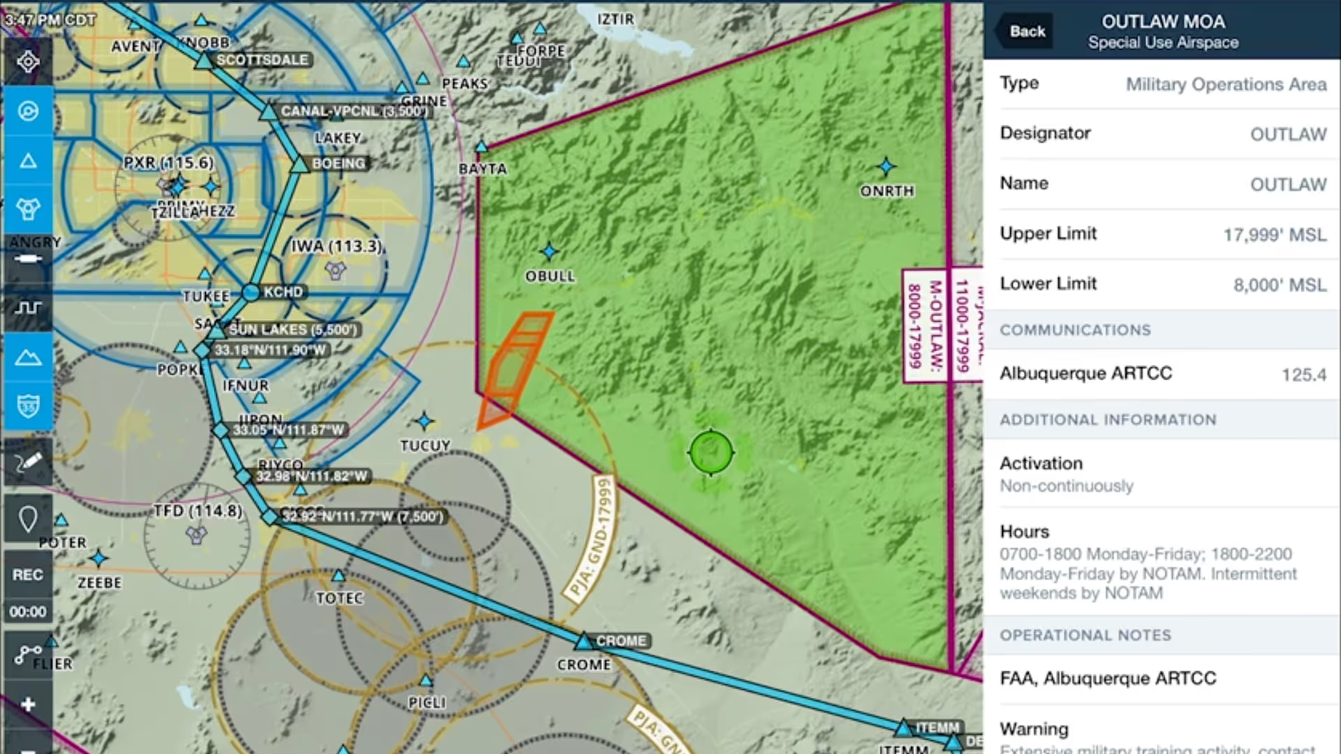
TFR Alerts enhance your inflight situational awareness by warning you of nearby TFRs, whether or not the TFR layer is selected.