ForeFlight Europe Region
Charts, Data, & Plans Overview
Chart & Data Overview Video
This video summarizes some of the European charts and data currently available through ForeFlight, both included and optional, and where you can access them in the app. Scroll down to see the full list of available charts and data.
View All Plans & Pricing
NOTE: This video only reflects coverage options for Germany, France, and Switzerland. Scroll down to see the full list of countries.
Watch the video
Included Jeppesen Data Coverage

JEPPESEN VFR NAVIGATION DATA COVERAGE
Integrated seamlessly into ForeFlight's Aeronautical map, Jeppesen's digital VFR navigation data dynamically appears as you pan and zoom. Includes VFR waypoints, entries and exits, traffic circuits, no-overfly areas, and more.

JEPPESEN IFR NAVIGATION DATA COVERAGE
Jeppesen's global IFR navigation and procedure data is included with all subscription plans. View airports, airspace, airways, navaids, waypoints, and frequencies around the world.
All ForeFlight subscription plans for any region also include Jeppesen's high-quality global terrain, obstacle, and airspace datasets.
Included National AIPs via EUROCONTROL
The table below represents the current AIP coverage included in all ForeFlight plans with the Europe region.
NOTE: ForeFlight Europe includes aerodrome charts, IFR procedure charts, and AIP documents for all countries listed below.
National AIPs included with Europe region |
|||
|---|---|---|---|
| IFR Enroute Charts | VFR ICAO Charts | VFR Procedures Charts* | |
| Albania |
|
|
|
| Austria |
|
|
|
| Belarus |
|
|
|
| Belgium |
|
||
| Bosnia and Herzegovina |
|
|
|
| Bulgaria |
|
|
|
| Croatia |
|
|
|
| Cyprus |
|
|
|
| Czech Republic |
|
|
|
| Denmark |
|
|
|
| Estonia |
|
|
|
| Faroe Islands |
|
|
|
| Finland |
|
|
|
| France |
|
|
|
| Germany |
|
||
| Greece |
|
||
| Greenland |
|
||
| Hungary |
|
|
|
| Iceland |
|
|
|
| Ireland |
|
||
| Italy |
|
|
|
| Latvia |
|
|
|
| Lithuania |
|
|
|
| Luxembourg |
|
||
| Malta |
|
|
|
| Moldova |
|
|
|
| Netherlands |
|
|
|
| North Macedonia |
|
||
| Norway |
|
|
|
| Poland |
|
|
|
| Portugal |
|
||
| Romania |
|
|
|
| Serbia and Montenegro |
|
|
|
| Slovakia |
|
|
|
| Slovenia |
|
|
|
| Spain |
|
||
| Sweden |
|
|
|
| Switzerland |
|
|
|
| Turkey |
|
|
|
| Ukraine |
|
|
|
| United Kingdom | |||
*AIPs that include VFR procedure charts may not provide charts for all available airports.
Optional VFR Add-Ons
The table below represents the currently available VFR Packages that can be added to ForeFlight plans with the Europe region. Click on each add-on's name to learn more about it.
Purchased VFR add-ons are available only in the ForeFlight Mobile app, not on ForeFlight Web.
Jeppesen VFR Procedure Charts are currently available for: Austria, Belgium/Luxembourg, Bosnia & Herzegovina, Croatia, Czech Republic, Denmark, Estonia, Finland, France, Germany, Greece, Hungary, Ireland, Italy & Malta, Latvia, Lithuania, Macedonia, Netherlands, Norway, Poland, Portugal, Serbia-Montenegro, Slovakia, Slovenia, Spain, Sweden, Switzerland, and United Kingdom.
Simplified Jeppesen Coverages via ForeFlight
Jeppesen chart coverages via ForeFlight include all civilian Jeppesen charts for each region, enabling true worldwide coverage as part of your ForeFlight subscription. Coverages include departure, arrival, and terminal procedures, airport charts, data-driven enroute charts, and Jeppesen Airway Manual supplements.
Jeppesen IFR coverages may be purchased for either ForeFlight Mobile, ForeFlight Web, or both.
ForeFlight Business customers must contact Sales to purchase Jeppesen charts via ForeFlight.


ForeFlight Plans Overview
ForeFlight offers three plan levels for personal aviation pilots: Starter, Essential, and Premium. All personal aviation pilot (Individuals) plans include the choice of one region:
- Europe (AIPs via EUROCONTROL plus the special Jeppesen VFR navigation data),
- US (FAA AIP),
- Canada (NAV CANADA AIP), or
- Australia (Airservices Australia AIP)
Additional regions can be added for an additional cost.
ForeFlight also offers two plan levels for Business Aviation Operators. Click here for more information on these plans.
Europe VFR Add-Ons
See what's included in each Europe VFR add-on so you can make a more informed purchase.
Jeppesen VFR Procedure Charts
Includes visual approach procedures and airport diagrams, plus the Jeppesen VFR manual in the Documents view's Jeppesen drive. Available as a bundle or individually for Austria, Belgium & Luxembourg, Bosnia & Herzegovina, Croatia, Czech Republic, Denmark, Estonia, Finland, France, Germany, Greece, Hungary, Ireland, Italy & Malta, Latvia, Lithuania, Macedonia, the Netherlands, Norway, Poland, Portugal, Serbia-Montenegro, Slovakia, Slovenia, Spain, Sweden, Switzerland, and the United Kingdom. Back to Top


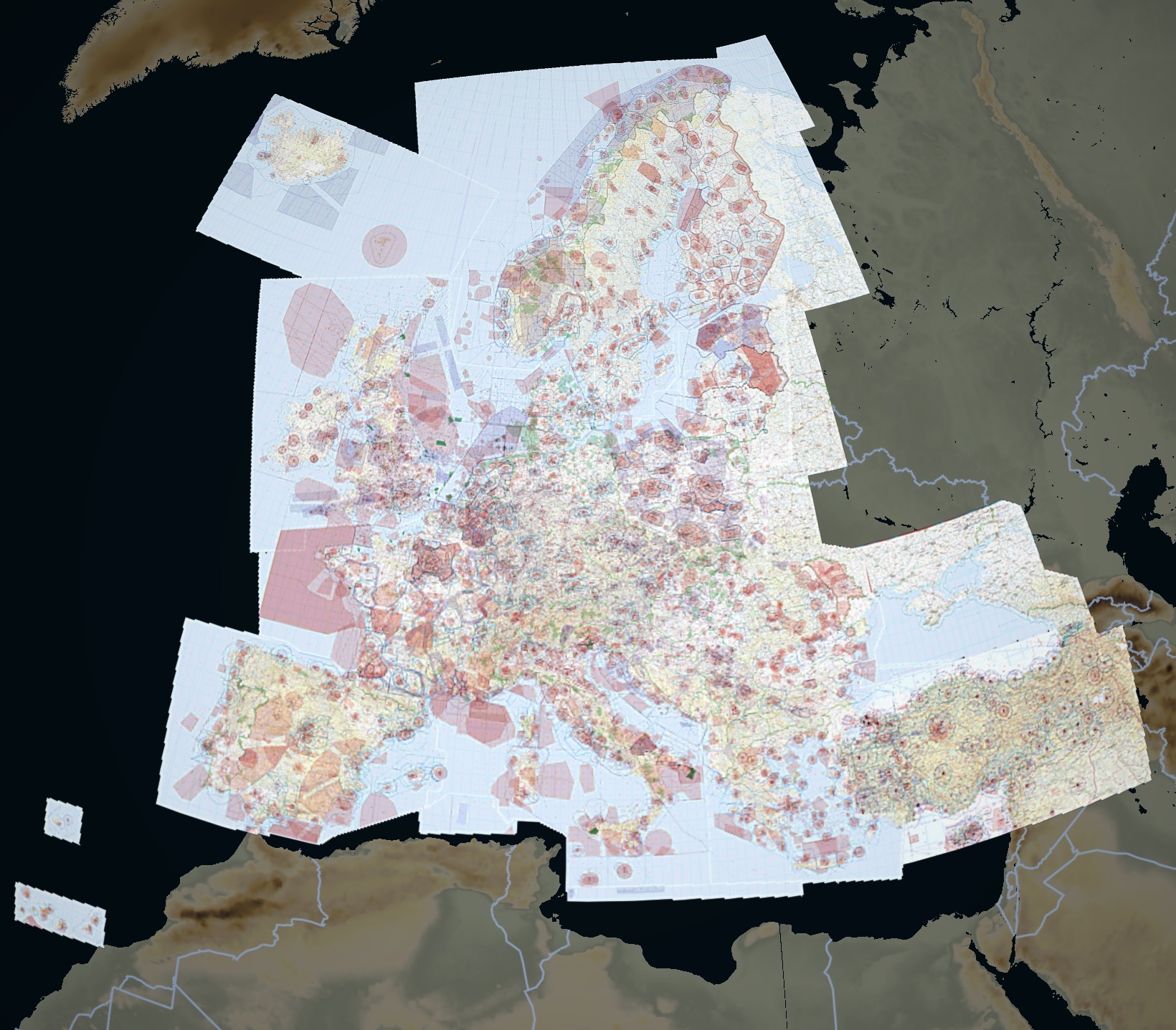
Air Million VFR Chart Combo
Air Million's 1:1,000,000 scale chart combo offers complete VFR coverage of western, central, and parts of eastern Europe, as well as Madeira and the Azores and Canary islands. Back to Top
DFS VFR/Visual 500 Charts
Aeronautical charts from DFS (Germany’s national provider) offer 1:500,000 scale VFR ICAO charts for Germany, and VFR charts for Austria, Belgium, Croatia, Denmark, France, Italy, Netherlands, Switzerland, Luxembourg, Slovenia, Spain, Portugal, Czech Republic, Hungary, and Poland. DFS charts depict aerodromes, runways, frequencies, airspace, terrain, obstacles, and more. Back to Top

Rogers Data VFR Charts
Rogers Data VFR charts use sophisticated topographic terrain shading and relief and includes aerodromes, runways, frequencies, obstacles, airspaces with altitudes, and more. Back to Top
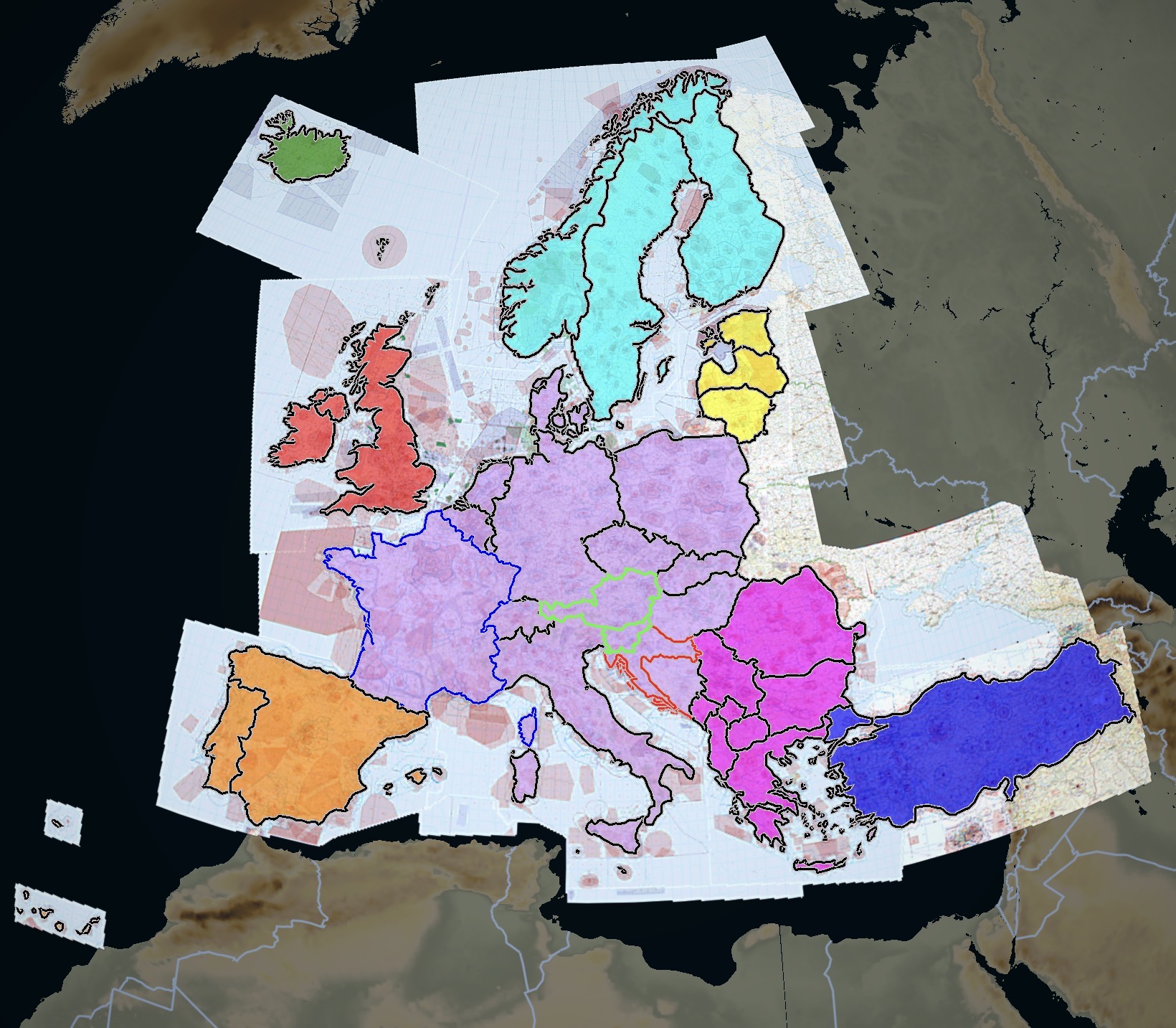
Rogers Data Map Legend
Red - Great Britain & Ireland VFR 500k Charts Combo
Purple - Central Europe VFR 500k Charts Combo (includes Austria, France, Croatia & Slovenia)
Blue Outline - France & Corsica VFR 500k Charts Combo
Green Outline - Austria & Slovenia VFR 200k Charts Combo
Orange - Spain & Portugal VFR 500k Charts Combo (includes the Canary Islands & Madeira)
Teal - Scandinavia VFR 500k Charts Combo
Yellow - Baltic VFR 500k Charts Combo
Magenta - South East Europe VFR 500k Charts Combo
Blue - Turkey VFR 500k Charts Combo
Dark Green - Iceland & Faroe Islands VFR 500k Chart
Red Outline - Croatia Rogers Data VFR 200k Chart
All Europe Charts - Full European Coverage VFR 500k Charts Combo (everything shown besides Turkey)
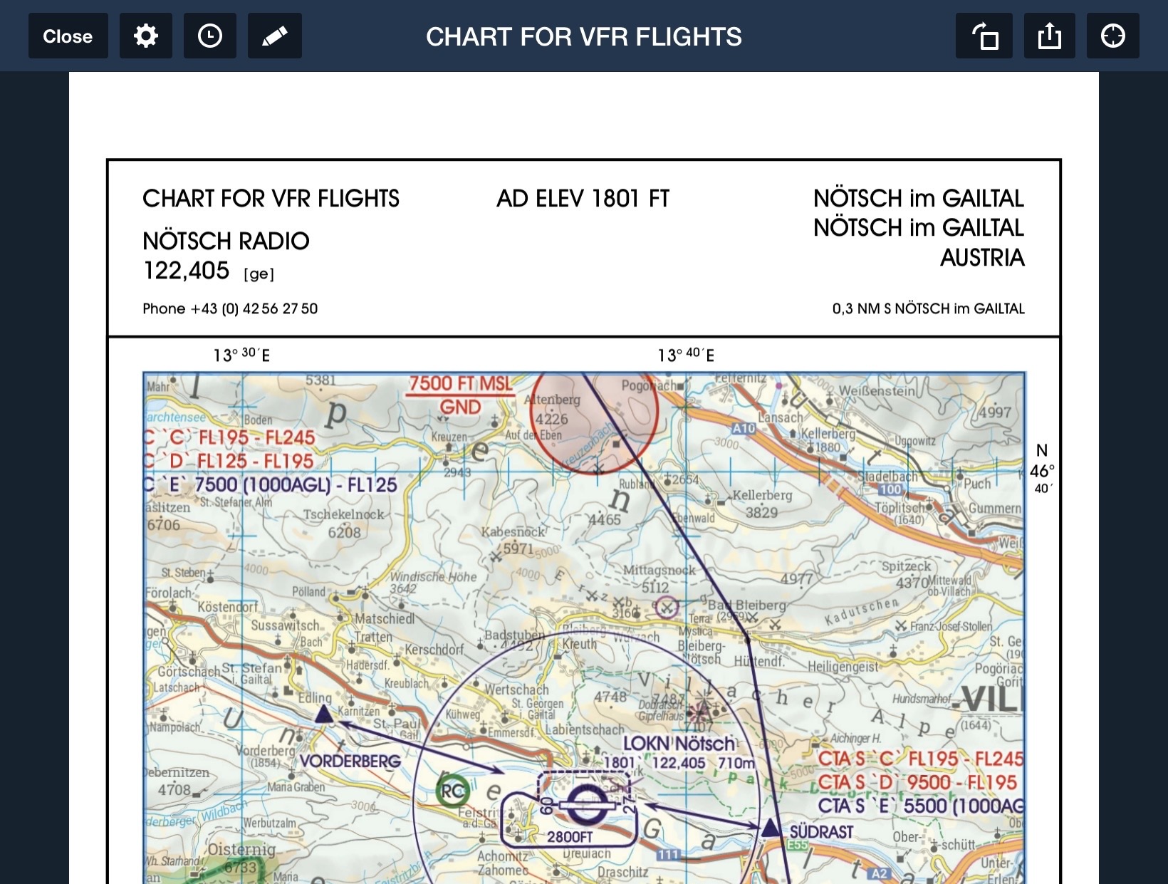
Austria Rogers Data VFR Trip Kit
Includes aerodrome charts and info, VFR procedure charts, and a VFR guide supplemental document. Back to Top
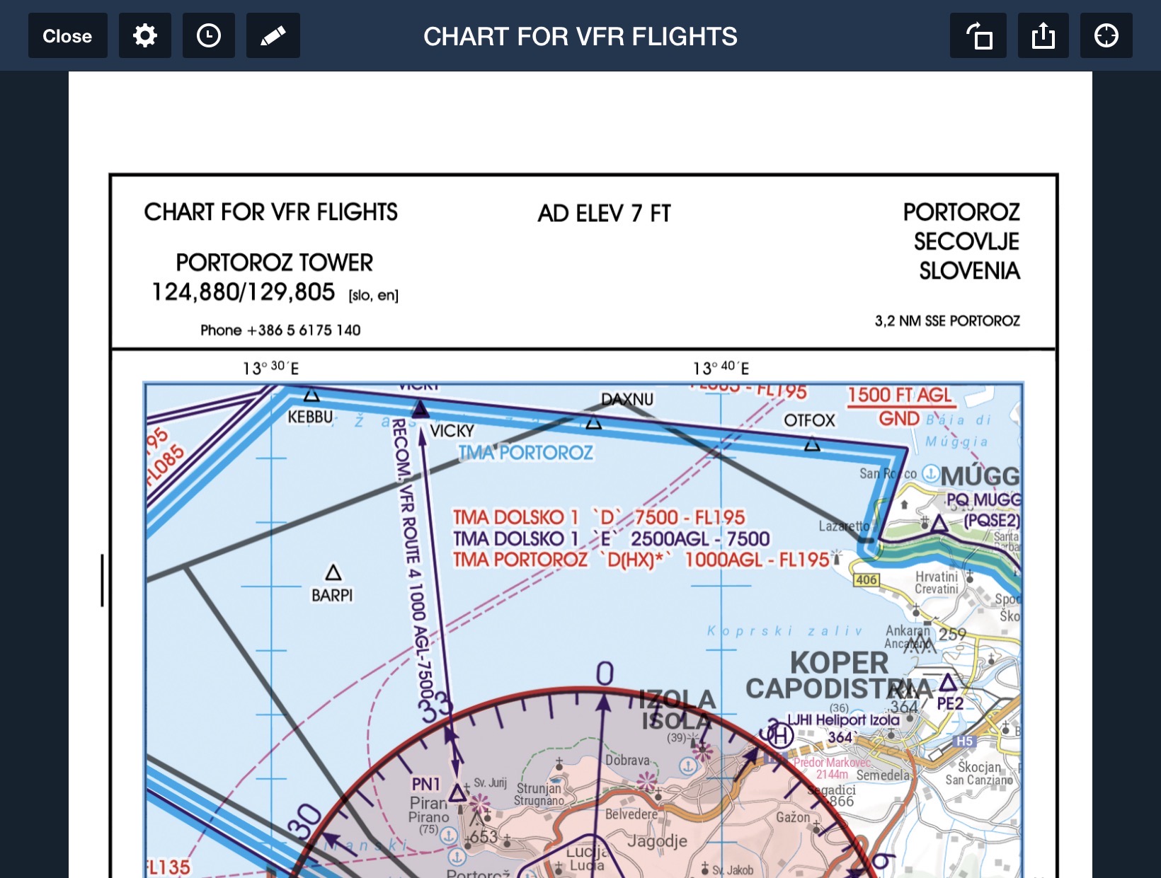
Slovenia Rogers Data VFR Trip Kit
Includes aerodrome charts and info, VFR procedure charts, and a VFR guide supplemental document. Back to Top
Finland ANS VFR ICAO Charts
Finland’s 1:500,000 scale VFR ICAO chart from Air Navigation Services (Finland's national provider) offers complete VFR coverage of Finland with Aerodromes, TRAs, traffic zones, frequencies, runways, windmills, lighthouses, and more. Back to Top


CartaBossy VFR Charts
CartaBossy's VFR Charts help you navigate in France, Switzerland, Belgium, and Luxembourg while keeping clutter to a minimum thanks to the 1:500,000 scale. Standard and Weekend versions make it easy to plan your flight by only showing active airspace. Back to Top
France IGN VFR ICAO Charts
IGN's VFR ICAO 1:500,000 scale chart displays terrain heights, aerodromes, detailed coastlines and waterways, obstacles, and more. Back to Top


Germany DFS AIP
Includes aerodrome charts and information, VFR procedure and area charts, and the AIP airport directory (AD) in the Documents view’s DFS drive. Back to Top
Italy Avioportolano VFR Chart
Italy’s 1:500,000 scale VFR chart from Avioportolano provides VFR coverage for all of Italy, including Sardinia, Corsi, Sicily, as well as Malta. Depicts aerodromes, runways, frequencies, airspace & altitudes, and more. Back to Top


Italy Avioportolano VFR
Flight Guide
Includes aerodrome charts and information, VFR procedure and area charts, and associated documents in the Documents view’s Avioportolano drive. Back to Top
Norway Avinor VFR
ICAO Charts
Avinor’s VFR ICAO chart provides complete coverage of Norway, depicting aerodromes, TRAs, frequencies, runways, TRAs, obstacles, and more. Back to Top


Sweden LFV VFR ICAO Charts
Luftfartsverket’s 1:500,000 scale VFR chart provides complete coverage of Sweden from Sweden's leading provider of air traffic control and associated services for civil and military aviation. Back to Top
Switzerland Skyguide VFR Guide
Includes aerodrome charts and information, VFR procedure and area charts, and associated documents in the Documents view’s SkyGuide drive. Back to Top


UK NATS VFR ICAO Charts
The United Kingdom’s 1:500,000 scale VFR ICAO chart from NATS (the U.K.’s national provider) depicts aerodromes, airspace with altitudes, frequencies, obstacles, and more. Back to Top