
Flying & Navigation
Hazard Awareness
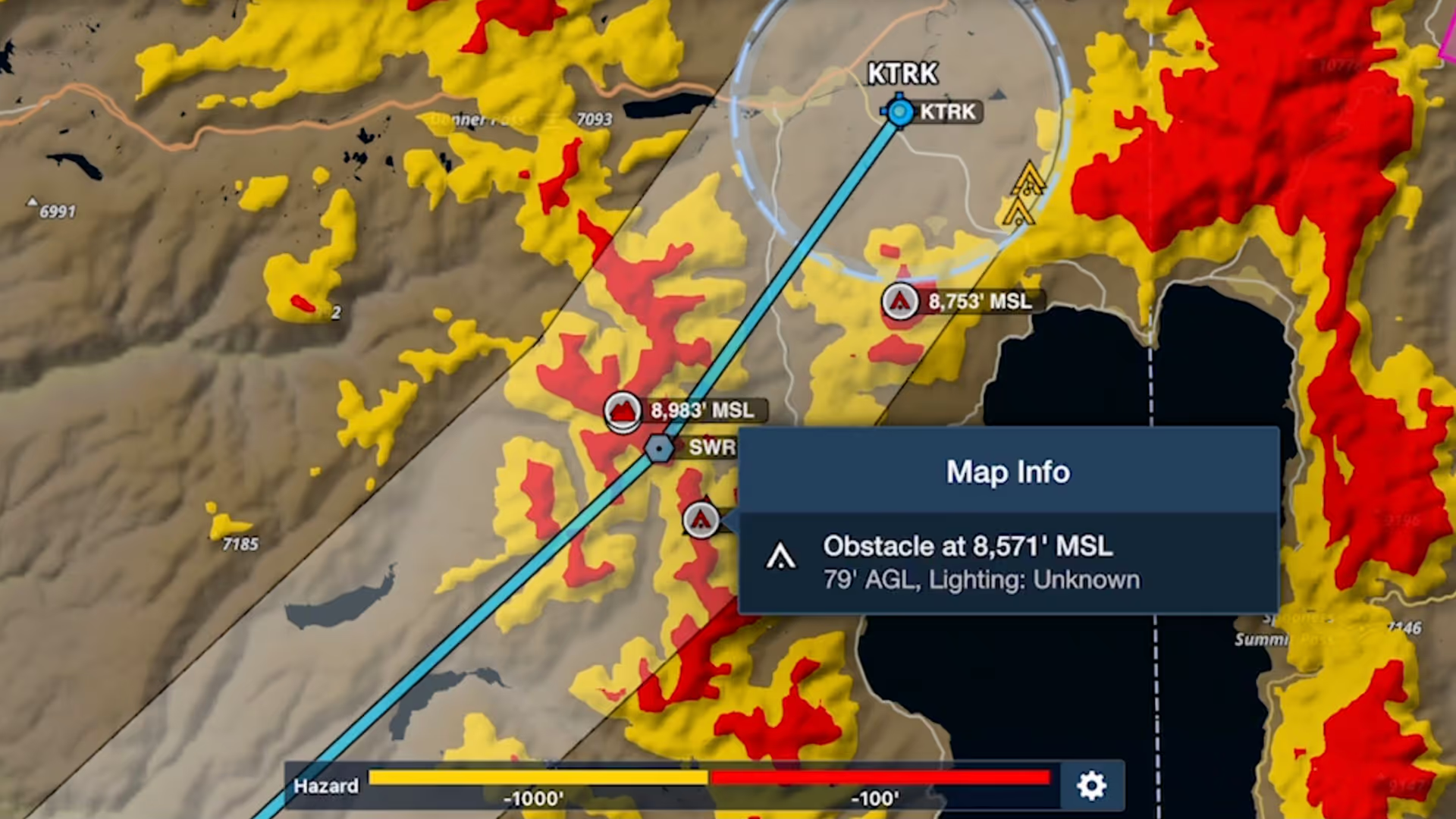
No sneak peaks with ForeFlight's powerful terrain and obstacle avoidance features.

Watch our latest videos and featured playlists to learn tips, tricks, and best practices for using ForeFlight like a pro.
No sneak peaks with ForeFlight's powerful terrain and obstacle avoidance features.

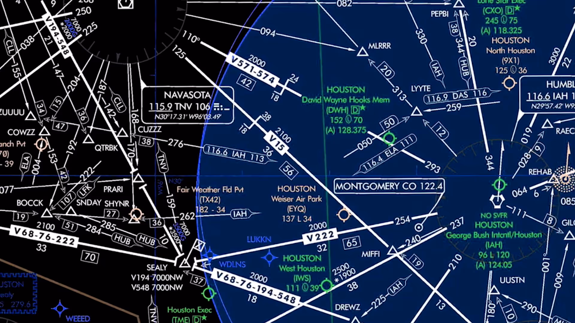
Plan and fly with industry-leading IFR charts, airport diagrams, and more in ForeFlight.

Get the full weather picture, from up-to-the-minute radar and satellite to global forecast layers.

Learn about powerful and underutilized features, whether you're brand new or a ForeFlight veteran.
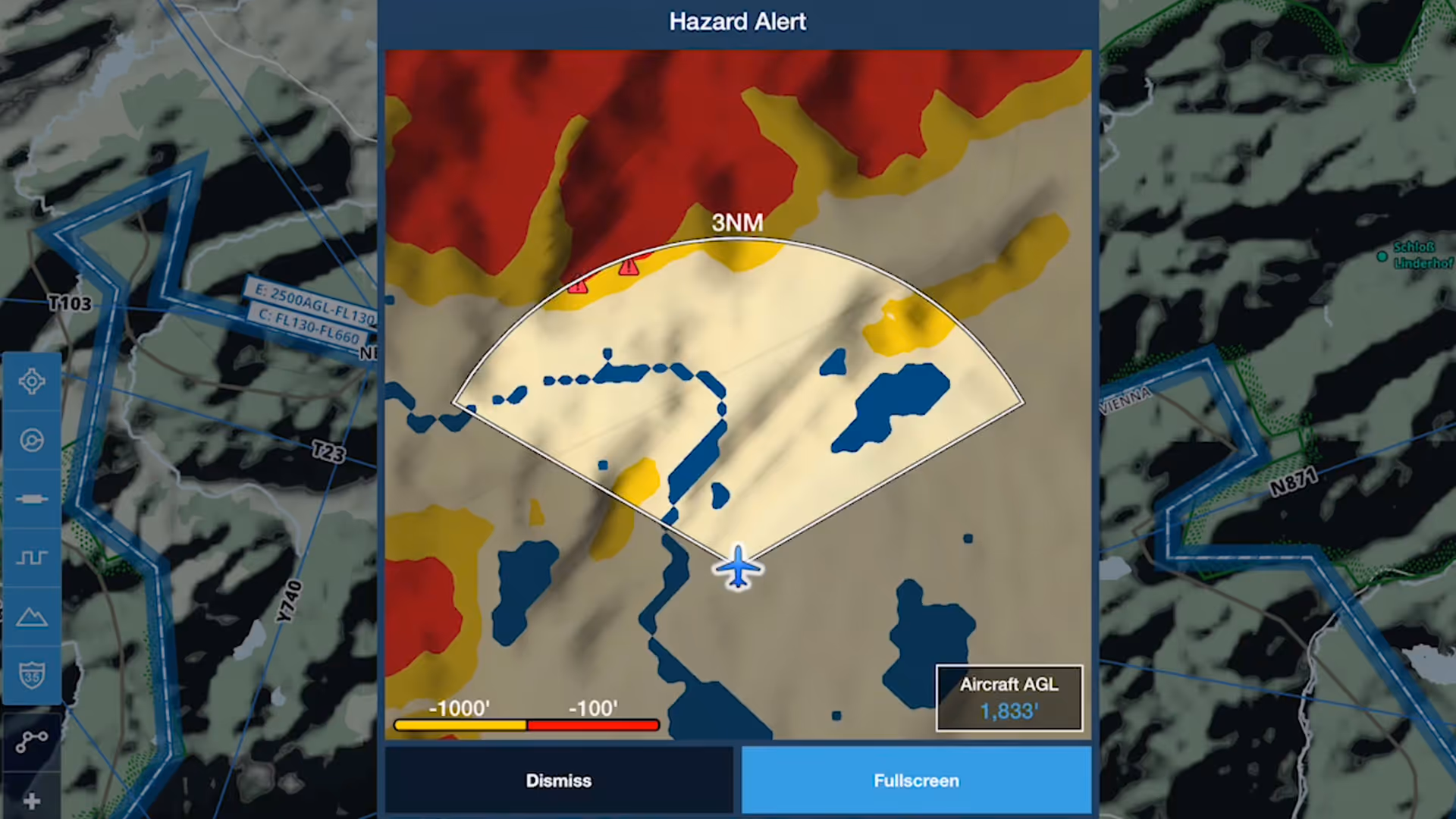
Hazard Alerts in ForeFlight enhance your situational awareness and provide greater peace of mind by warning you of potential hazards ahead.
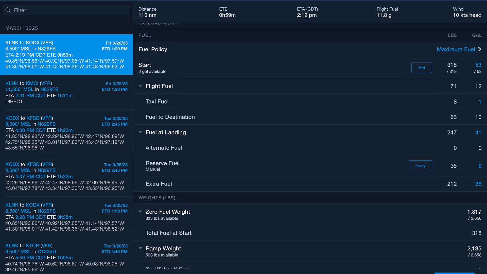
The Fuel Planning section on the Flights view makes it easier to switch between fuel policies and update target values for fast and accurate scenario planning.

ForeFlight's Synthetic Vision feature now provides even more situational awareness with integrated ADS-B traffic depictions and a 360-degree interactive Glance Mode.
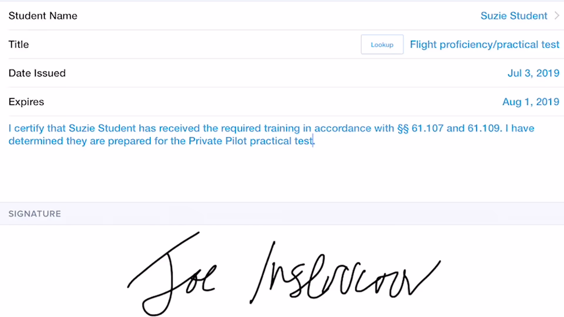
ForeFlight Logbook allows flight instructors to save their information and easily issue and track student endorsements using the Instructor Tools feature.
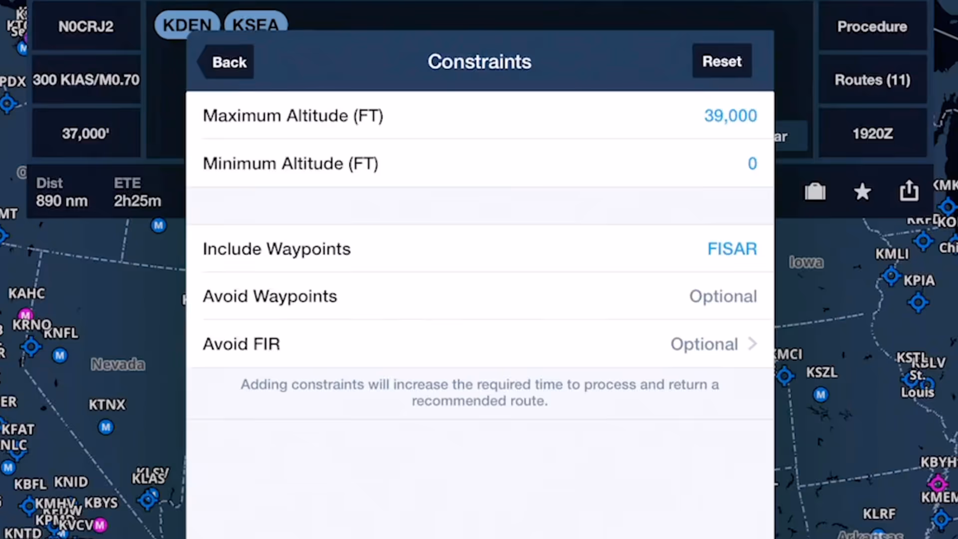
ForeFlight's Route Advisor allows you to customize the Recommended Route using flexible route constraints
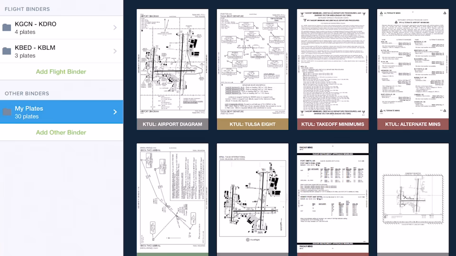
Quickly gather, organize, and access the plates you need for an entire flight using Flight Binders in the Plates view.
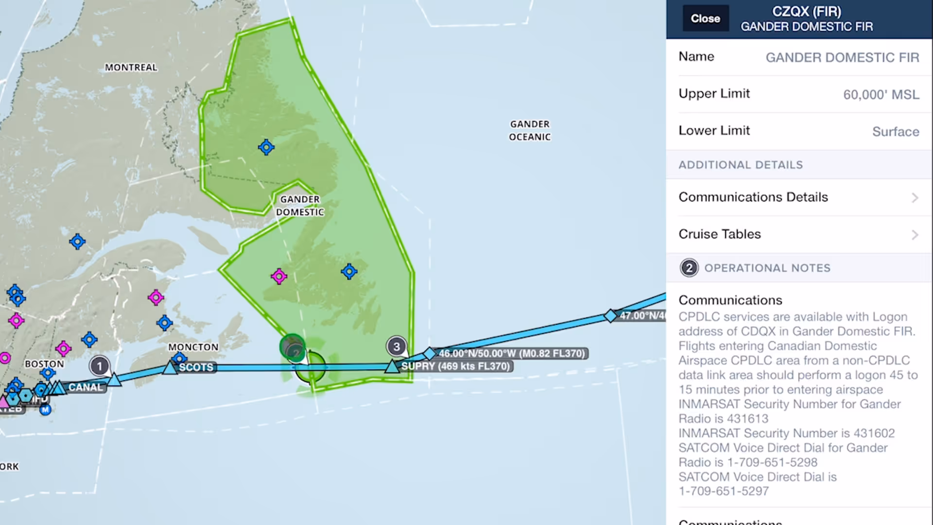
Easily find and review operational notes affecting your route from start to finish with Operational Note Flags

3D Preview in ForeFlight displays markers for each waypoint in your route, allowing you to better visualize every step of your approach all the way down to the runway.
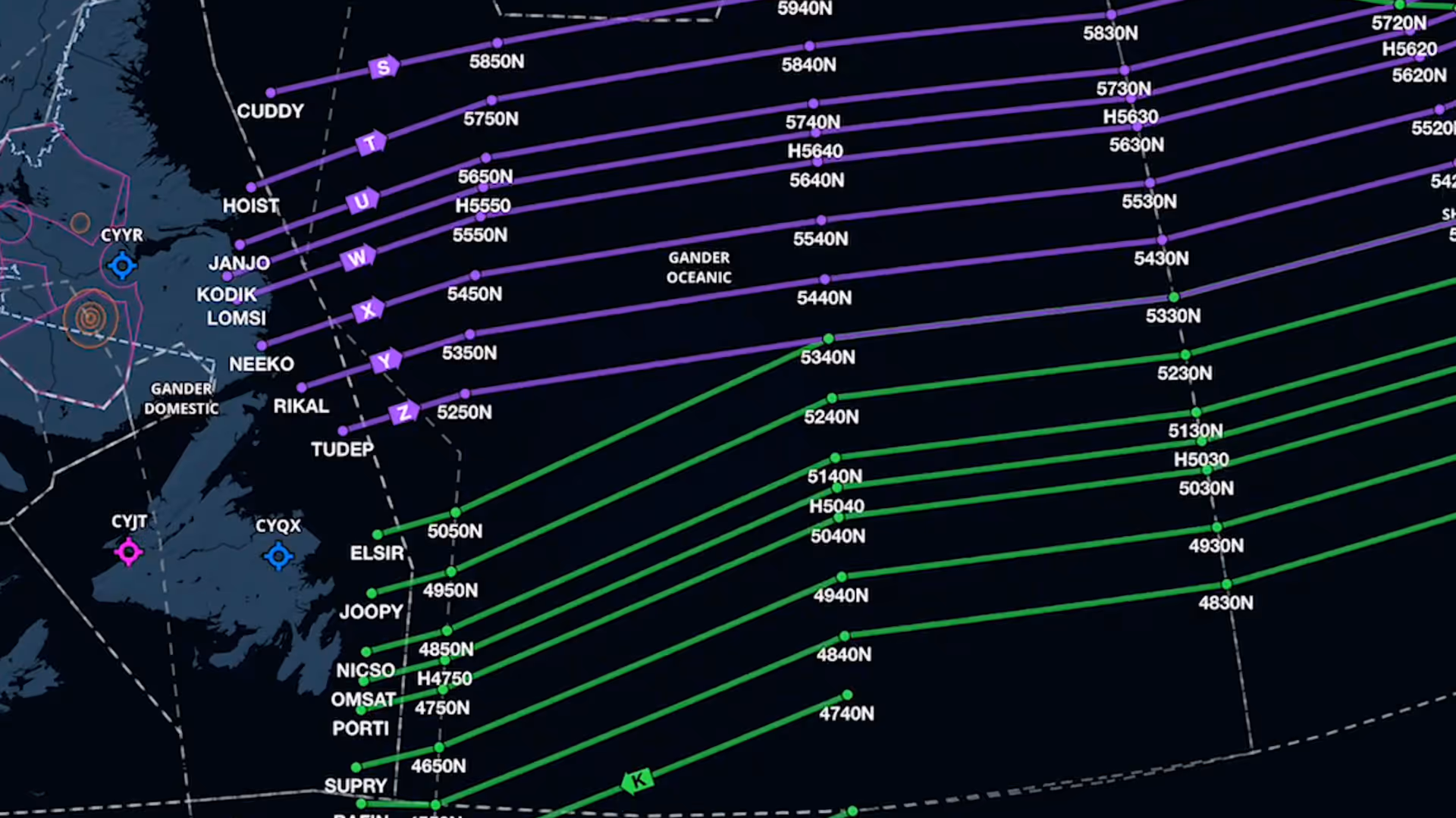
Organized Track depictions in ForeFlight provide a valuable reference for pilots who utilize these track systems.
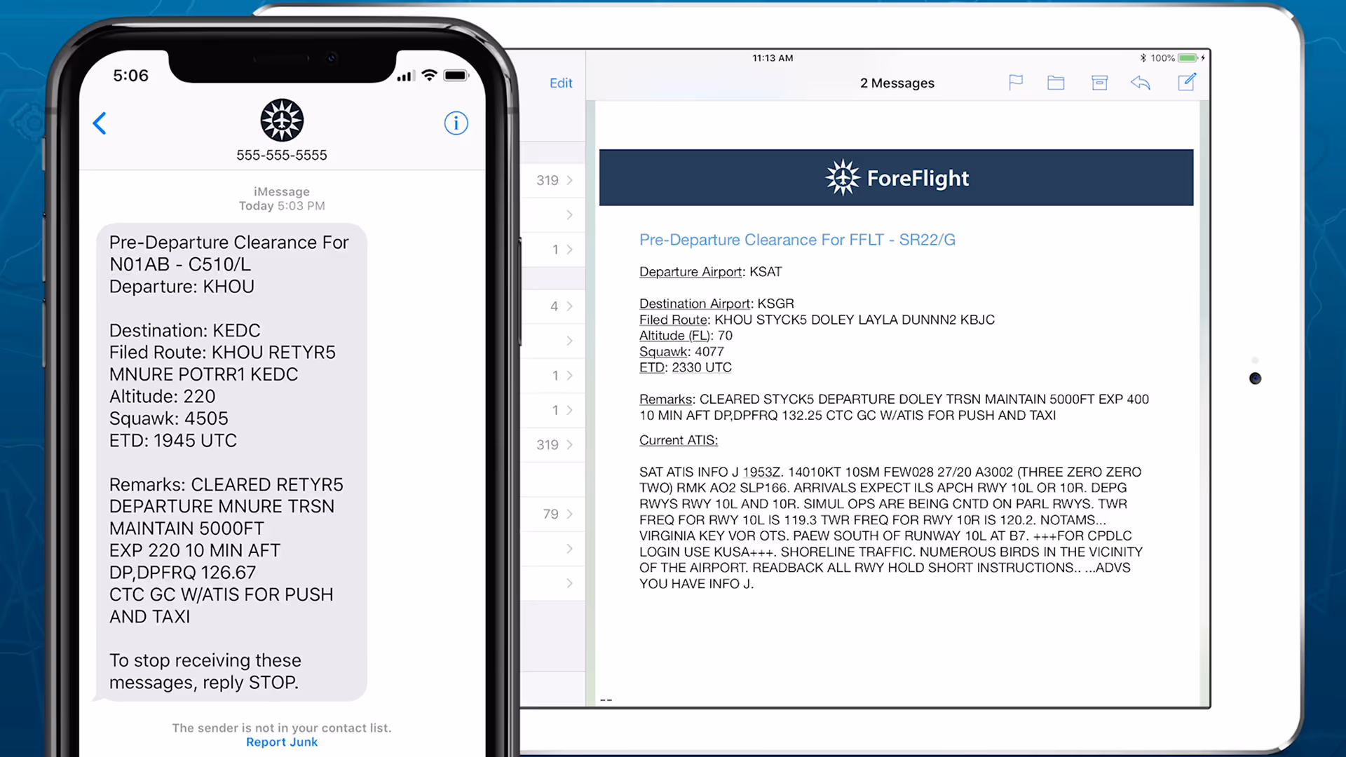
Get in the air faster at over 70 major U.S. airports with mobile pre-departure clearance and digital ATIS support
ForeFlight now supports exporting your entire digital logbook in a traditional logbook format, which you can then print for sharing, gifting, or storing for your records.
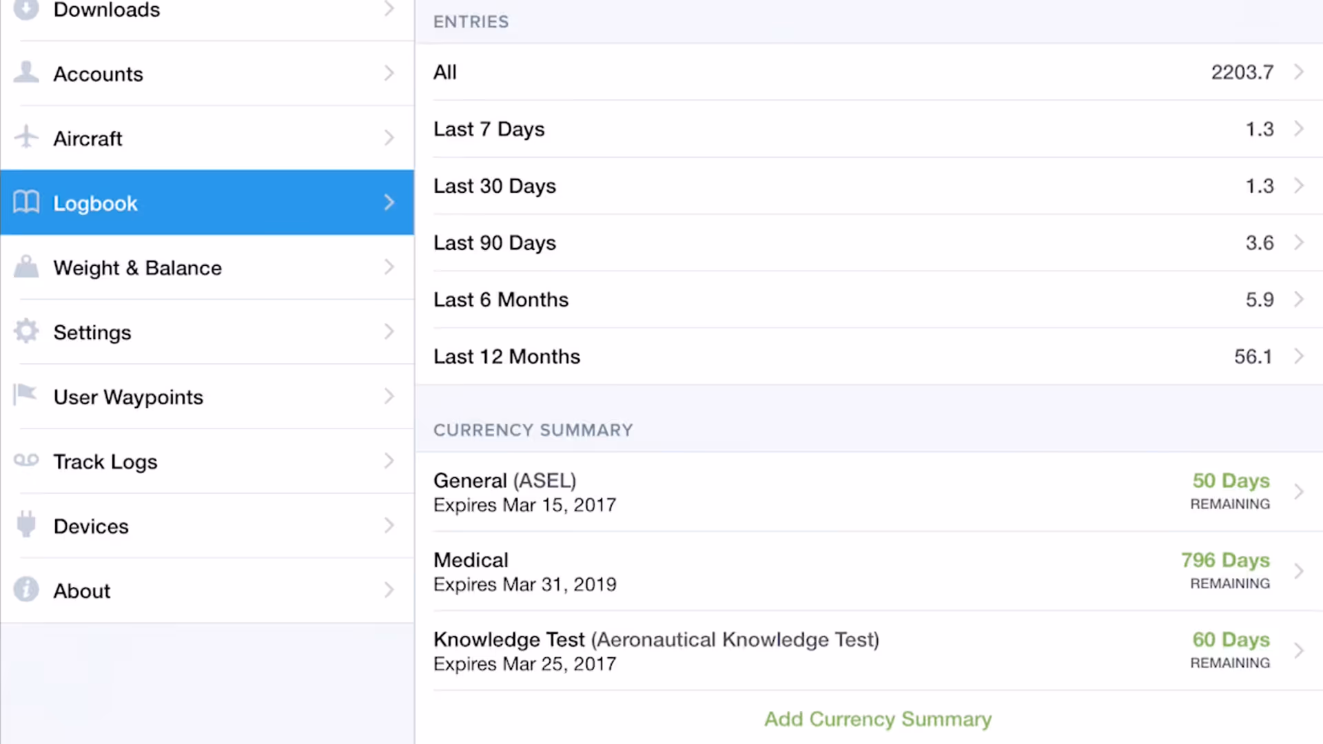
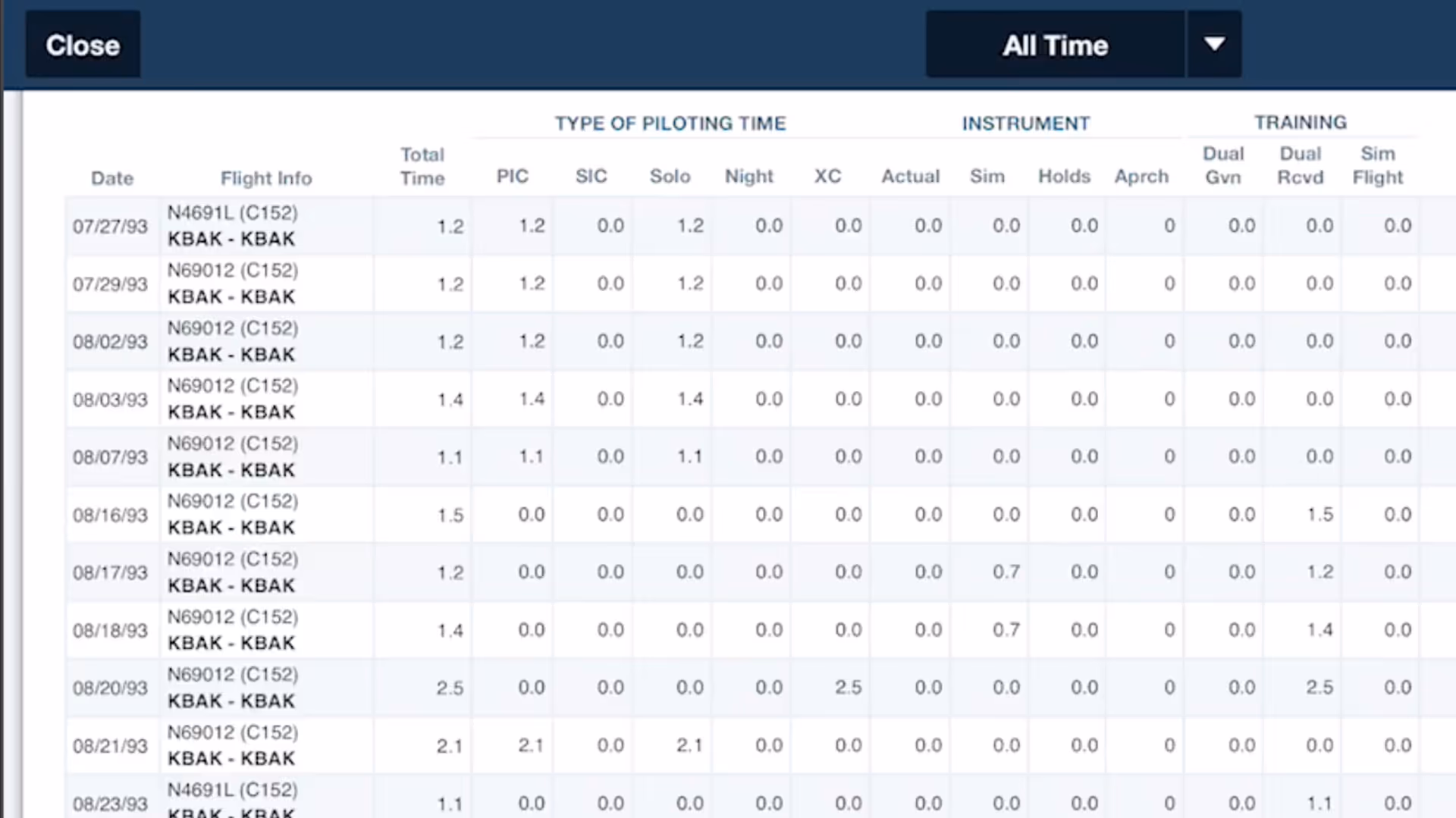
ForeFlight Logbook streamlines your flight logging with intelligent data entry and support for currency-tracking for multiple aircraft types.
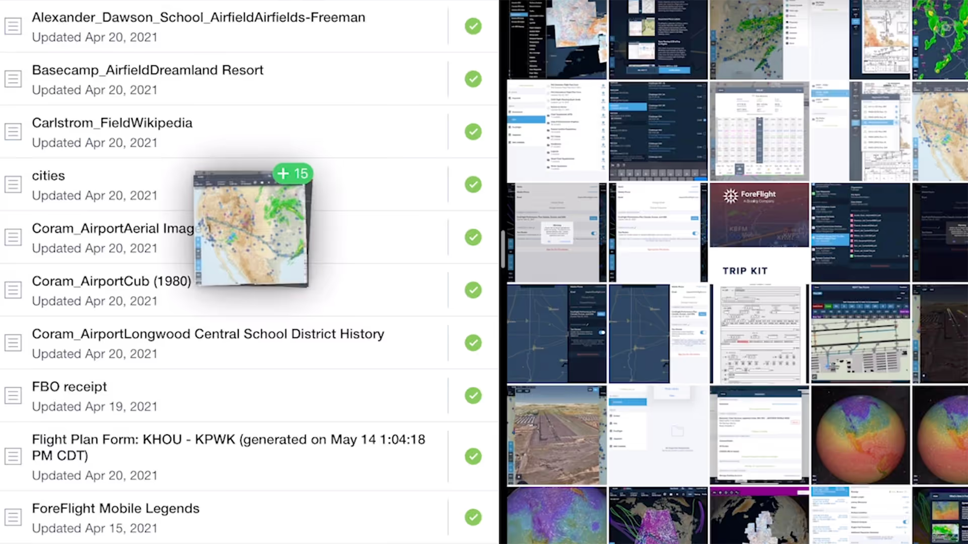
Easily import documents into ForeFlight and add them to custom binders using a dedicated Import button and flexible drag-n-drop gestures from other apps.
Color Inversion is an innovative setting for reducing glare from bright charts at night.
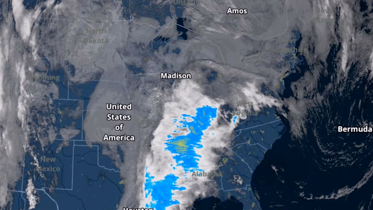
The Color infrared Satellite layer is an alternative to the original satellite layer (now called Enhanced Satellite) that extends ForeFlight's weather planning capabilities.

ForeFlight displays FBO fees from AOPA's Airport Directory to help you make more informed flight planning decisions.
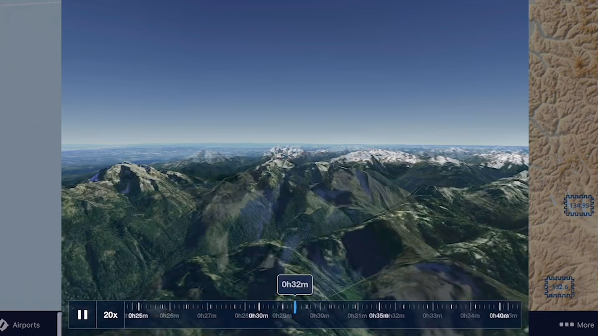
3D Review is a flight planning and debriefing capability that allows you to review planned and recorded flights with immersive 3D terrain and aerial imagery.
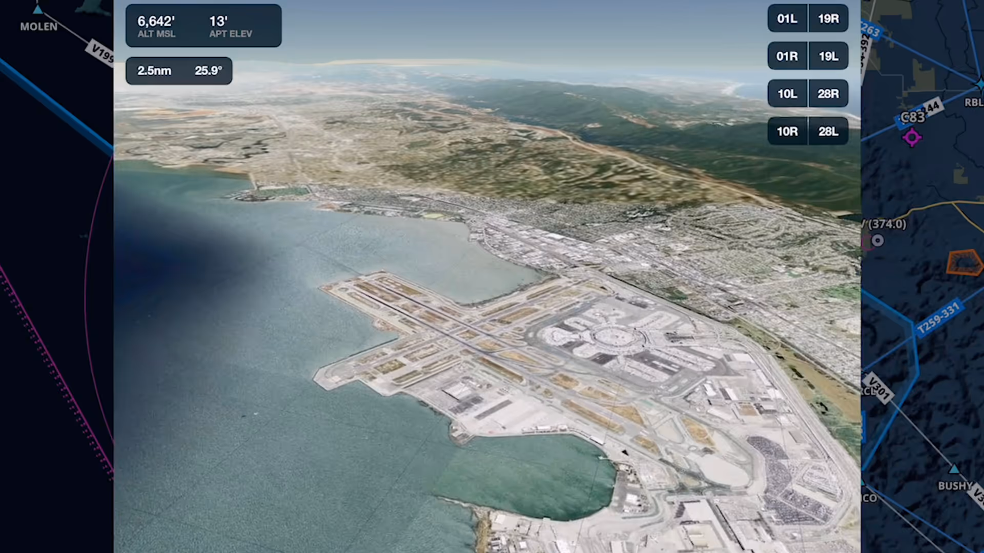
Airport 3D View is an interactive preview that combines terrain and aerial imagery to help you get familiar with new airports anywhere in the world
Switch between different camera modes while replaying a flight in 3D for a fully interactive experience
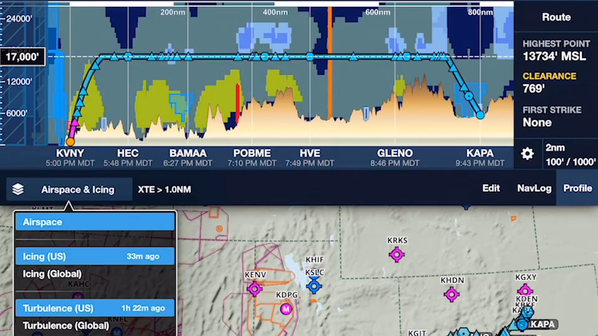
ForeFlight's Profile View includes selectable Icing and Turbulence forecast layers, providing a cross-section of weather in addition to terrain, obstacles, and airspace along your route.
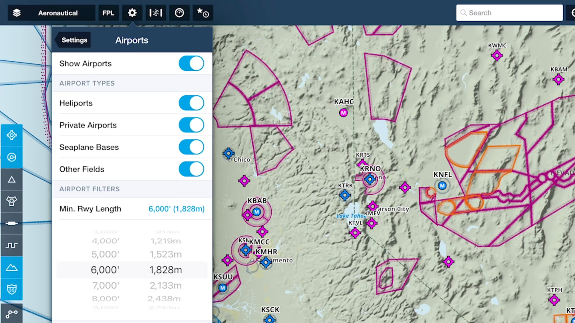
Customize ForeFlight’s Aeronautical Map by hiding airports with runways shorter than a set length with the Minimum Runway Length filter.
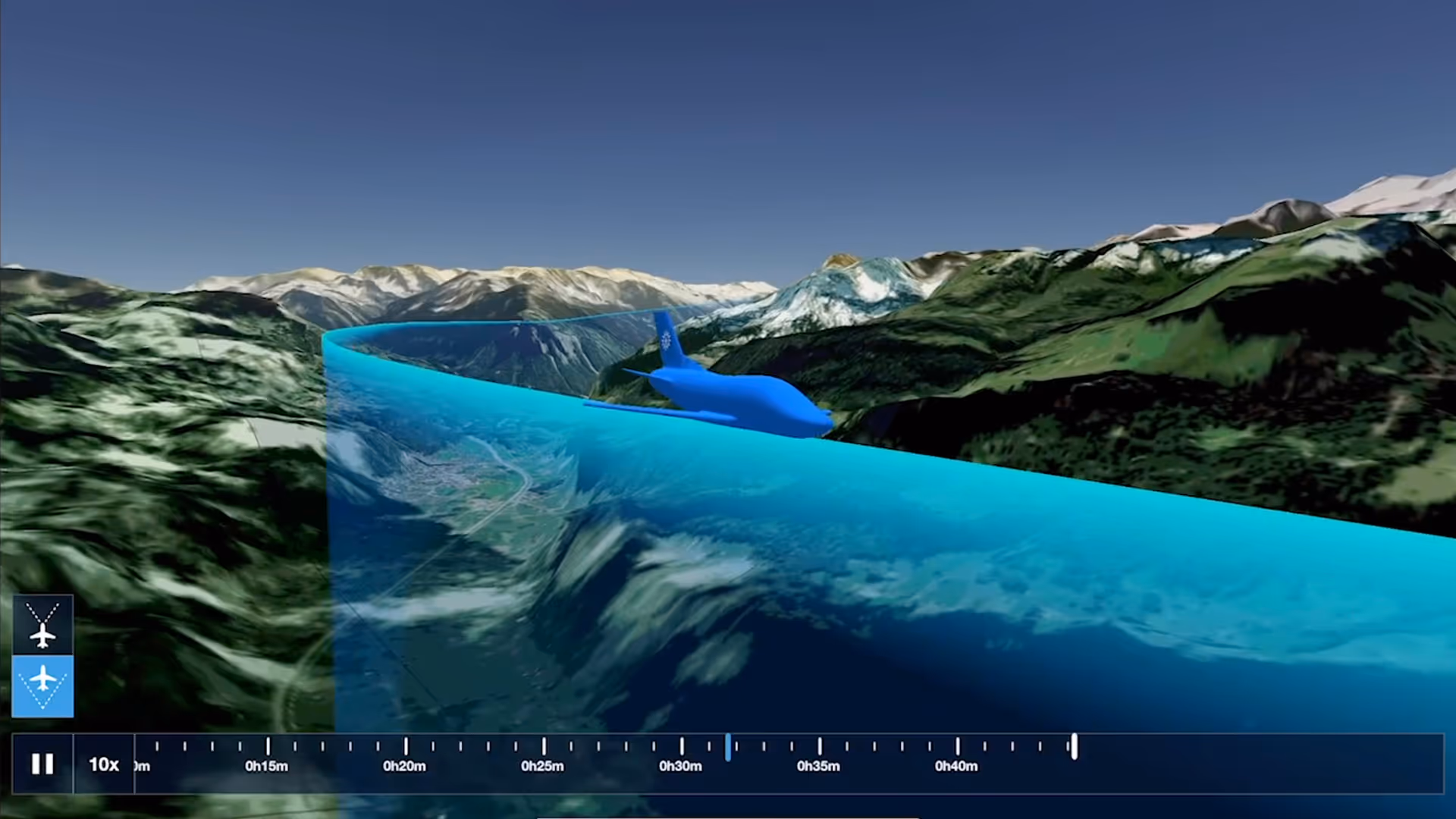
Bolster your preflight and inflight hazard awareness and get a fresh perspective on Profile View with Profile Corridor, available with ForeFlight’s Pro Plus subscription plan and above.

Manually control Hazard Advisor’s altitude before a flight to find a minimum altitude route around terrain, then revert to Auto mode during a flight to lock Hazard Advisor to your actual altitude.

Quickly find the appropriate minimum for an approach procedure and display it as part of your route to supplement the plate and reduce the risk of errors with Augmented Procedures.