Procedure Preview

Nov. 14, 2016   

 
With ForeFlight 7.0, planning gets even better with a more advanced Procedure Advisor and a dramatically improved navigation database that enables visual preview of SIDs, STARs, approaches, and pattern entries. Downloads are significantly faster and use less disk space. FBO locations are also mapped on Taxi Charts for better surface navigation.
Customize the Aeronautical Map

OLD VIDEO: This video was made before the "More" tab was redesigned from a single page to a pull-out menu, but all of the capabilities you access from "More" are the same as they were before. Visit the ForeFlight Mobile Pilot's Guide.

ForeFlight's data-driven Aeronautical Maps allow you to customize which map elements you show or hide. You can also choose between Light, Dark, and Classic map themes and toggle terrain features on and off. With the Aeronautical layer selected you can add or remove airspace, view high or low airways, and adjust label text size. Try mixing and matching the new map settings to find the combination that works best for you.

Color Inversion
Color Inversion is an innovative setting for reducing glare from bright charts at night.
Enabling Terrain
Having trouble finding the Terrain layer in ForeFlight 8? It just moved next door to the Map Settings menu. You can also recreate the World Map from the Map Settings menu by turning on Place Labels.
Basemap and Terrain Improvements

The ForeFlight map engine has a significantly upgraded basemap, which now renders more quickly, smoothly, and with sharper depiction of features such as major roads, railways, national parks, and state and national boundaries. There’s also a new “Shaded Terrain” option, which uses grayscale shading to depict terrain, providing the same level of detail as the colored terrain option with less visual distraction.

In the Map Settings menu, choose from multiple presentations: Colored, Shaded, or None.

High Resolution Basemap

ForeFlight’s High Resolution Basemap depicts ground features and cultural elements in much greater detail for improved inflight reference.

The default basemap provides a basic depiction of major roads and urban areas, while the High Resolution Basemap dramatically increases the level of detail, exposing minor roads and individual railway lines, increasing the resolution of coastlines and urban areas, and highlighting national parks and forests in green. The High Resolution Basemap also adds terrain peak markers with altitudes so you can easily identify the highest points in an area. You can disable these within Terrain settings in the Map Settings menu.

Organized Track Systems

Organized Track depictions in ForeFlight provide a valuable reference for pilots who utilize these track systems. Organized Tracks are available on mobile and the web with ForeFlight’s Performance Plus and Business Performance subscription plans.

ForeFlight displays three different track systems: The North Atlantic Organized Track System, the Pacific Organized Track System, and the Australian Organized Track Structure. Individual tracks are color-coded based on direction: East-bound tracks are purple and West-bound tracks are green. Zoom in to the start of each track to see labels for the track’s name and direction. Each waypoint in the track is also labeled.

Learn more about ForeFlight's Performance plans here.

Scheduled Flight Search

ForeFlight now allows you to search for aircraft tail numbers, call signs, and flight numbers on the Maps view to see recently filed flight plans.

Internet Traffic via FlightAware

Stream live global aircraft traffic directly in ForeFlight with the Internet Traffic feature. In partnership with FlightAware, ForeFlight allows you to view airborne traffic around the globe, and ground traffic at thousands of airports worldwide, to help you gauge airport activity like active arrivals and runways, see how ATC vectors traffic around weather, or assist with planespotting on the ground. Internet Traffic is included in all ForeFlight subscription plans.

Global Airspace Details

ForeFlight provides advanced global airspace details for FIRs, UIRs, and other airspace types, with important information about frequencies, cruise altitudes, and operational notes.

Tap-hold anywhere on the map to open the Add to Route window. The names and altitude ranges of any airspace at that location appears in the Airspace section. Tap on each name to highlight the airspace on the map. Tap the Details button to view more in-depth information about the airspace.

Automatic Airspace Highlighting

Airspace Highlighting in ForeFlight helps declutter the map and keeps you aware of the airspace affecting your route.

Available as part of ForeFlight’s data-driven Aeronautical map layer (available with ForeFlight "Plus" subscription plans), Airspace Highlighting changes the contrast of airspace boundaries based on whether your route intersects the airspace at your planned altitude. Airspace that you won’t pass through is dimmed, and airspace that you will pass through or pass near is highlighted.

Controlled Airspace Alerts

Fly more confidently around controlled airspace with multi-stage visual and audio alerts that proactively warn you of approaching airspace with Controlled Airspace Alerts.

Like TFR Alerts, Controlled Airspace Alerts are enabled by default for all ForeFlight users. To toggle or configure these and other alerts, scroll to the bottom of the Map Settings menu to find the Alerts menu, which is also available in the main Settings view, and scroll to the Airspace & NOTAMs section.

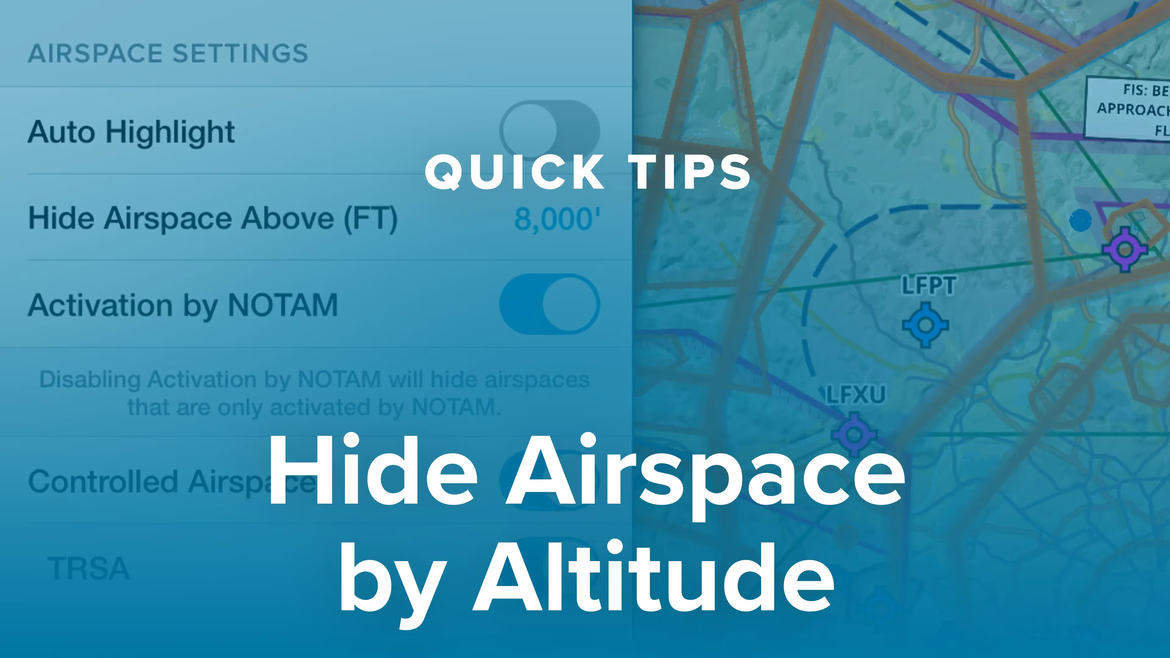
Hide Airspace by Altitude

You can declutter ForeFlight’s Aeronautical Map by hiding any airspace above a selected altitude, making it easier to focus on airspace closer to you. Combined with other airspace features like Auto Highlight and selectable airspace types, customizing the map to show only the most relevant airspace is easier than ever.

Aeronautical Maps Enhancements
ForeFlight 8.2 brings the first big update to the global data-driven Aeronautical Maps since their introduction with airspace altitudes, ARTCC frequency stamps, Mode C rings, Class E surface areas, TRSAs, SATRs, and US ADIZ. Aeronautical Maps are available as part of ForeFlight's Basic Plus, Pro Plus, and Business Pro subscription plans, and as an add-on to other plans. Visit foreflight.com/pricing to see what other features are offered on these plans and to upgrade.
Smart Airway Labels
In ForeFlight's Aeronautical Maps, Smart Airway Labels provide at-a-glance information about airways in your route. When your route includes one or more airways, labels appear along each airway segment. As you zoom in the labels expand to show more information, including the airway’s name, MEA, MOCA, if the segment has one, and the magnetic bearing. You can disable airway labels by tapping map settings and turning off Route Labels. Smart Airway Labels are just one more way to get useful information from ForeFlight without having to dig for it.
Global Procedure Advisor

All ForeFlight customers can now access international departures, arrivals, and approaches using Procedure Advisor, expanding the scope of ForeFlight’s global planning capabilities.

These global flight planning features are further enhanced by adding Jeppesen’s industry-leading charts to your ForeFlight account. Check out our other videos on purchasing Jeppesen charts through ForeFlight and linking an existing Jeppesen account to learn more.

Weather Layer Time Slider

ForeFlight’s radar and satellite layers now use an interactive time slider tool that provides more control when viewing and animating weather timestamps.

Icing, Turbulence, and Surface Analysis Layers

ForeFlight’s weather capabilities now include five new layers for icing, turbulence, and surface analysis forecasts, available on Pro Plus, Performance Plus, and Business Performance plans. The Icing and Turbulence layers each have a US and global option, and the Surface Analysis layer provides a global view of isobars and associated pressure readings, and a more detailed view of pressure centers, fronts, troughs, and other features for North America. All five of the new layers are also available on ForeFlight’s web application.

Distance Rings

OLD VIDEO: This video was made before the "More" tab was redesigned from a single page to a pull-out menu, but all of the capabilities you access from "More" are the same as they were before. Visit the ForeFlight Mobile Pilot's Guide.

Keep an eye on how far you are from nearby airports, obstacles, and landmarks using distance rings. You can set the rings to automatically grow and shrink as you change zoom level, or set them to display flight times rather than distances. This simple tool is a must-have for maximizing inflight situational awareness.

TFR Alerts
TFR Alerts enhance your inflight situational awareness by warning you of nearby TFRs, whether or not the TFR layer is selected. If ForeFlight detects that you will enter or pass near a TFR within the next five minutes, it will give you a visual and auditory alert. Alerts are also triggered if you enter a TFR, or fly above or below a TFR at a nearby altitude. You can adjust settings related to TFR alerts by tapping More, then Settings, then scroll down to Alerts.
New In-Flight Alerts
ForeFlight offers new alerts to keep you aware on the ground and in the sky. The Runway Proximity Advisor now provides the length of runway remaining as you taxi on to a runway. Two new in-flight alerts also improve situational awareness in the air - the Sink Rate alerts lets you know when your downward vertical speed becomes excessive, and the 500' AGL alert provides a simple callout when you descend past 500' AGL.
Weather Frequency Callout
Checking your destination airport’s weather is an important step in any pre-landing checklist. Like a helpful co-pilot, ForeFlight automatically displays the weather frequency as you near the airport.
Device Disconnect Alert

Devices that provide wireless inflight data like GPS and weather to your iPad can sometimes disconnect, whether due to a dead battery, connection issues, or human error. Whatever the reason for the loss of signal, the Device Disconnect Alert allows you to quickly take steps to restore the connection or switch to an alternative data source.

Map Touch Action
This video walks you through how to use our Map Touch Action feature. View US VFR Sectional and IFR Enroute chart legend panels directly on the Maps view. Map Touch allows you to rotate through each overlapping chart in turn based on where you tap the chart.
Improved Planning Features

OLD VIDEO: This video was made before the "More" tab was redesigned from a single page to a pull-out menu, but all of the capabilities you access from "More" are the same as they were before. Visit the ForeFlight Mobile Pilot's Guide.

ForeFlight now offers an enhanced flight planning workflow thanks to improvements to aircraft, the Maps view flight plan editor, and the File & Brief view, which is now called “Flights”.

This video is for ForeFlight customers with subscription plans other than Performance Plus, including the original plans and the Basic Plus and Pro Plus plans. If you have the Performance Plus plan, or want to see what is different with that plan, check out our Performance video series.

Procedure Preview
With ForeFlight 7.0, planning gets even better with a more advanced Procedure Advisor and a dramatically improved navigation database that enables visual preview of SIDs, STARs, approaches, and pattern entries. Downloads are significantly faster and use less disk space. FBO locations are also mapped on Taxi Charts for better surface navigation.
Marked Positions

Drop detailed markers along your route and view or share them after the flight using ForeFlight’s Marked Positions feature. Perfect for noting points of interest, conducting search and rescue operations, or plotting your position on oceanic flights, Marked Positions provides a highly-flexible solution for many use-cases. Marked Positions is available with ForeFlight Performance Plus plans.

Map Annotations

Take notes on the fly and mark up charts using ForeFlight’s Map Annotations feature.

Maps Sidebar

Tap to learn about airspace, map elements, and more using the Maps view’s information Sidebar, which lets you dig into details while still interacting with the map.

Tap on most map elements or tap-hold anywhere on the map to open the sidebar. A pulsing green circle indicates the marker or location you tapped, and selecting airspace within the sidebar will highlight it green on the map as well. Tap on other map elements with the sidebar open to load their information into it. Tapping on airways or legs in your route line will highlight those segments with a green outline rather than a circle.

User Map Layers

Visit foreflight.com/map-shapes for additional information about this feature and to download sample KML files.

Import Custom User Charts

In addition to user waypoints and user map layers, ForeFlight now allows you to import User Charts that you can manage and display on the map.

The User Charts feature supports MBTiles, an open source file format developed by MapBox that allows for efficient compression and distribution of large charts. The feature does not yet support vector charts, which can also use the .mbtiles extension. A great tool for creating your own MBtiles is MapTiler, which is free to download and allows you to quickly georeference and export raster charts.

Synthetic Vision
Synthetic Vision takes our hazard awareness platform to the next level with a three-dimensional representation of terrain and obstacle hazards, airport markers, runways, and water features. Check out this highlight video narrated by mapping team member and lead developer for Synthetic Vision, Malcolm Toon. To learn more or purchase visit http://foreflight.com/synthetic-vision/
Global Aeronautical Maps
ForeFlight’s Aeronautical Maps are data-driven, customizable, and powered by an entirely new map engine, purpose-built by ForeFlight’s graphics engineers to deliver a dynamic experience on the ground and in the air.
Color IR Satellite
The Color infrared Satellite layer is an alternative to the original satellite layer (now called Enhanced Satellite) that extends ForeFlight’s weather planning capabilities.
Hold Advisor

Easily insert a holding pattern anywhere in your route with flexible parameters and automatic pattern entry selection. Hold Advisor is included with ForeFlight Pro Plus subscription plans and above.

Augmented Procedures™

Quickly find the appropriate minimum for an approach procedure and display it as part of your route to supplement the plate and reduce the risk of errors with Augmented Procedures, available with ForeFlight Performance Plus and Business Performance plans.

Breadcrumbs

Breadcrumbs are an extension of ForeFlight’s Track Log capability allowing you to see the track log as it’s recorded, leaving a continuous line that you can reference for maneuvers, Search and Rescue and survey work, or just to see where you’ve been. Breadcrumbs are available with all ForeFlight subscription plans.

TFR Alerts
TFR Alerts enhance your inflight situational awareness by warning you of nearby TFRs, whether or not the TFR layer is selected. If ForeFlight detects that you will enter or pass near a TFR within the next five minutes, it will give you a visual and auditory alert. Alerts are also triggered if you enter a TFR, or fly above or below a TFR at a nearby altitude. You can adjust settings related to TFR alerts by tapping More, then Settings, then scroll down to Alerts.
New In-Flight Alerts
ForeFlight offers new alerts to keep you aware on the ground and in the sky. The Runway Proximity Advisor now provides the length of runway remaining as you taxi on to a runway. Two new in-flight alerts also improve situational awareness in the air - the Sink Rate alerts lets you know when your downward vertical speed becomes excessive, and the 500' AGL alert provides a simple callout when you descend past 500' AGL.
Quick-Access Airspace Frequencies

Easily locate frequencies for many kinds of controlled airspace on ForeFlight’s Maps view for quick inflight access. 

Tap-hold anywhere on the map to open the Add to Route popup, which lists any airspaces at the location you tapped. Those that have at least one associated frequency will include the frequency and its name at the bottom of that airspace’s summary, which you can tap to highlight the airspace on the map. If an airspace has more than one associated frequency it will indicate the number that are available. Tap the Details button to view these additional frequencies, as well as other information about that airspace. If there are more than four frequencies, tap All Frequencies at the bottom of the Communications sections to see the full list. Any frequencies designated as Secondary include a note indicating this.

Weather Frequency Callout
Checking your destination airport’s weather is an important step in any pre-landing checklist. Like a helpful co-pilot, ForeFlight automatically displays the weather frequency as you near the airport.
Device Disconnect Alert

Devices that provide wireless inflight data like GPS and weather to your iPad can sometimes disconnect, whether due to a dead battery, connection issues, or human error. Whatever the reason for the loss of signal, the Device Disconnect Alert allows you to quickly take steps to restore the connection or switch to an alternative data source.

Distance Rings

OLD VIDEO: This video was made before the "More" tab was redesigned from a single page to a pull-out menu, but all of the capabilities you access from "More" are the same as they were before. Visit the ForeFlight Mobile Pilot's Guide.

Keep an eye on how far you are from nearby airports, obstacles, and landmarks using distance rings. You can set the rings to automatically grow and shrink as you change zoom level, or set them to display flight times rather than distances. This simple tool is a must-have for maximizing inflight situational awareness.

Terrain & Obstacle Hazard Alerts

Hazard Alerts in ForeFlight enhance your situational awareness and provide greater peace of mind by warning you of potential hazards ahead. Hazard alerts are available with a Pro Plus subscription plan and above.

Learn more about ForeFlight's advanced hazard awareness features here.

Smart Airway Labels
In ForeFlight's Aeronautical Maps, Smart Airway Labels provide at-a-glance information about airways in your route. When your route includes one or more airways, labels appear along each airway segment. As you zoom in the labels expand to show more information, including the airway’s name, MEA, MOCA, if the segment has one, and the magnetic bearing. You can disable airway labels by tapping map settings and turning off Route Labels. Smart Airway Labels are just one more way to get useful information from ForeFlight without having to dig for it.
Customize the Aeronautical Map

OLD VIDEO: This video was made before the "More" tab was redesigned from a single page to a pull-out menu, but all of the capabilities you access from "More" are the same as they were before. Visit the ForeFlight Mobile Pilot's Guide.

ForeFlight's data-driven Aeronautical Maps allow you to customize which map elements you show or hide. You can also choose between Light, Dark, and Classic map themes and toggle terrain features on and off. With the Aeronautical layer selected you can add or remove airspace, view high or low airways, and adjust label text size. Try mixing and matching the new map settings to find the combination that works best for you.

Color Inversion
Color Inversion is an innovative setting for reducing glare from bright charts at night.
Mountain Passes & More in High Resolution Basemap

ForeFlight’s High Resolution Basemap includes Jeppesen-sourced terrain and cultural elements such as mountain passes, highway labels, and more for improved inflight reference.

The Basemap is what you see with no other charts or maps other than the Aeronautical Map enabled, and depicts terrain, roads, urban lighting, and more. Download the High Resolution Basemap for any region in More - Downloads.

Global Aeronautical Maps
ForeFlight’s Aeronautical Maps are data-driven, customizable, and powered by an entirely new map engine, purpose-built by ForeFlight’s graphics engineers to deliver a dynamic experience on the ground and in the air.
Aeronautical Maps Enhancements
ForeFlight 8.2 brings the first big update to the global data-driven Aeronautical Maps since their introduction with airspace altitudes, ARTCC frequency stamps, Mode C rings, Class E surface areas, TRSAs, SATRs, and US ADIZ. Aeronautical Maps are available as part of ForeFlight's Basic Plus, Pro Plus, and Business Pro subscription plans, and as an add-on to other plans. Visit foreflight.com/pricing to see what other features are offered on these plans and to upgrade.
Global Procedure Advisor

All ForeFlight customers can now access international departures, arrivals, and approaches using Procedure Advisor, expanding the scope of ForeFlight’s global planning capabilities.

These global flight planning features are further enhanced by adding Jeppesen’s industry-leading charts to your ForeFlight account. Check out our other videos on purchasing Jeppesen charts through ForeFlight and linking an existing Jeppesen account to learn more.

Weather Layer Time Slider

ForeFlight’s radar and satellite layers now use an interactive time slider tool that provides more control when viewing and animating weather timestamps.

Procedure Preview
With ForeFlight 7.0, planning gets even better with a more advanced Procedure Advisor and a dramatically improved navigation database that enables visual preview of SIDs, STARs, approaches, and pattern entries. Downloads are significantly faster and use less disk space. FBO locations are also mapped on Taxi Charts for better surface navigation.
ScratchPads
In ForeFlight Mobile version 6.7 or later the ScratchPads view has some handy pre-made templates and the ability to keep and share multiple scratch pads. This video walks you through the ScratchPads feature. ForeFlight Mobile version 6.7 is hitting the App Store now.
Synthetic Vision
Synthetic Vision takes our hazard awareness platform to the next level with a three-dimensional representation of terrain and obstacle hazards, airport markers, runways, and water features. Check out this highlight video narrated by mapping team member and lead developer for Synthetic Vision, Malcolm Toon. To learn more or purchase visit http://foreflight.com/synthetic-vision/
Synthetic Vision on iPhone

ForeFlight’s advanced hazard awareness capability and backup attitude indicator is now available on the iPhone, and it looks fantastic! See detailed 3D terrain, obstacles, and runways in full screen Portrait or Landscape mode, and pair with an AHRS-capable ADS-B receiver like Sentry or compatible Garmin equipment for dynamic backup attitude and traffic display. The iPhone also supports Glance Mode, allowing you to swipe within Synthetic Vision to view terrain and traffic in any direction.

Synthetic Vision is included in Pro Plus subscriptions and above.

Traffic & Glance Mode in Synthetic Vision

ForeFlight’s Synthetic Vision feature now provides even more situational awareness with integrated ADS-B traffic depictions and a 360-degree interactive Glance Mode. Synthetic Vision is available with the Pro Plus subscription plan and above, and as an add-on to Business plans.

To use Synthetic Vision, make sure you select and download high-resolution terrain for whichever regions you plan to fly in, using the settings menus at the top of More - Downloads. Synthetic Vision can double as a backup attitude display when you connect to an AHRS-capable receiver, but that isn’t required to use Synthetic Vision or either of the new features in this video.

Related Resources

 
Fanatical Pilot Support
Fanatical Pilot Support ™

Every support team member is a pilot and ForeFlight expert.

GET SUPPORT
 
Have an idea for a video?

If you can't find what you're looking for, or have an idea for a video, squawk it below.

SHARE YOUR IDEA
I'd love a video about...
Email Address: