iPad Setup Tips

Nov. 14, 2016   


This video covers some basic iPad settings we recommend to get the best experience from ForeFlight Mobile.

Getting Started with ForeFlight (January 2024)

Join ForeFlight support staff to learn everything you need to get spun up and off the ground with ForeFlight. They will demonstrate the essentials of critical workflows like using the map, setting up your aircraft, the multiple approaches to route planning, as well as tips and tricks to maximize your use of ForeFlight in no time.

Configure Chart and Data Downloads

Setting up your downloads in ForeFlight is easier than ever with new separate menus for Chart/Data selections and Region selections.

ForeFlight for Student Pilots

Join Kendall Stovall and Alex McMillan, both ForeFlight experts and active CFIs, as they explain what every student pilot needs to know about ForeFlight. They will walk you through setting up an aircraft and weight & balance, finding and uploading documents, and other features needed to plan your first flight. Kendall and Alex will also point out helpful features to help users on any subscription plan get the most out of ForeFlight.

New Customer Webinar: Basics of Flight Plan Filing (August 2022)
Join the dynamic duo of Rob MacLeod and Tim Stahl from ForeFlight's FlightOps Team to learn the essentials of filing flight plans and have your questions answered. The two will walk through the entire filing process, from basic aircraft setup to route planning, filling out the flight plan form, and amending, canceling, opening, and closing flight plans. Although this webinar will focus on filing in the U.S., pilots from other countries will still find much of the material helpful to their own flying.
Enhanced and Integrated Weight & Balance

ForeFlight’s Enhanced Weight & Balance capability is now available for all customers, allowing you to more easily create, edit, and plan with your W&B profiles. The new W&B contains features like Standard Weights and Saved Loads to save you time when inputting load information. Migrate legacy W&B profiles or easily set up new ones using our pre-built templates for hundreds of aircraft.

Additionally, with ForeFlight Performance Plus you can integrate your Weight & Balance profiles with Flights, simplifying your preflight workflow and producing more accurate time and fuel calculations.

Improved Planning Features

OLD VIDEO: This video was made before the "More" tab was redesigned from a single page to a pull-out menu, but all of the capabilities you access from "More" are the same as they were before. Visit the ForeFlight Mobile Pilot's Guide.

ForeFlight now offers an enhanced flight planning workflow thanks to improvements to aircraft, the Maps view flight plan editor, and the File & Brief view, which is now called “Flights”.

This video is for ForeFlight customers with subscription plans other than Performance Plus, including the original plans and the Basic Plus and Pro Plus plans. If you have the Performance Plus plan, or want to see what is different with that plan, check out our Performance video series.

Customize the Aeronautical Map

OLD VIDEO: This video was made before the "More" tab was redesigned from a single page to a pull-out menu, but all of the capabilities you access from "More" are the same as they were before. Visit the ForeFlight Mobile Pilot's Guide.

ForeFlight's data-driven Aeronautical Maps allow you to customize which map elements you show or hide. You can also choose between Light, Dark, and Classic map themes and toggle terrain features on and off. With the Aeronautical layer selected you can add or remove airspace, view high or low airways, and adjust label text size. Try mixing and matching the new map settings to find the combination that works best for you.

Enabling Terrain
Having trouble finding the Terrain layer in ForeFlight 8? It just moved next door to the Map Settings menu. You can also recreate the World Map from the Map Settings menu by turning on Place Labels.
Using the Airports View

OLD VIDEO: This video was made before the "Airports" tab was redesigned, but all of the capabilities you access from "More" are the same as they were before. Visit the ForeFlight Mobile Pilot's Guide.

The Airports view is your all-in-one source for any kind of information about airports. From current and forecast weather to runways, procedures, and FBOs, the Airports view is one of the most important places in ForeFlight when it comes to flight planning.

Helpful Web Features
ForeFlight on the web includes helpful features that enable fast flight planning from your desktop browser.
iPad Setup Tips

This video covers some basic iPad settings we recommend to get the best experience from ForeFlight Mobile.

Distance Rings

OLD VIDEO: This video was made before the "More" tab was redesigned from a single page to a pull-out menu, but all of the capabilities you access from "More" are the same as they were before. Visit the ForeFlight Mobile Pilot's Guide.

Keep an eye on how far you are from nearby airports, obstacles, and landmarks using distance rings. You can set the rings to automatically grow and shrink as you change zoom level, or set them to display flight times rather than distances. This simple tool is a must-have for maximizing inflight situational awareness.

Pack Charts & Weather on Flights

To further streamline your planning workflow on Flights, you’ll find a quick access button to Pack directly below the Flight Log. Just like the ‘suitcase’ button on the Maps view, tap ‘Pack and it will analyze your route and package up all of the charts, data, NOTAM, and weather information (including Icing and Turbulence for Pro Plus and Performance Plus customers) you’ll need to access offline during your flight.

Color Inversion
Color Inversion is an innovative setting for reducing glare from bright charts at night.
Helpful Logbook Features
ForeFlight Logbook streamlines your flight logging with intelligent data entry and support for currency-tracking for multiple aircraft types.
Weather Frequency Callout
Checking your destination airport’s weather is an important step in any pre-landing checklist. Like a helpful co-pilot, ForeFlight automatically displays the weather frequency as you near the airport.
File with a Call Sign
ForeFlight now allows you to add a call sign to flight plans. Enter a call sign contraction and number in the field to file the flight under that call sign; your N number will be included in the flight plan’s remarks so ATC can still access it. If you don’t enter any call sign the flight will be filed under your N number. Learn more about filing with ForeFlight at https://foreflight.com/filing.
Logbook Currency Details
Tap on any Currency Summary in ForeFlight Logbook to see detailed information about your progress towards that currency. In the Currency Detail view, the top section shows your progress towards satisfying currency as well as a short description of the FAA requirements for that currency type. Beneath that is a list of all the flights that contribute to currency, followed by a list of all the flights that do not contribute, but which fall within the currency's timeframe, such as 90 days for general VFR currency, and 6 months for IFR currency. This organization makes it easy to see how your flights affect currency, and allows you to easily track down and fix errors in flight entries that should contribute to currency.
TFR Alerts
TFR Alerts enhance your inflight situational awareness by warning you of nearby TFRs, whether or not the TFR layer is selected. If ForeFlight detects that you will enter or pass near a TFR within the next five minutes, it will give you a visual and auditory alert. Alerts are also triggered if you enter a TFR, or fly above or below a TFR at a nearby altitude. You can adjust settings related to TFR alerts by tapping More, then Settings, then scroll down to Alerts.
Smart Airway Labels
In ForeFlight's Aeronautical Maps, Smart Airway Labels provide at-a-glance information about airways in your route. When your route includes one or more airways, labels appear along each airway segment. As you zoom in the labels expand to show more information, including the airway’s name, MEA, MOCA, if the segment has one, and the magnetic bearing. You can disable airway labels by tapping map settings and turning off Route Labels. Smart Airway Labels are just one more way to get useful information from ForeFlight without having to dig for it.
Customize the Aeronautical Map

OLD VIDEO: This video was made before the "More" tab was redesigned from a single page to a pull-out menu, but all of the capabilities you access from "More" are the same as they were before. Visit the ForeFlight Mobile Pilot's Guide.

ForeFlight's data-driven Aeronautical Maps allow you to customize which map elements you show or hide. You can also choose between Light, Dark, and Classic map themes and toggle terrain features on and off. With the Aeronautical layer selected you can add or remove airspace, view high or low airways, and adjust label text size. Try mixing and matching the new map settings to find the combination that works best for you.

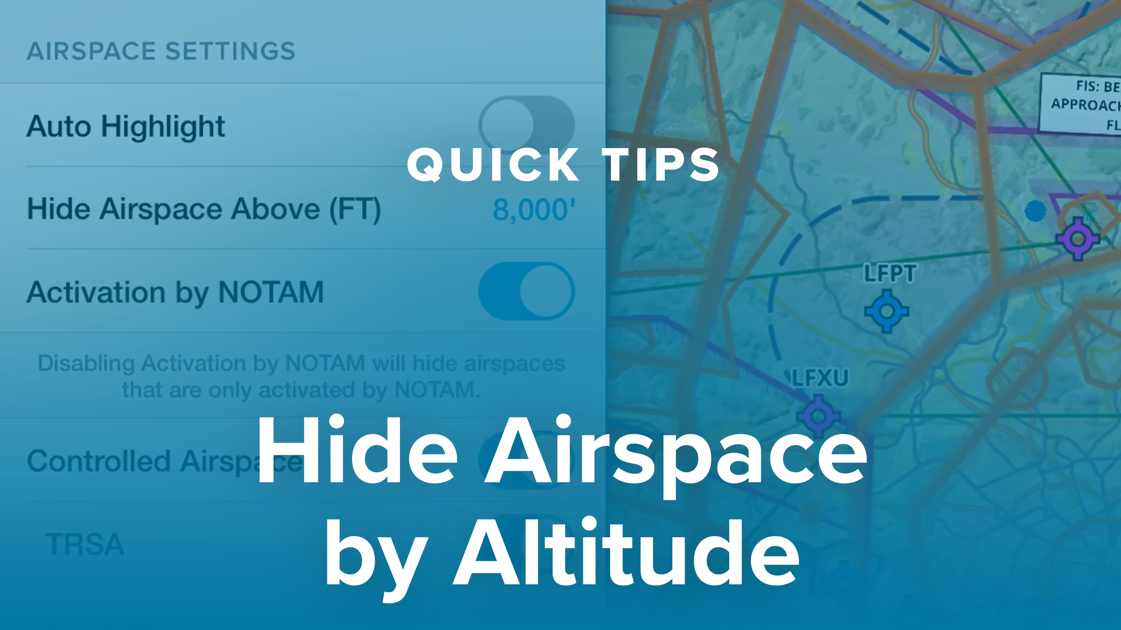
Hide Airspace by Altitude

You can declutter ForeFlight’s Aeronautical Map by hiding any airspace above a selected altitude, making it easier to focus on airspace closer to you. Combined with other airspace features like Auto Highlight and selectable airspace types, customizing the map to show only the most relevant airspace is easier than ever.

Automatic Track Logging

This video describes ForeFlight's auto-start, -stop, and -upload capabilities for Track Logs, and how you can automatically create new Logbook entries from Track Logs.

iPad Setup Tips

This video covers some basic iPad settings we recommend to get the best experience from ForeFlight Mobile.

ScratchPads
In ForeFlight Mobile version 6.7 or later the ScratchPads view has some handy pre-made templates and the ability to keep and share multiple scratch pads. This video walks you through the ScratchPads feature. ForeFlight Mobile version 6.7 is hitting the App Store now.
Synthetic Vision
Synthetic Vision takes our hazard awareness platform to the next level with a three-dimensional representation of terrain and obstacle hazards, airport markers, runways, and water features. Check out this highlight video narrated by mapping team member and lead developer for Synthetic Vision, Malcolm Toon. To learn more or purchase visit http://foreflight.com/synthetic-vision/

Related Resources

 
Fanatical Pilot Support
Fanatical Pilot Support ™

Every support team member is a pilot and ForeFlight expert.

GET SUPPORT
 
Have an idea for a video?

If you can't find what you're looking for, or have an idea for a video, squawk it below.

SHARE YOUR IDEA
I'd love a video about...
Email Address: